
Norwegian Mountains, Møre og Romsdal
Litletoren from Laurdalen, Sep 26 2010
To the main Litletoren page
(maps, pictures, other trip reports)

Litletoren
(Click for larger image)
The day after we had visited Grøtdalstindane, Anne Rudsengen and me went to Laurdalen to visit Litletoren. This peak was a "mystery peak" to me. I had of course seen it before, but only from a distance. The peak looked astonishingly beautiful, and the ridges seemed razor-sharp. Still, Litletoren was supposedly easy to hike. So, to raise the bar a little, we wanted to take a look at the east ridge, with the option to traverse the mountain.
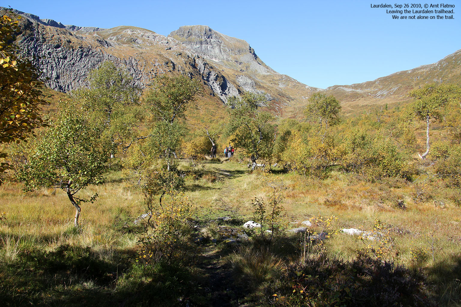
We drove up Laurdalen and found parking at the end of the road. That is - we barely found parking. There were quite a number of people outdoors on this beautiful Sunday. We headed out 11:50am, just after a group of 4 hikers. We crossed the Laurdalselva river together with the other group. A woman fell in the river. Not a good way to begin a hike...
The path was difficult to follow, so we sat a direct course towards Litletoren. We ended up in a terrible bush, but by the time we were out of it, we were way ahead of the others. We aimed for the east ridge, but it soon became apparent that we would not climb the east ridge today. The north side of the mountain was NOT the sunny side, and everything was frozen. Had we been here two weeks earlier, it would have been quite a different thing...

On the way to Litletoren
(Click for larger image)
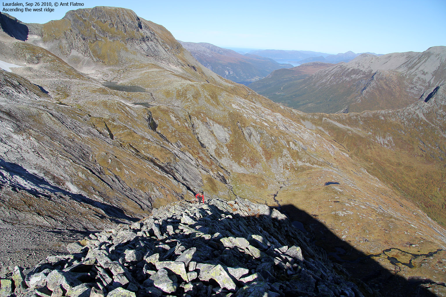
We kept heading west until we found a place to ascend the west ridge. The ridge still looked quite dramatic, but when we eventually got on it, the hike was straightforward. There was also a vague path, which made the ascent even easier. We reached the top of Litletoren 1:20pm - 1h:30m after leaving the trailhead.
We were now in a part of Sunnmøre that I didn't know so well, and as such, I studied the surrounding terrain with great interest. Storetoren, Klakken, Felden, etc. They all had been just names to me. Now I had "faces" to go along with the names. I did ski Trollvasstinden in 2003 with Petter, and that was my first trip to Sunnmøre ever. I still remember how completely unfamiliar Sunnmøre felt back then. But this is no longer the case; I could identify most of the peaks that we could see from Litletoren (Nordfjord and Stryn included...)

The east ridge, seen from the top
(Click for larger image)
Just as we prepared to leave, the other group arrived on the summit. We talked for a little while before starting our descent. We chose a different route down the ridge, and had to deal with icy rocks one more time. Once we reached the plateau at 800m, it was time for pranks and fun stuff...

Pranks
(Click for larger image)
After a failed attempt of descending along Mjeltefjellelva, we adjusted the course and followed the normal route back to the trailhead. We reached the car 3:43pm - almost 4 hours after leaving. Normally, I don't hike a mountain twice (with exception for local tops and some particularly cool peaks such as Liadalsnipa), as there are so many other tops I want to explore, but I'm quite confident I'll be back for Litletoren's east ridge. A full traverse across Litletoren, Klakken and Felden would have been just perfect...

Flying high above Laurdalen
(Click for larger image)


 balance")


")


