
Norwegian Mountains, Møre og Romsdal
Liadalsnipa traverse, July 3 2008
To the main Liadalsnipa page (maps, route descriptions, etc.)
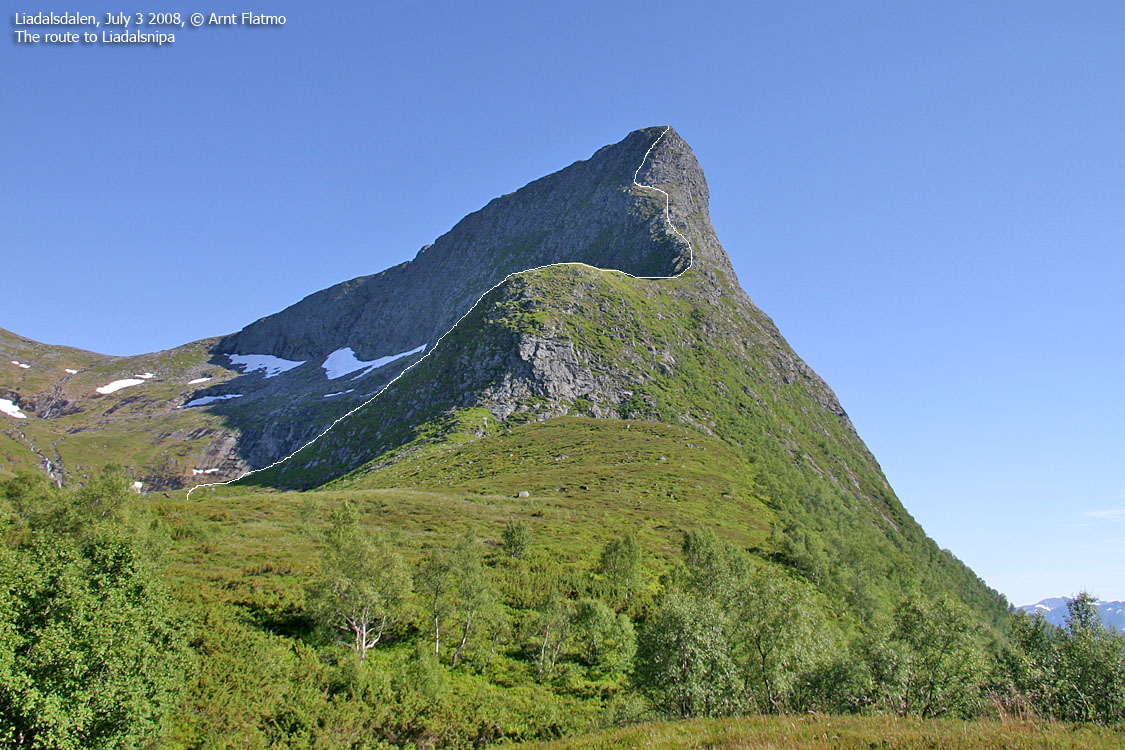
Liadalsnipa - normal route
(Click for larger image)
had been on my mind ever since I first saw it, back in 2006. What a tremendous peak! A Romsdalshorn in miniature! My colleague Rune and I agreed to visit the mountain on this Thursday afternoon, and I passed the word around to other hiking mates. Only my colleague Arngeir found the time, and when Rune called in sick, it was just the Arngeir and me.
what Liadalsnipa would be like. I had no idea myself, but found it best to paint a cruel picture. Just so he could mentally prepare for something airy. At least in respect to the traverse. I figured his psyche would good, now that he had climbed Romsdalshorn the day before.
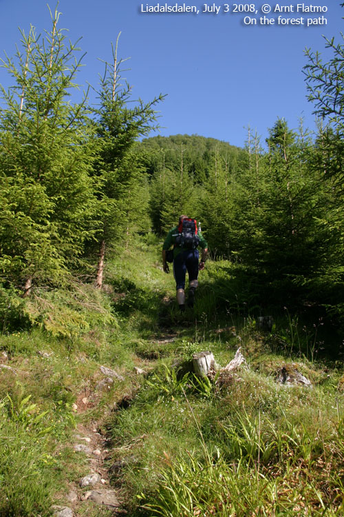
We headed out from the Halsa trailhead just after 17:00PM (I know; it's 5PM, but I'm not gonna edit all of my trip reports..). The local farmer pointed out the route, and I got a glimpse of a group of hikers up in the forest. Arngeir kept a fair pace up the forest, me trailing (limping) along. Once we got above the forest, I couldn't see the other group. I made a mental note about this group being strong hikers.
It was a tremendously hot afternoon, but we had the luxury of cooling off while crossing a creek at 460m elevation. As we approached Lake Nakkevatnet, we spotted the other group, on their way up Liadalsnipa's north ridge.
The north ridge ..
looked spectacular. I couldn't wait to see what puzzle the mountain had in store for us. But no puzzles were expected along the north ridge. The well worn path told us that this mountain have had many visitors. The north ridge reminded me a bit about Trollråsa - my local route up Sukkertoppen's west ridge. Steep terrain and easy scrambling. In other words; a whole lot of fun.
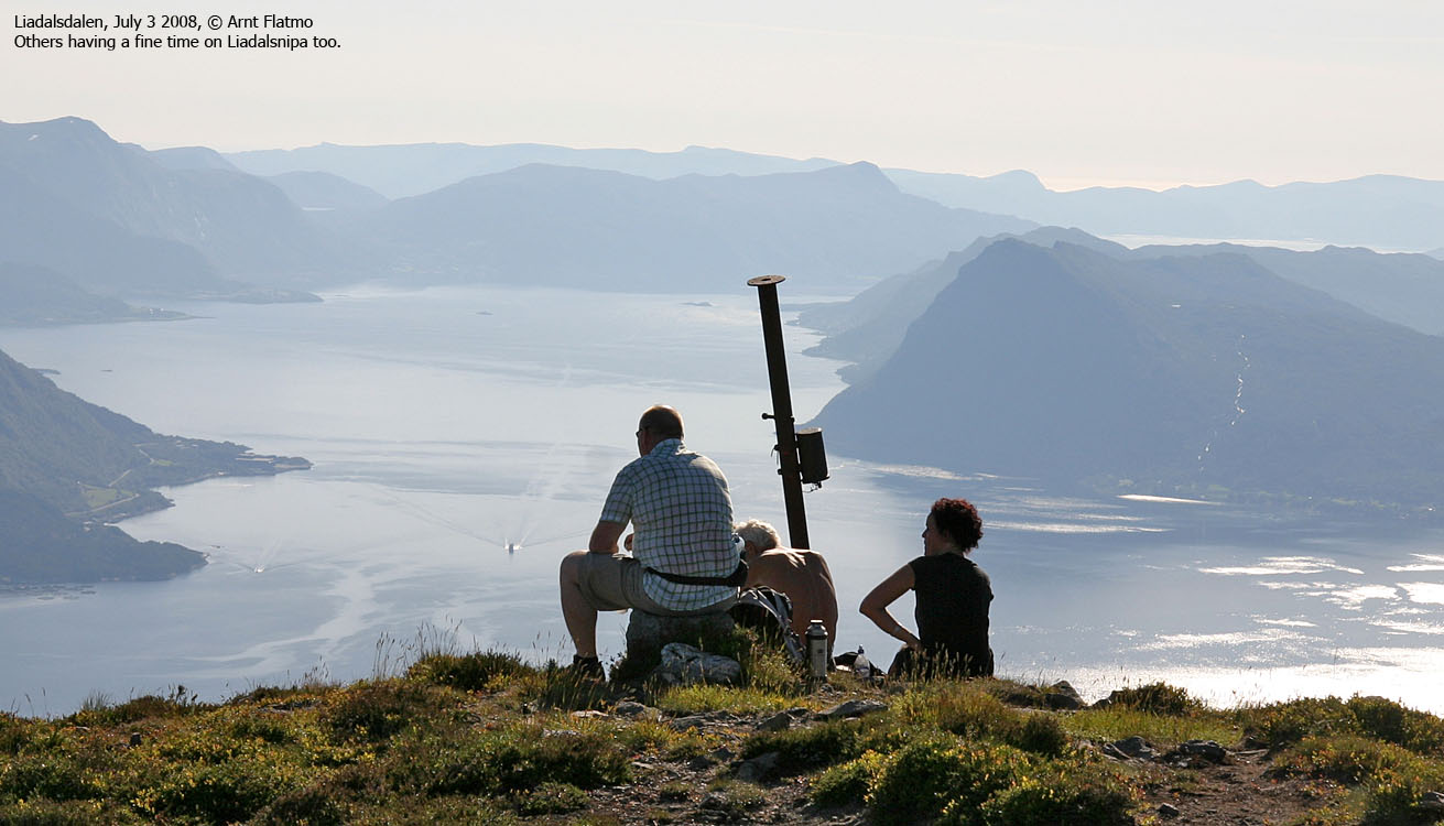
We passed the other group halfway up the north ridge and reached the summit 18:20PM. We chatted briefly with the other group as they sat down by the viewpoint marker.
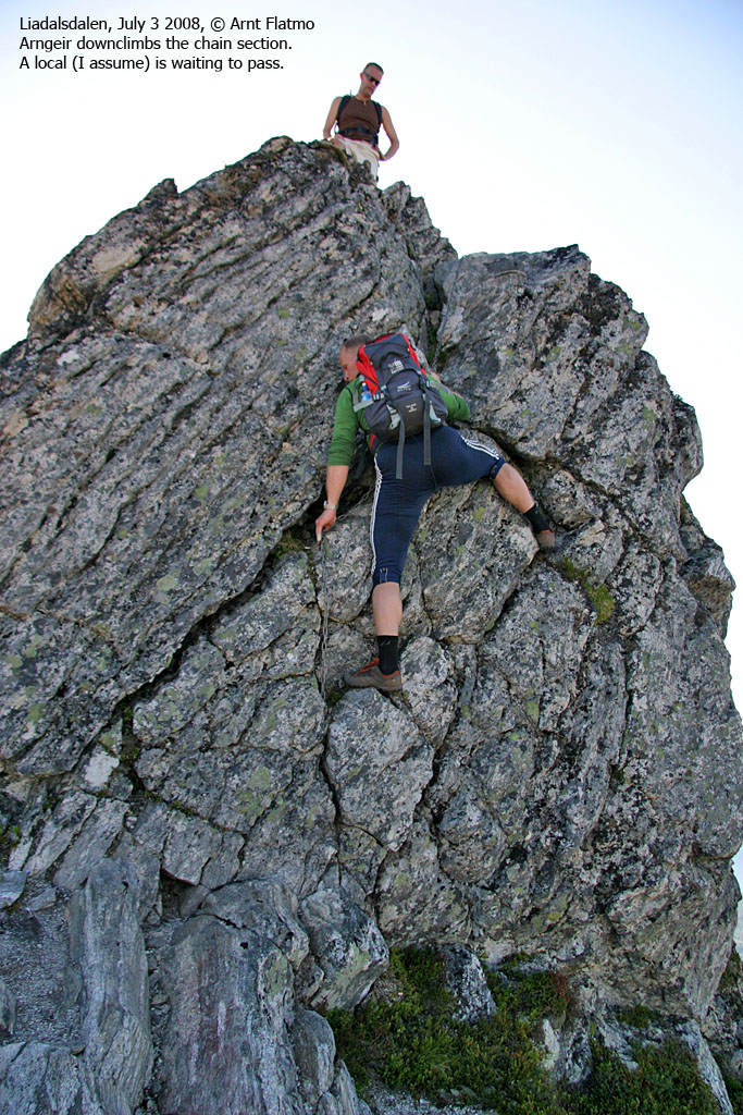
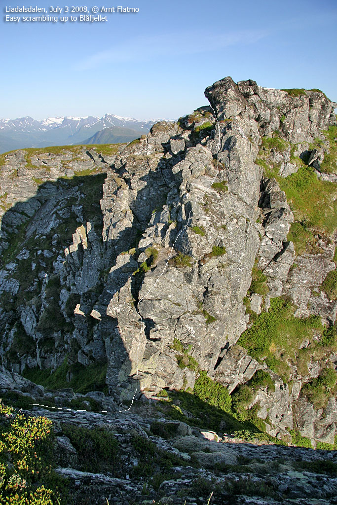
The traverse

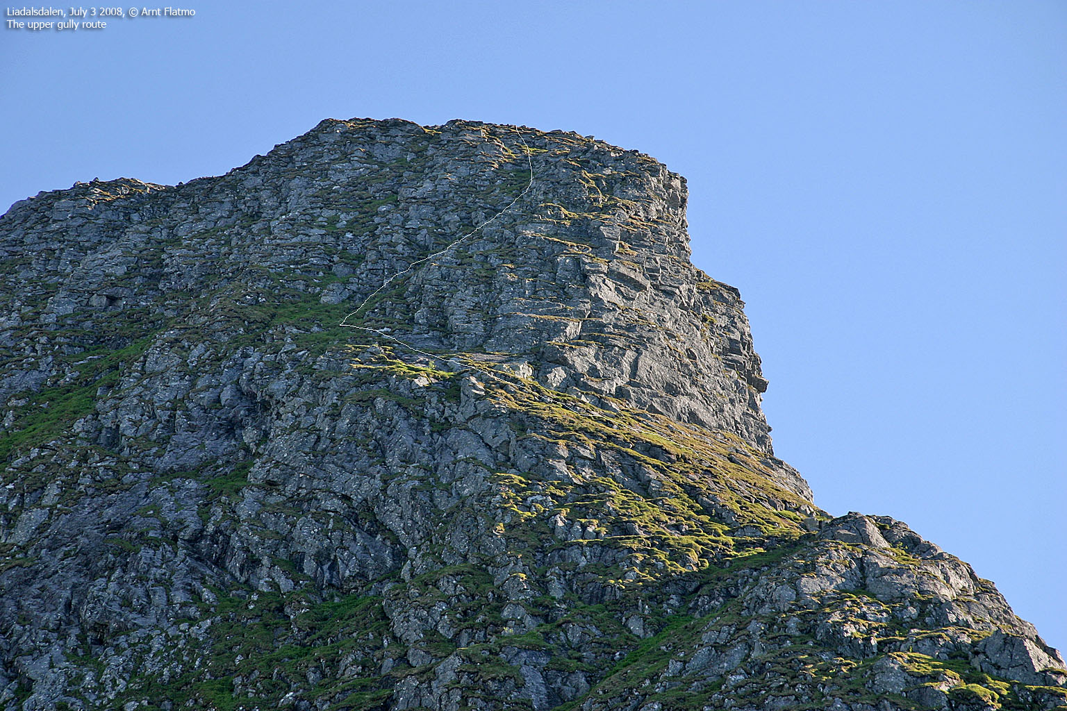
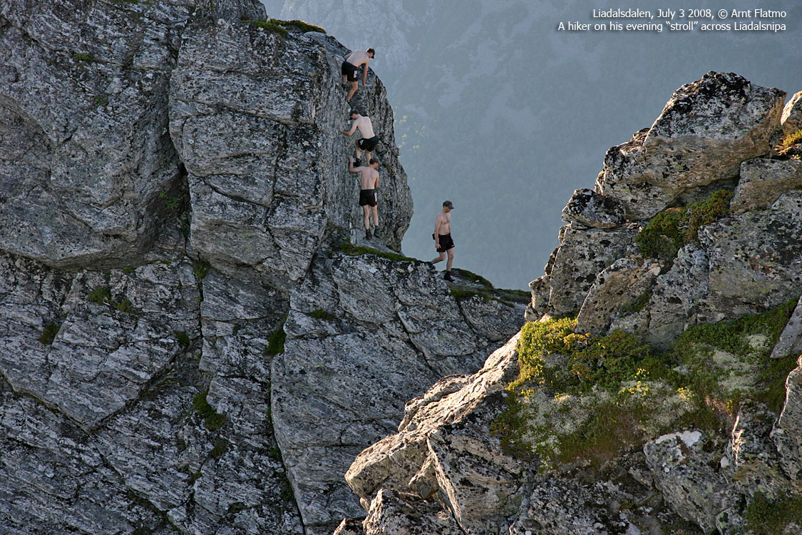
Part of the airy traverse
(Click for larger image)
Arngeir and I moved on, looking forward to the ridge traverse. The ridge soon turned narrow and then quite airy. Then we were standing on top of a 5m drop. A fixed chain suggested how this section should be descended. I was carrying a short rope, but the chain looked solid. I descended first, and Arngeir followed. Another hiker (moving quickly) passed us once Arngeir was down.
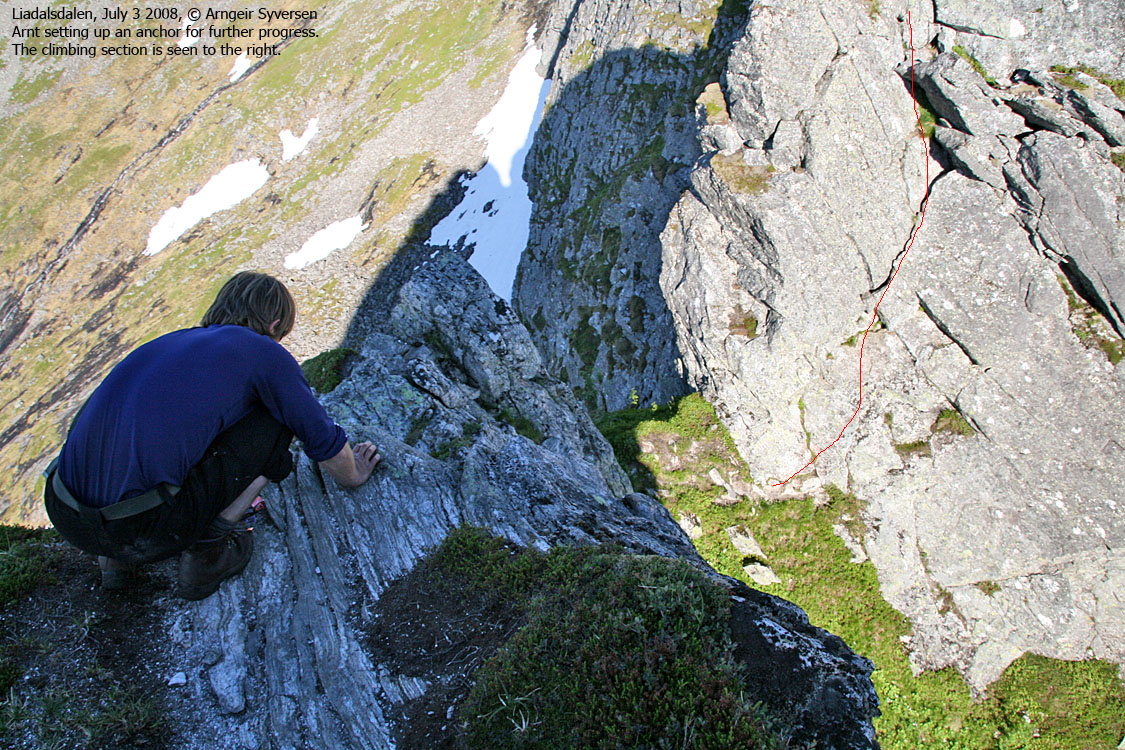
We were now on a ledge, looking down 3m to another ledge. There were no obvious handholds, and watching the passing hiker, it was evident that this section required delicate climbing. Arngeir gave me mandate to define the plan. My plan was simple; a rope! A nut anchored neatly and we climbed down with a prusik attached to the rope. We could of course have rappelled down, but we wanted to climb it and to get to know the mountain. Once down on the next ledge, it was easy to climb back up and pick up the anchor.
We weren't down yet, and I wanted to continue using the rope. I used the same nut, and then we both climbed down. The other group caught up with us, and I asked if they could pull out the nut. But the nut sat firmly, and I had to climb back up to retrieve it. Now that I knew how to climb this ridge, getting back down was easy.
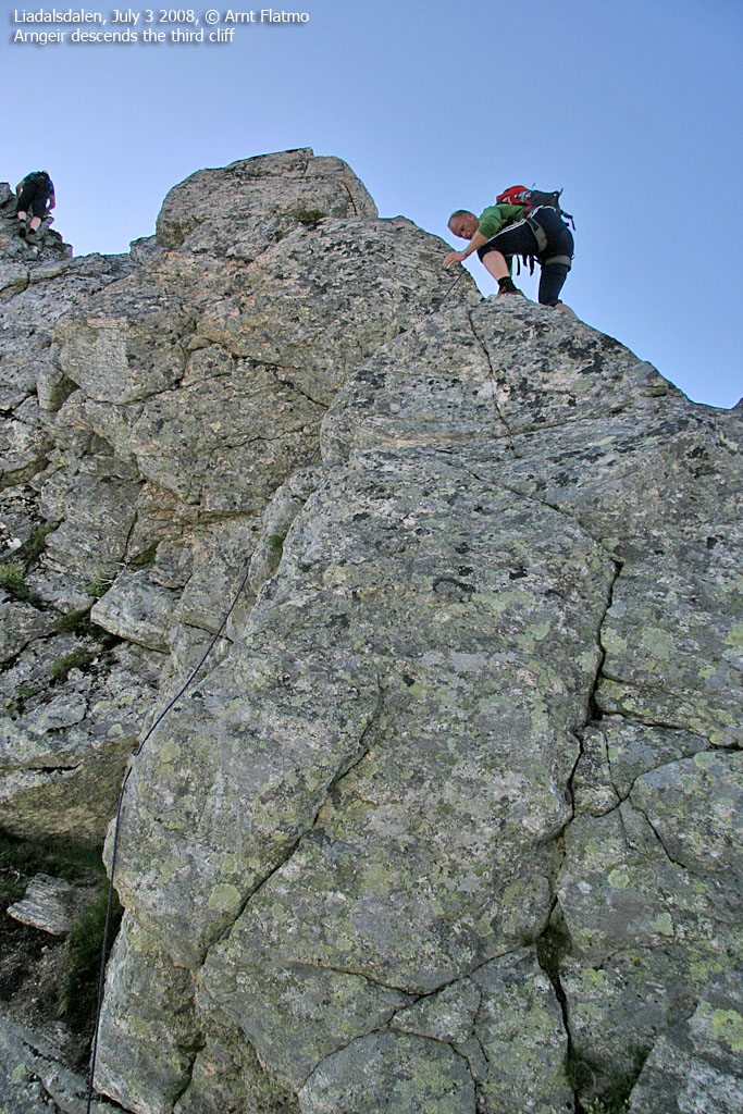
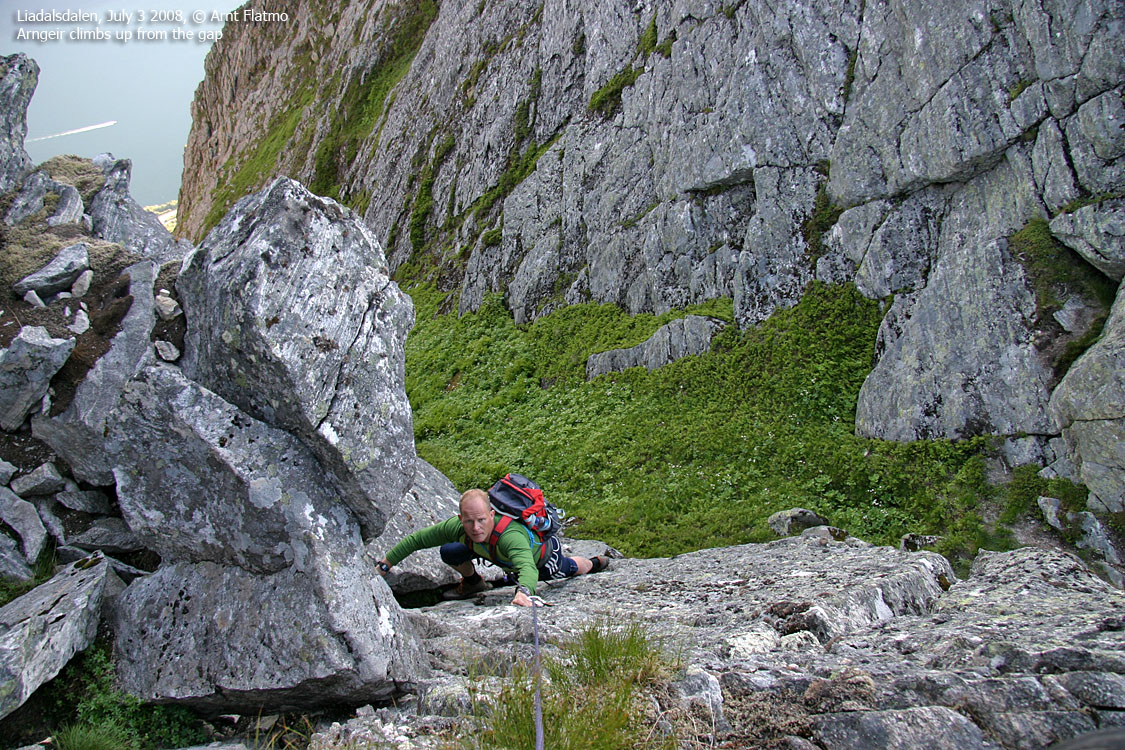
The other group began their climb up the cliff above the gap. Although a bit exposed, the climbing seemed easy enough. But since we had our harnesses on and the rope already out, I wanted to practice on leading a climb. We both enjoyed the practice, and after a little while we were standing on Blåfjellet. Looking at the watch, I couldn't believe that it took us almost two hours to cross the ridge. But this mountain requires focus the first time around. If I should ever do it again (and I will..), I'll allow 20-30 minutes across. Tops! And unroped..
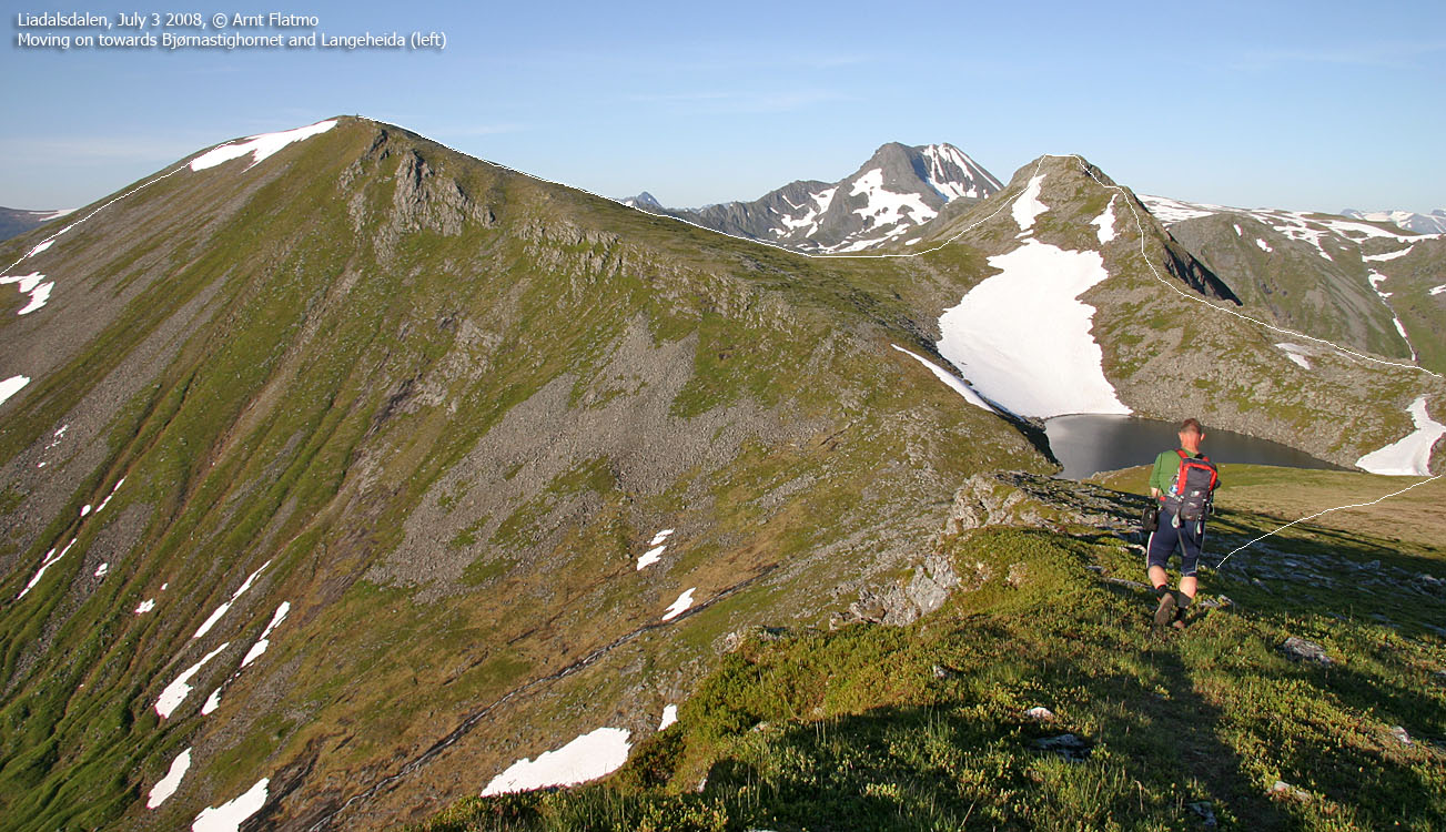
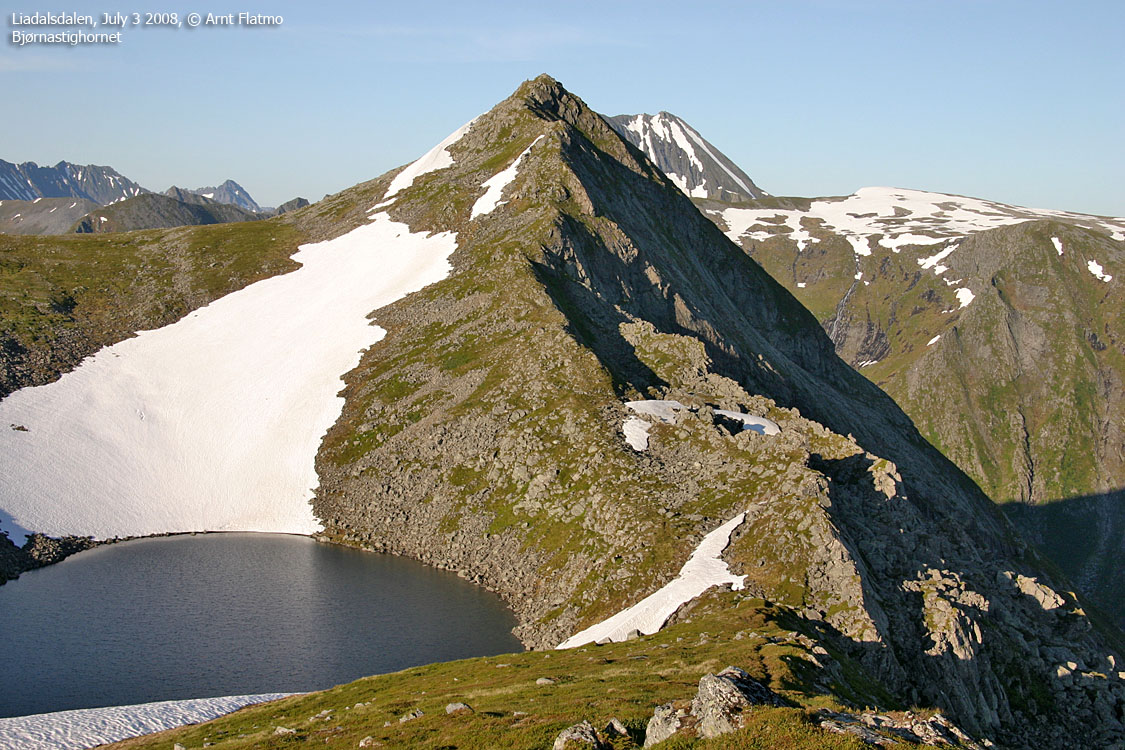
Bjørnastighornet & Eggja.
We decided to visit Bjørnastighornet, now that we were in the area. With Arngeir leading on, the pace was once again fair. In less than 30 minutes after leaving Blåfjellet, we were standing on top of Bjørnastighornet. The big question was now; should we visit Eggja too? We feared that the high point was closer to Hyningane (at least so it seemed), and while we headed down Bjørnastighornet, I made some phone calls to find out what the map stated.
The easternmost point on Eggja had no height on the map, and then we settled for point 982m as the official Eggja summit. This point was sort of "on the way" across. The easternmost point would cost us 1,2Km (total), and it was getting late. We reached point 982m 21:29PM, and Arngeir had a long drive back to Brattvåg ahead of him.
After having visited Eggja, we headed back down to the Liadalsnipa path and hiked quickly down the forest. We reached the trailhead 22:28PM, and were in good shape for the 23:15PM ferry from Festøya.
Thanks to Arngeir for good company on this memorable hike. I'm
looking forward to visit this mountain again. It will become one of my local
mountains when I move further south later in the year. And I'll traverse the
ridge in fine style, making people confuse me with an Ørsta hiker
![]()


