
European mountains
La Gomera, Canary Islands, Spain
Montaña de Yerta (1170m), "Las Toscas" (1045m), Tagamiche (980m), Dec 30 2009
To the main Las Toscas page (maps, route descriptions, other trip reports, etc.)
To the La Gomera introduction page.
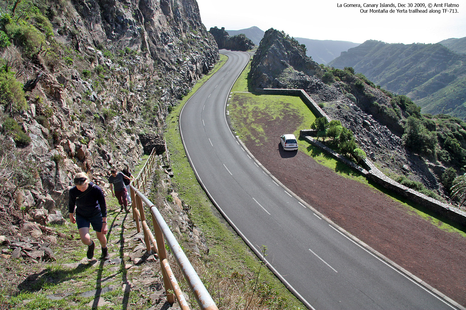
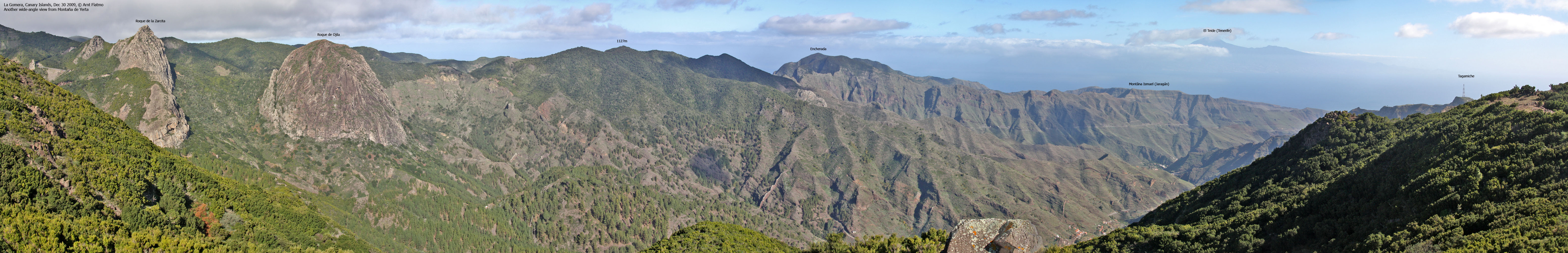
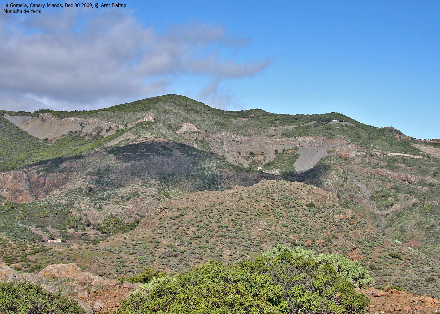
Montaña de Yerta

Montaña de Yerta
(Click for larger image)
This was our (Anne Rudsengen and me) fourth day on the island of La Gomera, and the day began by driving up to the Los Roques area and scramble up Roque Carmona (see a separate Los Roques report). Our plan for the day was a bit ad-hoc, and we assumed that fun would present itself along the way.
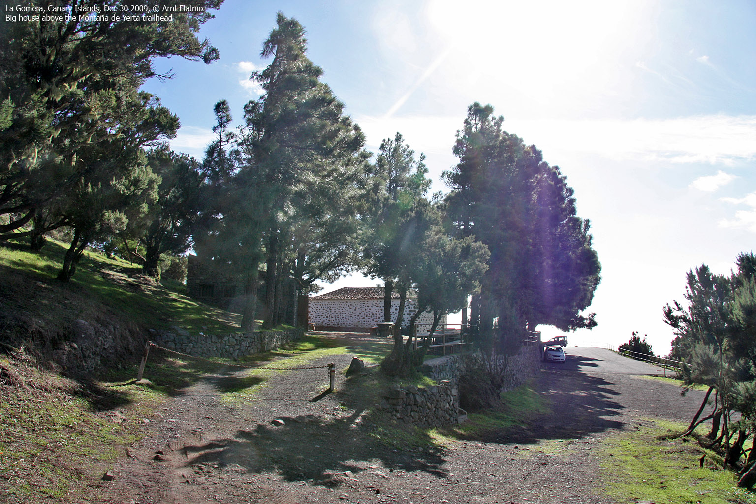
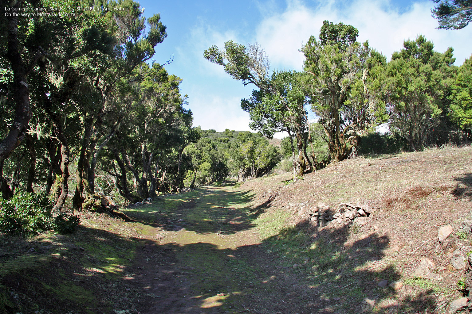
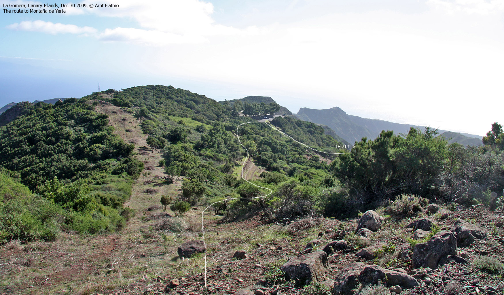
But first, a quick hike to Montaña de Yerta, which was just a few minutes drive from the Los Roques viewpoint. We found parking southeast of this forest hill, followed a stairway up to a house, a forest path for a little while and then a vague path which took us up to the top.
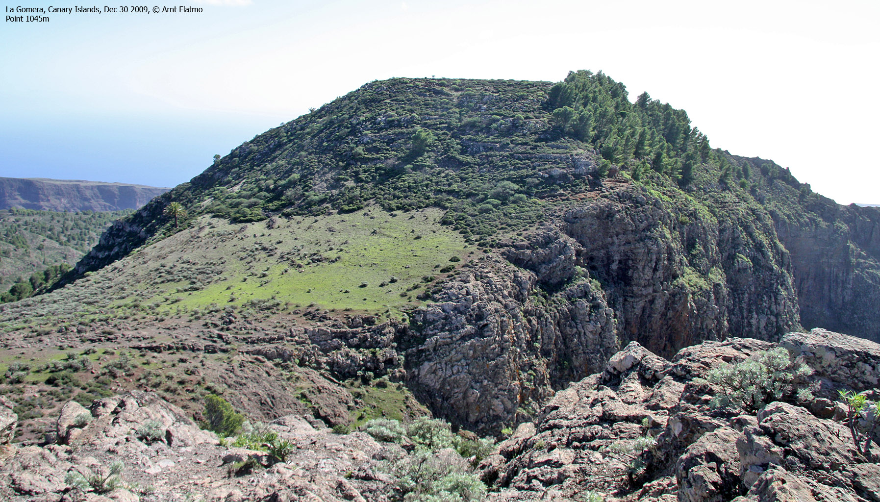
Montaña de Yerta was indeed a nice viewpoint, although not exactly fun. But from the top, I noticed a mountain (Point 1045m) 1,7km to the south which I recognized. Prior to the trip to La Gomera, I studied a ridge leading up to this mountain on Google Earth and recognized it right away. I had no idea if this ridge was doable, but we agreed to take a closer look. Later on, a woman in the restaurant at Degollada de Peraza answered "Las Toscas" when we pointed towards the mountain. As Las Toscas is a small village southwest of this mountain, we're not quite sure if it's the actual name of the mountain. But it sure beats "point 1045m" and we never found a more "official source"...

Point 1045m and the lower tops
(Click for larger image)
"Las Toscas"

The sandstone ridge
(Click for larger image)
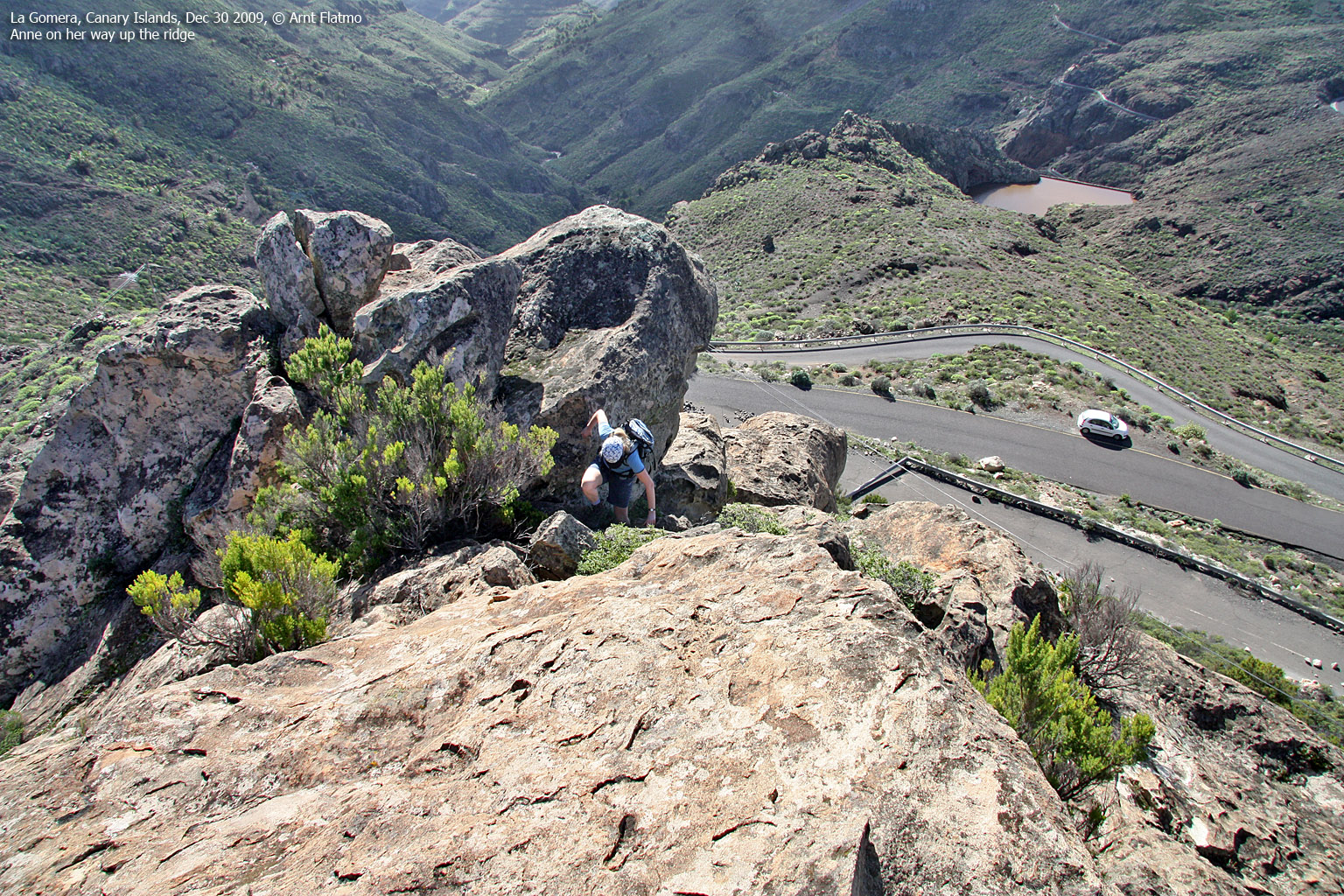
We followed the road to Playa de Santiago and when we reached the tunnel, we parked on the back side. We scrambled up the ridge, well aware that we might have to turn around at any given time.

The route - as seen in Google Earth
(Click for larger image)
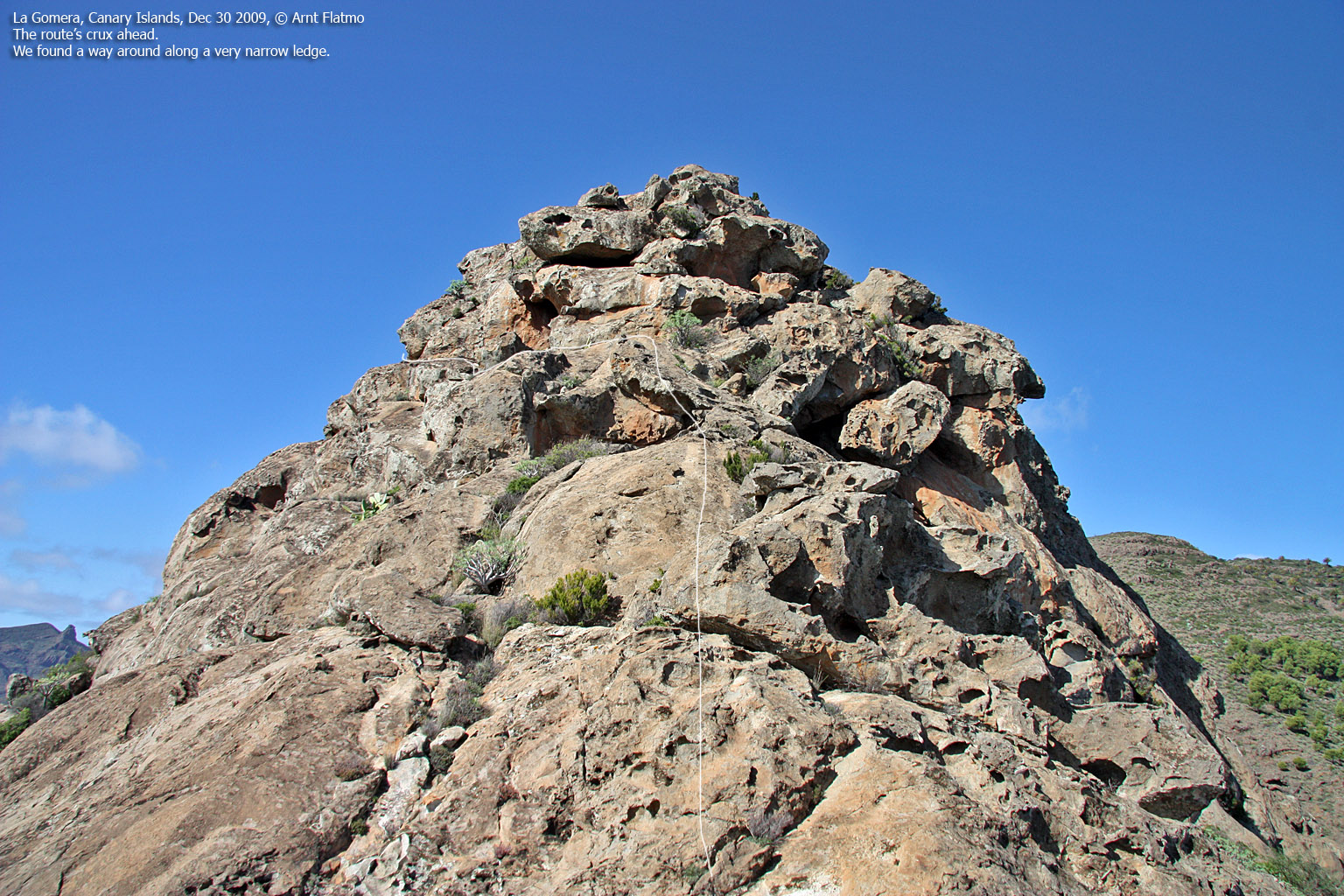
The beginning of the ridge was easy enough. And fun! We assumed that we were scrambling on a ridge of sandstone - subject to strong tear and wear over the years. A point in the distance caught my attention early on, and I suspected this point would give us some "headache" when we got there.
And sure enough - it seemed that we had run into a showstopper. That is - the obstacle could be climbed, but without knowing what was above, it wasn't tempting. But with 15-20 additional minutes of acclimating, my self-confidence might have have grown stronger. But we found a way around - along a narrow ledge. The ledge was indeed airy, but not difficult. And a few minutes later, we were back on the ridge.

Past the ridge crux
(Click for larger image)
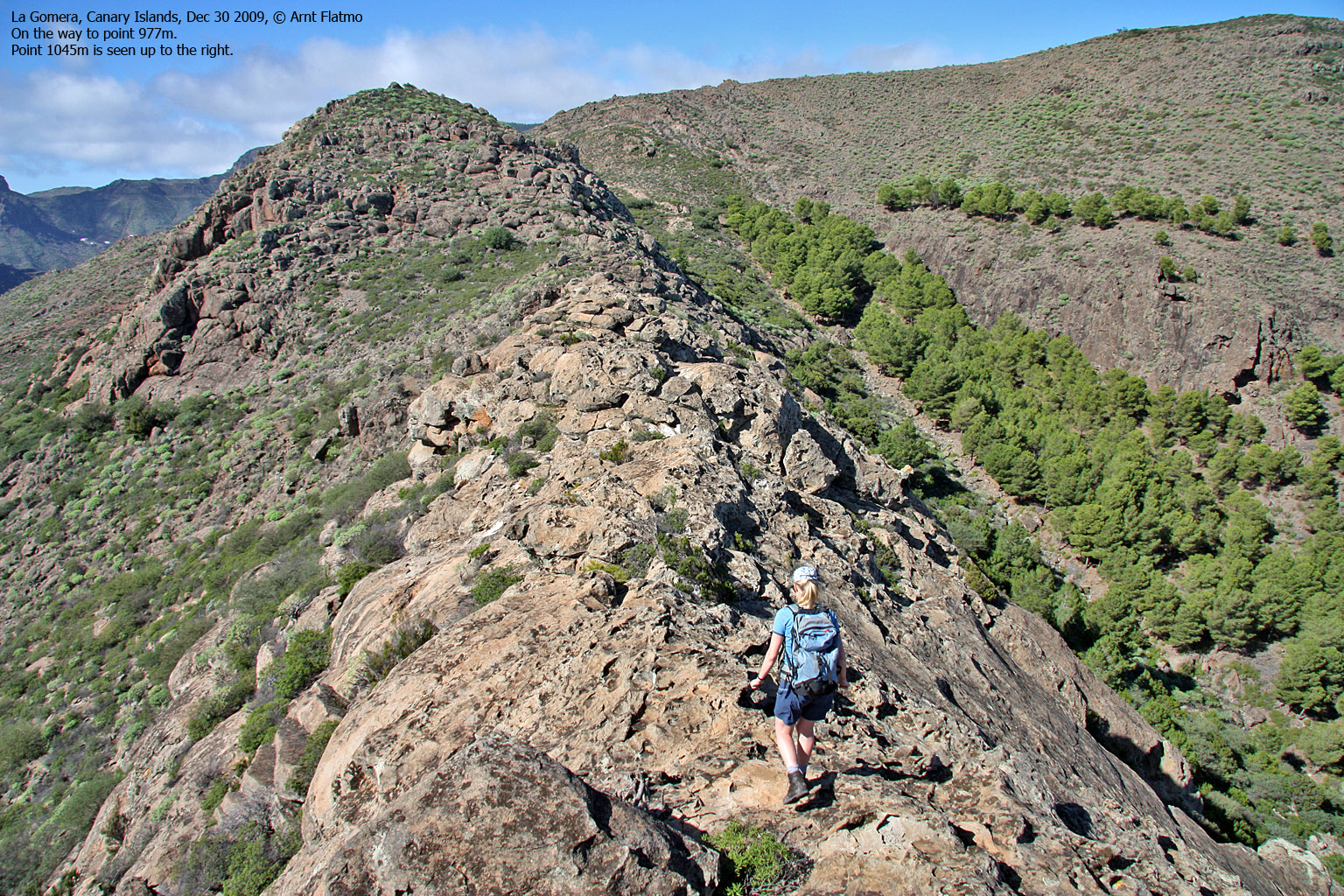
Spirit was quite high when we realized that we would reach point 1045m along this route, and that there would be no turning back. Arriving on point 977m - the north end of the ridge - we faced a rather steep descent before we could walk up to point 1045m - the main summit. The descent went fine, and we reached point 1045m 2:22pm - 1 hour after heading out. The fun was definitely on!
We agreed that the best thing would be head down to the east and walk the road back to the trailhead. Then we could also visit points 1039m and 1035m - both excellent viewpoints towards the grand valley between us and the La Gomera high plateau. We could see Roque de la Zarcita in the distance. Little did we know that we would be standing on top of this mountain later in the afternoon.
Anne found a good route through the bush, thorns, cactuses and the who-knows-what and we reached the road without spilling too much blood. Our car was 1000m up the road and we were back at the trailhead 3:23pm - two hours after heading out.
Past the ridge crux
(Click for larger image)
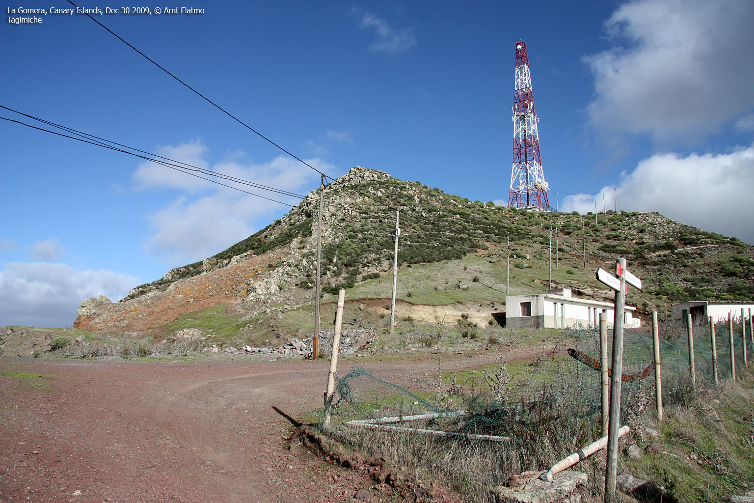
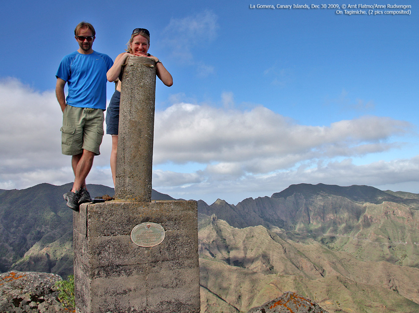
Tagamiche

Tagamiche
(Click for larger image)
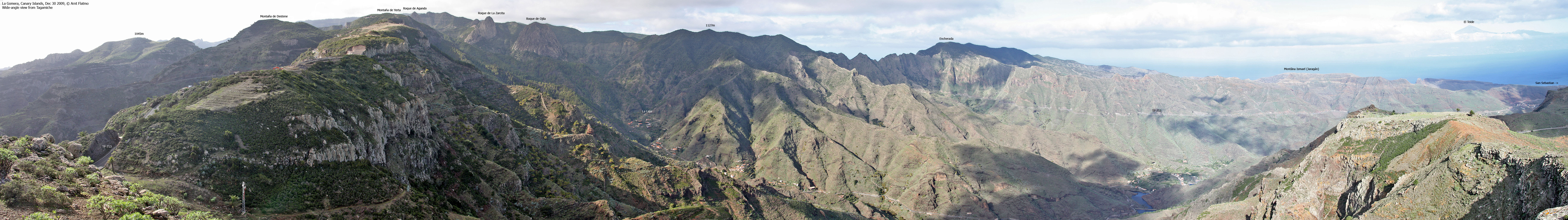
After the very enjoyable traverse across point 1045m, we drove to pass Degollada de Periza and had lunch at the local restaurant (seen in the foreground on the above picture). Then we drove a few meters down the road and walked up the service road to Tagamiche summit. The views were superb, but we had already seen most of this part of the island and soon headed back down. On our way back to Valle Gran Rey, Anne discovered a "secret" path to Roque de la Zarcita, and we had a most excellent end to an already very fine day (separate report).

On Tagamiche
(Click for larger image)
Next report: Tejeleche


")


")


