
|

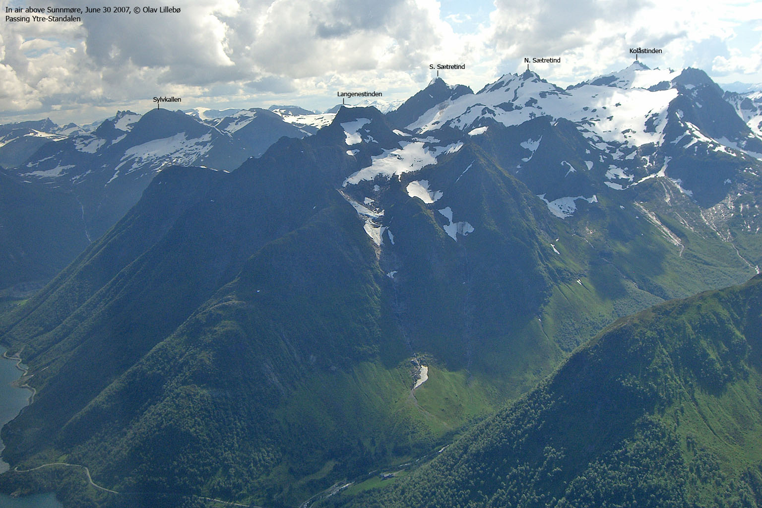
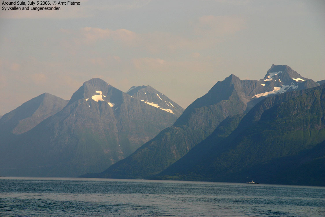
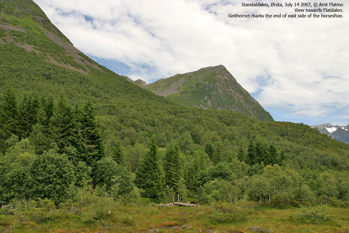
Langenestinden, Sætretindane and Kolåstinden are the main peaks north of Standaldalen and south of Ytre Standalen valleys. Langenestinden rises steep up from Hjørundfjorden, and is a very impressive peak when seen from below. Normal access is from Standaldalen via Flatdalen. The peaks Geithornet, Langenestinden, Ureggane, Snarhornene and Sætretindane form an extremely rugged and wild horseshoe around Lake Flatdalsvatnet.
The route from Flatdalsvatnet to Langenestinden is steep, but does not require scrambling (YDS class 2+). Losing your foothold in the hillside, as well as rockfall (primarily caused by other hikers) are dangers you need to take into consideration. Langenestinden is also known as Standalhornet (Standalhorn, ref. Randers' Sunnmøre) and Breitinden.


Langenestinden (Norge 1:50,000: 1206m, Økonomisk Kartverk: 1206m, UTM 32 V 364598 6908400) has a primary factor of 116m, towards the higher parent mountain Nordre Sætretind (1365m). The saddle (approx. UTM 32 V 362959 6908083) is found on the ridge between Ureggane and N. Sætretind. Ref. Norge 1:50,000 (20m contours), the saddle height is within the range 980-1000m, interpolated to 990m.
Google's interactive map. You can zoom, pan and click on the markers.
Notes: Class ratings are in reference to YDS. Click here for more information.
The trails described below are not necessarily the *easiest* trails to this mountain.
|
Standaldalen - Langenestinden (summer/autumn)
|
|
Access
(all distances are approx. distances)
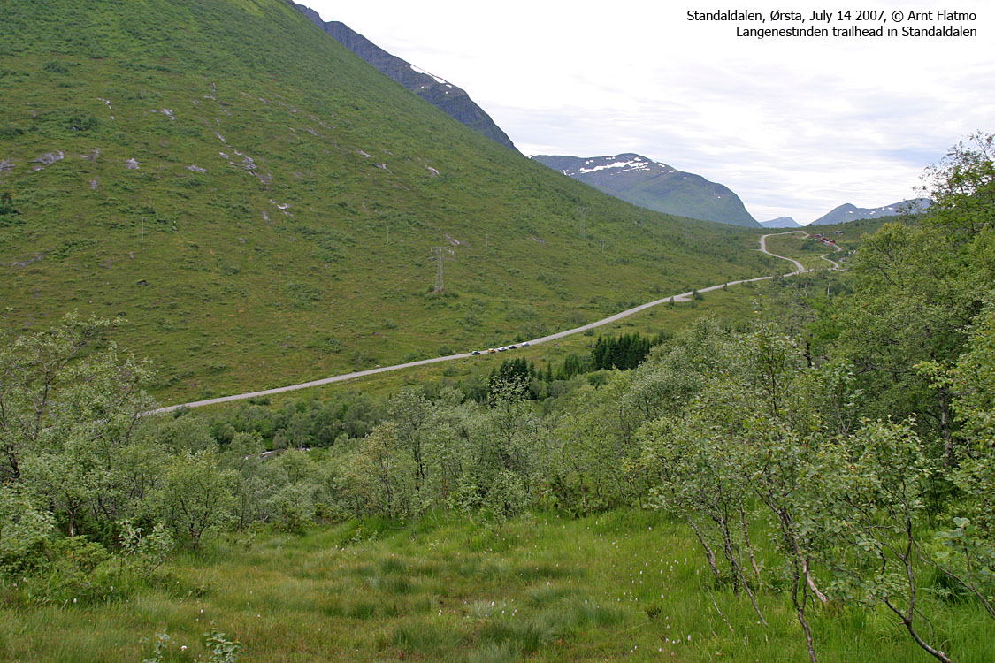
From Ålesund, follow highway E39 towards Bergen/Volda to the ferry at Solavågen. Take the ferry over to Festøya. Turn left in the direction of Standal and follow the road 19,2Km (passing Store Standal along the way). You're now 1,8Km east of Standalvatnet. Park alongside the road.
The road turns into a gravel road just after Store Standal. The road between Store Standal and Follestaddalen has traditionally been closed during winter, but according to standalalpesenter.no, the road is now open all year around (one of the pictures in the trip report says the road is closed in winter, but this is incorrect). Per May 2008, the road is not a toll road.

The route
To Flatdalsvatnet:
From the parking, locate the Flatdalen trailsign and follow a vague path that immediately crosses the river on a bridge. The path continues eastbound (along the river) and descends slightly before it continues northeast up the forest, towards the river from Flatdalsvatnet. The path is in overall boggy and your pants will be wet after rain (high grass).
Once you arrive at the river, cross it. Red paint on a rock marks that a crossing should take place. Continue on path on the other side and head up the valley. At 530m (elevation), cross one of the many streams coming down from the mountains. The crossing is not obvious, as you're already on a path. But the path continues in the direction of Nordre Sætretind, and you need to be further east in the valley.
After crossing, locate the path on the other side, by the stream. You'll follow a moraine that gets quite narrow and rises high above the streams. Eventually, the terrain levels out towards Flatdalsvatnet.
To Langenestinden:
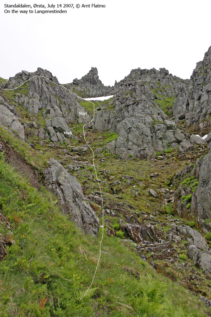
An overview of route up from the lake is shown on this picture, while the route is shown in full detail here.
Head to the drain from Flatdalsvatnet and cross it on rocks. Look northeast, and you'll see a grassy hill and to its left, a steep and narrow coluoir, growing wider higher up on the mountain. If there is snow below the couloir, head up the grassy hill and traverse left (north) so you get into the couloir above the snow. Without snow, you can head directly towards the couloir.
You'll stay in the couloir for a few minutes, before you seek left and finaly get on top of the ridge between this couloir and the next. Stay on the ridge and head up (along small boulder) to a cliff that has a red marker on it. Turn right at this cliff and traverse back into the couloir you started from.
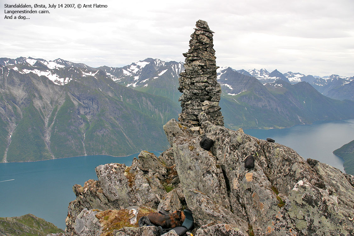
Next, you have three gullies ahead of you. Follow the center gully until you see the upper part of the main couloir. Once you pass the-rock-with-the-hole-below, turn left, cross a small ridge and enter the leftmost of the three gullies. Traverse the gully you just came into, and pass a distinct rock feature on the left-hand side. You're now on the final ridge to the summit, which is marked by a tall cairn.
Don't cause rockfall and don't stumble! If you pay attention to a VAGUE path and scattered red paint, then you should have no problems on this route. This is classic YDS 2+ terrain. You don't scramble - you walk and use your hands for balance and support. Bringing an ice-axe (yes, in summer too) is a very good idea.
 westcoastpeaks.com
Other Møre & Romsdal mountains
Other Norwegian mountains
westcoastpeaks.com
Other Møre & Romsdal mountains
Other Norwegian mountains

