
|

Kvitafjellet seen from Stølshorgi(No Javascript) |
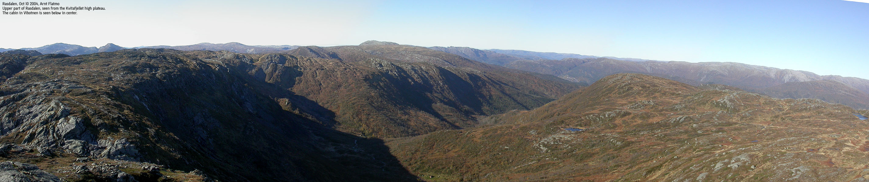
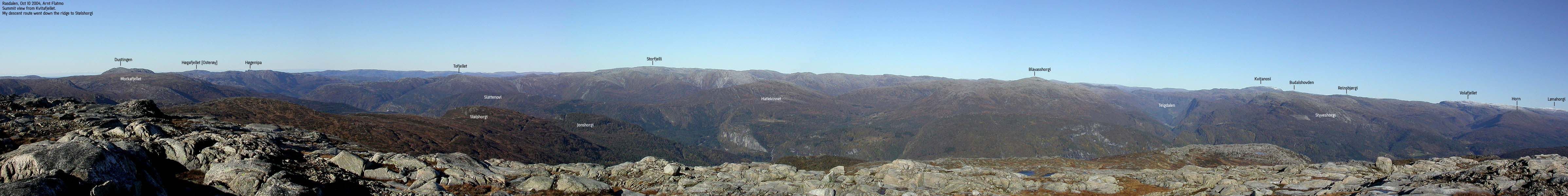
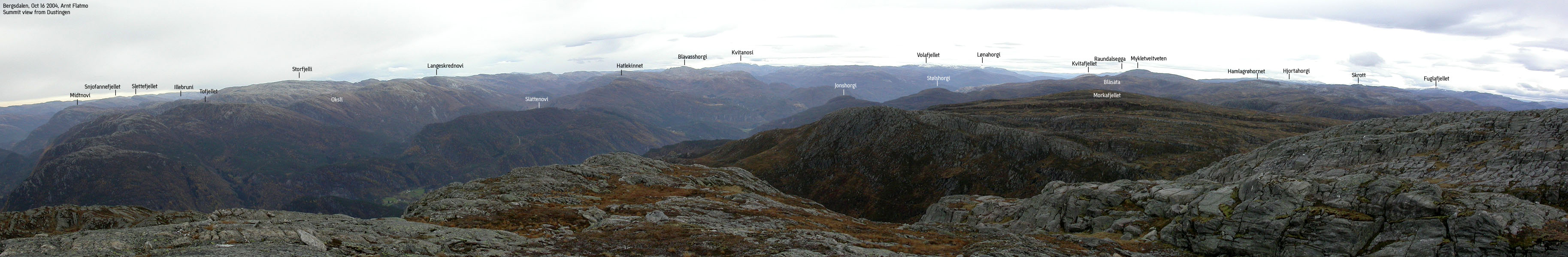
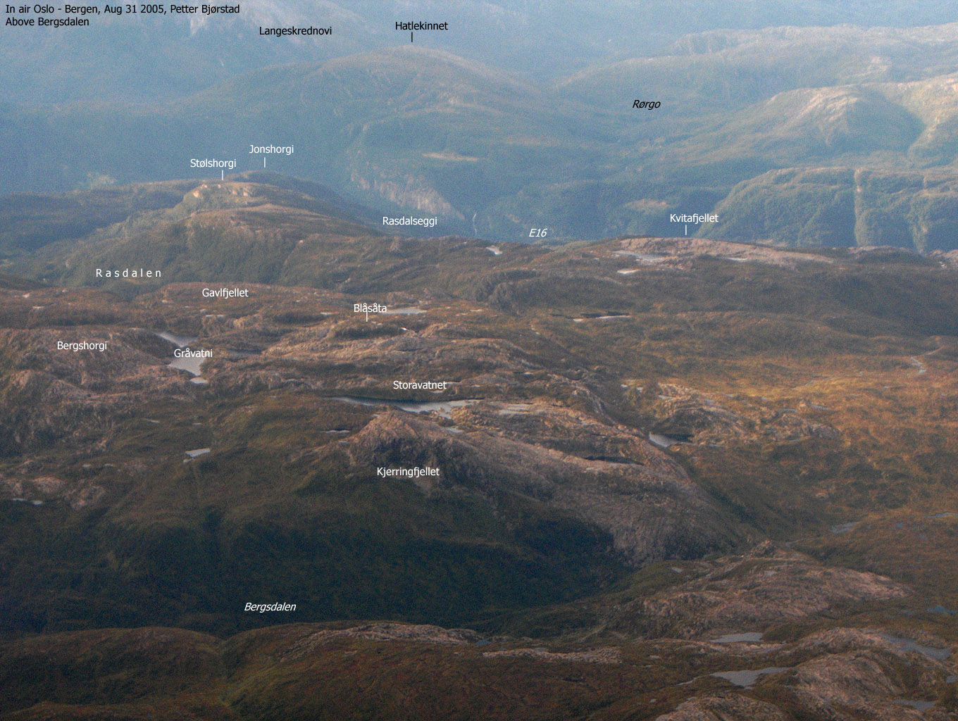
Kvitafjellet is located between Bolstadfjorden (between Voss and Dale) and lake Hamlagrøvatnet at the eastern end of Bergsdalen valley. From its summit, you have an excellent view of the southern Stølsheimen mountains facing Kvitafjellet. The view towards Hamlagrø and Bergsdalen is limited due to higher mountains in the foreground. The name - ("white mountain") most likely reflects the distinct white rock on the summit plateau.
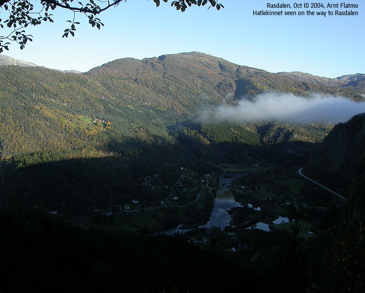
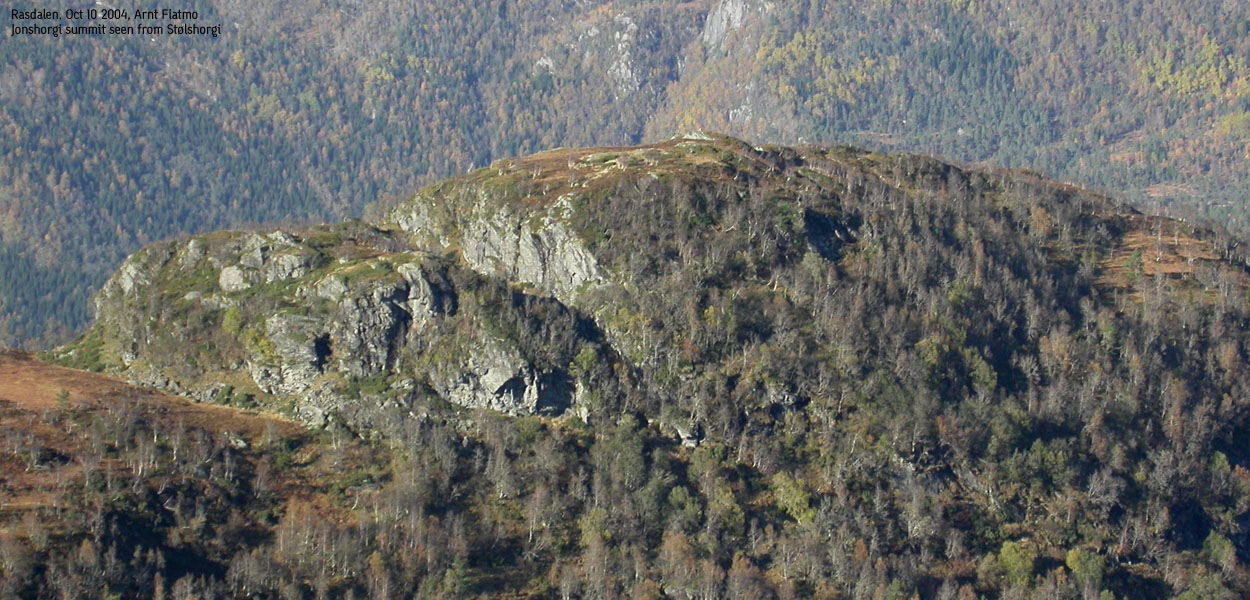
Stølshorgi is a forest hill above Rasdalen, the best starting point for reaching Kvitafjellet from the north. Stølshorgi is the higher neighbour to Jonshorgi, whose cliffs falls down to highway E16.
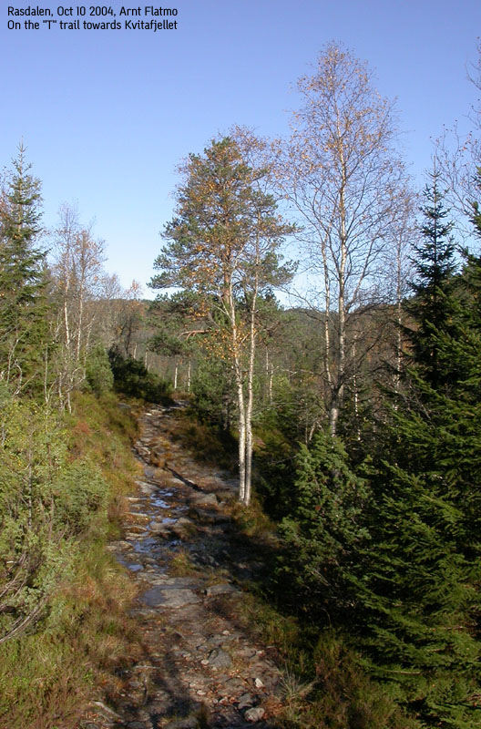
From øvre Rasdal, a well established "T" trail provides a gateway between Bolstadfjorden and Bergsdalen. The trail run through the Osskardet pass, and the walk is highly recommended. This page will describe how to reach Kvitafjellet via this trail.
Primary factor:
Kvitafjellet (995m) has a primary factor of 125m towards the higher Blåsåta (1029m). The saddle is found in Osskardet pass. Ref. the M711 map (20m contours), you cross the 880m contours on the high route, but not 860m. The saddle height has been interpolated to 870m.
Stølshorgi (764m) has a primary factor of 94m towards the higher Kvitafjellet (995m). The saddle is found between Stølshorgi and Rasdalseggi. Ref. the M711 map (20m contours), you cross the 680m contours on the high route, but not 660m. The saddle height has been interpolated to 670m.
Note: Ref. Økonomisk Kartverk (5m contours), you cross the 690m contours on the high route, but not 685m. This suggests an interpolation to 688m. If the height on this map had been consistent with M711, I would have used a primary factor of 76m. The height is however 768m on this map (primary factor would then be 80m). Due to the inconsistency between the maps, I have chosen to comply with the M711 map.
Notes: Class ratings are in reference to YDS. Click here for more information.
The trails described below are not necessarily the *easiest* trails to this mountain.
|
Øvre Rasdal - Kvitafjellet - Stølshorgi round-trip (summer/autumn)
|
|
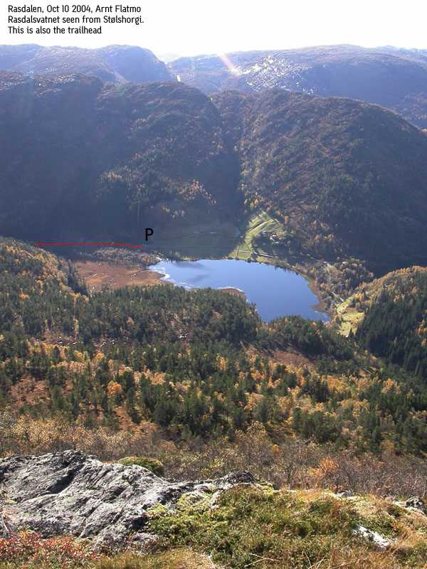
From Bergen, follow highway E16 towards Oslo. From the highway 580/E16 roundabout before Arnanipatunnelen, continue on E16 for 46,3Km. Exit left towards "Bolstadøyri". Turn left in the very first junction. Drive 50m. Turn left up "Rasdalsvegen". Follow this road to road end by lake Rasdalsvatnet. Park here.
The road up to Rasdalen turns to gravel after 600m. You will pass a gate after 4Km, which is closed when the sheep are out. Make sure you close the gate behind you.
Ascent
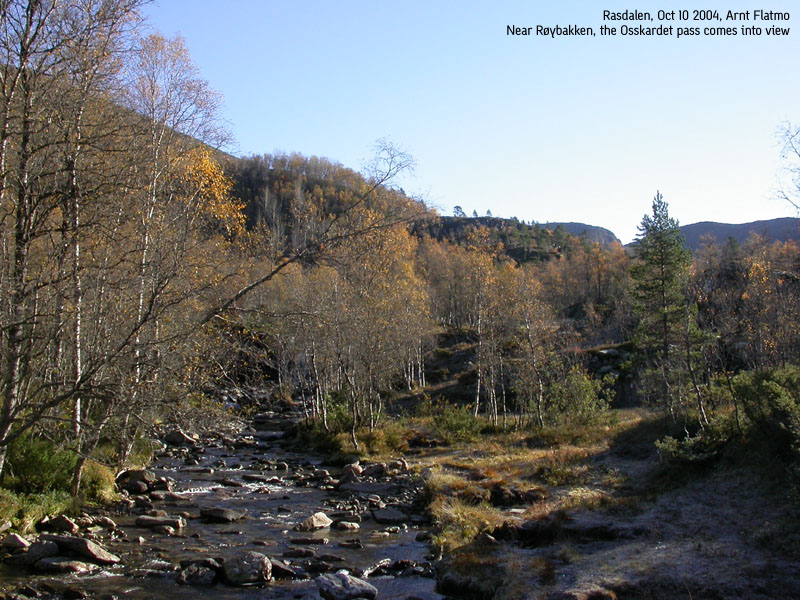
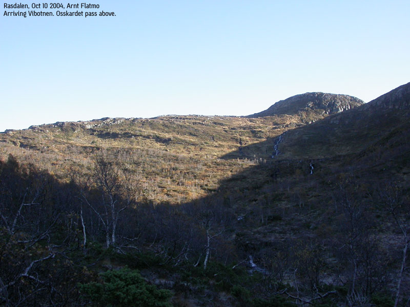
Walk through a gate (may be open late autumn) and enter the "T" trail that begins by the innermost houses. The trail follows a stream all the way to Vibotnen, where you have a clear view towards the Osskardet pass. At Vibotnen, the trail crosses the stream from Njukatjørni. This is near the cabin in Vibotnen, and the crossing is well marked.
If you find that there is too much water in the stream, then you may follow the ridge from the cabin up to Øykjabotseggane. It is supposed to be a trail heading up this way. From Øykjabotseggane, proceed eastbound (off-trail) towards Kvitafjellet.
Assuming you can cross the stream at Vibotnen, follow the "T" trail up to Osskardet pass. The trail is more like a path up this strenuous hillside, and not nearly as well traveled as the trail up the forest. Red "T"'s on rocks will however indicate the route, on the right hand side of the stream coming down from Osskardet.
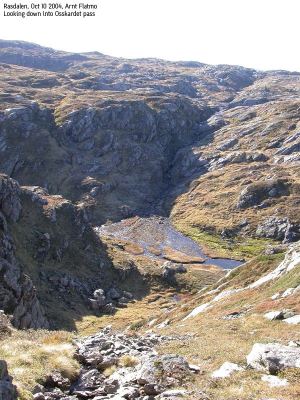
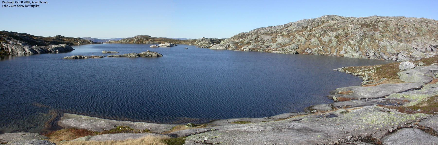
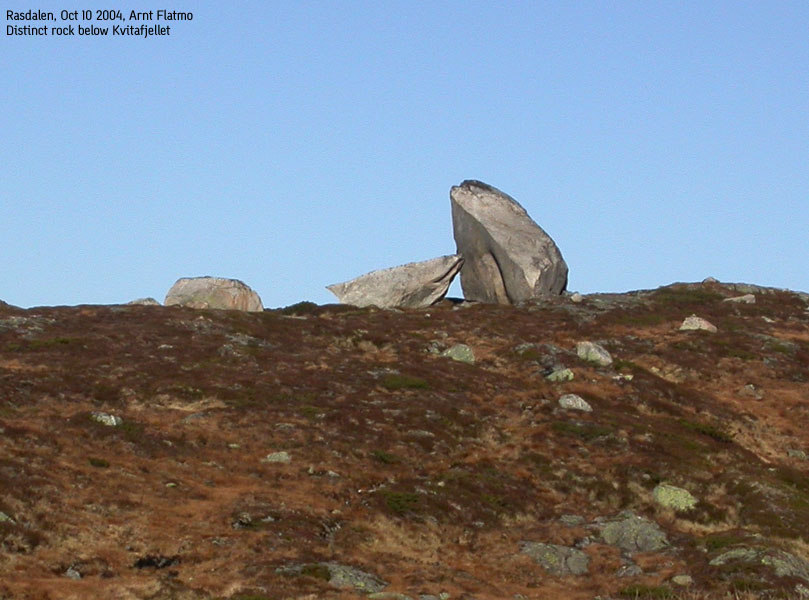
In Osskardet, locate a gully that runs up to your left. Follow this gully up to the high plateau. You will soon have Kvitafjellet point 991m in view (995m is hidden behind). Follow the terrain where natural until you reach lake Gråhorgavotni below Kvitafjellet. Cross between this lake a smaller, unnamed lake to the east, and walk up on to the Kvitafjellet summit, marked by a proper cairn.
Descent
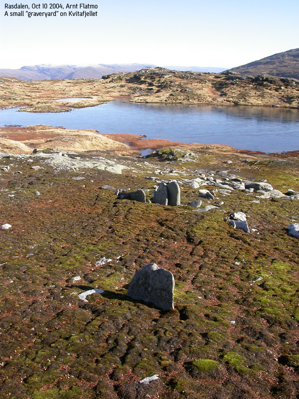
Descend your ascent route (perhaps taking a more direct route back to Vibotnen) or follow the high ridge towards Stølshorgi. The characteristics of this ridge are a number of cliffbands which you don't see when you come from Kvitafjellet. A path can be followed more or less down the ridge. All cliffbands, except the one between Rasdalseggi and Stølshorgi should be descended to the right (east). The final cliffband can be descended in the middle.
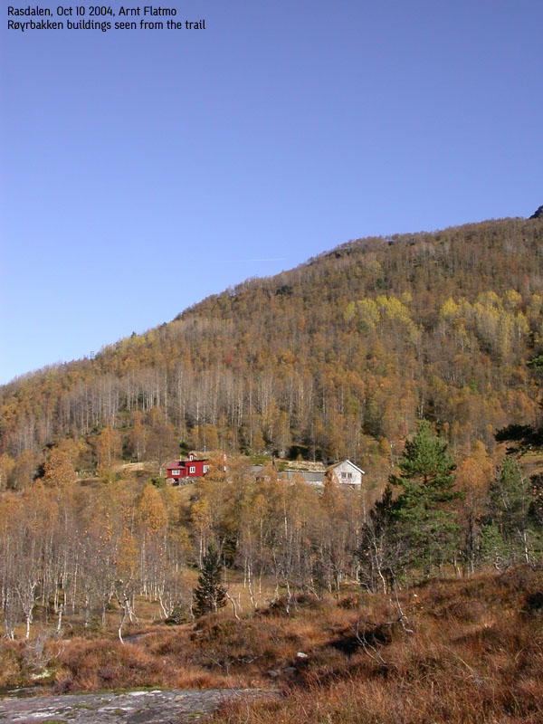
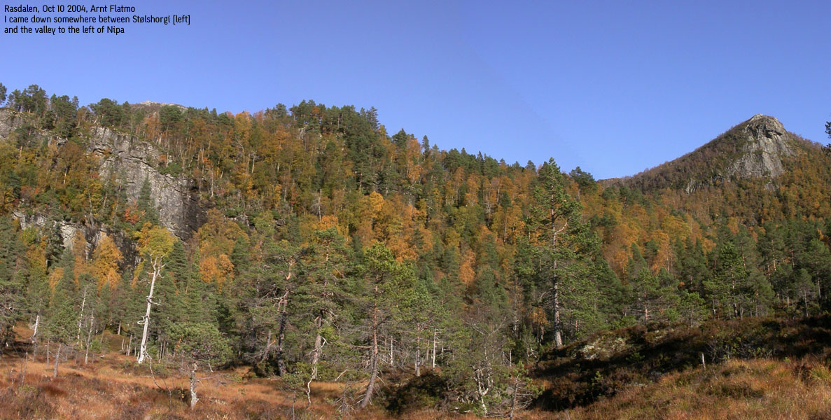
After reaching Stølshorgi (marked by a small pile of rocks), you will have to base your descent to lake Rasdalsvatnet upon no trails, alternatively search for one. It is most unlikely that there are no trails from Rasdal up to Stølshorgi. A visible path can be followed from the 750m elev. viewpoint west of the summit, but I managed to lose it rather soon. My recommendation is that you seek down towards the valley between Stølshorgi and Nipa and follow the stream all the way down to the lake. At the lake, turn right and join the forest road from Tuftene. Alternatively, turn northwest at 580m elevation and join the trail to Jonshorgi in Tuftedalen, a bit north of Tuftene.
After a long walk to Hjortahorgi with my friend Torbjørn the day before, I didn't feel strong for a serious project. Actually, I had quite modest plans until I saw the weather forecast for this Sunday. No rain, no clouds, just a big, shining sun. Hello? Excellent weather in the week-end? Why didn't I submit a lottery ticket?
Deciding on where to go was hard, but I have had Kvitafjellet on my to-do list for quite some time now. Only Kvitafjellet and Kvamsnovi were undone in the Bergsdalen region. I had always assumed I would hike this mountain from the Bergsdalen side, but since I now knew about Rasdalen from my Jonshorgi hike, I decided to start from there.
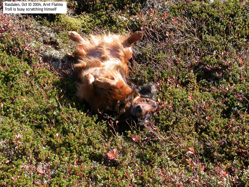
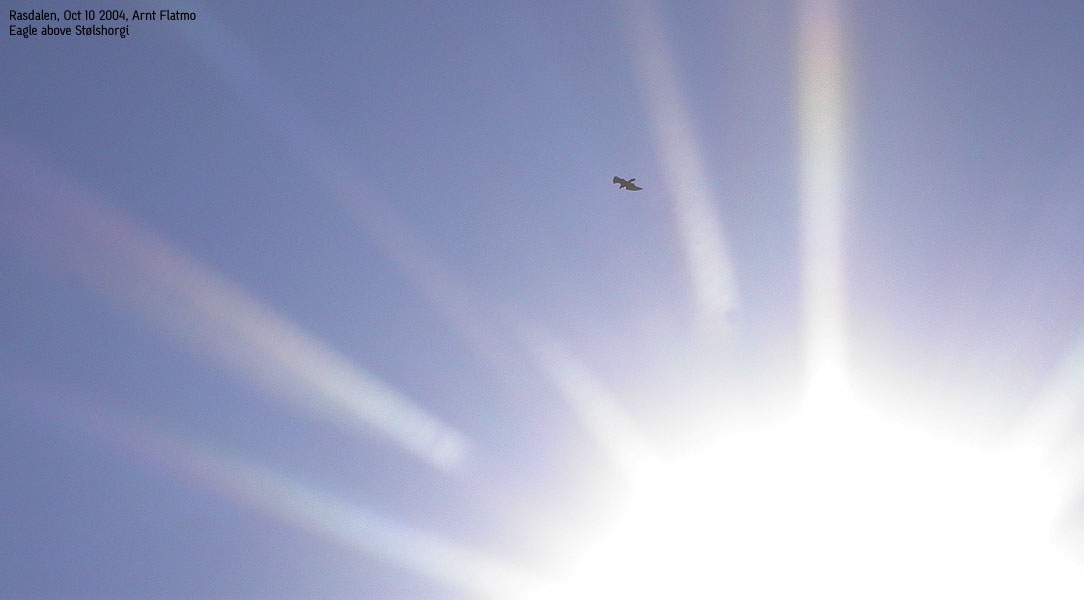
We left the trailhead by lake øvre Rasdalsvatnet 10:55AM. A local farmer kept me company for the first 10 minutes. He was on his way up the mountain, trying to figure out where a substantial number of lambs had gone. He suspected the "evil eagle", and told me I would probably see the bird once up on the mountain. The trail was excellent, although slightly muddy in places. This didn't stop Troll from walking, and he kept a steady rhythm all the way to Vibotnen. I put him in the backpack when I saw the steep rise towards Osskardet pass, and as usual, he didn't mind.
The local farmer had referred to the path from Vibotnen to Osskardet as "murder". This wasn't the term I would have used, but it was surely more strenuous than the route so far. In Osskardet, the terrain was a bit rugged, and it was difficult to get a clear understanding on where to go. I decided to move to high ground as soon as possible, and followed a convenient gully. Above this gully, the rest of the route was fairly obvious, and by 13:25PM, we were on Kvitafjellet summit.
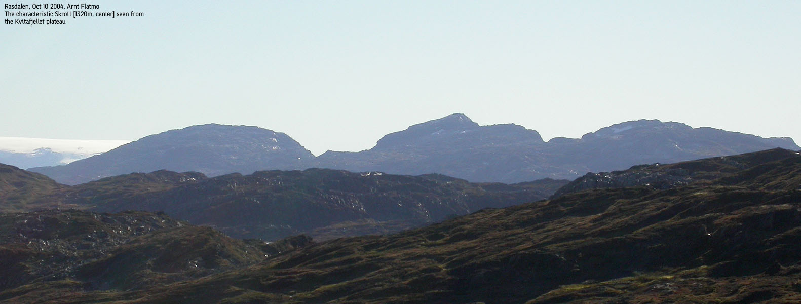
I enjoyed this ascent. First a long nice trail up the valley. I'm not a valley man, but I enjoyed this walk. Then a steep ascent where you feel your leg muscles working, followed by a nice walk on the high plateau. The sounds of water hitting the rocks by lake Gråhorgavotni made me wish I had brought the tent. And then there were the views from the summit. I laid down for a little while, just enjoying life. Troll came and put his head over my throat. I took this as a sign that he was enjoying life as well.
The perfect setting was spoiled by a grouse hunter on the neighbour top. I expected the sound of a shotgun any second, and got up for a round of pictures. A couple of senior hikers arrived the summit shortly after. We chatted for a while, until it was time to move on. The plan was to hike down the ridge parallel to Rasdalen, and visit Stølshorgi before descending down to Rasdalen.
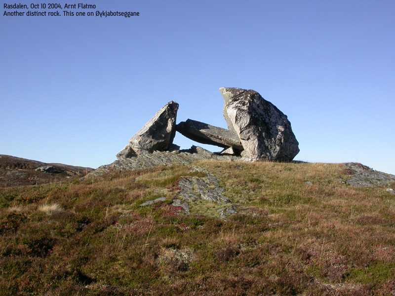
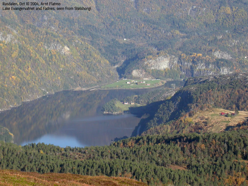
The hike across the ridge was nice. It was much longer than I had foreseen, but a series of cool rocks, good views and the "evil eagle" above me, made the hike enjoyable. We arrived Stølshorgi summit 15:20PM. I had a good view down towards Jonshorgi, which I had hiked in pouring rain, only to be rewarded with fog on the summit. I was convinced I would find a good path down from Stølshorgi, but I didn't. I probably didn't look too hard either. My instincts told me to follow the stream between Stølshorgi and Nipa, but I didn't. Instead, I had a swift descend down birch forest until I was standing on top of a serious cliff 40m above lake Rasdalsvatnet. After some research, I was able to reach the lake without too much pain. From the lake, it was easy to get back onto the road, and we were back at the trailhead by 16:15PM.
Move cursor to read notes, and click on the images to see full version.
Some of the thumbnails may have been cropped to fit the format.


No Javascript:
1 2 3 4 5 6 7 8 9 10 11 12 13 14 15 16 17 18 19 20 21 22 23 24 25 26 27 28 29 30 31 32 33 34 35 36 37 38 39


No Javascript:
 Other hordaland mountains
Other Voss K. mountains
westcoastpeaks.com
Other hordaland mountains
Other Voss K. mountains
westcoastpeaks.com

