
Norwegian Mountains, Møre og RomsdalTrollhesten, Klausethornet, Digergubben, Oct 21 2007Back to the main Klausethornet page

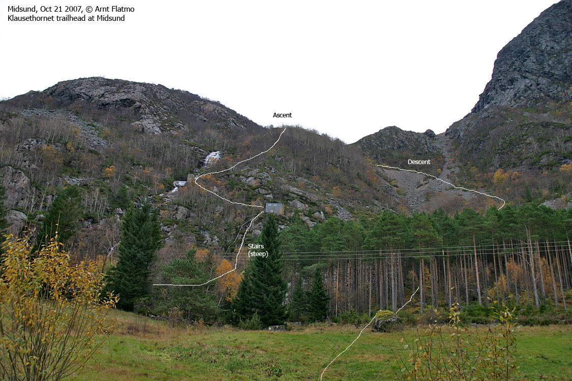
Route overview
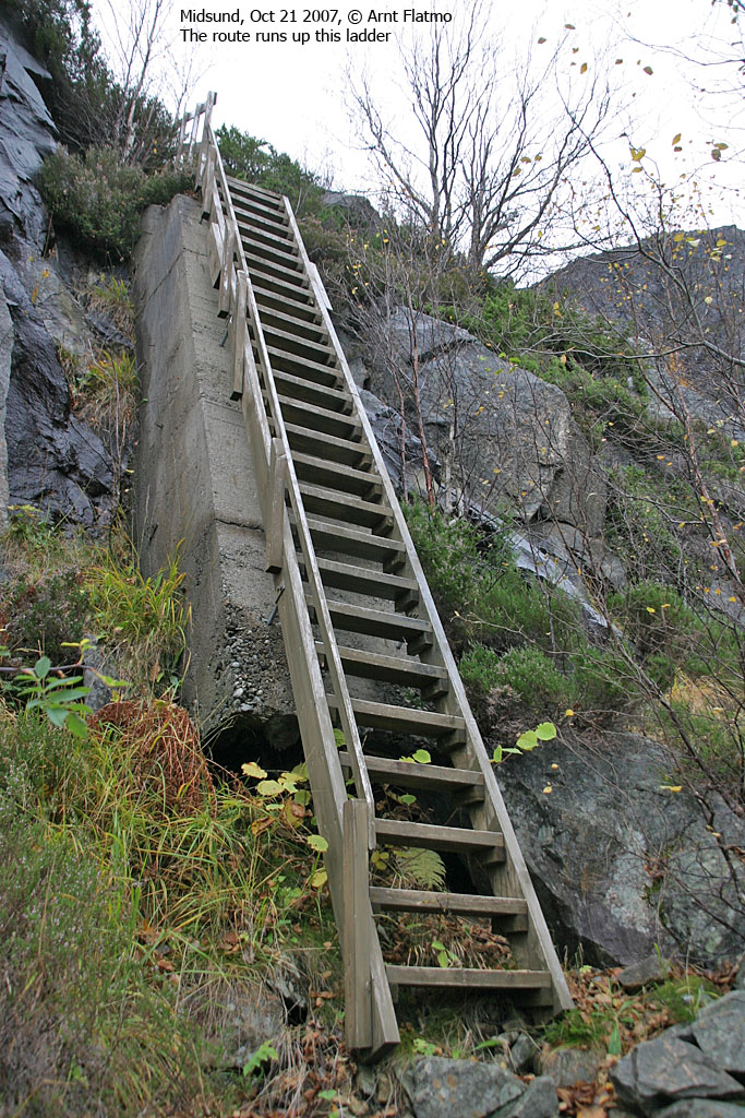
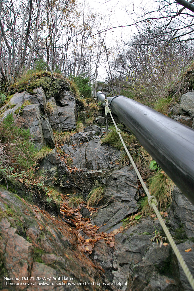
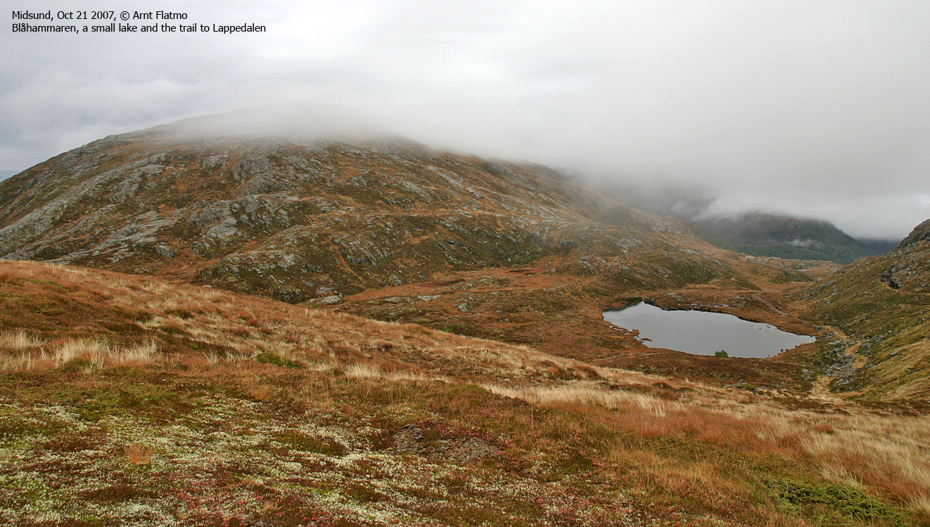
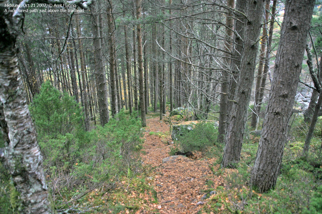
New terrain.. was top priority this Sunday. As the plan is to move to Gurskøya next summer, my focus until then will include the Otrøya and Midøya tops. The plan today was a roundtrip across three tops. This roundtrip is also described in the book Turbok for Molde og Omegn (Olsen/Pedersen). I read the section about the trailhead, then put the book aside. It can get a little boring if all of the answers are given up front. After hard negotiations.. my dog Troll agreed to walk the 100m up to the first building (we headed out 11:45AM). There he entered the backpack, which he would have done anyway. This stairway was not built for dogs. The 20-30 cm tall handrail amused me. But it gives a clue of how steep the stairway was, and the handrail should NOT have been taller. Having done much worse ladders than this, the ascent was quite trivial and enjoyable. My "mentor" Petter says.. that fixed ropes should be avoided, in order to fully understand the route's difficulty. After all, ropes are not guaranteed to be there. So when I arrived the ropes along the pipeline, I obeyed to his guidelines. For a while. Carrying the camera in my right hand, and preventing the dog to fall out of the backpack with my left, left few hands for scrambling. Petter would probably suggest that the camera should be in the backpack, but for various reasons that involve the dog, it isn't practical. And since I lost the lens cap the day before, I had to be extra careful. After some awkward scrambling, using one finger and all of my balance skills, I decided to void the rules if I was to make some progress. Trollhesten On top of the ridge, I followed the path in the direction of Midsundhornet (part of Trollhesten). However, the path seemed to turn towards Lake Midsundvatnet. I then noticed a lesser path that took me straight up on Trollhesten, where I entered fog. The walk up to the summit cairn (13:00PM) was rather uneventful, as little could be seen. Klausethornet From Trollhesten, I stayed close to the drop towards Midsundvatnet, and after a little while, I found myself on a vague path. This path ended in the Trollhesten - Klausethornet saddle, and I decided to just continue upwards. I could see the contours of Klausethornet, and was hoping that the fog would lift. But it didn't. Halfway up the mountain, I came across a path and I let Troll walk up to Klausethornet. We reached the top 13:30PM, and it was raining light. No point in sticking around. Digergubben I expected that the path would lead me down the mountain, but I lost it where I found it on my way upwards. I decided to descend to the southeast until I got below the fog. Almost down in the saddle, I changed my course to northwest and joined a vague path above the two cabins. After passing the cabins, I headed across the meadow and joined the wider trail from Lappedalen. This path ran up to Digergubben and was good enough for Troll to follow. Now that he has lost most of his sight, he needs a defined trail in order to stick with it. Plain meadows are hopeless. Even if he copes with the terrain, he has no clue where to go. A couple of hikers were ahead of us, but we never made contact. They left Digergubben one minute before we arrived at 14:05PM. The "mentor" calls... On Digergubben, I got a phone call from my "mentor" Petter, walking back and forth in the fog on Lifjell by Hyllestad. His mission (in addition to claiming yet another 600m+ primary factor top) was to trace my - trembling - footsteps from my unforgettable hike back in 2001. Just like me, he was looking for a way down the mountain (in thick fog), but knowing him quite well, I knew he would find one. I almost "hoped" that he didn't find one - not to be cruel - but it would have been just hilarious if the both of us had been stuck on that mountain. Things turned out well for Petter. He found a good trail down the mountain, and his ferry back to Oppedal did NOT slam into the pier, as it did in the early hours of the morning... Descent Troll was eager to get back home, and kept a good place down from Digergubben. But as the terrain leveled out, and the path got less distinct, he ran into problems. 5m progress, then 90 degrees to the right. Any verbal instruction is pointless - he needs to be lifted back on track. 5 more meters, then 90 degrees to the right again. And so on... Back on the ridge by the pipeline, we took the other route down. I feared a nightmare in this boulder area, but someone has built a really clever path. Disctinct too, as the dog never had any stray spikes to the right. After an enjoyable roundtrip, we were back at the trailhead 14:45PM. My ferry didn't leave until 17:25PM, so to kill some time, I visited Drynjahatten. Pictures
Slideshow, all pics on this page:
Map of the route
Up along the pipeline
Trollhesten and Klausethornet
To Digergubben
Descent
No Javascript: 0 1 2 3 4 5 6 7 8 9 10 11 12 13 14 15 16 17 18 19 20 21 22 23 24 25 26 27 28
|


