
|

Jonshorgi(No Javascript) |
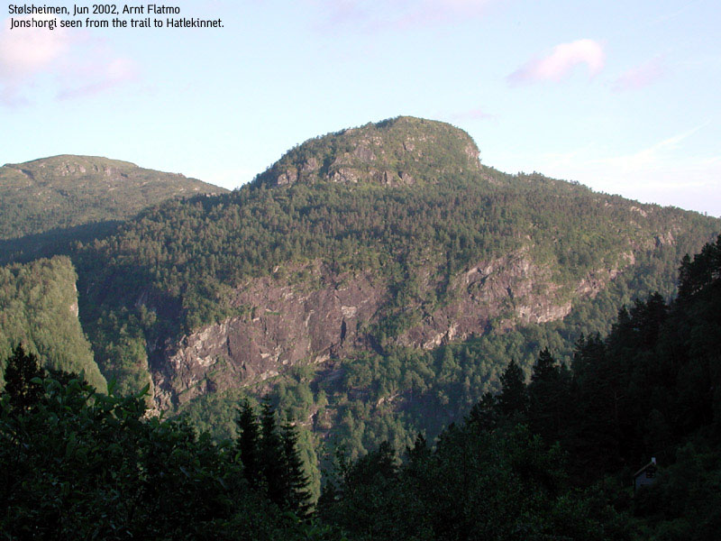
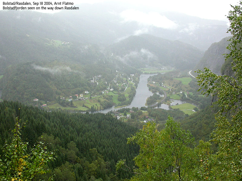
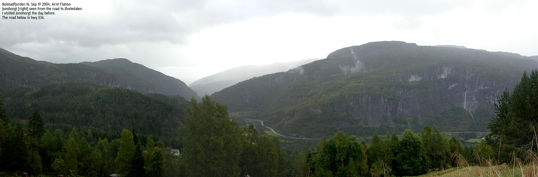
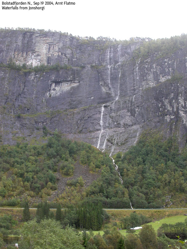
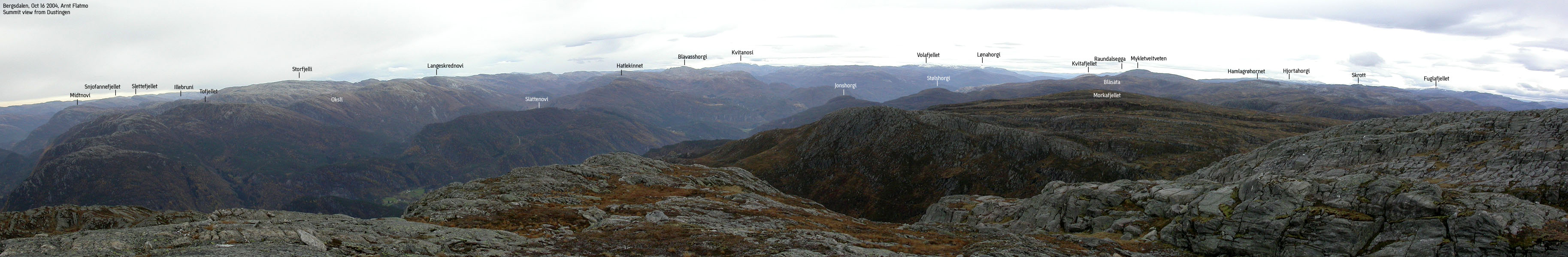
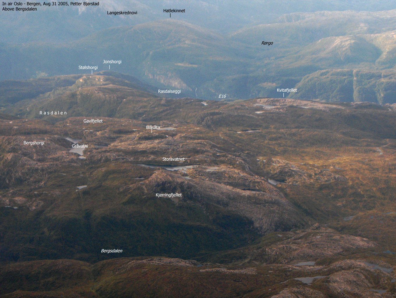
Many who have passed Bolstad between Voss and Bergen, have surely noticed the steep and mighty walls above highway E16. These walls are the north face of Jonshorgi, a fairly modest-height forest hill when viewed from the Bergsdalen plateau, further south.
Reaching Jonshorgi is very easy outside the winter season. A road takes you up to 370m elev. You continue on a wide forest road and then follow a marked trail through the forest. Excellent as a family hike. In winter, the road up Rasdalen is plowed, but there is a good chance that you need chains to drive up the narrow and curved road.
Rasdalen ("Avalanche Valley") also provides access to Bergsdalen from the north. A trail runs all the way to Osskardet pass, between Kvitafjellet and Blåsåta.
Primary factor:
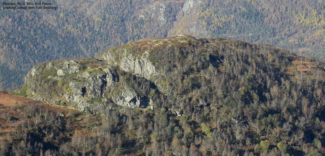
Jonshorgi (643m) has a primary factor of 120m towards the higher Stølshorgi (764m). The saddle is found in Tuftadalen valley. Ref. Økonomisk Karverk (5m contours), you cross the 525m contours on the high route, but not 520m. The saddle height has been interpolated to 523m
Notes: Class ratings are in reference to YDS. Click here for more information.
The trails described below are not necessarily the *easiest* trails to this mountain.
|
Øvre Rasdal - Jonshorgi (summer)
|
|
From Bergen, follow highway E16 towards Oslo. From the highway 580/E16 roundabout before Arnanipatunnelen, continue on E16 46,3Km. Exit left towards "Bolstadøyri". Turn left in the very first junction. Drive 50m. Turn left up "Rasdalsvegen". Follow this road 4,1Km to "Øvre Rasdal". Turn left onto a narrow forest road and drive approx. 300m. Find parking just after a gate, and just before the road starts to ascend up Tuftadalen. If you have a low clearance vehicle, park by the main road.
The road up to Rasdalen turns to gravel after 600m. You will pass a gate after 4Km, which is closed when the sheep are out. Make sure you close the gate behind you.
Follow the road up to the houses at Tuftane. Walk straight through the farm up to your left. Pass a gate and descend down to the stream. Cross the stream and follow a trail marked by plastic tape hanging from the trees. The trail runs to the top of Tuftadalen valley and then turns left up the forest.
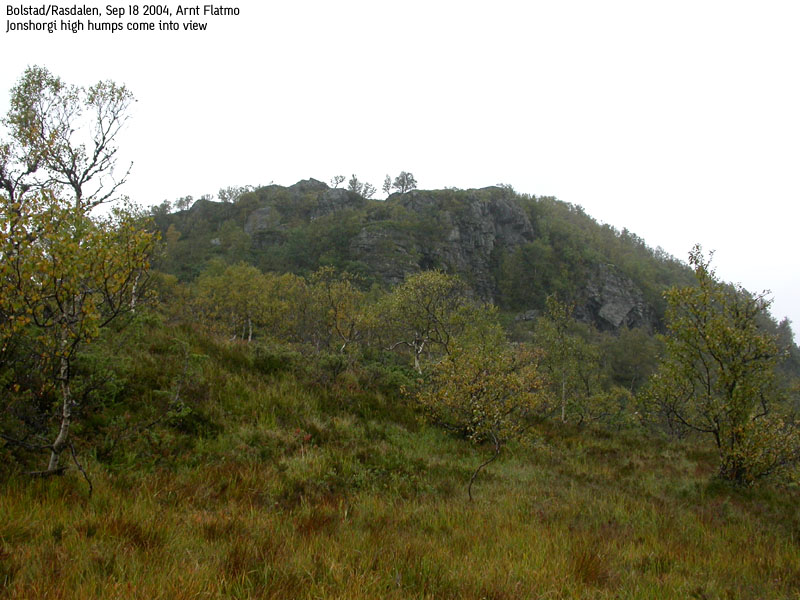
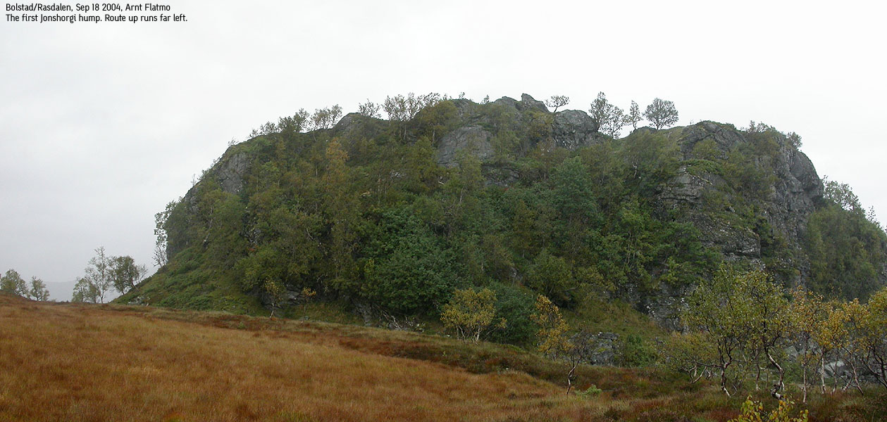
On the high ridge, you have a distinct hump in front of you. Cross boggy ground and ascend the hump from the left. On top of this hump, you have another hump ahead of you. Also ascend this hump from the left. The summit is on top of this hump, and is marked by a small summit cairn. A trail register may be found here.
I felt just considering a hike this Saturday to be a "small miracle". I had been suffering from a very bad back and had more or less been in bed since Thursday afternoon. I was able to get "acute" physiotherapy on Friday, which must have helped. I wave aside any bad jokes about me getting older, and blame it all on carrying the dog.
The only problem this Saturday, was the incredible bad weather. It was pouring down, like it has been doing for weeks. One sort of gets used it, so I decided to go for a quick hike. I chose Jonshorgi from the criteria - not too far to drive, and not too far to hike. On the way to Bolstad, I noticed that despite of the pouring rain, the clouds weren't covering the mountains. I didn't expect my GPS to work in the forest below Jonshorgi, so I had a bag full of red band. In case of thick fog. So far, this sophisticated navigational aid didn't seem to be needed.
At the trailhead, I met people with walkie-talkies. I knew that the deer hunting season had begun. On top of this, grouse hunting began today, and the sheep was being brought down from the mountains. I felt that I didn't belog up here this Saturday, but decided to carry out the mission. At the Tuftene farm, I spoke with an old lady who told me that the trail to Jonshorgi was marked all the way. Almost too good to be true. This trail has been marked as part of "Turkarusellen" - a specific list of mountains that people should "collect". Prizes awaiting the eager ones.
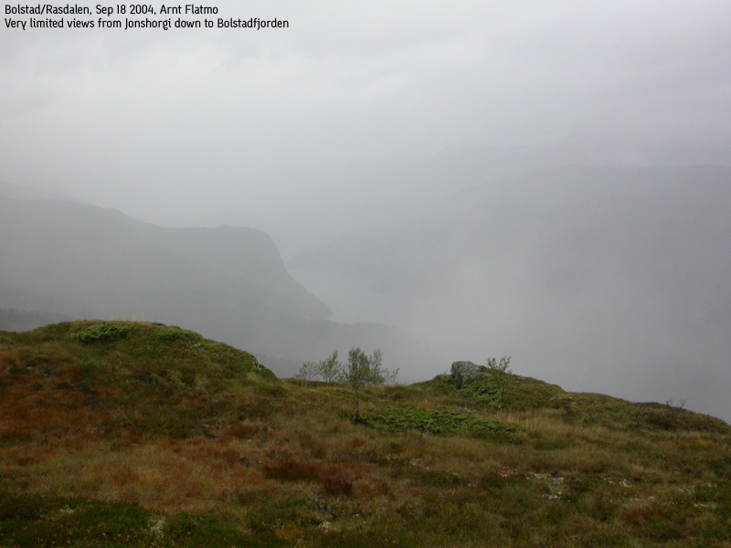
The forest trail was easy to follow. Troll had walked up to Tuftene, but refused to walk the forest trail. We left the car 14:15PM and arrived the summit 15:05PM (time including chatting with people at Tuftene). We were entering a fog layer on the summit, and had almost no visibility down to the fjord. It was a bit chilly for the both of us, and as soon as Troll had digested his lunch-box, we were on our way down. Fortunately, Troll walked all the way back to the car, and by 15:50PM, the hike was over.
I noticed that a gate now blocked the road. The gate was open when I arrived, but now it was closed, and a flock of sheep was on the other side. They seemed very eager about my precense. It was like they were saying - "hey, open this gate so we can get back to the forest!". I was a bit nervous. Would they come running through the gate once I got in the car? If so, people in Bolstad would probably talk about me for years. I tried to scare them off, but they only moved a few meters. The "drive-through-gate-in-record-time" operation however turned out quite well, and we could head back to Bergen. It was raining more than ever, and the fog now hung far down the mountain sides. Not a great day for hiking, but I was very content about having done "something good" on a fairly bad day.
Move cursor to read notes, and click on the images to see full version.
Some of the thumbnails may have been cropped to fit the format.


No Javascript:
1 2 3 4 5 6 7 8 9 10 11 12 13 14


No Javascript:
Other hordaland mountains
 Other Voss K. mountains
westcoastpeaks.com
Other Voss K. mountains
westcoastpeaks.com

