
For Information, maps, trailhead and route descriptions, click HERE.
Pre-hike stuff
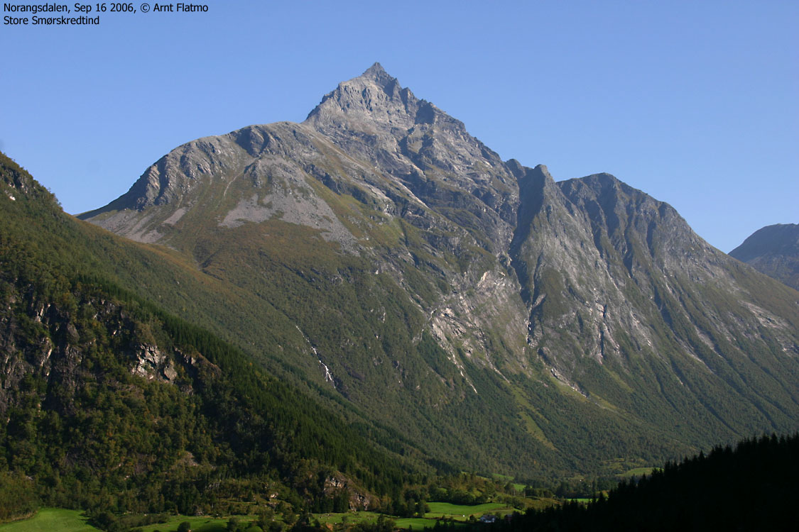
During my first 8 months in my new city Ålesund, I had promised myself to visit Jakta and Slogen before 2006 came to an end. By mid-September, and with a fairly busy autumn schedule, I didn't think I would be able to be true to my promise. But along came a high-pressure period, to last half-a-week and include the week-end. Unfortunately my neighbour (and dear, dear baby, err. dog-sitter) was out traveling, which meant I had to bring my small dachshund "Troll" to the summit of two of Sunnmøre's very finest peaks.
Getting company on such a short notice isn't easy, but my colleague Terje Bergset had the time and the will to come along for Slogen. Preferrably on Sunday. I decided to visit Jakta alone on Saturday. On a summer-trip to Saksa, I noticed that there were several nice spots for camping in Norangsdalen (or is it Norangdal as the local sign says?). I left Ålesund Saturday morning, found the perfect campsite in Norangsdalen, raised the tent and continued towards Jakta. I had no time to plan the Jakta hike and had really no clue where the trail was. The day before, I emailed with Torill Berg and asked if she could send me the Garmin GDB track from her recent hike to Konehornet (same trailhead as Jakta). With a close eye on the GPS, I drove down Norangsdalen, heading for the Jakta trailhead.
To Jakta
With the dog in my back-pack, I headed out from the Jakta trailhead 13:05PM. There was one car at the parking, so I expected to see people up on the mountain. I felt strong and could keep a fair pace up the forest. Two factors allowed for this; a) I was walking in shade and b) I didn't have to carry water, because of the river from Konedalen. The plan was 6-5-4 (600 vertical meters the first hour, etc.), but I reached 800m elevation after 1 hour of walking. We satisfied our thirst in Konedalen before commencing with "part two" - getting to the col.
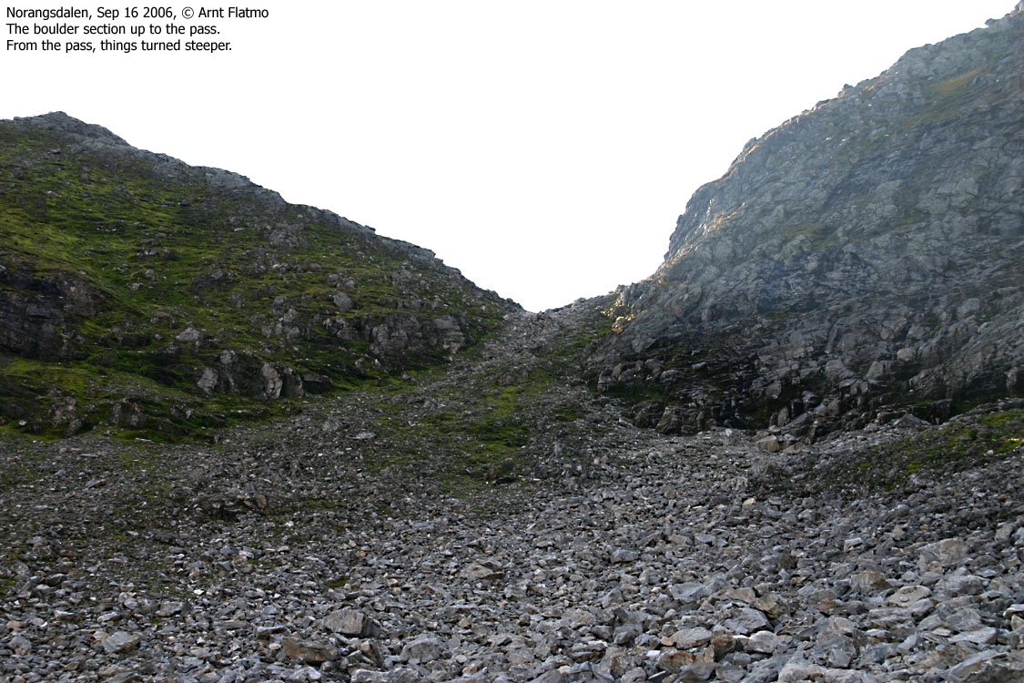
Crossing the valley went fairly quick. As I got closer to the col, I was sort of struck by how steep the route was. Getting close to the slabs and turfs that make the ascent route up from the col, I realised that there was no room for errors. The upward route was just easy scrambling, but scrambling down with the dog would be far MORE awkward. I realised that I wasn't exactly looking FORWARD to head down this way.
I passed 1200m approx. 15:03PM, and I was still ahead of schedule. I met three male hikers coming down the mountain. They had started out from Viddal and would go down the same way. They made me aware of an alternative route down to Konedalen, and I could see the path from the point we were standing. I continued upwards and ran into three female hikers just heading out from the summit. They had started out from Norang and it was their car at the trailhead. After a small chat, I was standing on Jakta summit 15:40PM, 2h:35m after leaving the trailhead. This was the fastest 1500m ascent I've done with a dog on my back.
Troll was happy to be out of the backpack and wanted to explore the area. Given the 1500m drop down to Storfjorden, I told him that exploration was out of the question. I shot a round of pictures and turned around to see if the dog was following orders. The dog wasn't there.
I looked around and saw him with his front paws on the very edge of the 1500m drop, looking down on Storfjorden. What was he thinking about? "Man, it's a long way down..." Nah, they're not human. It was quite obvious that I should call him in the gentlest possible manner, and I carefully whispered out his name. He turned his head around and gave me the "are we talking lunch?" look. I nodded and promised him a heaven of bones, if he only could get the hell away from the edge. Leashed, Troll enjoyed his lunch on the summit of Jakta.
Descent
The views from Jakta were outstanding, and I stayed 45 minutes at the top. Troll entered the backpack again, and we left Jakta summit 16:25PM. I decided to go for the alternative descent route, and from 1300m elevation I saw the three girls far down in Konedalen. Except for one tricky spot on the descent route, the descent was overall trivial. My ice-axe came in very handy on the tricky spot. I had to cross a slab, slanting down to the right. To my left was a small wall with no handholds, with less trustworthy bush on top. The slab was muddy and did not look very inviting at all. I found a tiny crack half-way across the slab, pointed the ice-axe into the cracked. Now, locked in position, I could safely cross the slab. The axe - an invaluable tool!
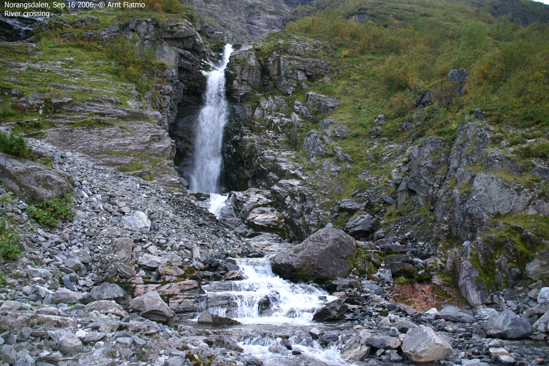
Troll started walking half-way down Konedalen and moved very light, given his age (soon 13 yrs). Down by the waterfall crossing, we had the three girls in front of us. Troll refused to part with his new friends, and got busy keeping the group TOGETHER. Sporty, young girls. They had obviously traveled to get here, and they walked Råna the day before. I gave them big credit for taking on high Sunnmøre mountains like these. They seemed to appreciate my words.
The FINEST of evenings
With this headline, the eager (and positive thinking) reader may conclude that I "scored" upon descent, but that's not what this section about. The dog and I arrived the trailhead close to 18:00PM and drove back up to the campsite. I laid down inside the tent, just resting for a while. The time wasn't even 18:30PM, and I felt tired. It had been a long day, and a strenuous hike, but I'm used to that. I just felt tired in a good way!
Half an hour later, I managed to turn myself around and cook dinner. The dinner tasted heavenly and I was even more tired. Darkness came around 20:00PM, and except for a couple of passing cars and the commanding sheep bleating BEDTIME!! throughout Norangsdalen valley, it was just QUIET! I felt a very rare form of peace, and I was afraid of falling to sleep. I remembered that I had a six-pack in a bag. I managed to enjoy three beers in a horisontal position, petting Troll, laying in a nose-up-the-arse position next to me, breathing caaaalmly. I opened the tent door and took a look at the sky. It was the most intense starry sky I've ever seen. Absolutely zero disturbing light came out of Norangsdalen, and this was the last thing I saw before I fell to sleep. I slept non-stop until 07:30AM the next morning (that NEVER happens), and had plenty of time to rig down the camp before Terje arrived 08:30AM. Next stop: Slogen.
Norangsdalen


To Jakta


Ascent from Konedalen


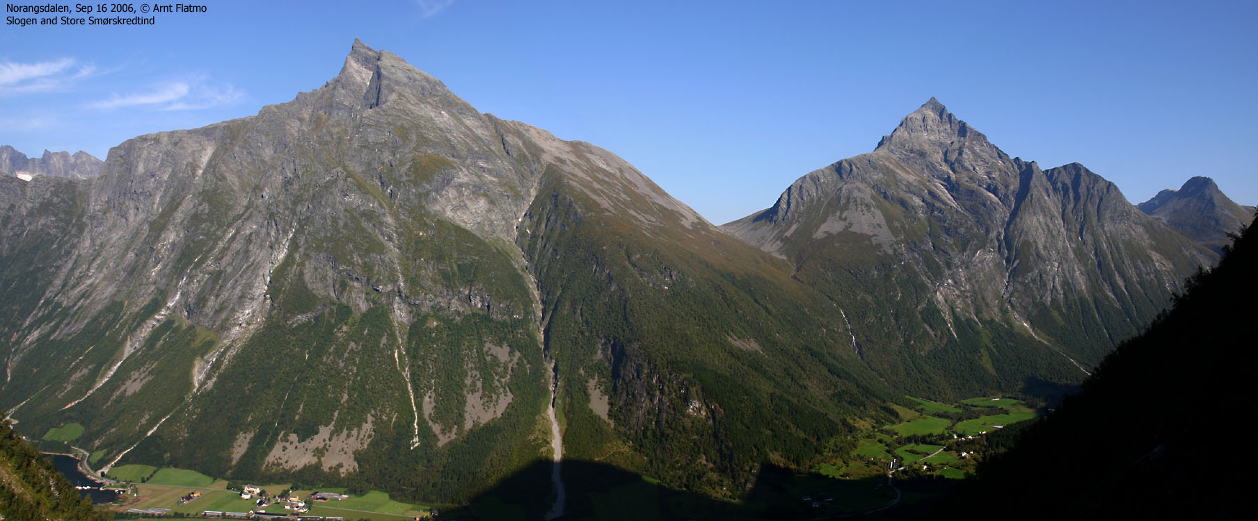
Wide-angle views from Jakta


50mm views from Jakta


Other pics from Jakta


Zoom panoramas, 4 parts


Descent


No Javascript:
1 2 3 4 5 6 7 8 9 10 11 12 13 14 15 16 17 18 19 20 21 22 23 24 25 26 27 28 29 30 31 32 33 34 35 36 37 38 39 40 41 42 43 44 45 46 47 48 49 50 51
 westcoastpeaks.com
Other Møre & Romsdal mountains
Other Norwegian mountains
westcoastpeaks.com
Other Møre & Romsdal mountains
Other Norwegian mountains