
|


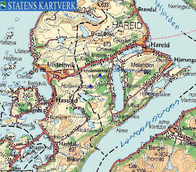
The Ramnefjellet - Hovdenakken ridge is centrally located on the south side of the Hareid - Ulsteinvik road (RV61). I would not be surprised if it turns out that Hovdenakken is the most frequently visited top (on annual basis) on the Hareidlandet island.
It is located half-way between Hareid and Ulsteinvik, it is only 2Km to the top of Hovdenakken (only 1Km to Ramnefjellet), and while most of the (independent) tops on Hareidlandet exceed 600m elevation. Hovdenakken is only 474m high, Because of the central location of this mountain, the views are quite good.
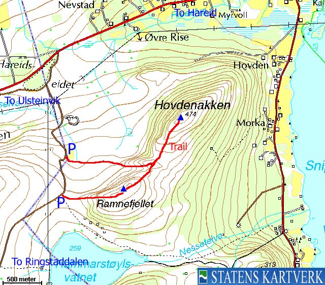
The most frequently used trailhead is found along the Hareidseidet - Haddal road (closed in winter). While many are happy with just visiting Hovdenakken or Ramnefjellet, you should consider visiting both one the same hike. This page describes such a roundtrip.
Hovdenakken (Norge 1:50,000: 474m, Økonomisk Kartverk 1:15,000: 474,14m, UTM 32 V 341811 6915793) has a primary factor of 173m towards the higher Gardnestua (653m). The saddle is found at Halsen, north of Lake Hammarstøylsvatnet, on the east side of the road to Ringstaddalen. Ref. Økonomisk Kartverk (5m contours), the saddle is given as a fixed point - 300,5m ~ 301m.
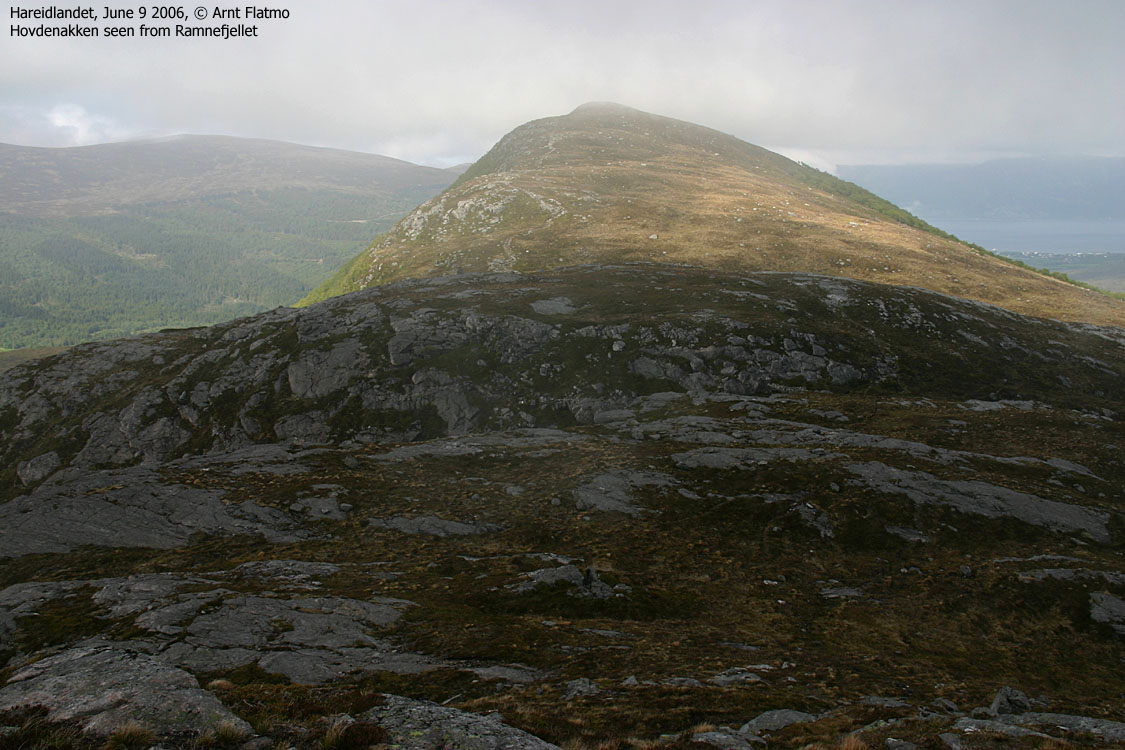
Ramnefjellet (Norge 1:50,000: -, Økonomisk Kartverk 1:15,000: 444m, UTM 32 V 341092 6914882) has a primary factor of 74m towards the higher Hovdenakken (474m). The saddle is found in Nordre Bjørnaskaret, between the two tops. Ref. Økonomisk Kartverk (5m contours), the saddle is given as a fixed point - 369,5m ~ 370m.
Note; My GPS recorded 576m as average height over 10 minutes, measured on the ground.
Notes: Class ratings are in reference to YDS. Click here for more information.
The trails described below are not necessarily the *easiest* trails to this mountain.
|
Hareidseidet - Hovdenakken - Ramnefjellet (summer/autumn)
|
|

Access
From Ålesund, follow highway E39 towards Bergen, and then RV61 towards Hareid. Take the Sulesund - Hareid ferry and follow RV61 6,5Km from the roundabout in Hareid. You are now on Hareidseidet, the road high point between Hareid and Ulsteinvik. Turn left onto a gravel road, and after 500m, turn left again. Drive 1,5Km upwards and park at a turn-out on the left-hand side of the road.
The route
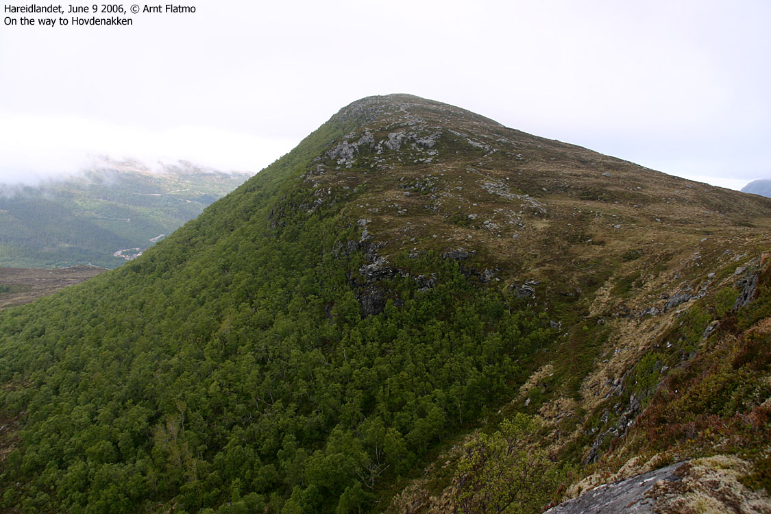
From the parking, head eastbound on trail towards Hovdenakken/Ramnefjellet. On your way up the mountain, you run into a trail-fork. Stay left. The trail to the right leads to Ramnefjellet. Follow the trail up to Hovdenakken summit, which is marked by a trig. point.
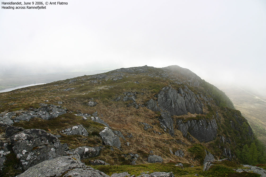
Descend your ascent route down to the Hovdenakken - Ramnefjellet saddle, and continue on trail directly up to Ramnefjellet (you don't have to go via the lower fork). Ramnefjellet high point is not marked (although I found a stick close to the summit - see picture). Proceed westbound along the Ramnefjellet ridge and back down to the road. Follow the road 600m northbound back to the Hovdenakken trailhead.
The trail is not marked, but well-worn and visible.


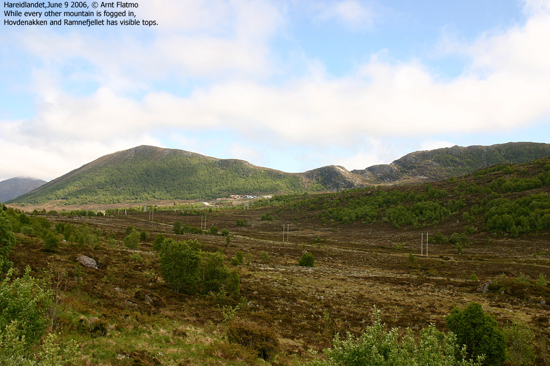
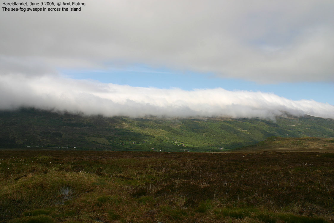
Bad luck. Weather earlier was absolutely great, and I planned on visiting Sollia - the highest point on Gurskøya island after work. But by the time I got in my car, the sea fog was sweeping across most of the interesting tops in Ytre Søre Sunnmøre (what a name...)
I decided to do a hike in the Ålesund region instead, but when I got to Hareidseidet, I noticed that Hovdenakken was fog-free. As it was on my mountain-list, I decided to pay it a visit. The dog ("Troll") and I left the trailhead 15:25PM. I had passed here several times recently, and was well aware of the trailhead.
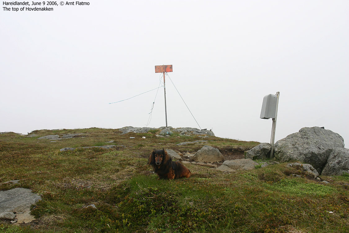
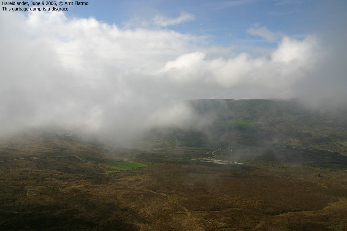
Just before we reached the top 16:00PM, the sea fog had closed in on the mountain, and views were indeed very vague. The fog was freezing cold, and I had to put on more clothes, although it was a hot day. We reached the top of Ramnefjellet 16:25PM, and I didn't see much there either. Back on the road, after having descended the west ridge, the fog had left the island. Outrageous! It wasn't much of a hike. We were back at the car 16:55PM, and I decided to classify the hike in the "exercise category".
Nothing wrong said about the mountain, though. Fog-free, I'm sure the views are excellent and it is a short and nice hike across the two tops.
Hovdenakken


Ramnefjellet


No Javascript:
1 2 3 4 5 6 7 8 9 10 11 12 13 14 15
 westcoastpeaks.com
Other Møre & Romsdal mountains
Other Norwegian mountains
westcoastpeaks.com
Other Møre & Romsdal mountains
Other Norwegian mountains

