
|

Follow the "Trip Reports" link at the bottom of the page for pictures.
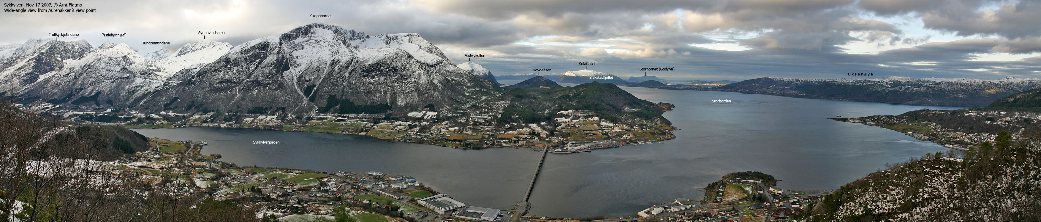
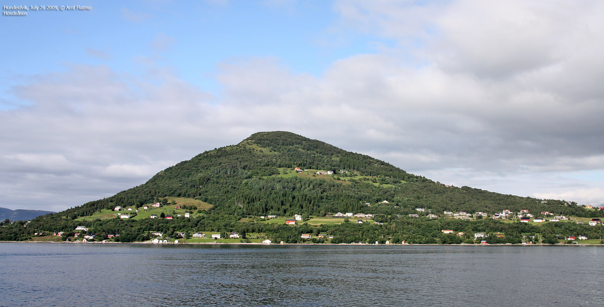
| Hovdeåsen, along with its close neighbour Blakstadfjellet (297m) are the lowest
independent tops in Sykkylven kommune (municipality). The top is however quite popular. A good path takes
you to the top in less than thirty minutes, the view is outstanding and you can enjoy a short rest indoors, inside
Vetestova.
And there is and interesting history behind Vetestova. On the right-hand side on this page, you can read an excerpt from an information board on Hovdeåsen. On Hovdeåsen, you will also find a story about Den Norske Leidangen - the old Norwegian coastal defense system, written in Norwegian, English and German.
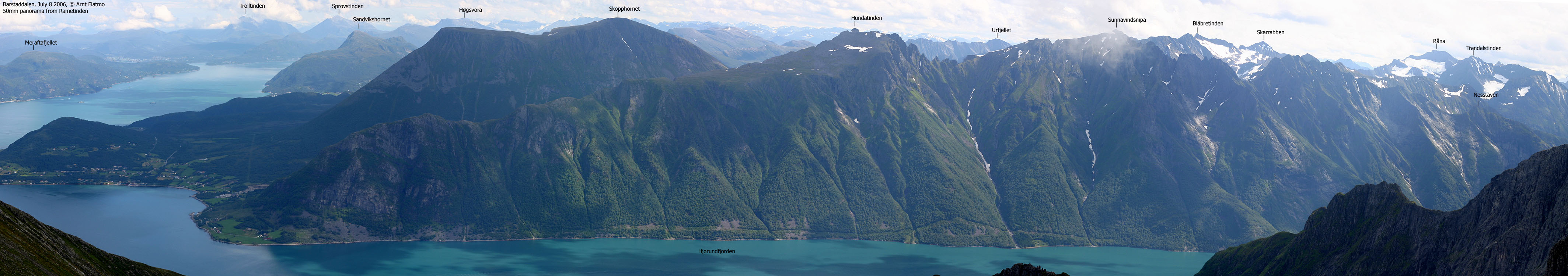
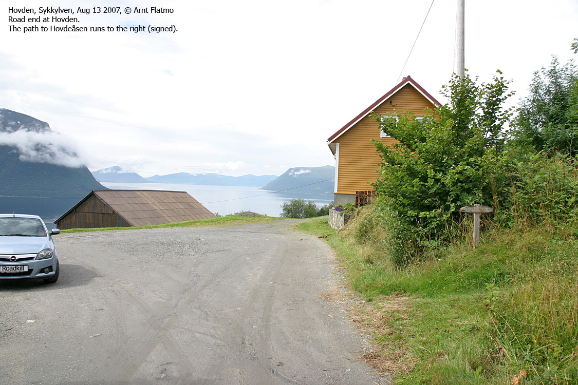
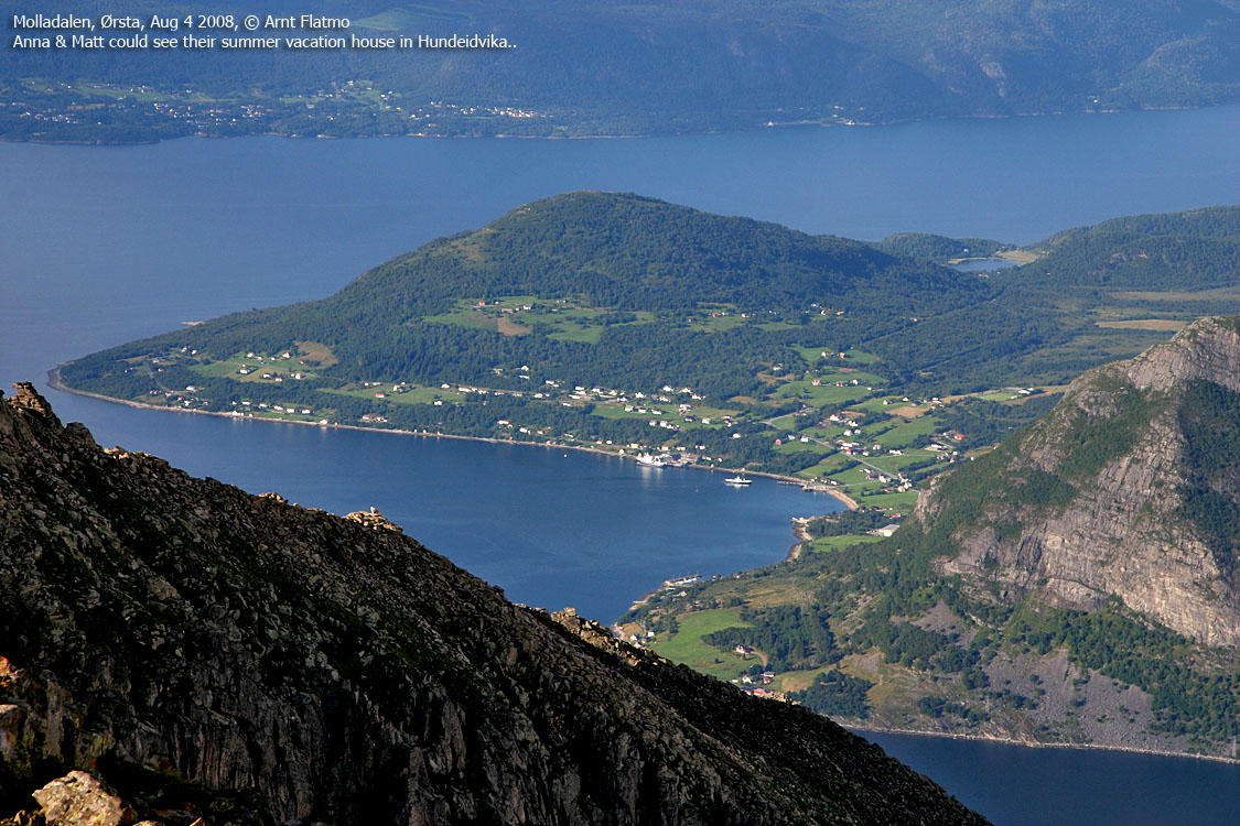
Hovdeåsen can be reached both from Hovden and Hatlemorka. This web page will describe the Hovden route. It is indeed a family hike with very good views towards the Ålesund & Sula region, Molladalstindane, Vartdalsfjorden and northern Sykkylven mountains. |
The Cottage on Hovdeåsen The hill on which you now stand is called Hovdeåsen, and has an altitude of 369 meters above sea level. It is situated in Sykkylven borough, between the hamlets Tusvik on the north-side, and Hundeidvik on the south side. In older times, you would here find a vete, that is to say a signal-fire (beacon), designated by the king. In times of war, the vete would receive light-signals from the signal-fires further out by the coast, for instance from Vigra or Valderøya. When the Hundsvete, as the vete on Hovdeåsen often is called, was lighted, it gave signal to other similar beacons in Hjørundford to the south and Storfjord to the north. These would then pass on the news of war. According to Magnus Lagabøtes national law of 1267, cottages should be built by every vete. The book "Sykkylven in old times" tells us that the remains of such a cottage have been found on Hovdeåsen. If you walk a little to the west of the new cottage, you will see stones laid in a pattern which resembles the foundation of a small cottage, approximately 2,5m x 2,5m. In the 20th century it was discovered fire steel here as well. The present cottage was built by the people of Hundeidvik and Tusvik as a monument of our peace-loving ancestors who wished to protect their vicinages and country against intruders who wanted to plunder the land and enslave the people. It was Hans Hovden who first had the idea of building a new cottage on Hovdeåsen. He has for many years worked as a sort of watchman for the ancient memorials. Among other things he has cleared pathways and created signs showing the location of the old walls. In addition he has often guided schoolclasses and others who have visited Hovdeåsen. In the spring of 2003, there were made concrete plans to build a new cottage. In order to make this possible, a bonding course was arranged at Hundeidvik school. The participants in this course, which was led by Kåre Løvoll, were Ole Myrseth, Ole Vedvik, Odd Kruger, Noralf Vedvik, Morten Hermansen, Lars Kåre Utgård, Askjell Hjelle and Roald Solheim. The timber was primarily taken from the parcels of Ole Myrseth and Knut Hovden in the autumn of 2003. The cottage was then built by a group of volunteers in connection with a bonding course arranged in the autumn of 2003 and spring of 2004. The cottage was bonded at Hundeidvik school, and afterwards the timber was marked, and the cottage taken apart and brought up here by the use of a helicopter. Naturally, when building the original cottage, horses would have to pull the logs all the way up to Hovdeåsen - a work that is sure to have been both time-consuming and strenuous. Particularly Ole Myrseth, Knut Hovden and Hans Hovden have done a great effort to rebuild the cottage on Hovdeåsen. The metal work was done by the smith Olav Blakstad. Amongst the many who have been very helpful with the practical work are .... Excerpt from an information board on Hovdeåsen |

Hovdeåsen (Norge 1:50,000: 369m, Økonomisk Kartverk: 368.62m, UTM 32 V 367162 6919761) has a primary factor of 256m, towards the higher parent mountain Skopphornet (1226m). The saddle (approx. UTM 32 V 368135 6919302) is found east of the road to Hovden. Ref. Økonomisk Kartverk (5m contours), the saddle height is within the range 110-115m, interpolated to 113m.
Personal GPS measurement averaged (over 10 minutes) Hovdeåsen's height to 371m, with an error margin of 1,8m. It is reasonable to assume that 369m is a correct elevation.


Google's interactive map. You can zoom, pan and click on the markers.
Notes: Class ratings are in reference to YDS. Click here for more information.
The trails described below are not necessarily the *easiest* trails to this mountain.
|
Hovden - Hovdeåsen (summer/autumn)
|
|
Access
(all distances are approx. distances)
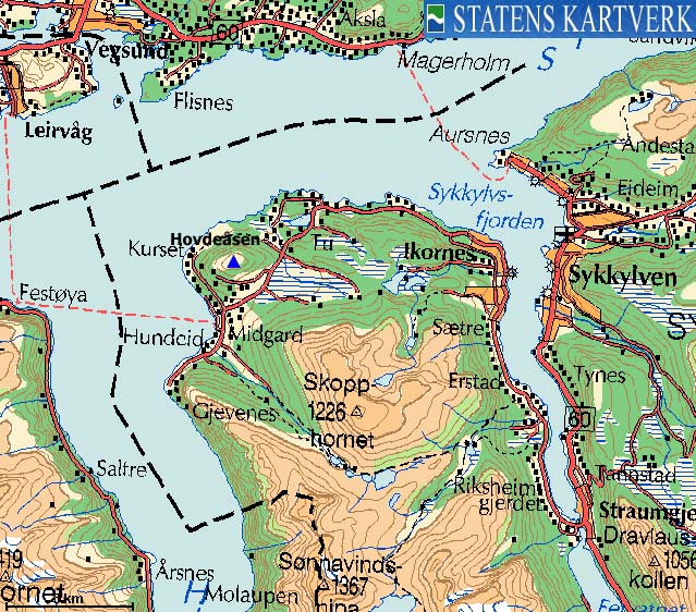
From Ålesund, follow highway E39 towards Bergen, and then highway RV60 (Stranda) to the Magerholm - Ørsneset ferry (7,9Km). This ferry runs quite often; every 20 minutes in the busy hours of the day. From Ørsneset, drive RV60 to the Hundeidvik/Ikornes junction south of Sykkylven (4Km). Drive on toll bridge across Sykkylvsfjorden (fee is NOK 31,- for passenger cars per August 2007). At the upcoming roundabout (1,1Km), follow signs to Hundeidvik and drive 7,3Km until you see the "Hovden" sign. Turn right and drive 1,5Km to road end. You can park at road end, but don't block for large vehicles which need space to turn around.


The route
Follow a visible path from the house at road end. Follow this path up through the forest and up to the top of Hovdeåsen. There are no forks and no problems. The summit is marked by a trigonometric point, a cottage and an information board.


No Javascript:
 westcoastpeaks.com
Other Møre & Romsdal mountains
Other Norwegian mountains
westcoastpeaks.com
Other Møre & Romsdal mountains
Other Norwegian mountains


