
Norwegian Mountains, NordlandHornsveten, 148m
|
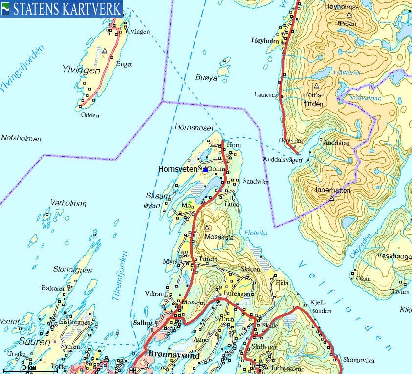
| Fylke/Kommune : | Nordland/Brønnøy | ||||||
| Maps : | 1826-III Vevelstad (Statens Kartverk, Norge 1:50 000) | ||||||
| Primary factor : | 135m | ||||||
| Hiked : | July 2009 | ||||||
| See also : |
| ||||||
| See also : | Other Nordland mountains on westcoastpeaks.com |

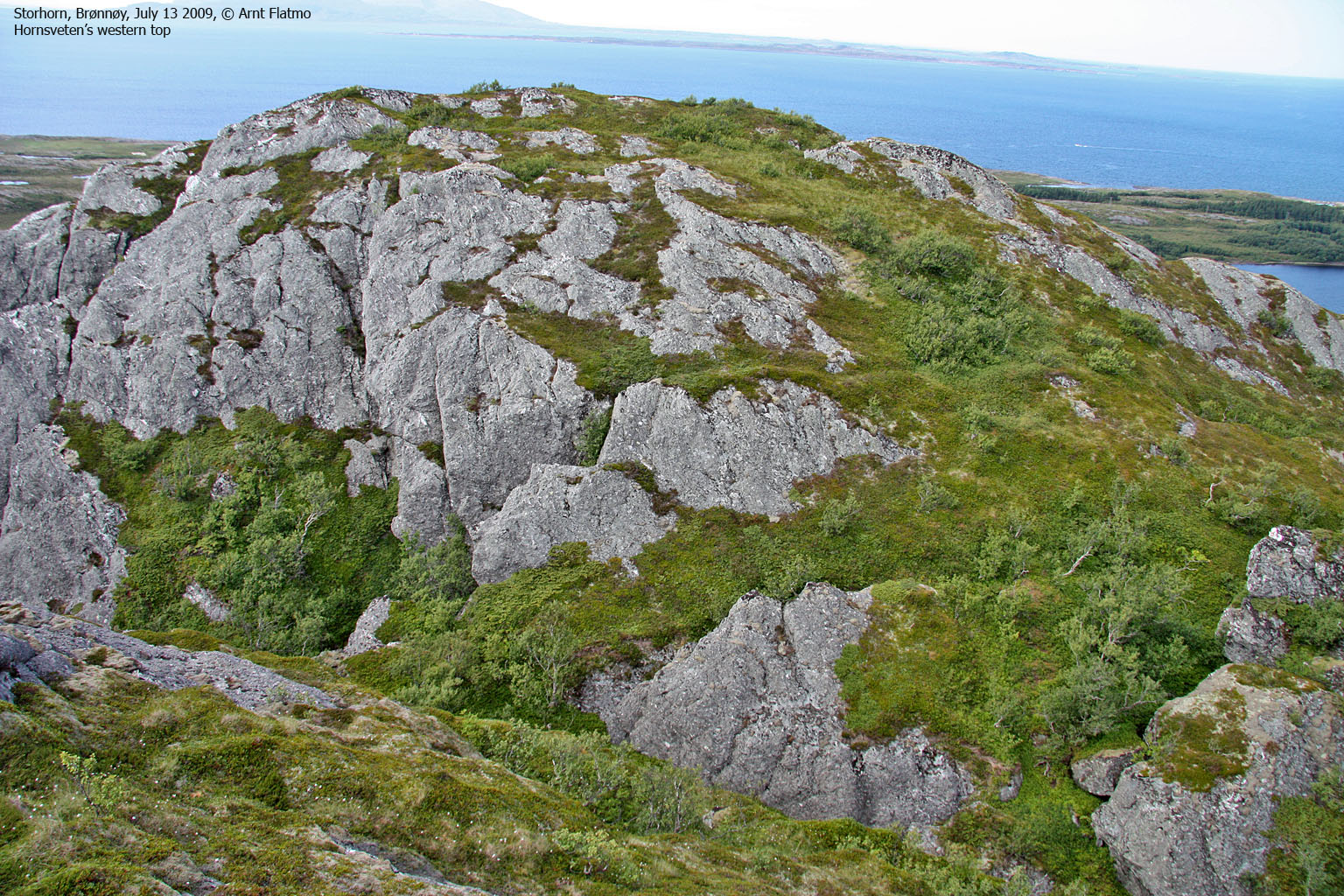
Hornsveten seen from Skutfjellet
(Click for larger image)
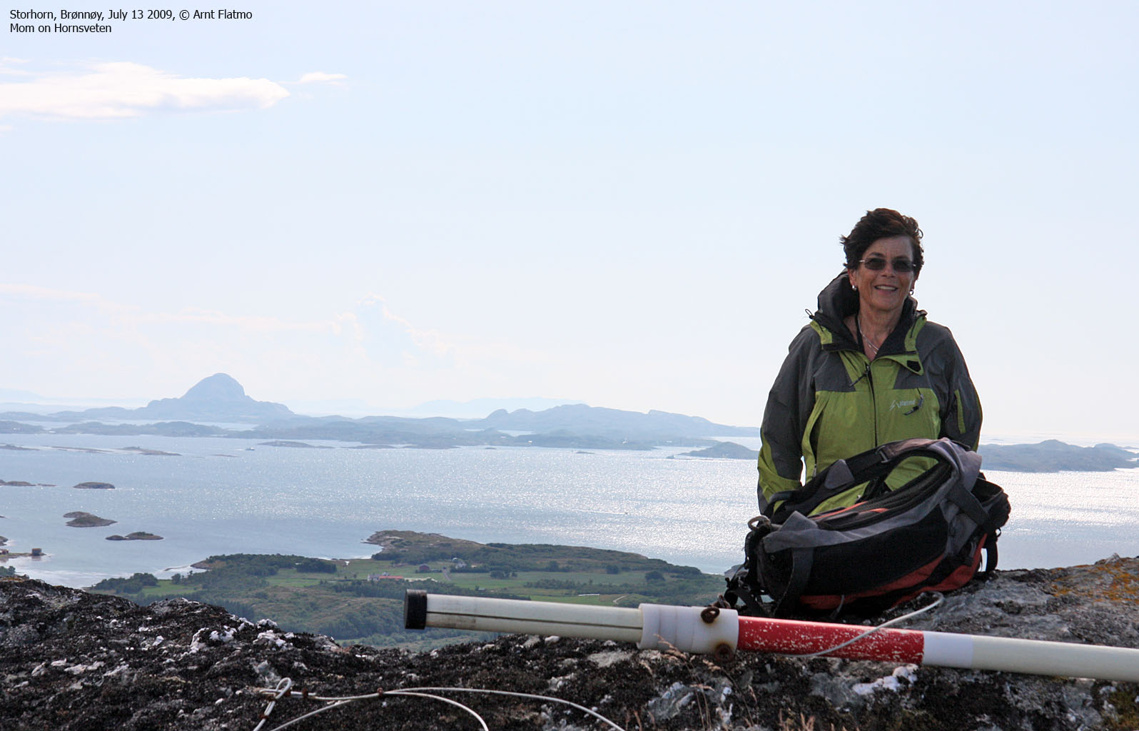
Hornsveten is a twin-summit coastal top located just south of Horn and approx. 11km north of Brønnøysund. There is no established trail and the top does not receive a lot of visitors. Nevertheless, this rugged and rocky "coastal feature" offers a fine view towards some of the well-known Vevelstad mountains (De Syv Søstre, Høyholmstindan and Dønnamannen). On a clear day, Lovund is also visible.
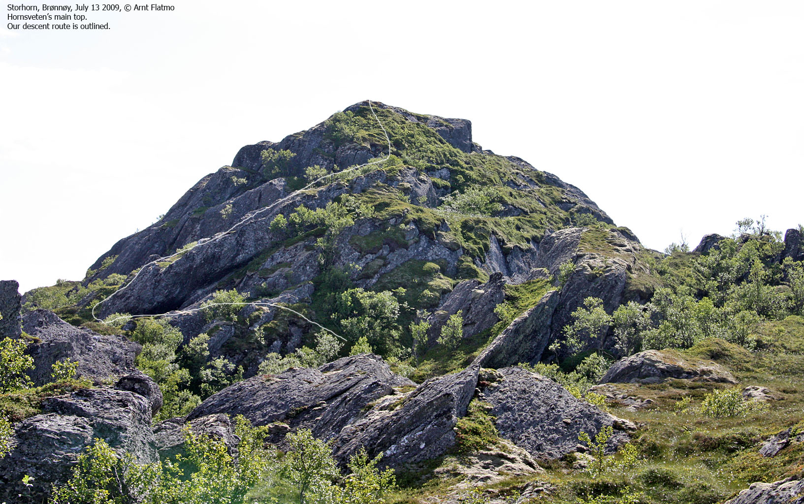
A good starting point is Storhorn. Follow a forest road 500m, ascend a ridge (off-trail), head up to the antenna and continue up to the east (main) top, the west top or both. Getting from the west to the east top involves some minor scrambling.
 and Skutfjellet")
Hornsveten (left) and Skutfjellet
(Click for larger image)
Hornstinden (Norge 1:50,000: 148m, Økonomisk Kartverk: 140,10m, UTM 33 W 374611 7274443) has a primary factor of 135m towards the higher parent Mosaksla (526m). The defining saddle (approx. UTM 33 W 375416 7274619) is found between Hornsveten and Åsen. Ref. Økonomisk Kartverk (5m contours), the saddle is within the range 10-15m, interpolated to 13m.
GPS measurement on the east (main) top read 148m (on the ground), averaged over a 5-minute period (error margin not recorded). GPS measurement on the west top read 144m (on the ground), averaged over a 3-minute period (error margin not recorded). This reading also correlates well with the official height - 144m.
Google's interactive map. You can zoom, pan and click on the markers.
|
|
|
|
Route 1: Storhorn - Hornsveten round trip (summer/autumn)
|
|
This route description is valid per July 2009
Access
(all distances are approx. distances)
The starting point is Brønnøysund. Follow highway RV17 towards Sandnessjøen. 9,8km after the Mosheim junction and 1,3km south of Horn, turn west onto a gravel road. Follow this road 300m and find a place to park and apply consideration.
The route

The route to Hornsveten
(Click for larger image)
Follow a forest road across a field for 500m until it ends. Turn right and head into the forest (off-trail) and get on the ridge that leads up to the antenna. From here, head towards the west top. This is an easy ascent.
From the west top, descend into the small valley between the two tops and locate some grassy ledges that will bring you up to the east top. This is a slightly exposed section. The summit is marked by a (fallen) trigonometric point.
From the east top, descend to the northeast while actively searching for a route that leads you down to easier terrain - and your ascent route.

No Javascript:
 westcoastpeaks.com
Other Nordland mountains
Other Norwegian mountains
westcoastpeaks.com
Other Nordland mountains
Other Norwegian mountains


