
|

Hornindalsrokken(No Javascript) |
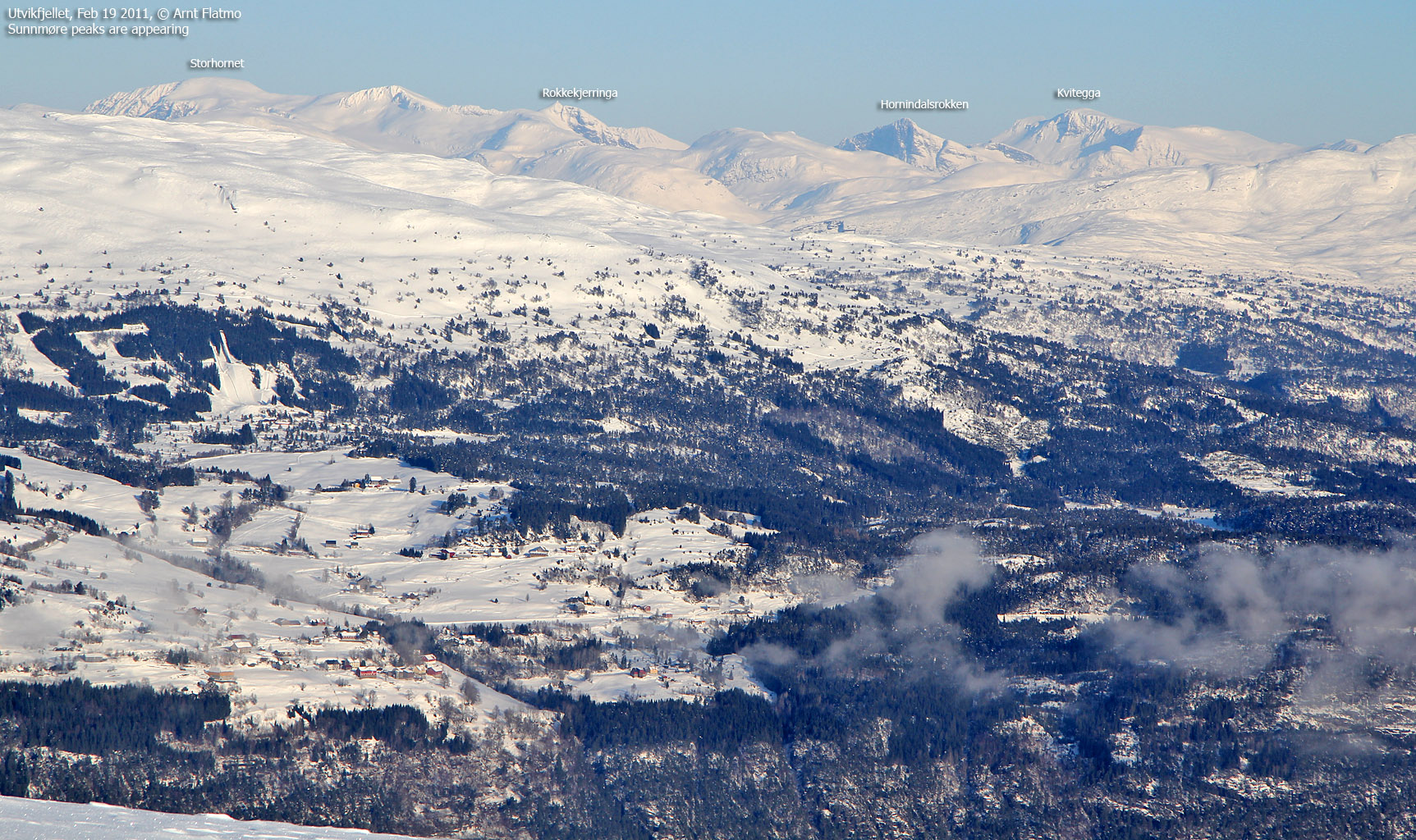
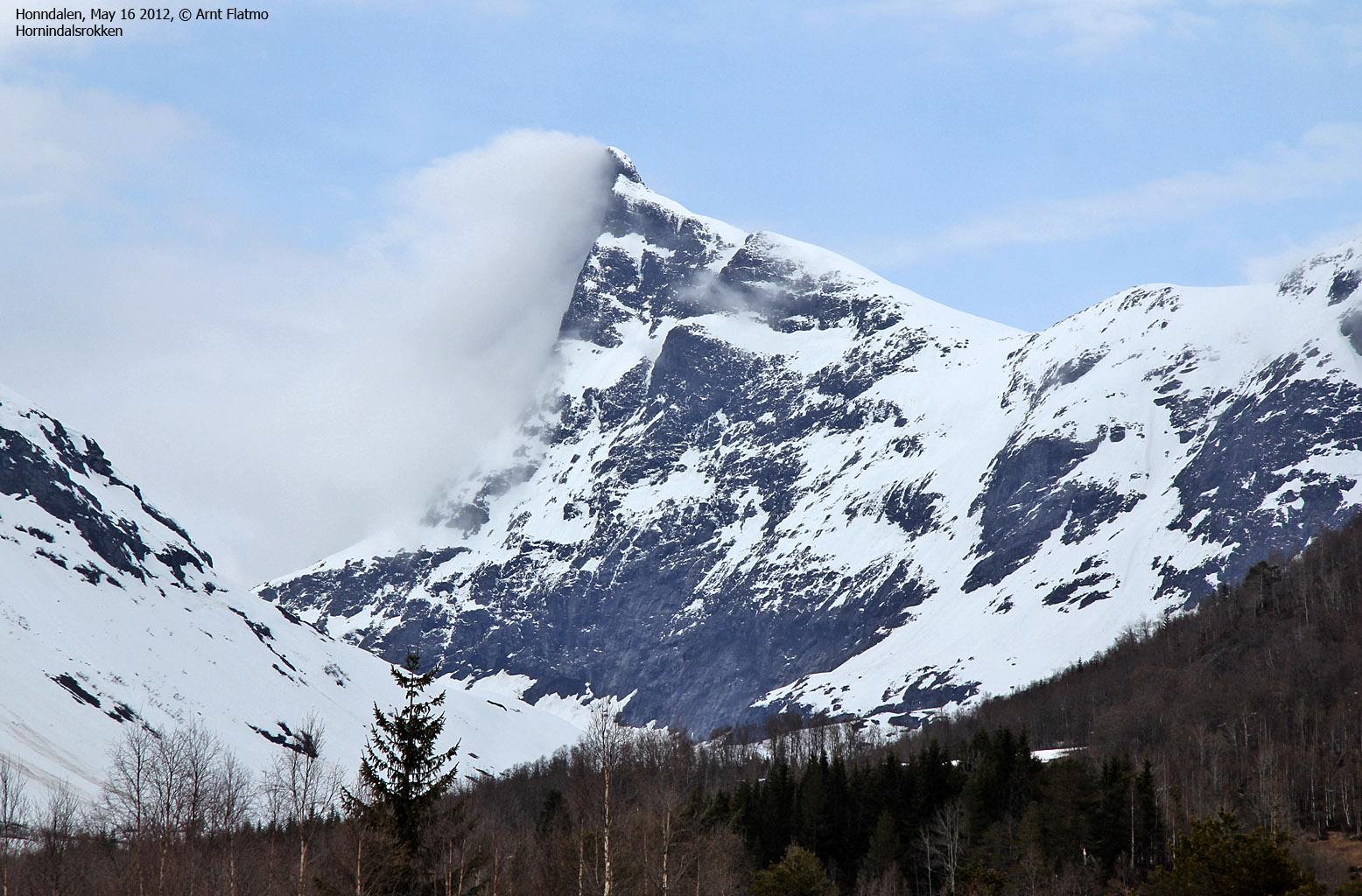
Hornindalsrokken is located in (or close enough to) a mountain region that contain some of Norway's finest mountains - "Sunnmørsalpene" - the "Sunnmøre alps". The mountain is located on the Møre og Romsdal/ Sogn og Fjordane county border, and is a triple-divide between Hornindal, Stranda, and Ørsta kommuner. Like most of its neighbours in this region, Hornindalsrokken is a very characteristic mountain, at least when seen from certain angles.
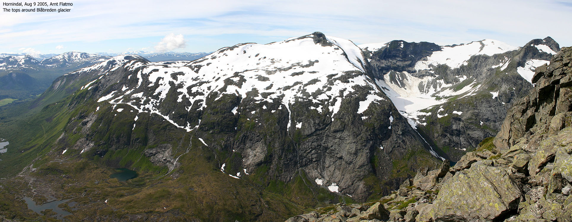
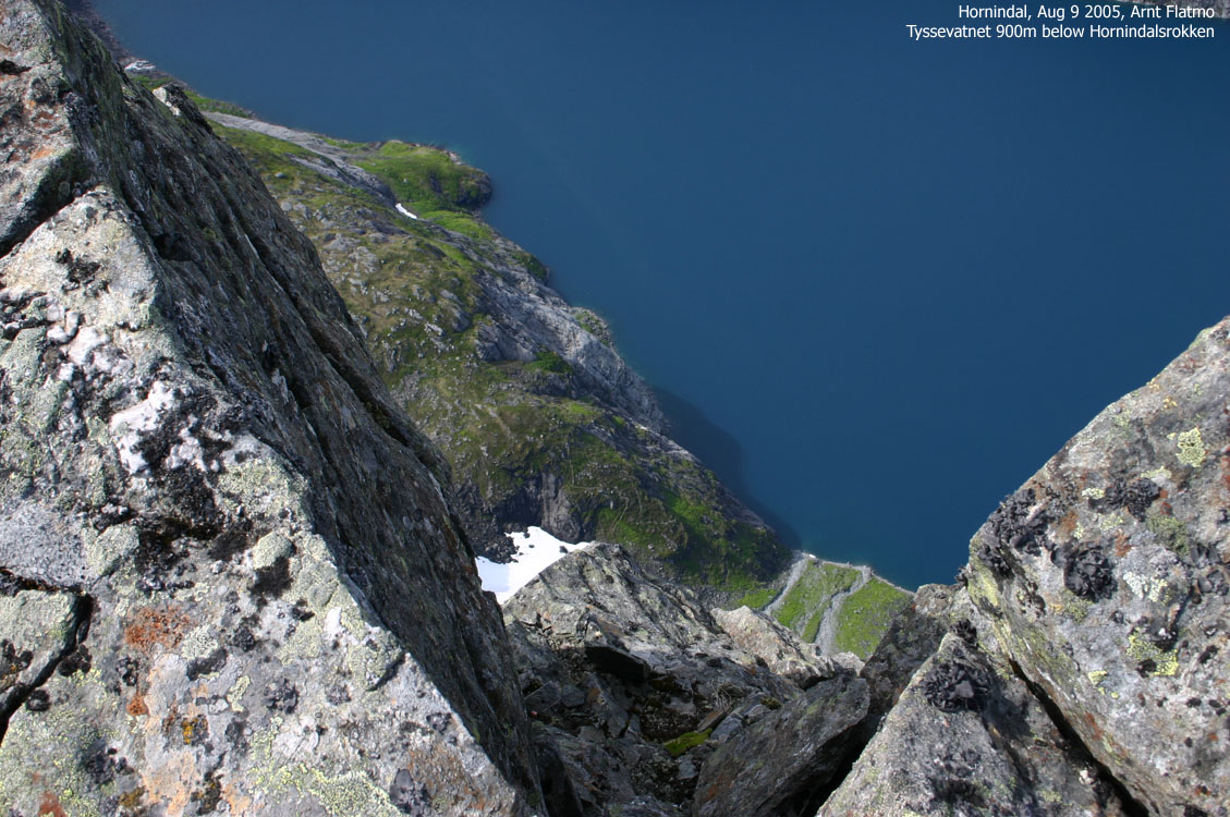
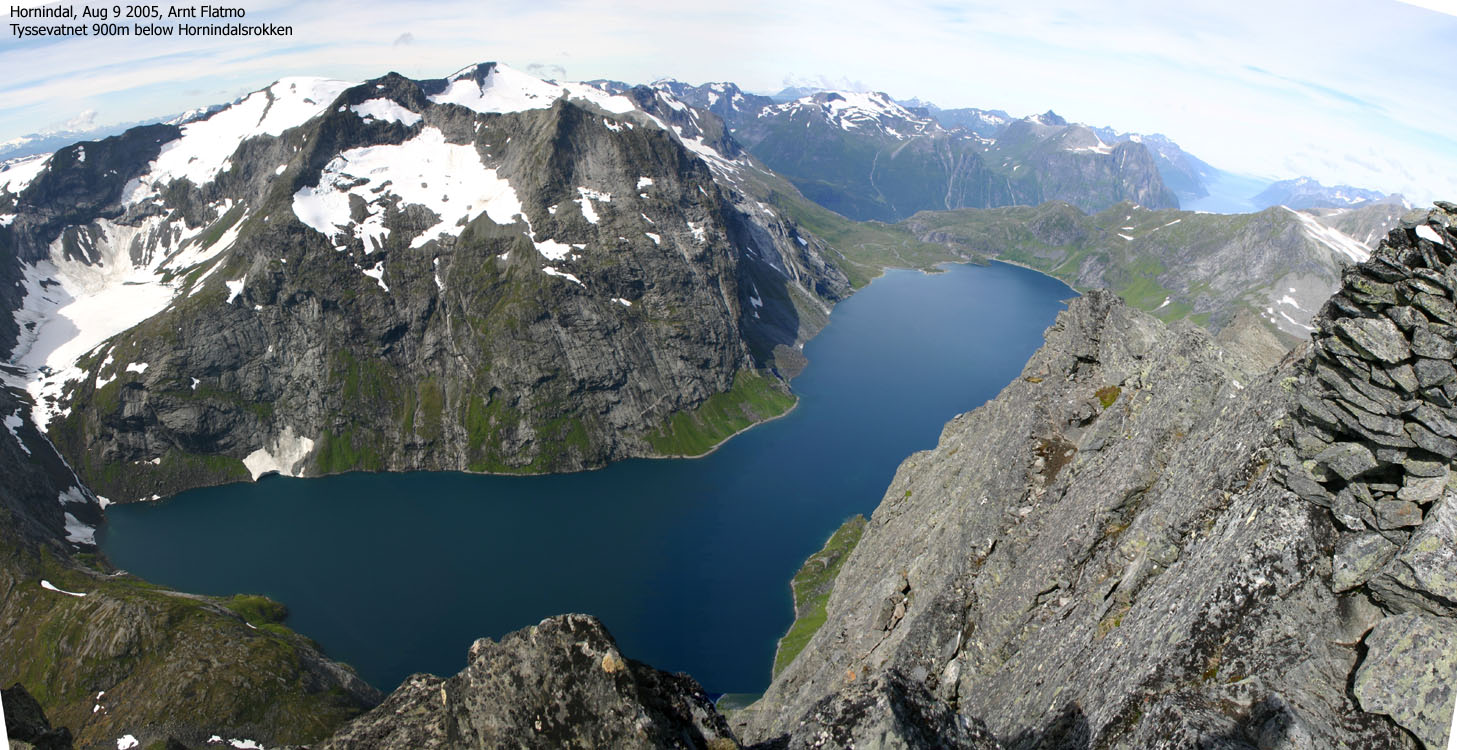
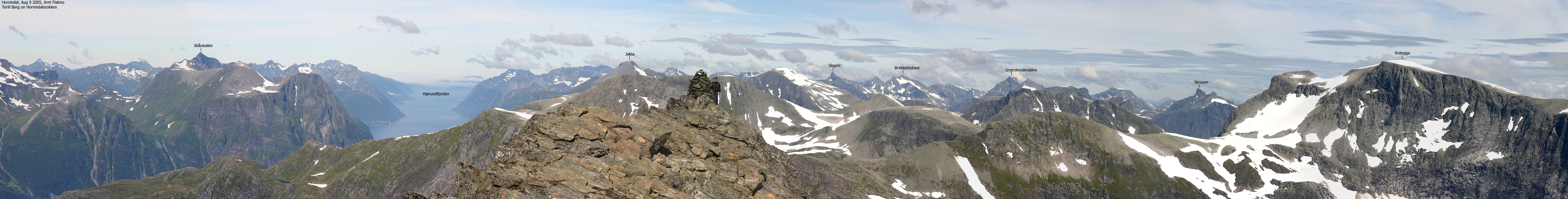
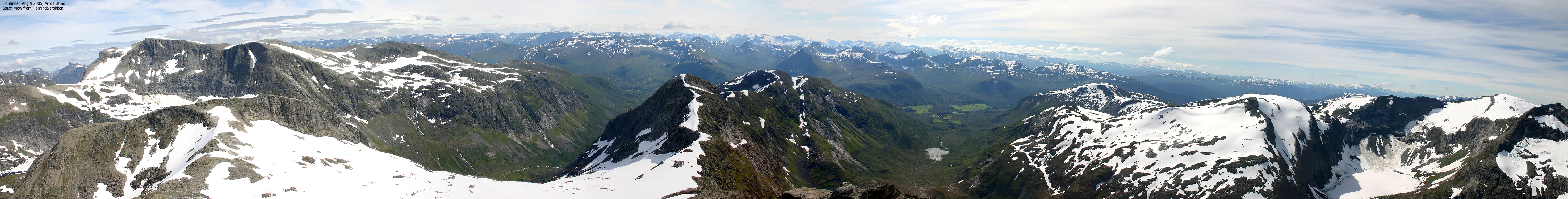
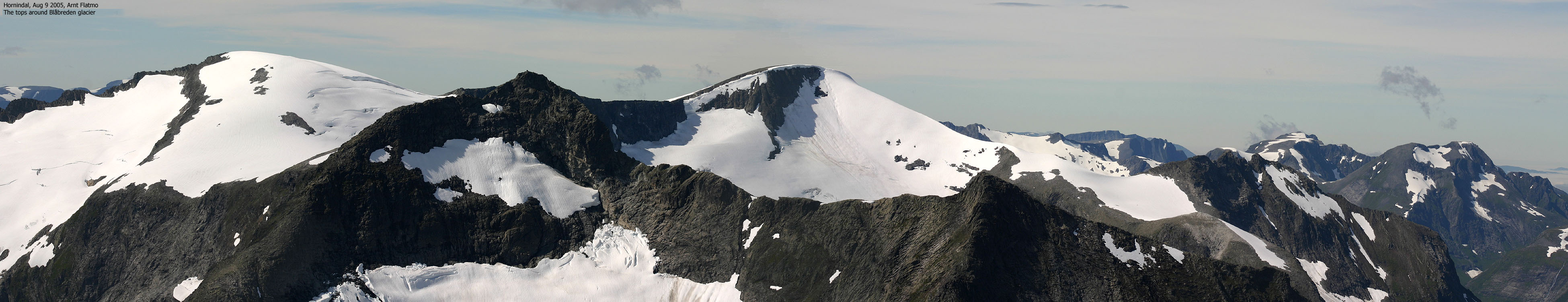
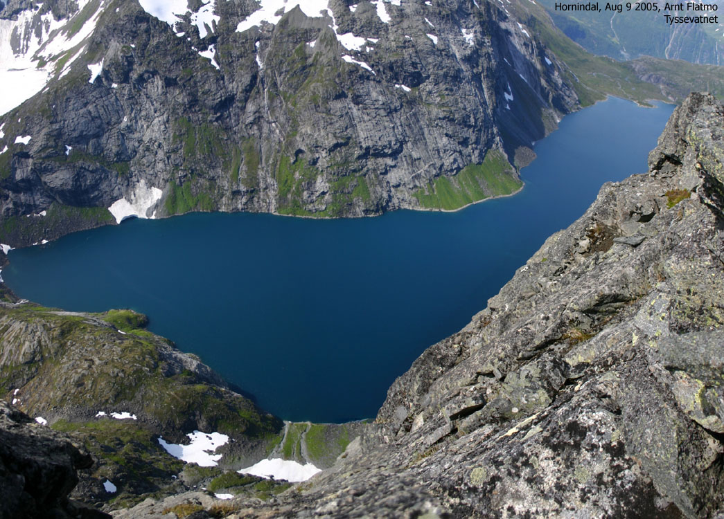
The views are good, but the neighbours Kvitegga and the peaks around Blåbreden glacier steal some of the views towards the east and the west. From Hornindalsrokken, you can see Hjørundfjorden and mountains such as Jakta, Slogen, Smørskredtindane and Jønshornet towards the north, and the mountains around Jostedalsbreen glacier towards the south.
There are several ways to get to the mountain, but the most frequently used route runs up Sæterdalen with Horndøla Bru as the starting point. Another route is up the neighbour valley Kjellstaddalen. Care should be taken in winter, as there may be avalanche danger along the trails.
Hornindalsrokken (M711: 1526m, Ø.K: -, Other source: 1529m) has a primary factor of 459m towards the higher Kvitegga (1717m). The saddle is found E of Trollaksla, S of Lake 1059m. Ref the 1219-III map, you cross the 1080m contours on the high route, but not 1060m. The saddle height has been interpolated to 1070m.
My GPS reported 1534m (top of the cairn) over a 15-minute period, on point 32 V 377617 6884402.
Notes: Class ratings are in reference to YDS. Click here for more information.
The trails described below are not necessarily the *easiest* trails to this mountain.
|
Horindalssætra - Hornindalsrokken (summer/autumn)
|
|
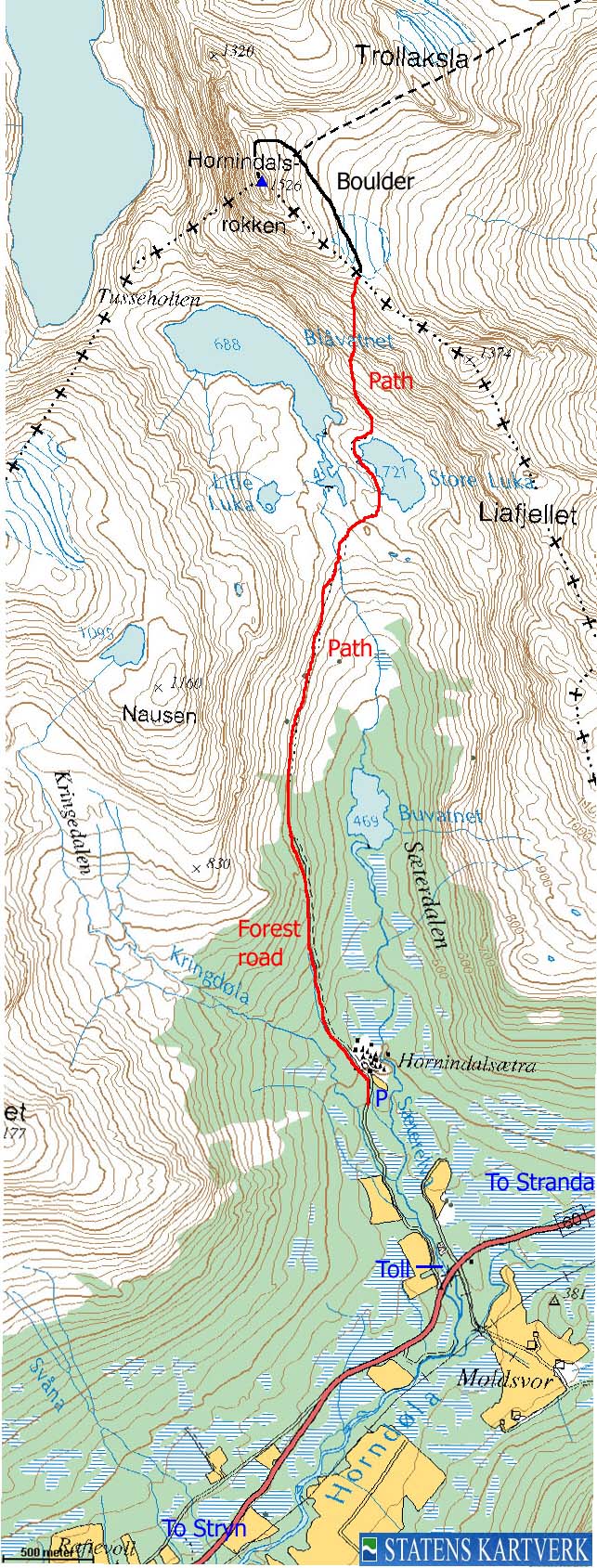
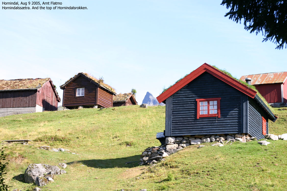
Locate "Horndøla Bru" (signed) along highway RV60 between Hornindal and Hellesylt. Follow a gravel road approx. 1,2Km to the parking below Hornindalssætra. This is a toll road. The fee for passenger cars (per Aug 2005) is NOK 20,-.
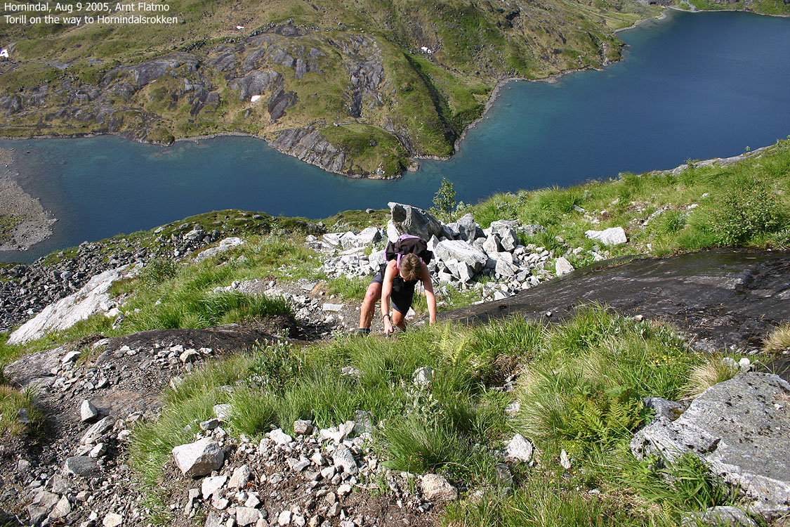
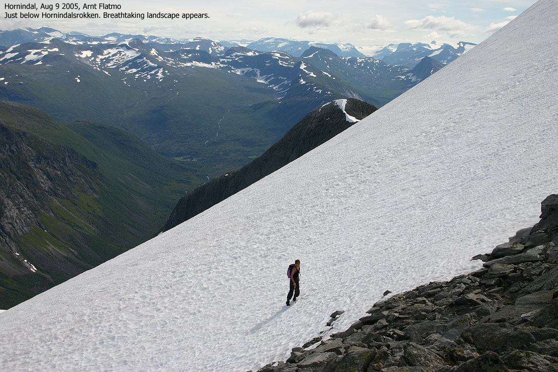
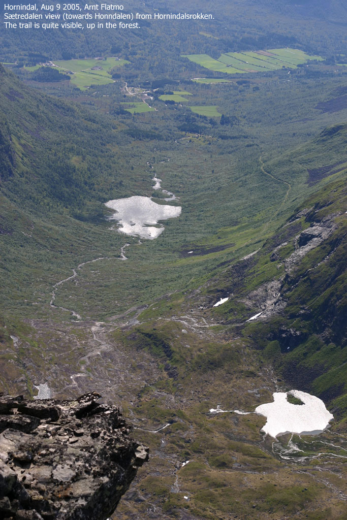
Follow the gravel road up to Hornindalssætra and then a forest road (signed "Hornindalsrokken") up Sætredalen, high above the valley floor. At the drain from Lake Blåvatnet, the road fades and a trail (red paint) continues. Cross the drain and then pass Lake Store Luka on the west side and start the climb at the north end of this lake. The trail makes a long traverse before it climbs up a long and distinct gully. The lower sections of the route often require use of hands, but the terrain is not difficult. Be extra careful if the rock is wet and slippery.
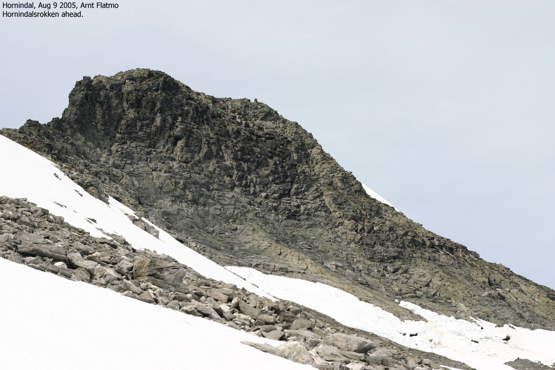
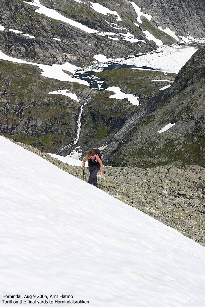
The trail tops out in the col between Hornindalsrokken and Liafjellet. Head up along Hornindalsrokken's east side, all the way to the north ridge. Then turn towards the south and head up the ridge. Maintain some distance while you pass Hornindalsrokken on your way up, as blocks of ice/snow often fall down to the east, towards the trail. That is, if there still is snow on the mountain. The terrain from the col and up to the summit is boulder fields.
Exposure, as in fatal consequences:
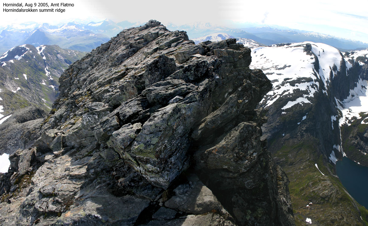
There is no exposure on the route to the summit. The steep part up from Lake Store Luka has a couple of sections which are more awkwards than the overall route, but you don't fall *off* the mountain, unless you do something extraordinary. The summit ridge is very airy, but you don't have to cross this ridge in order to reach the summit cairn.
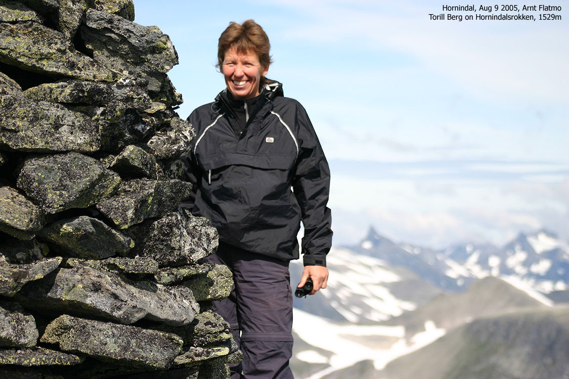
Torill Berg, a friend of mine who lives in Møre og Romsdal county, thinks I spend too little time up in "Sunnmørsalpene". She is right of course, but the distance from Bergen is a practical problem. However, from time to time, a visit is simply "a must", and I had agreed to hike Hornindalsrokken with Torill this summer. Last year, bad weather had forced her group to turn around 100m below the summit and this year she wanted to reach the top in good weather.
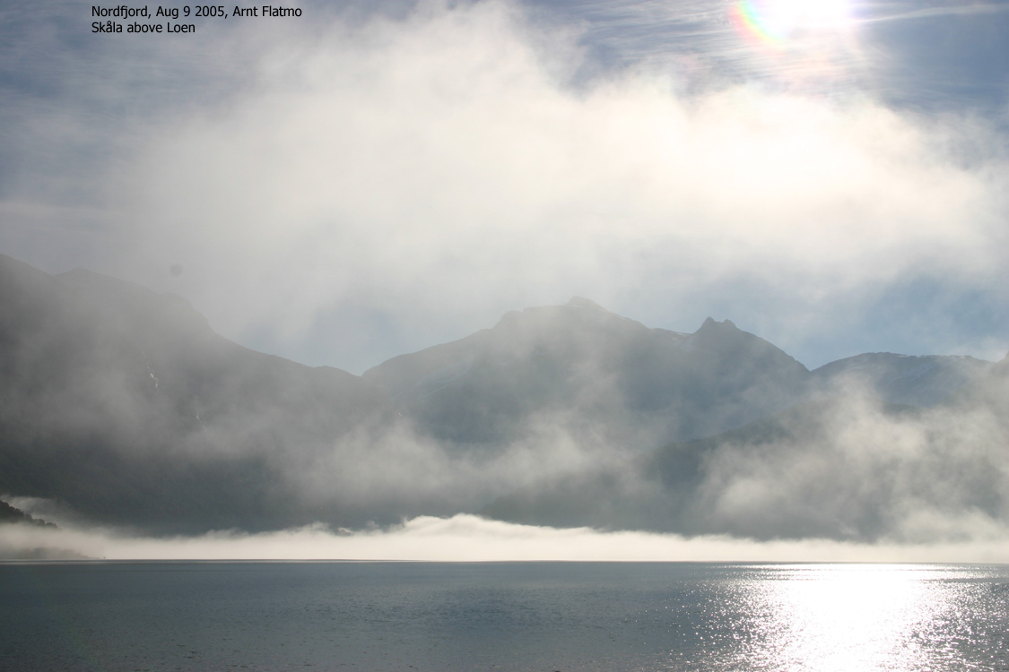
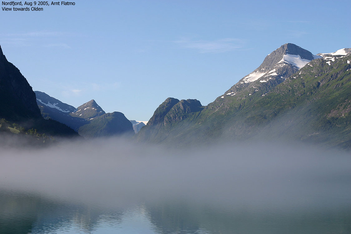
We chose a day that had an OK weather forecast. In western Norway, one can never be sure about the weather, but there was absolutely a fair chance for good weather. I had a very early start and left Bergen 04:00AM in order to reach the 06:00AM ferry across Sognefjorden. It was soon apparent that it would be a wonderful day. The morning fog covering Nordfjorden was nothing to worry about.
Torill also had to take a ferry in order to get to Hørndøla Bru, and arrived 5 minutes before me. Horndøla Bru was completely *packed* with tourists, and we had to drive through the toilet queue to get to the road to Hornindalssætra. We parked the cars and were ready to go at 09:50AM.
As Torill had been here before, I didn't focus on anything else than the majestic appearance of Hornindalsrokken. I started to "wake up" when I noticed that we were off-trail in partly wet and muddy terrain. I asked Torill if we shouldn't be following a trail, and it seemed that she was wondering the same. I pulled out my GPS and noticed a path, 50m up to our left. After being "fed up" with the bush and bog, we scrambled up the forest and found a "motorway". This made more sense. This is a famous Norwegian mountain, and of course there is a trail.
We continued along the "motorway" which was the greatest outdoor toilet (for sheep) that I have ever seen. You have to "love" the smell, otherwise the trip becomes a burden. A fine mountain came closer and closer and at Lake Store Luka, it was time to take on the steep part of the route. We had walked for 70 minutes and had 800m vertical meters ahead of us. I wondered if there was anyone on the mountain. It seemed quiet. The main summer holiday was over and it was Tuesday morning. But still it was a bit strange not seeing *anyone* on the path, while hundreds of tourists were taking pictures of this mountain, down at Horndøla Bru.
Torill was considering buying an ice-axe, and I suggested that she borrowed mine for the day, to get "the feeling" of it. Some pictures show Torill with this axe, but an axe is not needed on this mountain during summer. Still, I normally carry one. It serves many purposes, from bush fighting, eagle protection, "root-axe" in steep forest, "one-pod" for the camera, arm extenstion in boulder, and much more. Oh yes, it is useful on ice and snow as well. We took our lunch-break in the col between Hornindalsrokken and Liafjellet, knowing that the hardest part was below us. Torill thinks it is silly to go to the mountains without food, so to avoid "foul language", I had prepared a decent lunch-meal.
We arrived the summit 13:10PM, and a wonderful landscape opened up before us. These views are worth all the effort you can put into it. We tried to figure out where Slogen was, but all mountains looked the same to me. Steep, sharp and fierce. We could see straight towards Hjørundfjorden, which is good for navigation. It was good to be up here. A strong reminder of that Sunnmørsalpene should be visited more often.
After spending a good while on the summit, we began the descent. After chatting with a family that were resting at the col, we continued downwards and were back at the cars 16:15PM. As we passed Hornindalssætra, we wondered how we could have missed the "Hornindalsrokken" trailsign and the forest road. I left the parking area first and hoped that all the cows that had passed a couple of minutes earlier had left the road. They hadn't. Worse; they had stopped on the road. Maneouvering between the 10-15 cows was a whole lot more challenging than driving through the toilet queue at Horndøla Bru. But I got through, and could continue towards Skei. I planned to spend the night at a hotel and hike Eggjenibba the next morning.
Move cursor to read notes, and click on the images to see full version.
Some of the thumbnails may have been cropped to fit the format.
On the way to Hornindal


To "Rokkjen"


Summit views


No Javascript:
1 2 3 4 5 6 7 8 9 10 11 12 13 14 15 16 17 18 19 20 21 22 23 24 25 26 27 28 29 30 31 32 33 34


No Javascript:
1 2 3 4 5 6 7 8 9 10 11 12 13 14 15 16 17 18 19 20
Other hordaland mountains
 Other Norwegian mountains
westcoastpeaks.com
Other Norwegian mountains
westcoastpeaks.com

