
|

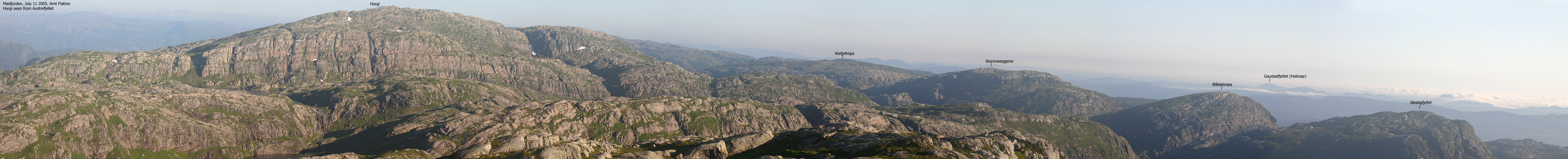
Horgi seen from Geitfjellet(No Javascript) |
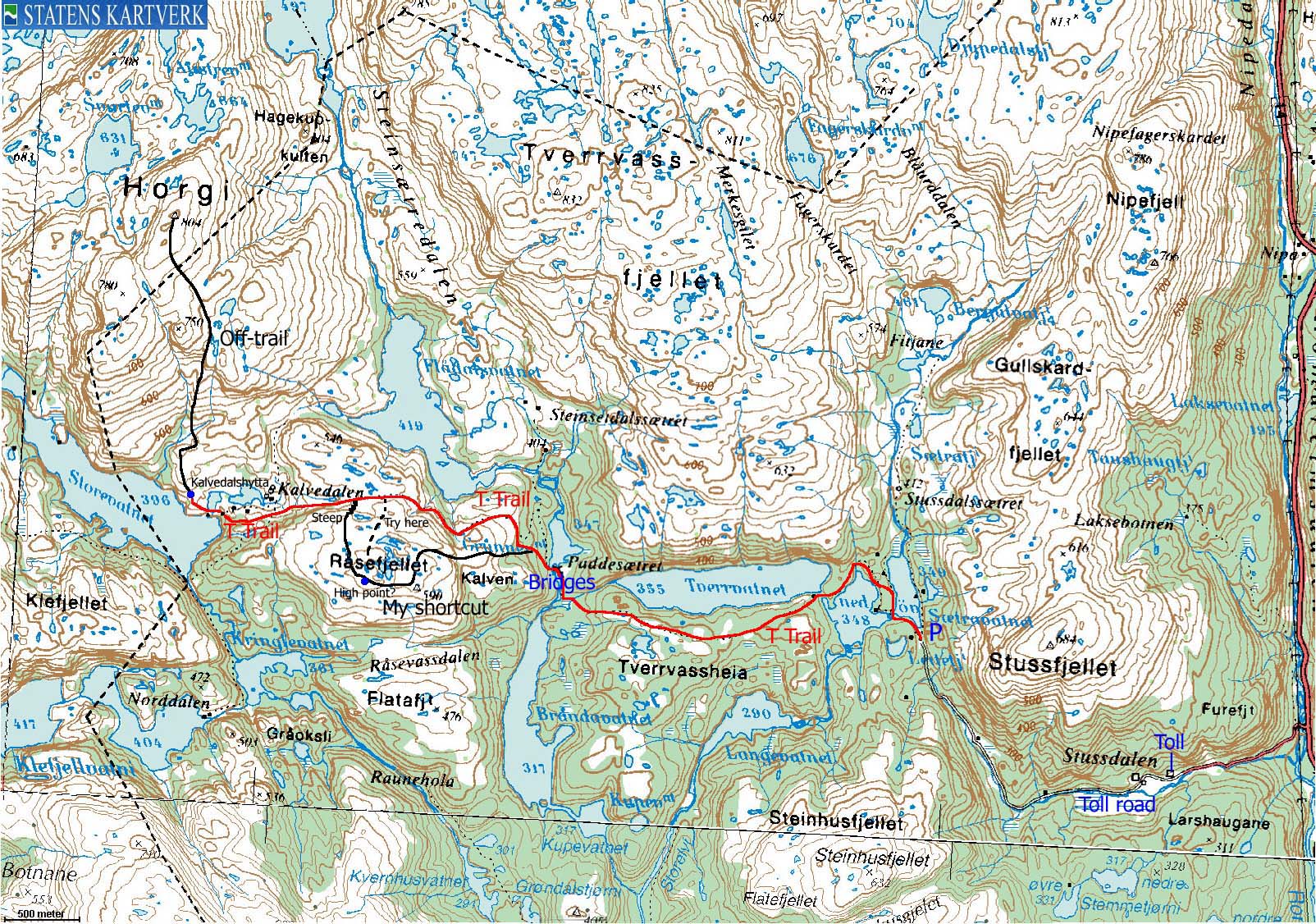
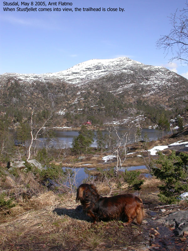
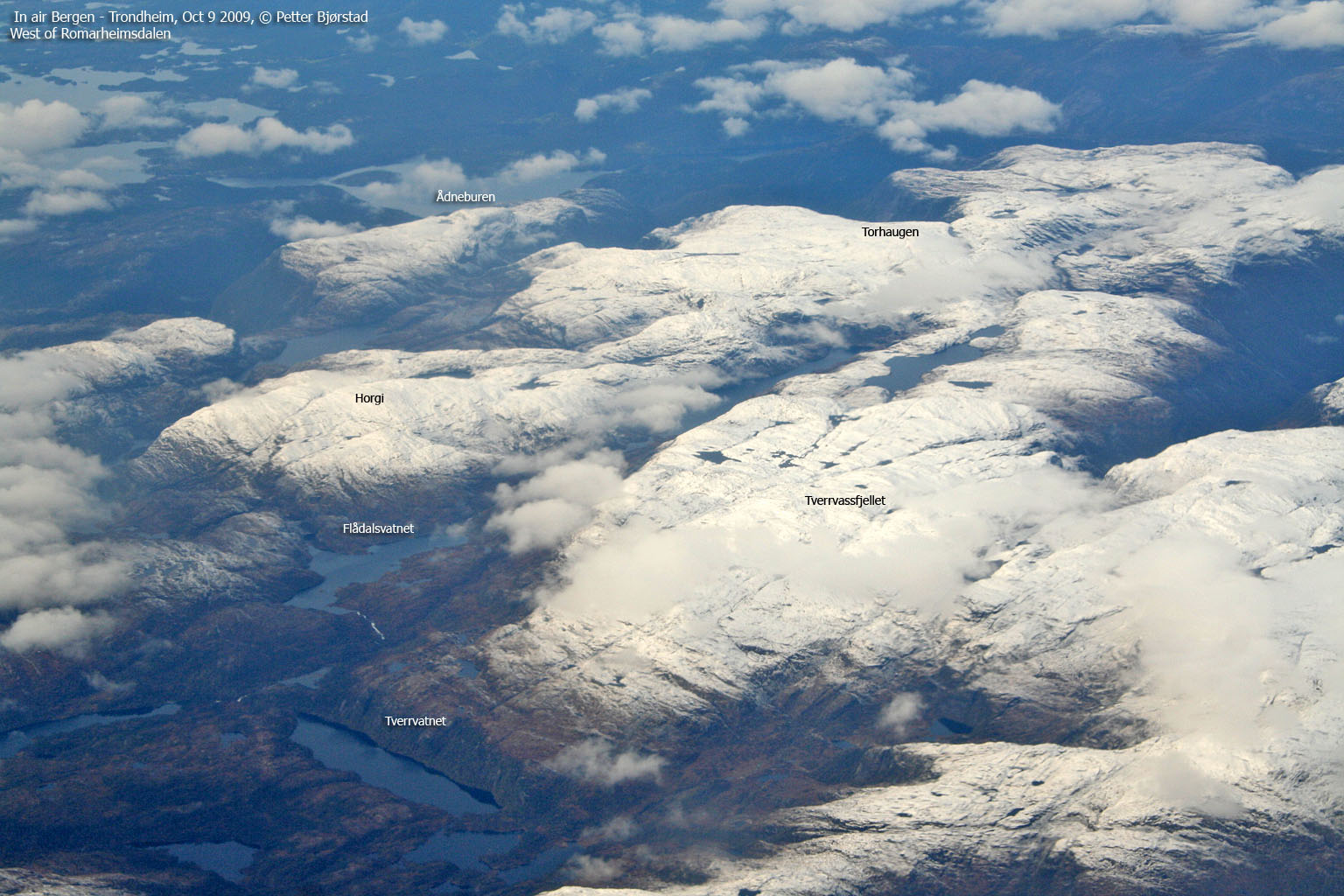
Horgi is located in the very center of the large mountain region west of highway E39 (Romarheimsdalen - Matre) and the fjords Romarheimsfjorden, Austfjorden, and is one of five mountains exceeding 800m elevation. With its 804m elevation, Horgi is the lowest mountain in this group, but is the mountain that offers the longest hike. The views are however well worth the long trip. You will get a very good overview of this large mountain region from Horgi. Råsefjellet is a lower top next to Horgi, and is convenient to hike if you start out from Stusdal.
Stusdal is perhaps the best trailhead in summer, as you can drive all the way up to Lake øvre Sætravatnet (348m), cutting deep into this mountain region. Another option is to hike from Nordkvingo and across Storevasseggene before you descend down to Kalvedalen. This is an excellent, marked trail, A third option is to hike up Meisdalen (which also leads to Ådneburen and Torhaugen. As I am writing this page, I have yet to visit Austrefjellet (766m) north of Horgi. I will add more information about approaching Horgi from Meisdalen after having visited Austrefjellet. There are other routes to Horgi, but I recommend starting out from Stusdal or Nordkvingo.
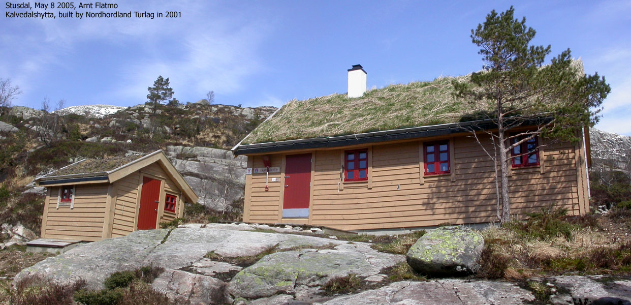
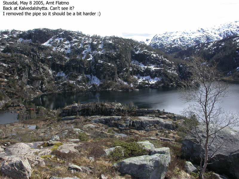
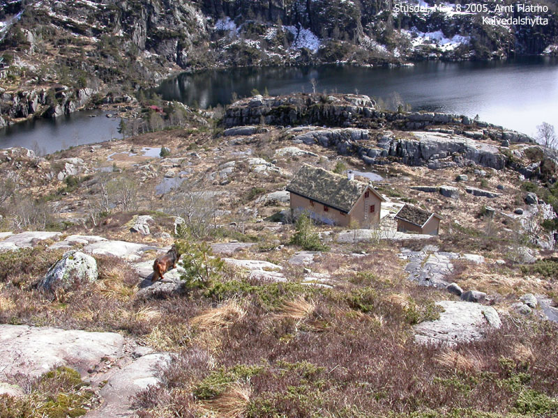
Located south of Horgi, you will find Kalvedalshytta, a self-serviced cabin built in 2001 where you can spend the night. It is located in beautiful surroundings down by Lake Storevatnet and is blended into the terrain in an excellent way.
Although the Masfjorden/Lindås; kommune border runs across the Horgi summit plateau, the high point belongs to Masfjorden kommune. Råsefjellet belongs to Lindås kommune.
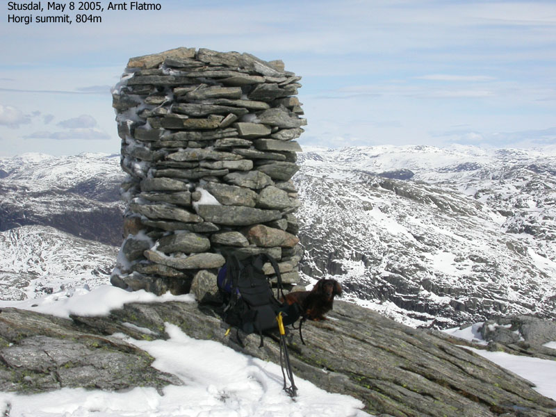
Horgi (M711: 804m, Ø.K: Highest contour is 800m) has a primary factor of 151m towards the higher Torhaugen (834m) The saddle is found in a pass just N of Austrefjellet. Ref. Økonomisk Kartverk (5m contours), you cross the 655m contours on the high route, but not 650m. The saddle height has been interpolated to 653m.
Råsefjellet (M711: 590m, Ø.K: 590,15m) has a primary factor of 140m towards the higher Horgi (804m) The saddle is found in a pass between the two mountains. Ref. the M711 map (20m contours), you cross the 460m contours on the high route, but not 440m. The saddle height has been interpolated to 450m.
Notes: Class ratings are in reference to YDS. Click here for more information.
The trails described below are not necessarily the *easiest* trails to this mountain.
|
øvre Sætravatnet - Råsefjellet - Horgi (summer/autumn)
|
|
From Bergen, follow highway E39 northbound towards Førde. Pass the toll station on Nordhordlandsbrua (fee for passenger car per May 2005 is NOK 45,-) and continue 41,9Km northbound. Turn left towards Stusdal. Drive 1Km and pay fee (NOK 20,- per May 2005). Continue 200m to a 3-way junction. Follow the middle road to the left. Continue 2,2Km on this road up to Lake Øvre Sætravatnet. Drive carefully. The gravel is loose and there are a couple of humps.
In winter, park down by E39 if you don't think you can drive up the steep road to Stusdal. 800m upwards you will find another parking area which you need to use if the road to the Lake Øvre Sætravatnet is not open.
Note 1: The route description for Horgi assumes you can drive all the way to Lake Øvre Sætravatnet.
Note 2: On this web page, I write "Stusdal", while the map says "Stussdal". The map spells the name wrong. I may still have the wrong spelling on some web pages and pictures.
Note 3: Other hikes I have done from Stusdal;
Stusfjellet,
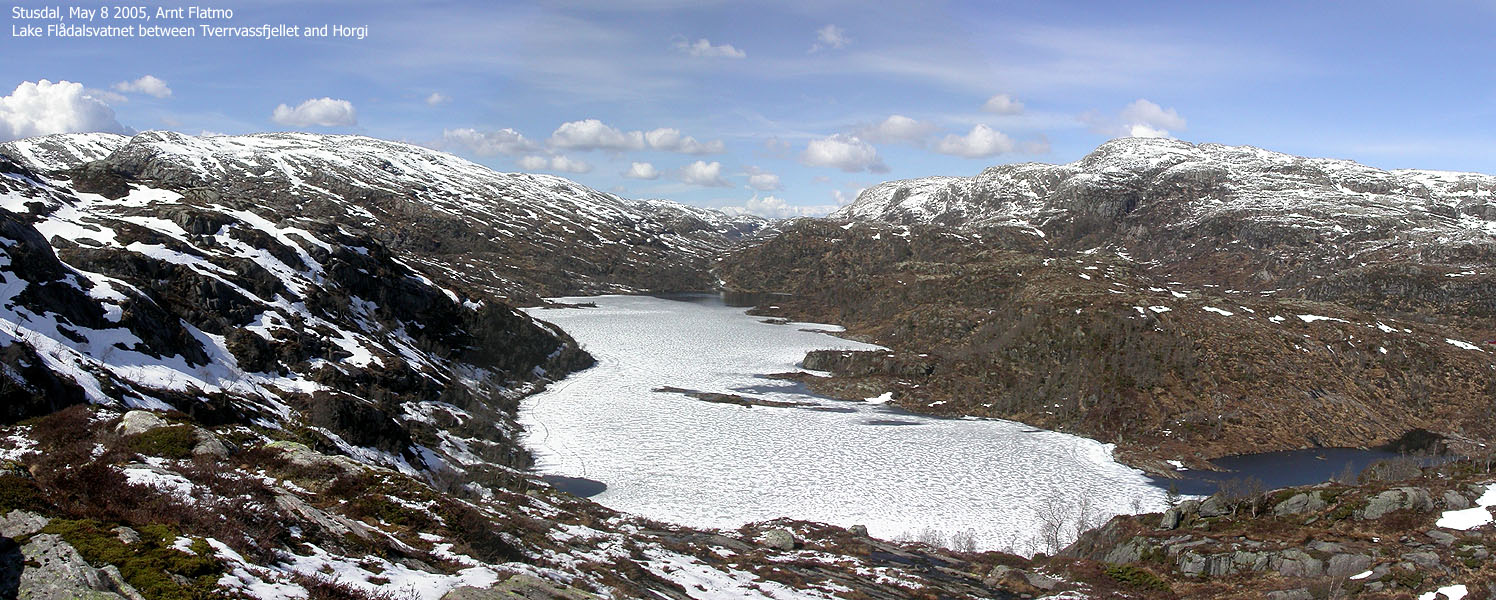
Steinhusfjellet and Tverrvassfjellet.
To Råsefjellet
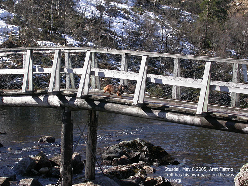
Follow the T trail that begins by the lake. Very soon, a bridge takes you across the lake. Turn right just after the bridge. Soon after, you see the Kalvedalen/Skavlabu trailsign. Go left here. Follow the trail that takes you around the north side of Lake nedre Sætravatnet. The T trail continues across Tverrvassheia where you have a good view towards Lake Tverrvatnet down to your right.
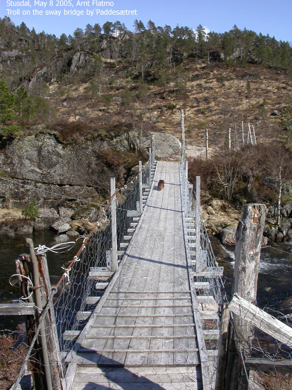
After descending Tverrvassheia, turn north when you arrive the river from Lake Grunnevatnet. Follow the trail up to Paddesætret. Pass these two cabins and cross the drain from Lake Grunnevatnet via two bridges (one is a swaying bridge). 80m after the second bridge, there is an unsigned trail junction. Go left (don't follow the path that runs along the lake). You're now on the T trail to Kalvedalen.
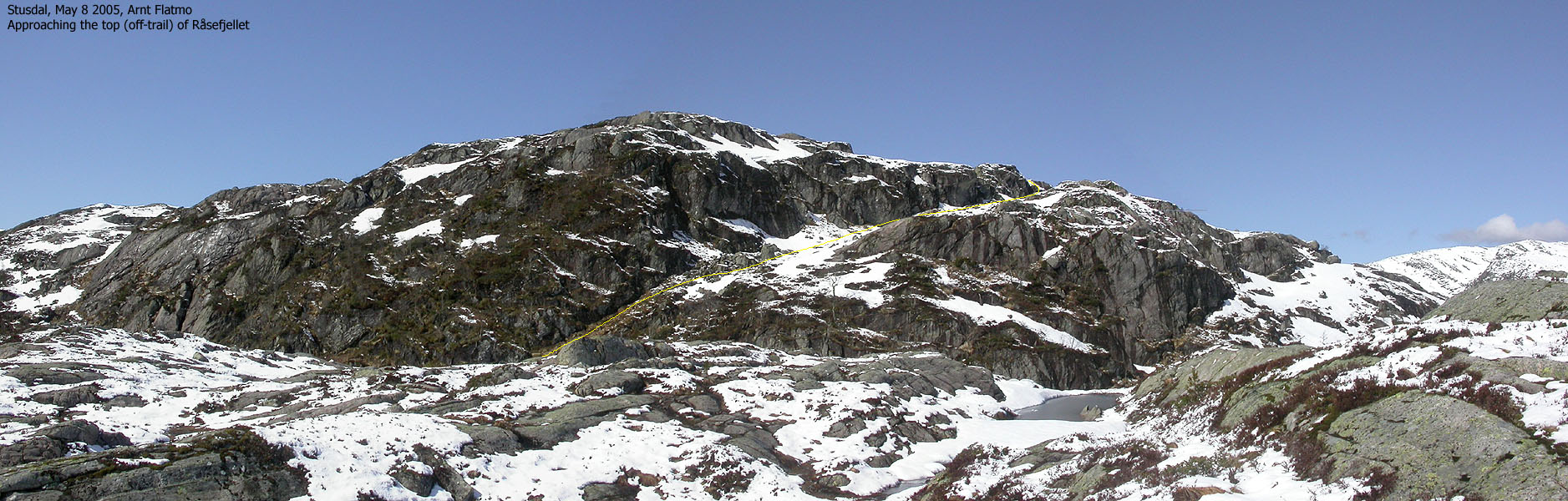
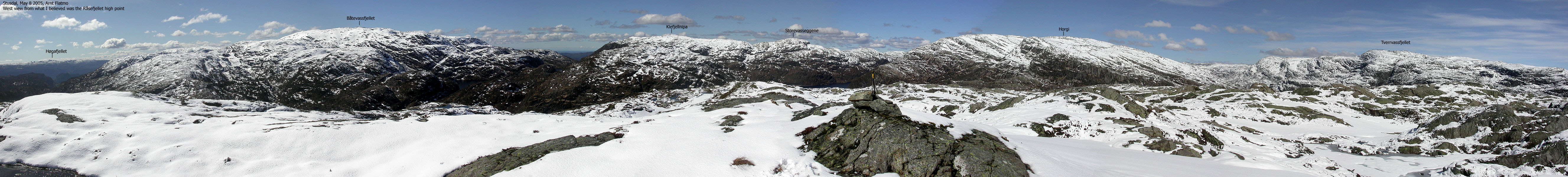
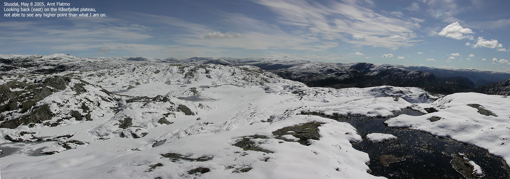
Follow this T trail up to 525m elevation, just when the trail begins to descend towards Kalvedalen. Turn left and go off-trail up to the Råsefjellet plateau. There are two distinct high points with a few small lakes in-between. Map point 590m is found on the eastern high point (to your left). I followed a different route up to Råsefjellet (from the east) and was very focused about the various high points. I passed 100m N of the map high point, but did not notice any distinct high point in this direction. I found a few rocks obviously marking something on the hump west of the small lakes, and the elevation was 590m. After completing your stay on Råsefjellet, return to the T trail.
To Horgi
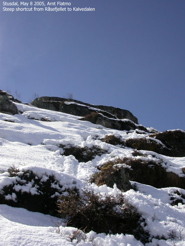
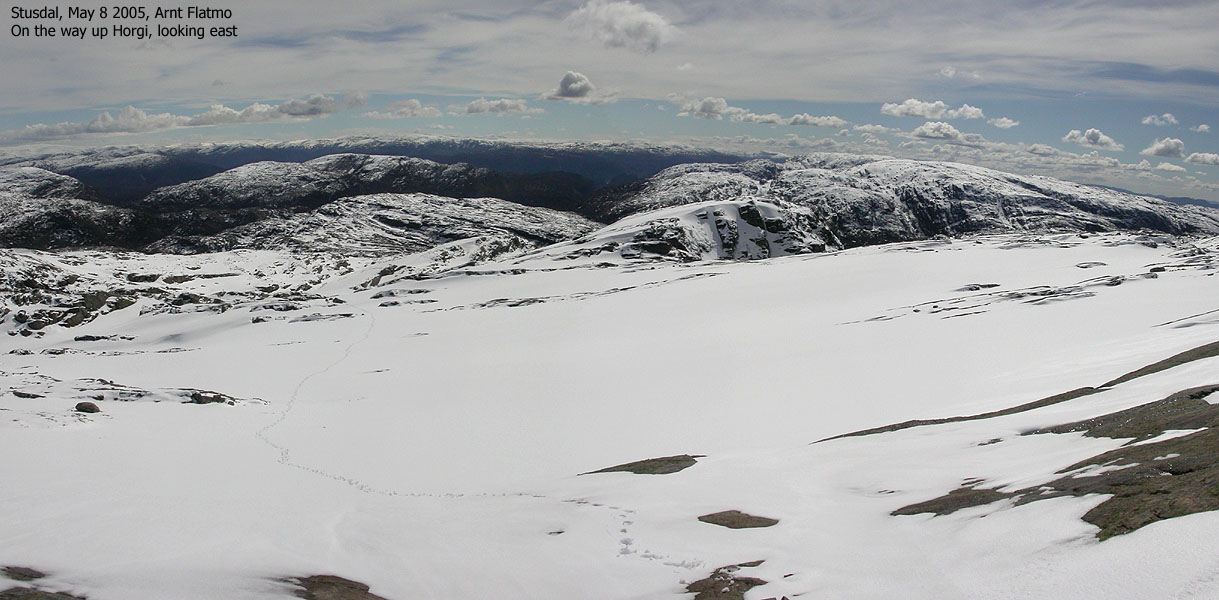
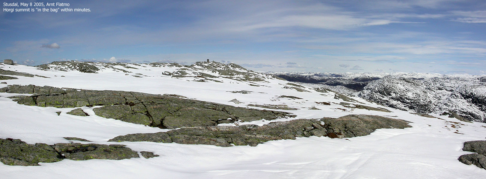
Follow the T trail down to 440m elevation where you see the Kalvedalshytta/Kvingo trailsign. Continue towards Kalvedalshytta which marks the end of this T trail. The cabin can not be seen until you are standing in front of it. Head off-trail northbound from the cabin. You will see a gully (very deep in parts) where two streams from Horgi unite. Stay on a ridge on the right-hand side above this gully. Head towards (the steep) point 750m and walk up on the right-hand side of this point. The route is quite obvious. On top, walk around point 750m and set a direct northwest course towards Horgi summit. The summit is marked by a large cairn. Descend your ascent route.
I had only 4 more mountains and hills yet to do in Lindås kommune, and Råsefjellet was one of them. It was natural to visit Horgi as well, once there. All in all, I was looking towards a long walk. Something that I knew I couldn't do as an evening trip. The weather forecast promised sunshine and rain. The day before was a beautiful mix of hail, snow above 300m, rain and sunshine. I woke up in the middle of the night to the sound of rain. I expected that the Horgi hike would be a wet and miserable experience.
But then I woke up to bright sunshine. I didn't know how long this would last, so I was in the car, ready to go approx. 20 minutes after getting up. Breakfast was skipped, but I brought along 2,5 bisquites (leftovers from a previous hike) and a chocolate bar. And of course - the lunch box for my dog "Troll". I could tell from the mountains that snow had fallen recently. Austlendingen, which had been nearly free of snow on the west side had fresh snow from 600m elevation.
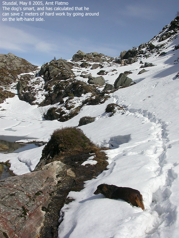
We left the trailhead by Lake øvre Sætravatnet 09:55AM. I knew the route across Tverrvassheia from my previous hike down Tverrvassfjellet. There was still pockets with soft and deep snow, so I had Troll in the backpack until we started the descent towards Paddesætret. It took me 55 minutes to reach the cabins. I followed the T trail towards Kalvedalen for a while, but left the trail at 420m elevation. Troll was now firmly seated in the backpack again. I hiked across "Kalven" and followed a steeper route up some cliffs above Kalven. I crossed the plateau and located some rocks that matched my idea on what had to be the high point.
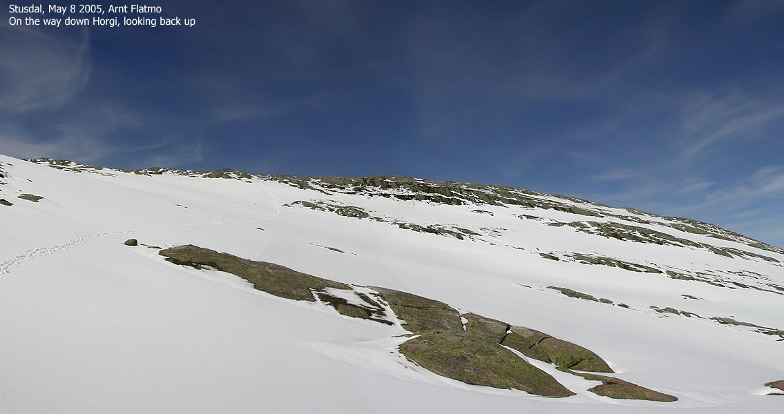
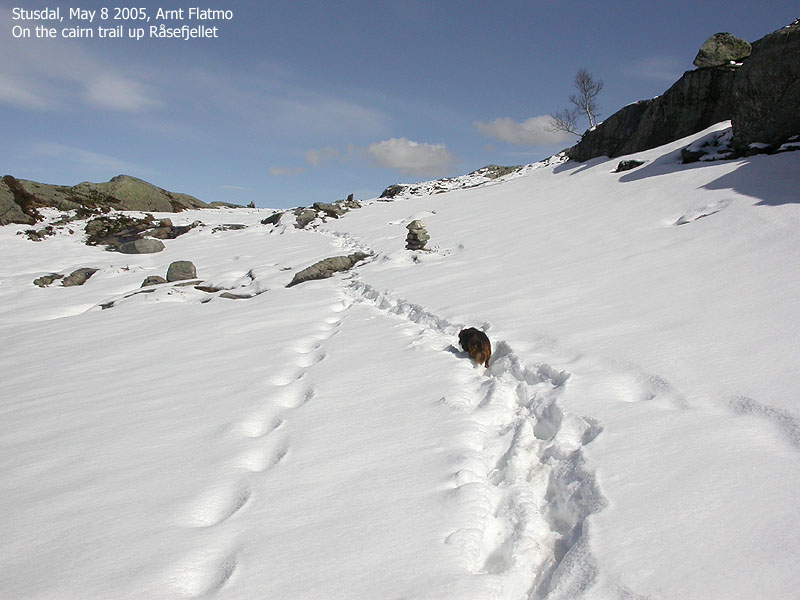
I took a direct course towards Kalvedalen, but some nasty cliffs forced me in the opposite direction. When I finally reached the T trail, I met a family of four who had spent the night in Kalvedalshytta. We talked for a good twenty minutes before I let Troll out again and continued down to Kalvedalshytta. The route up to Horgi was not obvious from the cabin. While I had some plans to hike the south ridge up to point 780m, I stayed on the ridge east of the gully long enough to make the crossing impossible. The gully was tremendously deep in places. I continued up along the ridge and found an excellent place to ascend the mountain, just east of point 750m. Troll entered the backpack again because the snow was almost knee-deep. Walking up to the summit was tiresome, but 13:40PM, nearly four hours after we left the car, we were standing on Horgi summit.
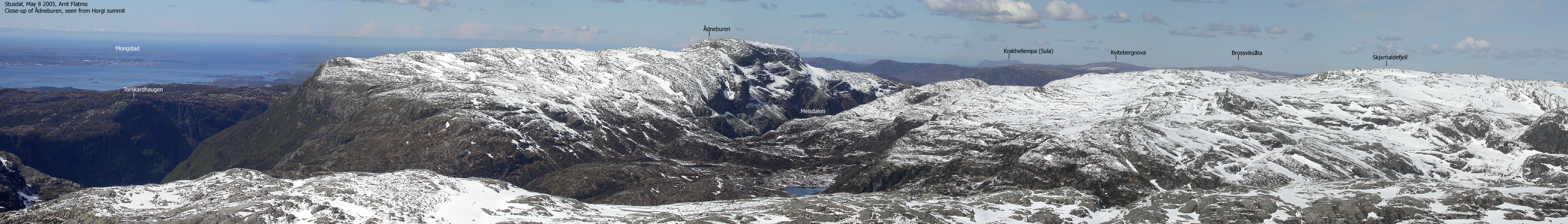
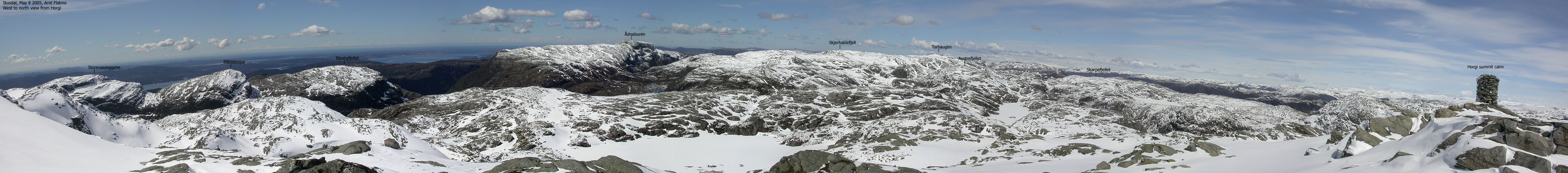
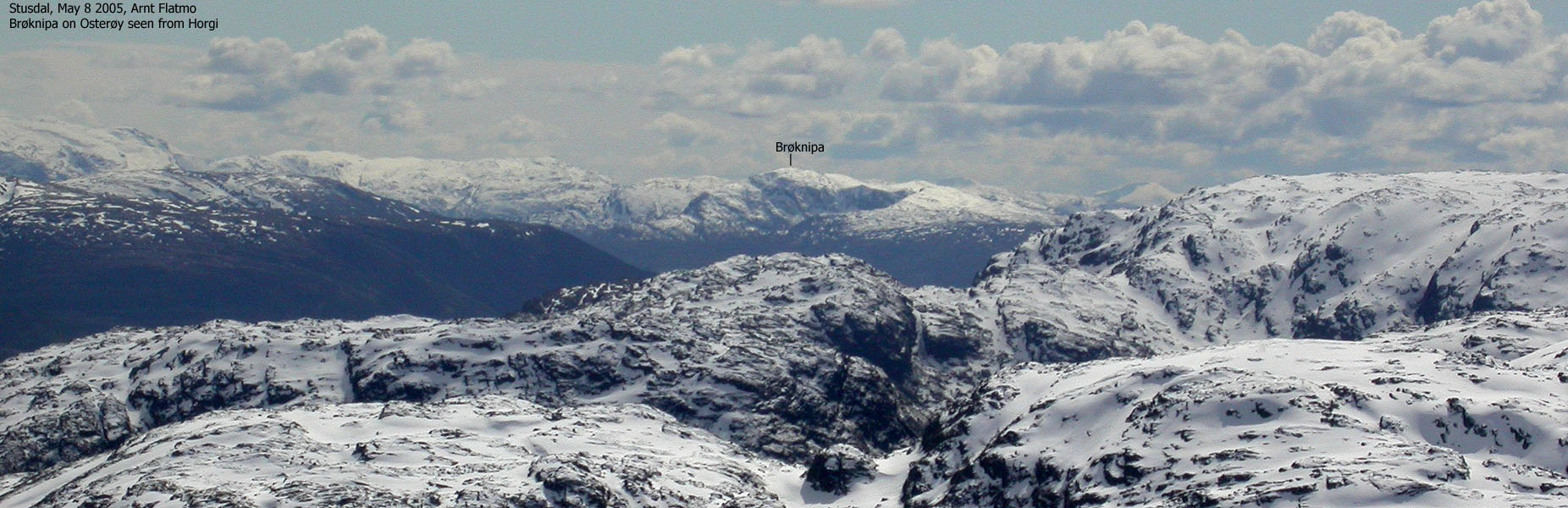
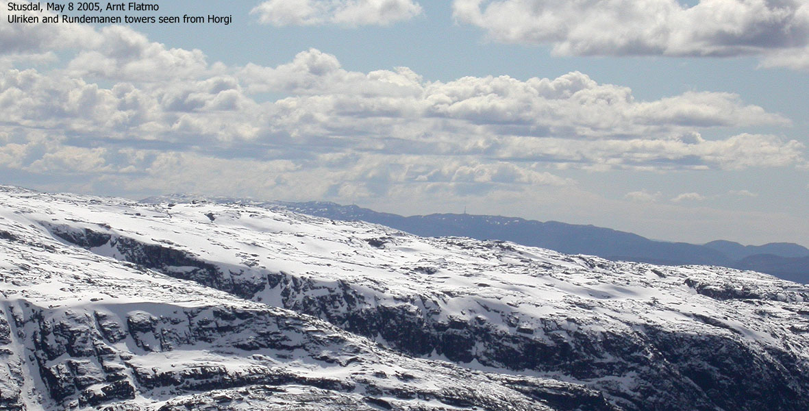
The views were magnificient. A breeze made life more comfortable with a wind jacket on. Troll enjoyed his lunch while I captured a whole lot of Hordaland onto disk. It was very interesting to see Storevasseggene, Blånipa, Illestigfjellet and Ådneburen from this angle. These are wild mountains! After finishing my chocolate bar and my 2,5 bisquites, we left the summit 14:00PM. I wanted to see how long Troll could walk and plowed the snow ahead of him. At 17:00PM, 3 hours after leaving the top, we were back at the trailhead. Troll had walked the whole distance, which was no small effort by this little dog. What a fight he had to put up in the soft and deep snow at times. Quite amazing. The more tired I got, the more eager he seemed. Always ahead of me, looking back and wondering what's keeping me up. I stopped by Anders Stusdal at Stusdal and talked for a while. This has become a "tradition". Talking with Anders is always very enjoyable and he has helped me out with route descriptions for the local mountains.
Move cursor to read notes, and click on the images to see full version.
Some of the thumbnails may have been cropped to fit the format.
Note: Panoramas are larger (in size) than usual. This is caused by the weather.
The compression factor is the same as always.
To Råsefjellet


To Horgi


Horgi summit views


Back to the trailhead


No Javascript:
1 2 3 4 5 6 7 8 9 10 11 12 13 14 15 16 17 18 19 20 21 22 23 24 25 26 27 28 29 30 31 32 33 34 35 36 37 38 39 40 41 42 43 44 45 46


No Javascript:
Other hordaland mountains
 Other Masfjorden K. mountains
Other Lindås K. mountains
westcoastpeaks.com
Other Masfjorden K. mountains
Other Lindås K. mountains
westcoastpeaks.com

