
Norwegian Mountains, Hordaland
Holmanuten (1399m), July 22 2010
To the main Holmanuten page (maps, route descriptions, other trip reports, etc.)

The route, as seen in Google Earth
(Click for larger image)
After two nice weeks in northern Norway, Anne and me returned to Sunnmøre with a really poor weather forecast awaiting us. We had one week left of our summer vacation and decided to go wherever the sun was shining. And according to the weather services, the southern part of Hordaland seemed promising. This was good news. Not only could I (hopefully) tick off a couple of more tops on my Hordaland "pf" list, but we could also visit Liv - westcoastpeaks' most excellent flora and fauna consultant - along the way.
Already the day after we returned to Sunnmøre, we were on our way south. It was raining all the way, and we might have had doubts about the alleged nice weather in southern Hordaland. But - when we got to Hardanger, the rain had stopped and we could enjoy blue sky. We had a very pleasant stay over at Liv's place. Her dog and two cats seemed to enjoy the visitors, but were a bit skeptical to Loke...

In Hardanger
(Click for larger image)
After a nice breakfast, we parted with Liv, thanked her heartfully for her generousity and sat course for the Røldal region. On our way, we stopped (of course) by the magnificent Låtefoss...

Låtefoss
(Click for larger image)
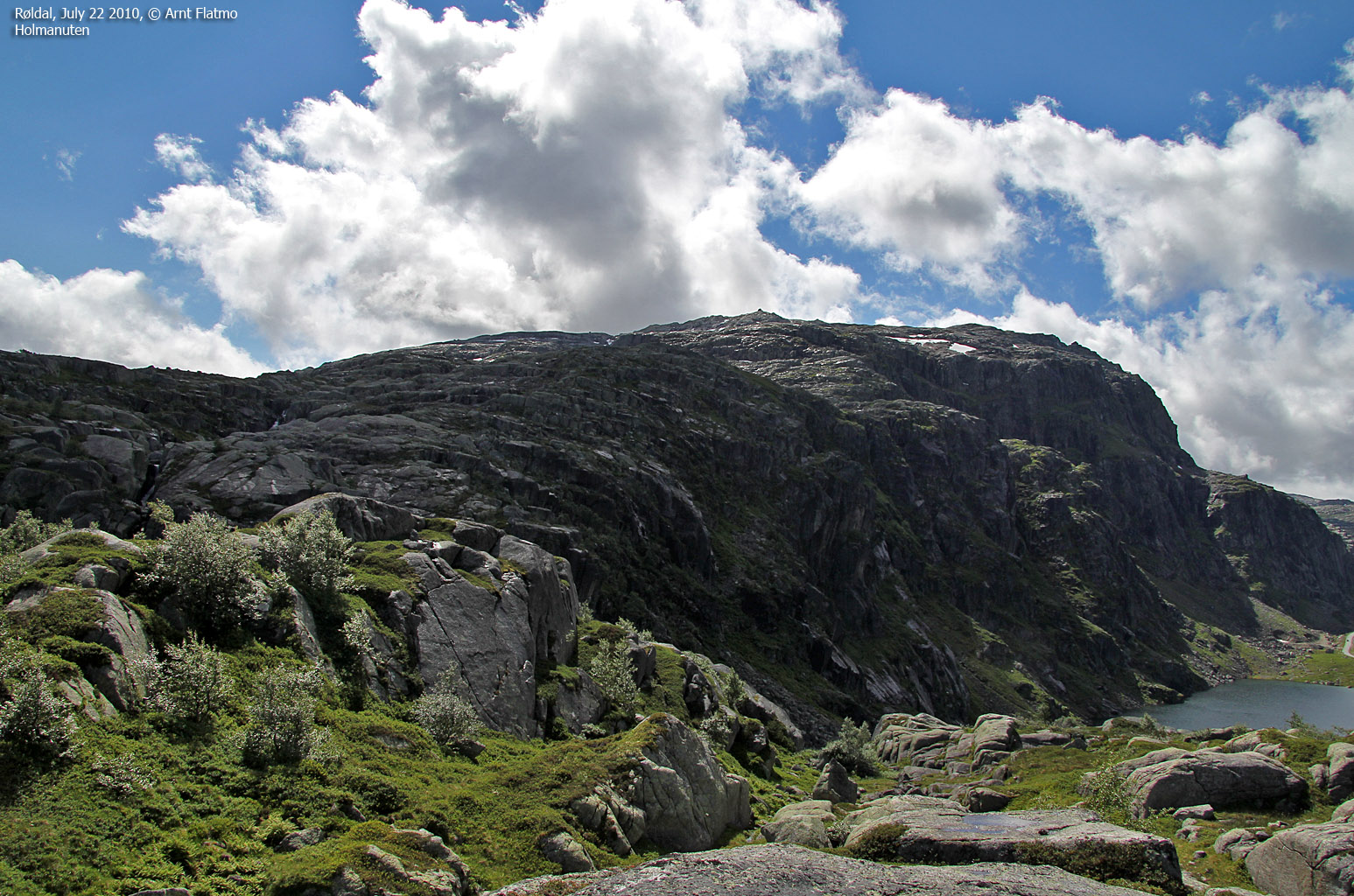
As we planned to stay in the Røldal area for a few days, we decided to locate our base-camp first. Røldalsterrassen had a very good offer - off season as it clearly was. We booked a room for 3 nights and continued on the road to Sauda and Ekkjeskartjørna - the trailhead that we had chosen. It didn't take long before we had Holmanuten in clear view.

Holmanuten
(Click for larger image)
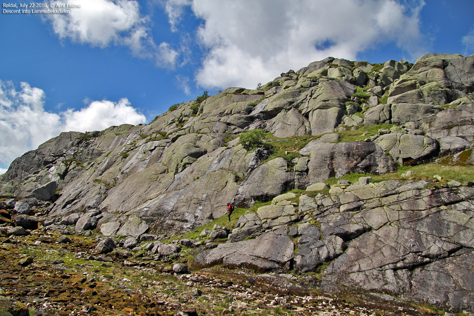
We drove up to Ekkjeskartjørna (848m) and found a path that led us up to a mast/antenna (approx. 940m). From here, we had most of our route up Holmanuten's north ridge in clear view. It didn't look very difficult at all, but first we had to descend from the mast and into Lammabekkdalen. This required some route finding, and soon we found a good route into this small valley.
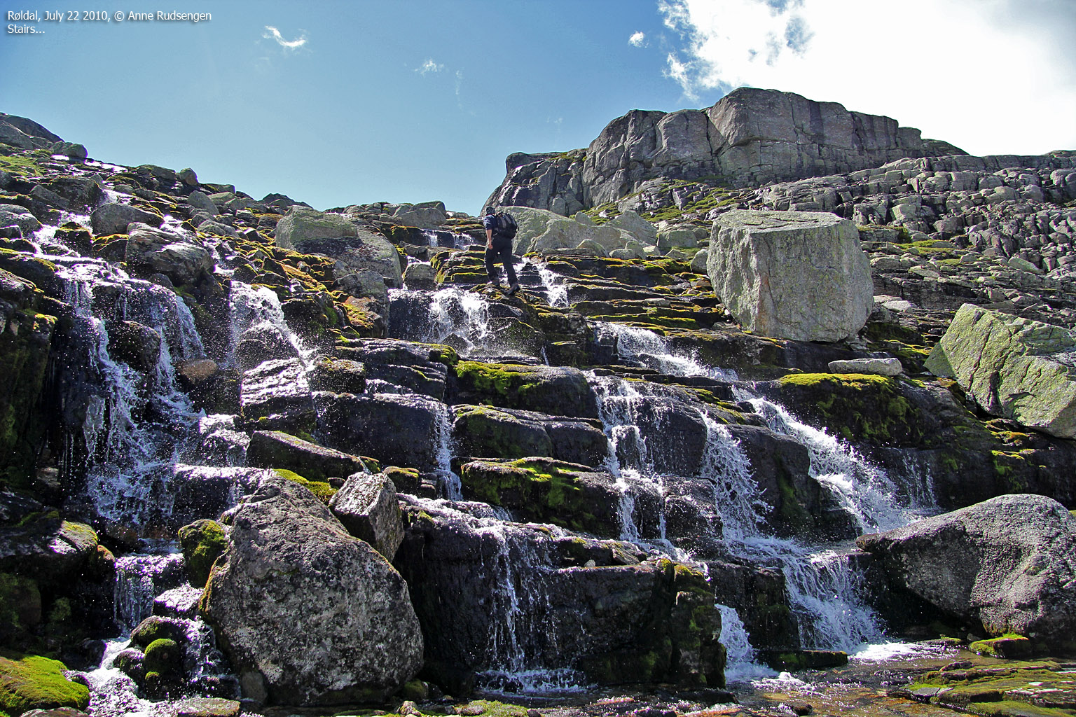
The hike up the north ridge was big fun, as the terrain kept changing the whole way. We had several choices, and sometimes chose a route that was a bit more "dramatic" than it had to be...

Optional scrambling on Holmanuten
(Click for larger image)
The route on the upper part of the mountain was less obvious. Rather than spending too much time on looking for the best route, we headed straight up - crossing slab rock that would have been challenging if wet.
We reached the top of Holmanuten 2:52pm - 1h:44m after heading out - and were rewarded with a grand view (see the panoramas in the trip report section). It was nice to see Hordaland mountains again. The last time I had a Hordaland view like this was in 2008, when Torbjørn and me visited Helgedalsnuten.

Røldal and Røldalsvatnet
(Click for larger image)
The highlights of the descent were a) Telemark booting (?) on snow and b) scrambling on a cool rock. The latter gave me a slight scare when I was unable to climb down with the same ease as I climbed up. But after getting my head together (on command!), I got back down - safe and sound.
We returned to the car 4:45pm - 3h:37m after heading out. We then returned to our base-camp at Røldalsterrassen, and after a little while I went up the road to hike Elvershei. Our Røldal vacation was off to a good start! I had only good things to say about Røldalsterrassen, even if we had a comment or two about the local restaurant. But all in all, I very much looked forward to our stay!

Me - doing stuff I am no good at
(Click for larger image)


