
Norwegian Mountains, Møre og Romsdal
Næremstindan
Næremstindan from Kjersemdalen, July 9 2008
To the main Høgsvora/Næremstindan page (maps, route descriptions, etc.)
Svein Myhre initiated this evening's outing; a quick hike up to Næremstindan. He had only limited time available this evening, so a traverse was out of the question. I was merely interested in the high point and as a bonus - some research to simplify a future traverse. A big minus was the possibility that we could be walking in fog, but we were optimistic and hoped the fog would lift during our hike.
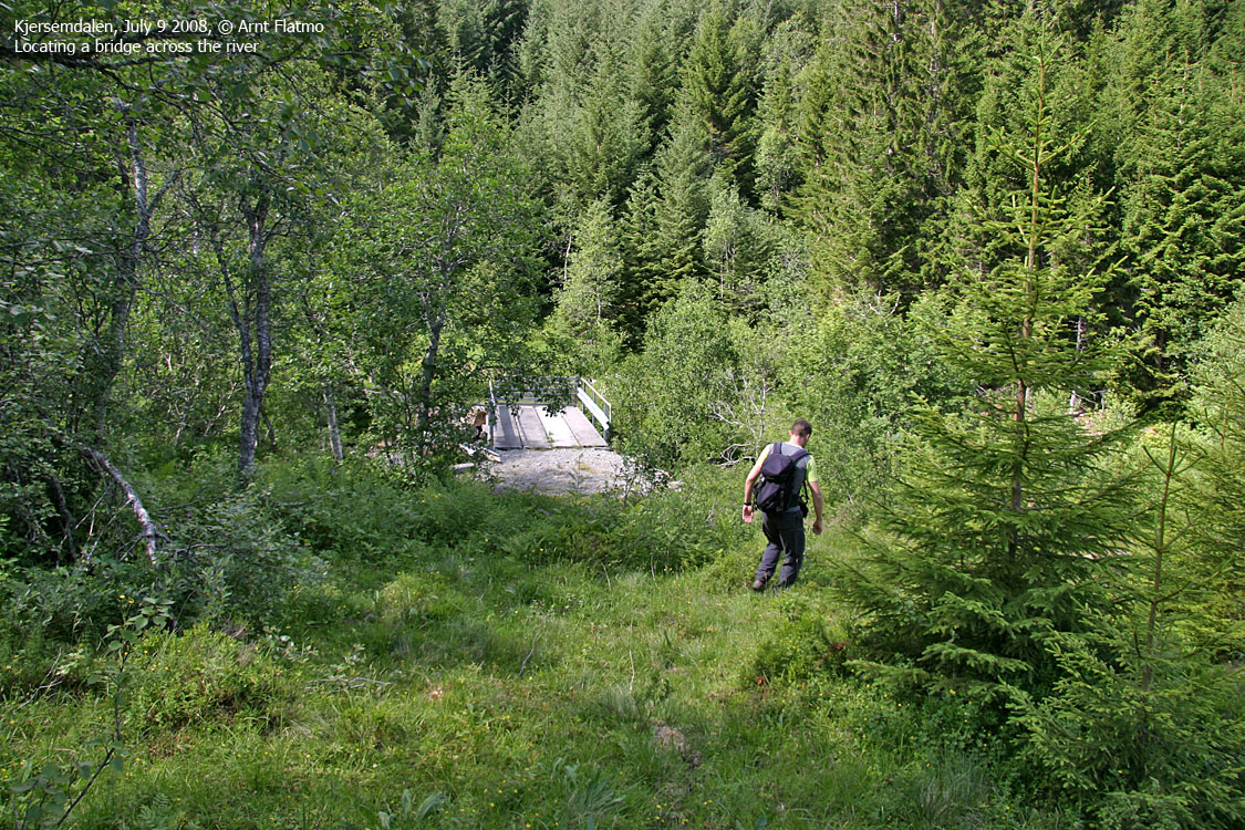
We knew little (or nothing) about this mountain, so we brought a short rope, just in case. We had a rough idea on where to begin, and when we discovered a bridge across the river, the trailhead was settled. Not that the river was hard to cross at this point of the season, but a bridge may lead to a path.
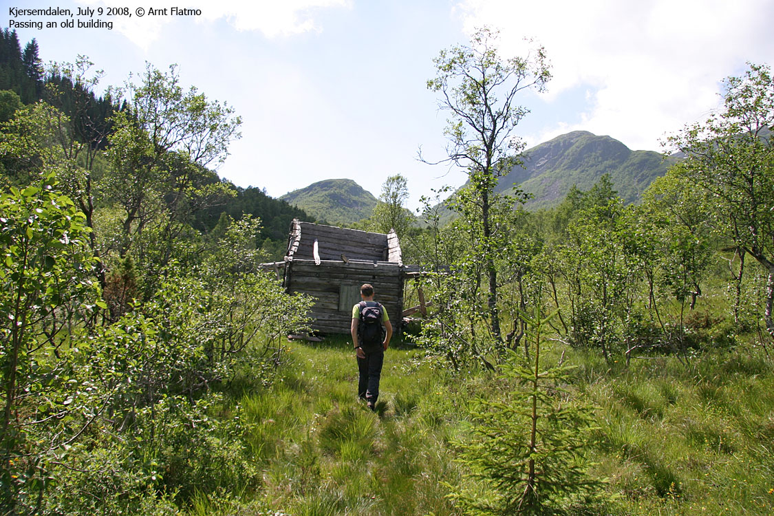
It did, but only for 100m. Standing next to the remains of an old building, we couldn't see any further path and decided to go through the spruce forest, rather than following soft and boggy ground to the left of the forest. If you don't mind razor sharp branches, the forest floor is actually quite nice to walk on.
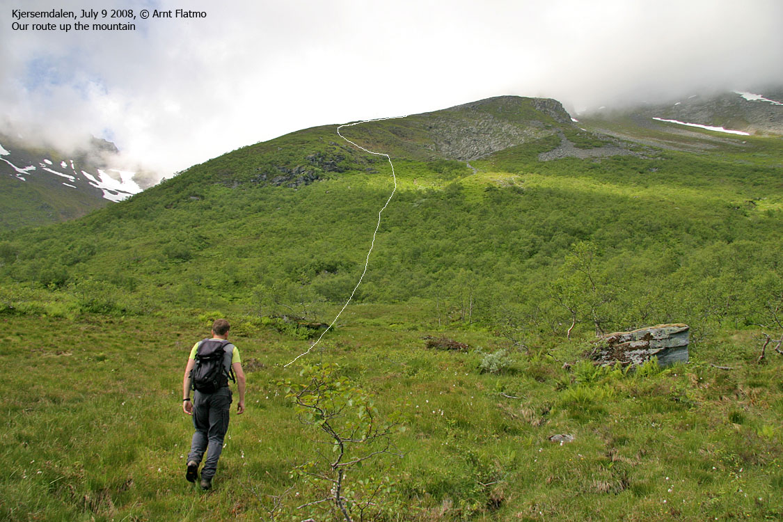
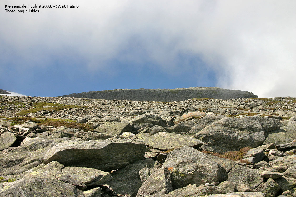
After another meadow, we found a path up the birch forest. Then we crossed a section with bush and high grass before got on a ridge. Higher up, we had to cross a boulder field before we gained the Næremstindan ridge, close to the saddle to Høgsvora. And the fog .. hurray .. was lifting.
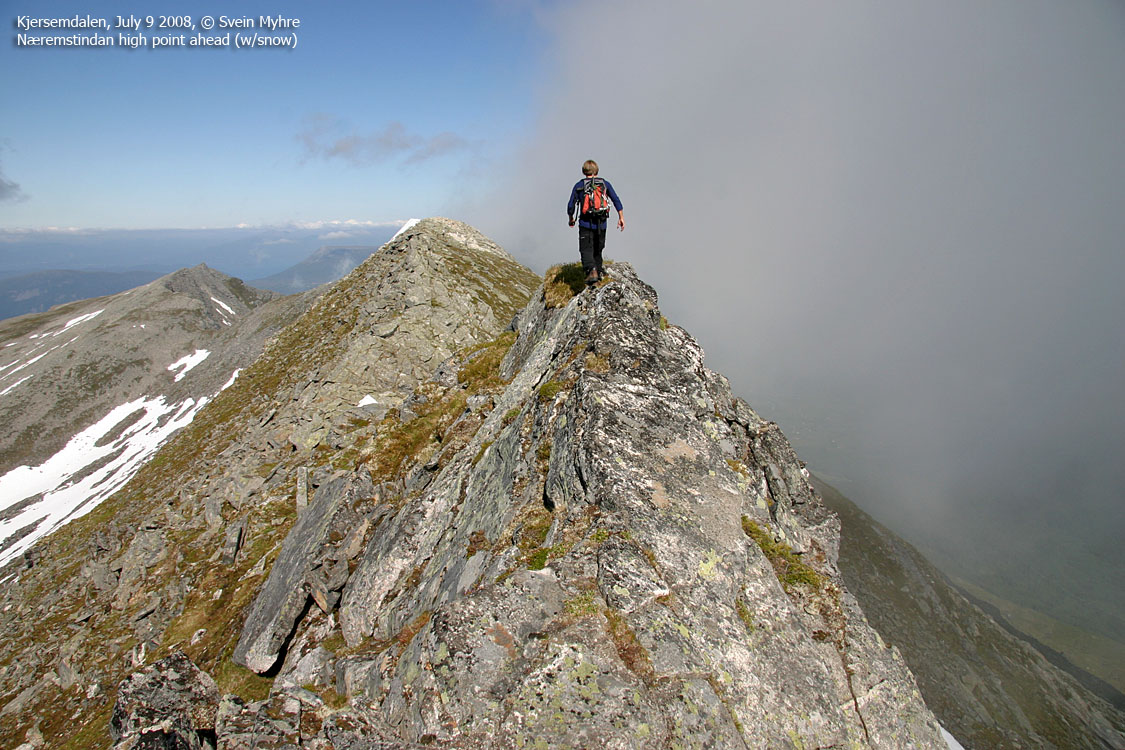
Walking on Næremstindan
(Click for larger image)
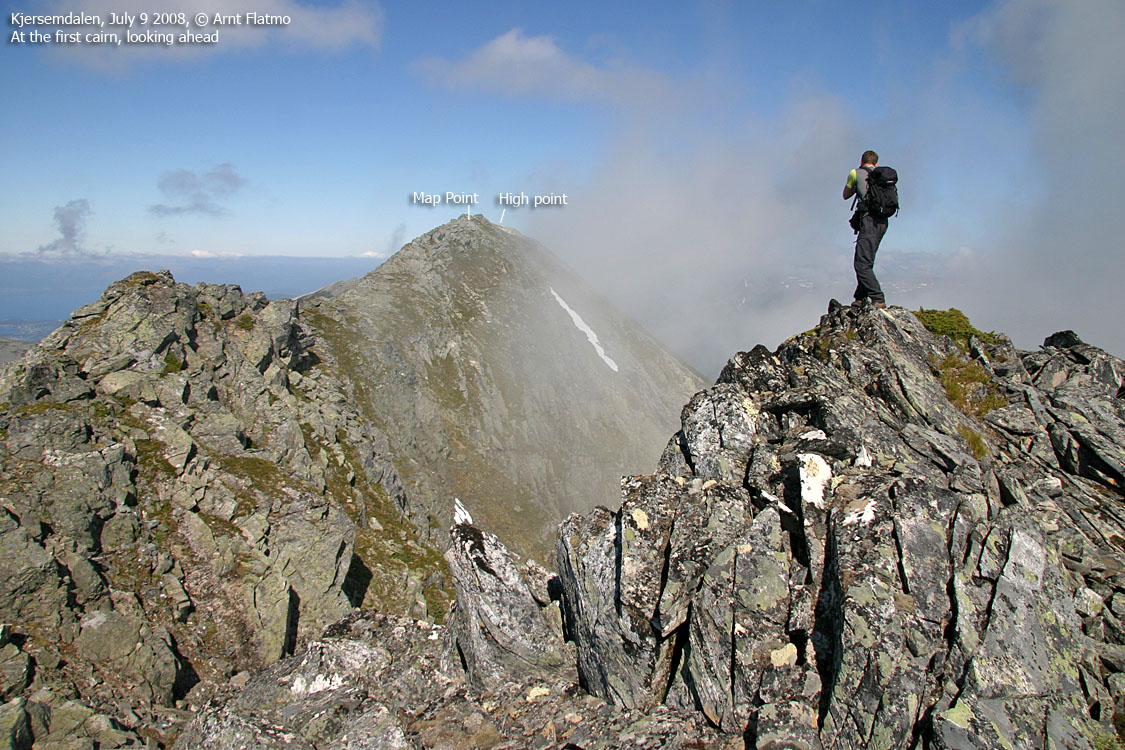
We walked up the first top along this ridge and found a cairn. From here, we had
a good overview
of the ridge ahead. The need for a rope was by no means imminent.
Shortly after, I stepped on a loose rock and stumbled. In order to protect the
camera, I had
to take an awkward landing. I twisted my foot in the process. Quite
badly too.
The foot was acing for a week, and then some. But hey, the camera was OK!
There's no end to what men will do for their gadgets.
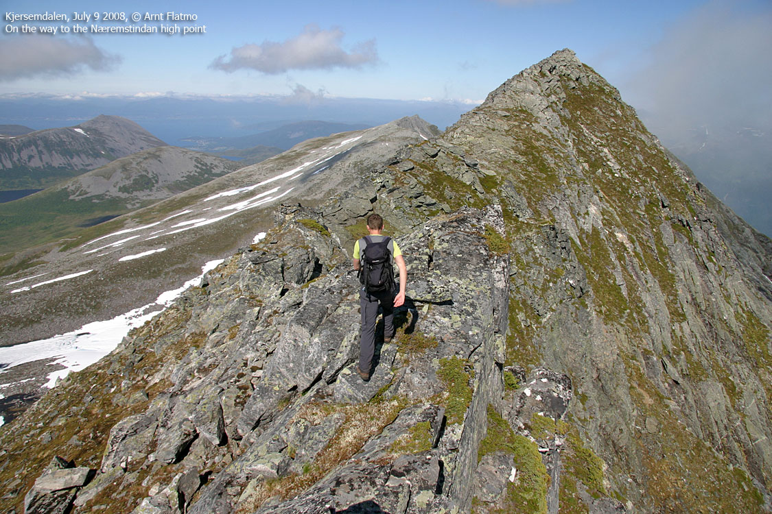
We aimed for what we - without doubts - considered to be the high point. Upon arrival, I could see from my GPS that we had passed the map point 1164m. Looking back south, it wasn't so obvious any more, but we both concluded that this had to be the highest point. While Svein added value to the existing, but modest cairn, I let the GPS work to establish our present elevation. After 10 minutes, the GPS recorded 1171m as average, with only 1,5m error margin. I suggested 1169m as the summit elevation, which was fine by Svein. I'll do the traverse some other time and take time to measure more thoroughly.
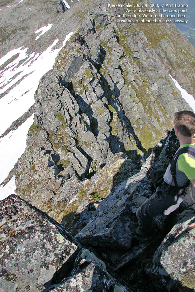
We still had time to have a quick look around, and continued along the ridge until we reached a prominent gap. It didn't look trivial to descend all the way down to the gap, and we assumed that this part of the ridge was more doable, coming from the north. Svein announced that he (thus, we) had to turn around, and so we did. On the way back to the first cairn, I picked up my sunglasses, which (quietly) had left my head upon the rough landing.
A slide down on snow saved us from the boulder field, and then we (more or less) descended our ascent route. We had started out out 2:27pm, reached the high point 4:38pm and were back at the trailhead 6:45pm.

A place with a view
(Click for larger image)
Svein's trip report (in Norwegian) can be found here.


