
|

Veten/Høgstefjellet |
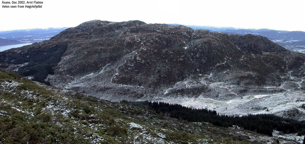
Høgstefjellet and Veten are dominating among the Åsane mountains. Seen from distance, they resemble Ulvanosa/Englafjell in Uskedalen, although Høgstefjellet/Veten are 700m+ lower. A number of trails exist in this region, and the area is popular amongst hikers.
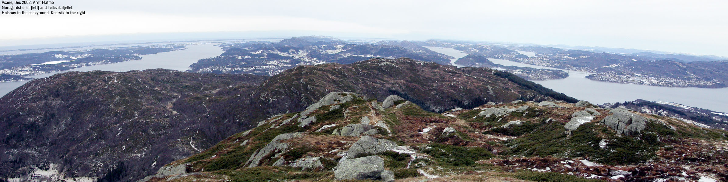
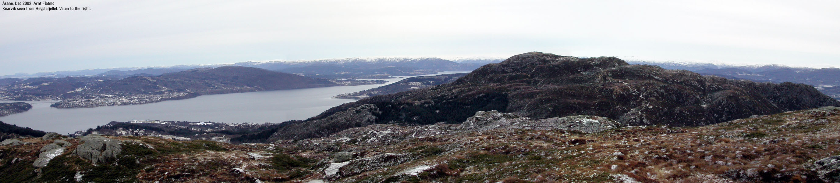
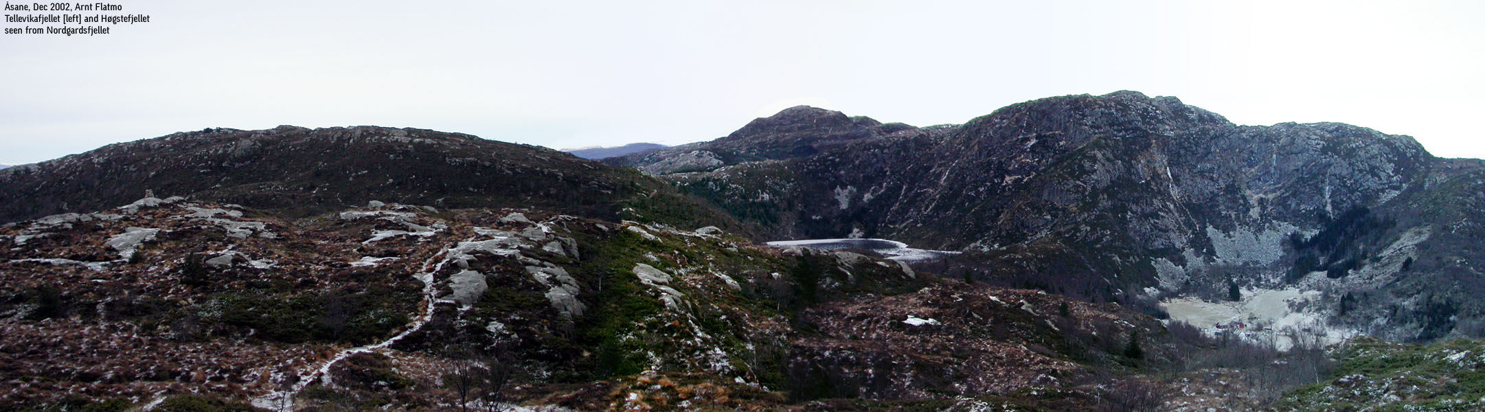
Tellevikafjellet and Nordgardsfjellet are quite anonymous compared to Høgstefjellet and Veten, and does not have the primary factor to qualify as "real mountains". However, they provide good terrain for hiking, and excellent views all around. One can easily see all the way to Sognefjorden in the northern direction, as well as oil rigs out in the sea.
Høgstefjellet's primary factor towards Veten is set to 194m, after 10m interpolation of 280m curves in Rimmaskardet (464-280+10).
Note: Class ratings are in reference to YDS (Yosemite Decimal System).
The route described below is a round-trip that includes all three mountains. The route is graded as class 1, all the way.
|
Baugtveit - Høgstefjellet - Tellevikafjellet - Nordgardsfjellet - Hitland (all seasons)
|
|
Access
From Bergen, follow E39 north. At the first roundabout in Åsane (10 minutes from Bergen), exit left. After a few hundred meters, exit right onto highway 564 towards Salhus. Approx. 3,5Km from the E39 roundabout, exit right towards Baugtveit and find parking somewhere in this area (Hitland).
The route
Høgstefjellet
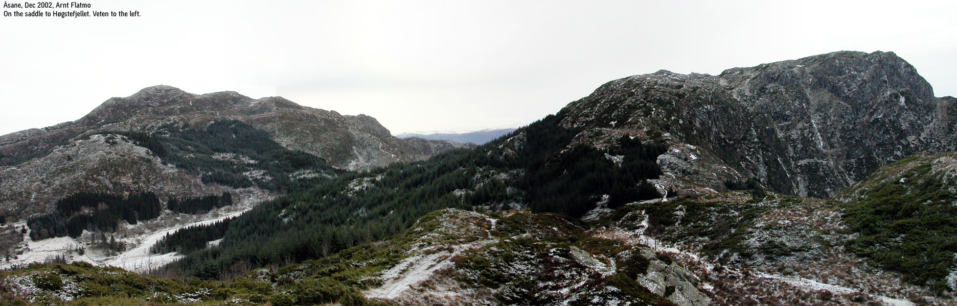
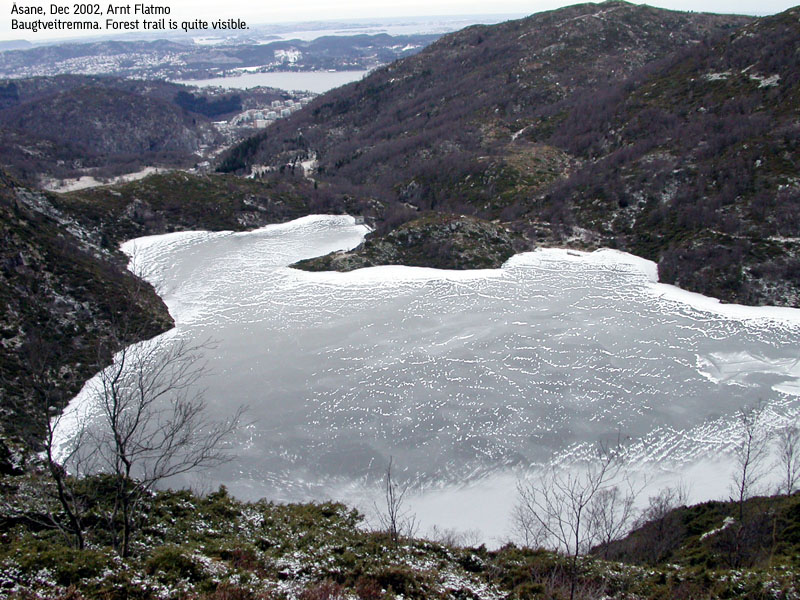
Follow the paved road up to Baugtveit parking (approx. 1050m). It is up to you if you want to park at Hitland or Baugtveit. You will have to do this uphill anyway, if you go for this round-trip. From the Baugtveit parking, continue on the paved road a few hundred meters. You have Høgstefjellet straight ahead in front of you. The paved road turns into a wide forest trail that runs up to the Baugtveitremma dam. Stay on the dam's left hand side. Soon, the trail runs up through the forest. Above the forest, you enter a tiny meadow. Stay left, close to the forest and within a couple of minutes you reach a 4-way trail junction. The trail to the left goes to Tellevikafjellet. The one straight ahead goes to Falkang. Go right, towards Høgstefjellet.
The trail runs across a saddle with Baugtveitremma far down on your right hand side. Make sure you don't end up on the trail that runs to Rimmaskardet, the pass between Høgstefjellet and Veten. This trail forks left from the saddle you are on. Follow the trail all the way to the summit of Høgstefjellet. There are two summit points, and I'm not quite sure which are higher. Visit both.
Tellevikafjellet
Return via the saddle to the 4-way trail junction, and continue straight ahead towards Tellevikafjellet. Within a minute or two, go left when the trail forks (marked by a small red stick). You'll reach Tellevikafjellet summit quickly.
Nordgardsfjellet
Continue on the trail that runs across Tellevikafjellet summit. The trail takes you into the pass between Tellevikafjellet and Nordgardsfjellet. Down in the saddle, observer a trail that forks to the left. This trail runs down to Baugtveit. Continue across the pass and head up towards Nordgardsfjellet. There are two summit cairns, but I believe the one closest to the sea is the high point.
Heading home
Continue across the summit, and follow the trail that runs in the Salhus direction. Within 5-10 minutes, make sure you exit left on a trail that forks off the main trail. This trail runs straight towards Hitland. You will come down from the mountain by the upper houses. Then follow the gravel road all the way down to Hitland. If you parked at Baugtveit, you will have to follow the gravel road upwards for another Km.
|
I was in no particular hiking mood this Sunday. But by default, I put on the hiking gear when I got up from bed. A sign to be worried about, perhaps. It was cloudy, cold and windy, and I decided not to go hiking today. So, at noon, I was on my way to Høgstefjellet.... From my Ulriken hike the night before, I learned that the westernmost mountains were totally iced after the recent rain and frost. I decided to hike close to civilization. The chance of a broken leg was high. Not much to say about the hike. The trails were icy, and I hiked in grass next to the trails. Troll couldn't walk outside the trails, so he was combating ice for three solid hours. I had no lunchboxes left, and had to disappoint him at Høgstefjellet summit. At Tellevikafjellet summit, he was moaning, but accepted to continue walking without lunch. At Norgardsfjellet summit, there was no mistake. He cried loud, and when translated into human language, his message was quite to the point: "ASSHOLE!". Even due to the difficult trails, I kept running into other hikers. I imagine these trails are quite crowded on nice summer days.
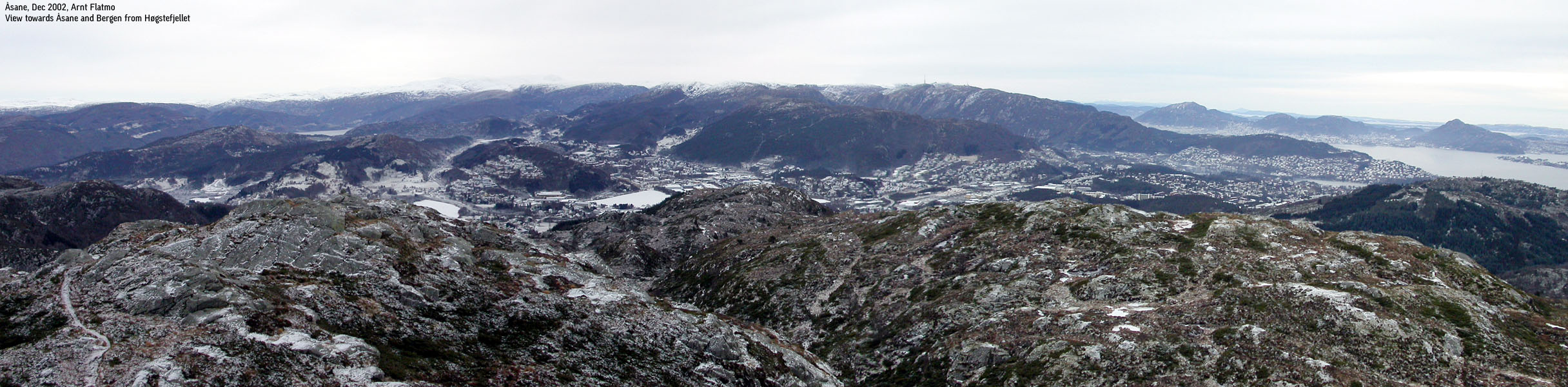
Pictures from the Dec 22 2002 hike:
Move cursor to read notes, and click on the images to see full version.
No Javascript:
|


 Other hordaland mountains
Other Bergen K. mountains
westcoastpeaks.com
Other hordaland mountains
Other Bergen K. mountains
westcoastpeaks.com


