
|

Høgehaugen seen from Fløyen(No Javascript) |
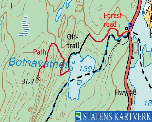
Høgehaugen is a fairly anonymous forest hill, located on the eastern side of Samnangerfjorden, a few Km south of Tysse. The forest hill does not have a name on the M711 map, only the height (301m). The Norgesglasset 5m detail map reveals that the hill is named Høgehaugen, but does not give the height (highest contour is 295m). My GPS suggests that the forest hill is closer to 307m, but I will refer to the 301m as the official height.
The hill is part of a long ridge that begins with Djupvikåsen further north, and ends in Klurasundet in the south. Although the forest paths are plentyful, this is not the easiest hill to reach. Knowledge about the area is quite useful. The route described in this document calls for some off-trail hiking, even though most of it runs on paths. It is however clear that one may reach the top via regular trails.
Høgehaugen (M711: 301m, Ø.K: -) has a primary factor of 103m towards the higher Såta (489m) The saddle is found near lake Vetlevatnet. Ref. Økonomisk Kartverk (5m contours), you cross the 200m contours on the high route, but not 195m. The saddle height has been interpolated to 198m. On Ø.K., the highest contours is 295, which should indicate an interpolated height of 298m, which forces Høgehaugen out of the list of mountains exceeding 300m elevation. As long as no height has been given, I stick with the M711 height.
Note: Class ratings are in reference to YDS (Yosemite Decimal System).
Note: The trail described below is not necessarily the easiest trail to this mountain.
|
Hyw 48 - Høgehaugen (summer)
|
|
Access
From Bergen, follow highway E16 towards Oslo. From the E16/highway 7 junction at Trengereid, follow highway 7 (turn right in the roundabout). Follow highway 7 until you reach the highway 48 exit just after Bjørkheim and two tunnels. Follow highway 48 for 10,3Km and you will see the Fusa Kommune sign. Park just in front of the sign.
The route
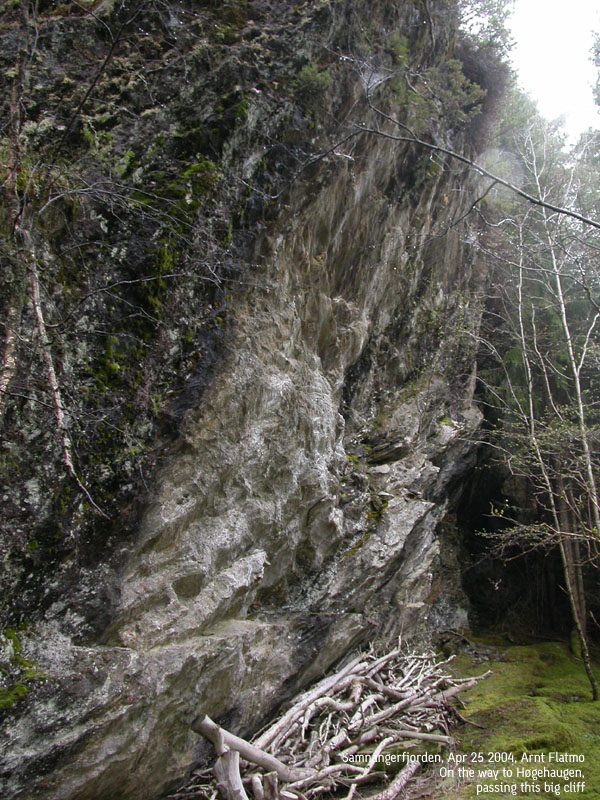
Follow the road up to the nearest house. After just a few meters, follow a forest road that runs down on your left. Prepare for a muddy and wet hike. Follow the forest road until it forks. Take the leftmost forest road which runs southwest with a forest ridge above. Near the end of this ridge, the forest road ends. Continue straight ahead. After 100m you see a very large cliff on your right hand side. You will find a path by this cliff.
The path curves around the forest ridge, heading northwest. Leave the path after the first curve, and when you notice that the path is going in the opposite direction of lake Botnavatet. Head down into a dense spruce forest. Your job is to find a good route down to the lake (250m distance). This is the off-trail section.
Once down by the lake - make a mental note of where you came down the forest. Follow the lake's northwest shore, and approx 200m later, you will see a vague path that heads up the ridge to your right. This is also the first sane place to ascend the ridge to your right. After approx. 150m, it is time to turn northbound and follow the ridge upwards. You may see a blue ribbon attached to a tree.
Follow the path for 200m northbound. Then look for a path that climbs northwest up to a higher ridge (on your left). This path takes you up to a meadow. Just over 200m elevation, the path turns southwest. Follow this path for another 200m and watch out for the place the path climbs steep up to the highest ridge. This is a class 2 route. Steep and slippery, but by no means dangerous. Once on the high ridge, continue southbound. The summit is approx. 200m up the ridge. The path climbs all the way to the high point, but note that the path passes to the right of the high point. You need to leave the path in order to reach the highest point, which is unmarked. Descend your ascent route.
|
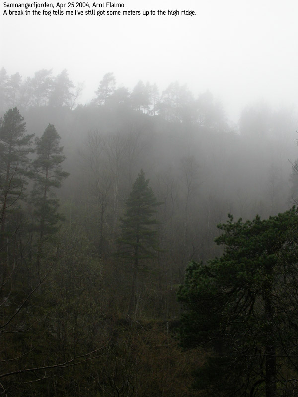
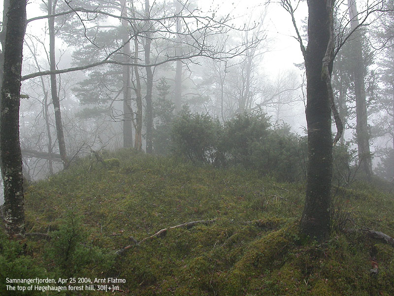
Trip Report Apr 25 2004This Sunday was incredible foggy, and there was light rain. It was the perfect day for a low forest hill, whose trees would prevent any summit views anyway. I settled for Høgehaugen and planned to follow a forest road down to lake Botnavatnet, and make my way from there. I decided to leave the map and compass at home, but studied the map before I left. At least that would add some nerve to a hike, which I expected not to get into the "top twenty hikes" list. I was looking forward being focused on details in the terrain, which would hopefully help me from getting lost. Once at the trailhead (14:45PM), it was clear that I had forgot to take the river from lake Sævellavatnet into consideration. I definitely had to stay on the right side of this river, which was almost impossible to cross. I found a forest road on the north side of the river, followed it for a while until it ended. Soon after, I found myself on a path, but this one was going the wrong way. My ambition was to get down to the lake. From the lake, I had planned a steep ascent directly to the summit. In order to get to the lake, I had to fight bush and dense spruce forest. It was actually a quite awful experience, but it didn't last long. Finally, I was down by the lake. Nothing looked like I had pictured it from the map, and the fog didn't help the situation. I walked around the lake until I reached the point where I had planned to ascend from. Right there I found a path, and this path took me all the way to the top. A direct approach would have been impossible, and I was very thankful for this path. As I scrambled up a steep hill, I caught up with a frog on his Sunday hike. I guess frogs have a rule when they run into strangers - freeze. I was a bit curious, and decided to see how long he would stay frozen. I could have probably stayed there all day, but the frog had frozen in an almost vertical position. After a minute he fell down and landed on his back, just before my feet. After a quick turn, he resumed the freezing procedure. I guess the frog was thinking - "he could impossibly have seen that!". It was time to stop bugging this little fellow, and I continued upwards. When I eventually reached the high ridge, I followed the high ridge up to the first high point I ran into. I was fully convinced this was the 301m high point. I checked my GPS, and it read 314m. I normally subtract 6-7m, as the reading is always a little higher. I was looking for rocks to make a little cairn, but no rocks could be found. The time was now 15:35PM, which meant it had taken me 50 minutes to reach the high point. On my way down, I was struck by the enormous amount of fallen and rotten timber. It looked like lighting had struck the ridge all week. My focus on details had clearly decreased as I got closer to the summit, because once I had descended the high ridge, I was quite lost. I was heading southbound when I should be heading northbound. It took me a couple of minutes to sort things out, and there were no more hick-ups (using the GPS would have been "cheating") I reached the car 16:20PM, and I was dirty from top to bottom, in addition to being soaking wet. Still, I was happy to had done something "useful" on this foggy Sunday. I stopped by Ulriken (605m) before I had myself a very welcome shower.
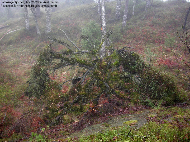
Pictures from the Apr 25 2004 hike:
Move cursor to read notes, and click on the images to see full version.
No Javascript:
Pictures from other hikes:
|


