
|


Hoemstinden is located above the place Tresfjord, and you can follow forest roads, trails and paths from the starting point, and to the top. This page describes a route from Hoem, via Hoemsætra, and is probably the most convenient route to the top. You may also start from the Øvstedalen road, pass Syltesætra or Nordigardsætra, then pass the foothills of Sandfjellet's west ridge before heading up Hoemstinden.
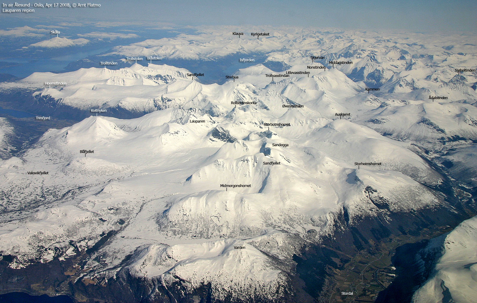
Although Hoemstinden is a low top, compared to the mountain range it connects to, you will probably not complain about the views. You get a good overview of the Ørskog-Vaksvikfjellet tops, as well as the tops north and northeast of Molde.


Hoemstinden (Norge 1:50,000: 927m, Økonomisk Kartverk: 927m, UTM 32 V 405940 6934782) has a primary factor of 217m towards the higher Sandfjellet (1041m). The saddle (approx. UTM 32 V 406090 6934066) is found in Sylteskaret between the two tops. Ref. Norge 1:50,000 (20m contours), the saddle is within the range 700-720m, interpolated to 710m.
Personal GPS measurement read 930m as average height over 10 minutes.
Google's interactive map. You can zoom, pan and click on the markers.


Notes: Class ratings are in reference to YDS. Click here for more information.
The trails described below are not necessarily the *easiest* trails to this mountain.
|
Hoem - Hoemstinden (summer/autumn)
|
|


Access
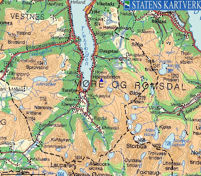
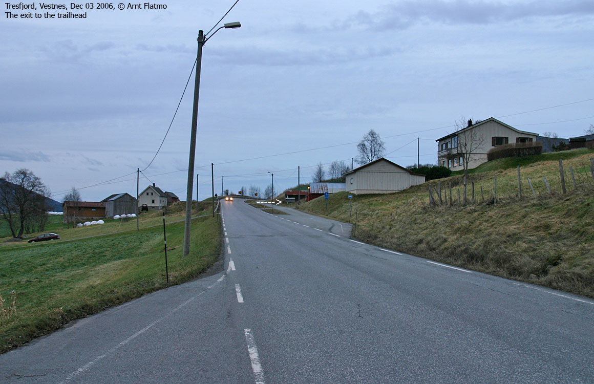
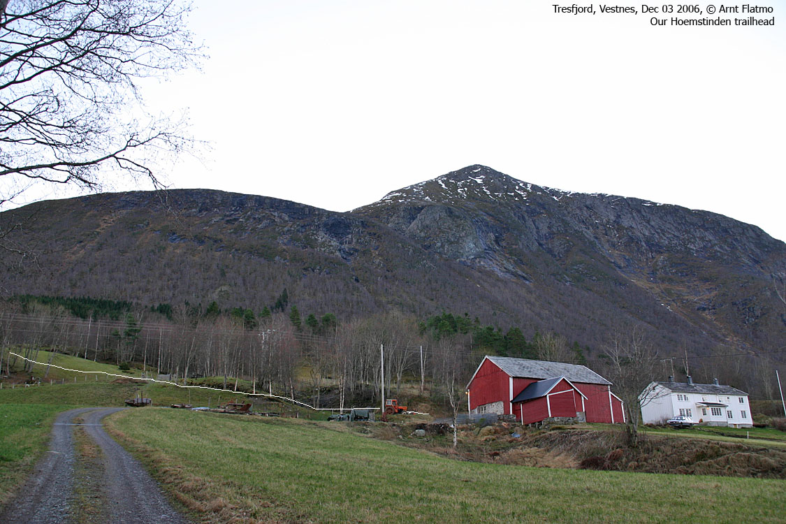
From Ålesund, follow highway E136->E39 towards Åndalsnes. From the E136/E39/Olsvika roundabout near Breivka, follow E39 47,1Km (passing the place Sjøholt along the way). Turn right towards "Åndalsnes". Drive approx. 10,5Km (you pass the place Tresfjord along the way) and turn right onto a narrow road, just after a bus-stop on the right-hand side. Drive 300m up this road and park alongside the road, well below the uppermost house.
The route
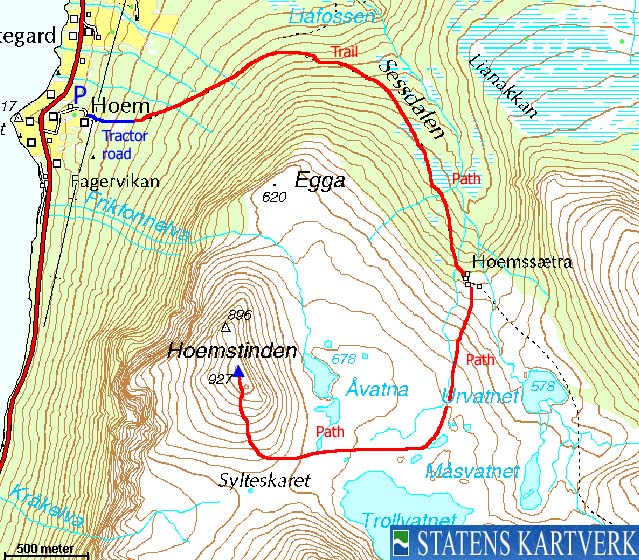
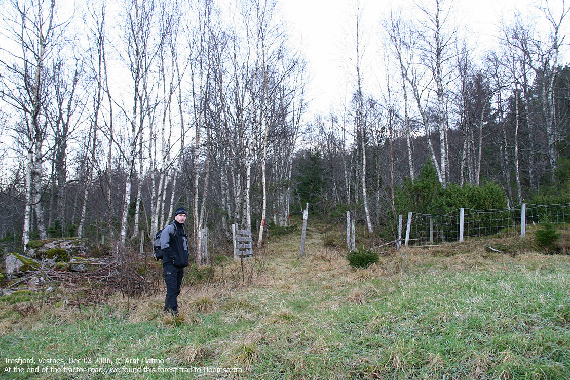
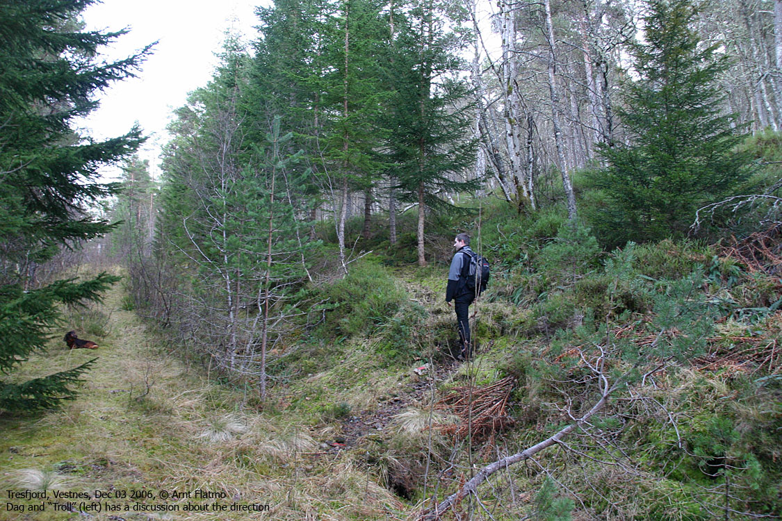
Go up the barn by the house, and follow a tractor road in the northeast direction. At the end of the field, on the left-hand side, you will see the forest trail, marked with red paint. After approx. 1,2Km, 210m elevation, turn right onto a narrow forest path (the red marking continues here). This path soon joins a forest trail coming from the north. After a while, the forest trail becomes a forest path, and continues all the way up to Hoemsætra.
From Hoemsætra, follow the sign to Hoemstinden. This path heads towards Lake Trollvatnet before it changes direction and runs westbound towards Hoemstinden's south ridge. The path continues all the way to the top, but you may lose it as you cross some minor boulder fields on the ridge. A small cairn marks the top. Descend your ascent route, or make a short-cut along lakes Åvatna and directly down to Hoemsætra.
A summit logbook can be found in a container slightly north of the cairn.


No Javascript:
 westcoastpeaks.com
Other Møre & Romsdal mountains
Other Norwegian mountains
westcoastpeaks.com
Other Møre & Romsdal mountains
Other Norwegian mountains

