
|

Hjørungneshornet/Hornet is the easternmost top on Hareidlandet island, located just east of the historic place Hjørungavåg. An overgrown path runs up the southwest ridge, and up to the high point, where an antenna is located. This is a short and easy walk.
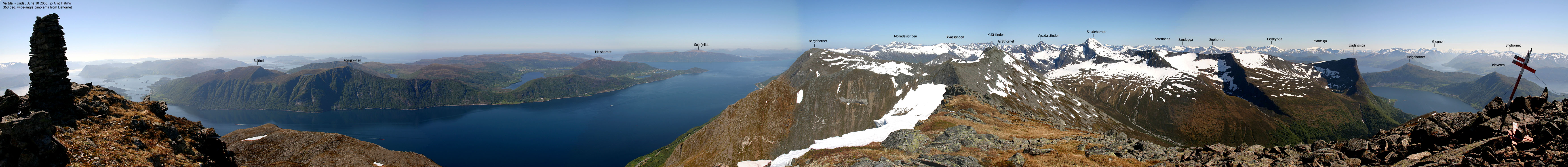
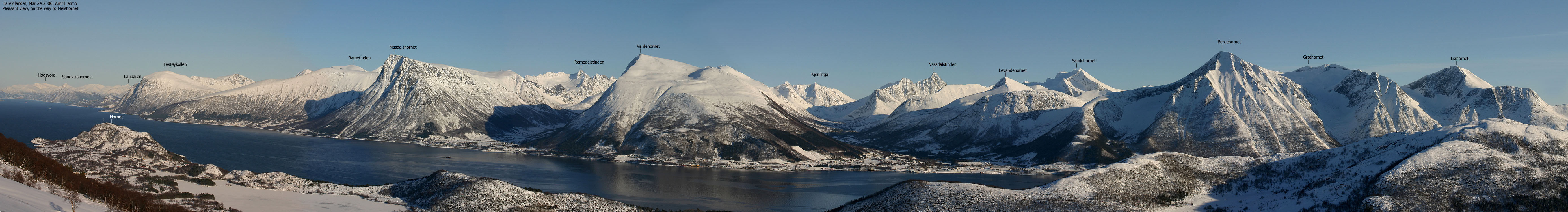
You get a good view towards Sula, Godøya and Melshornet (Hareidlandet), in addition to the Storfjorden mountains from Sandvikshornet by Sykkylven to Liahornet near Ørsta.


Hjørungneshornet (Norge 1:50,000: 185m, Økonomisk Kartverk: 184,58m, UTM 32 V 349769 6916236) has a primary factor of 157m, towards the higher parent Ulsettua (389m). The saddle (approx. UTM 32 V 348882 6915701) is found NE of Hjørdalsvatnet. Ref. Økonomisk Kartverk (5m contours), the saddle is within the range 25-30m, interpolated to 28m.
Google's interactive map. You can zoom, pan and click on the markers.
Notes: Class ratings are in reference to YDS. Click here for more information.
The trails described below are not necessarily the *easiest* trails to this mountain.
|
Bakken - Hjørungneshornet (all seasons)
|
|

Access
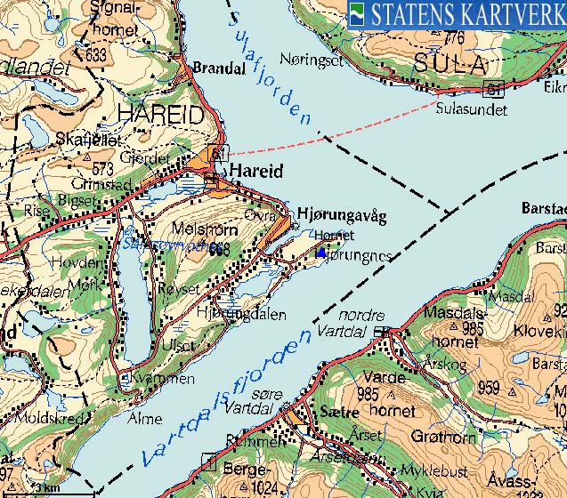
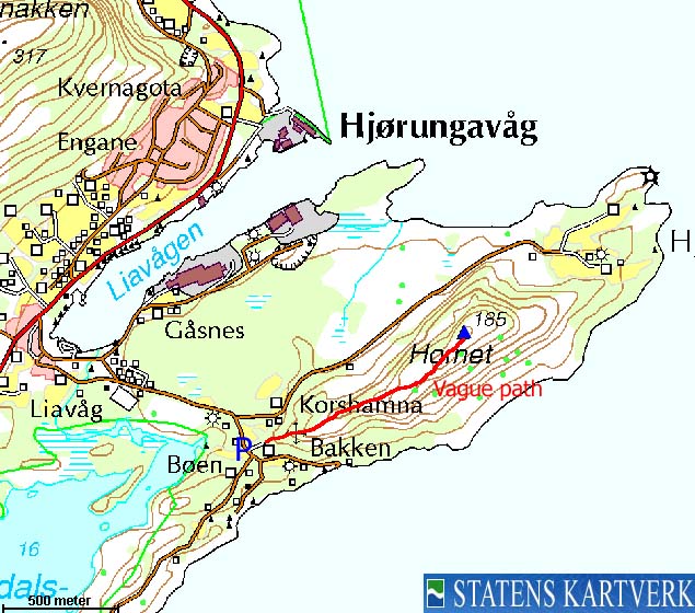
From Ålesund, follow highway E39 towards Bergen, and then RV61 towards Hareid. Take the Sulesund - Hareid ferry. From Hareid, turn left towards Hjørungavåg. Drive approx. 4,1Km to Hjørungavåg, then turn left (signed Korshamna/Hjørungneset). Continue 400m and turn right in the upcoming fork (Korshamna/Hjørungneset). Continue 500m and turn right (Korshamna) in this fork. Drive 200m and find a place to park, without blocking for other traffic
The route
Follow a gravel road that leads up to a farm. Step over the fence and locate an overgrown path that runs up the ridge. You pass an antenna at 60-70m elevation. Follow the path all the way to the top. The top has a broken trigonometric point. Another antenna is located nearby.
Descend your route of ascent, or continue the ridge towards Hjørnungneset, and follow a road back to the trailhead.


No Javascript:
 westcoastpeaks.com
Other Møre & Romsdal mountains
Other Norwegian mountains
westcoastpeaks.com
Other Møre & Romsdal mountains
Other Norwegian mountains

