
Norwegian Mountains, Møre og RomsdalHerdalsnibba, 1231m (Rundefjellet)
|
| Fylke/Kommune : | Møre og Romsdal/Stranda | ||||||
| Maps : | 1219-II Geiranger (Statens Kartverk, Norge 1:50 000) | ||||||
| Primary factor : |
Herdalsnibba: 201m Kjerringane: 58m |
||||||
| Hiked : | Nov 2008 | ||||||
| See also : |
| ||||||
| See also : | Other Stranda mountains |

Herdalsnibba
(Click for larger image)
Herdalsnibba is a characteristic peak, rising majestically from the Strandadalen valley floor. There are no marked routes to this top, but the top is quite accessible (short distance), and provided you're comfortable with boulder terrain, the ascent is not difficult. The easiest route runs directly up from Strandadalen. Another route (much longer) runs via Ljøsæta and Båsenibba.
The name comes from Herdalen valley, which may be the correct name for the southern part of the valley that most refer to as Strandadalen. Nibba is a popular suffix in this area. In close proximity, you'll also find Flosteinnibba, Blåfjellnibba, Nokkenibba, Båsenibba, Sætrenibba, Røyrnibba, Åkernesnibba, Lianibba, Klovningsnibba, Middagsnibba, Stadheimsnibba, Tretindanibba, to name some...
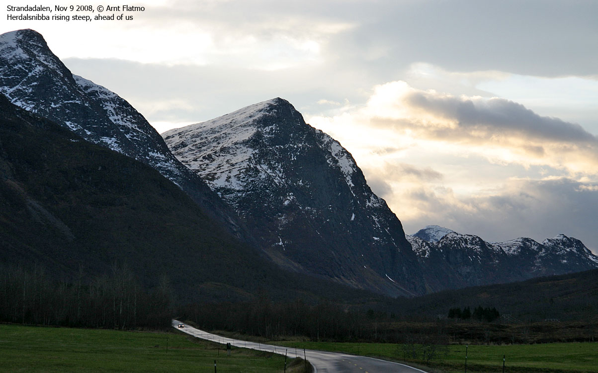
Herdalsnibba seen from RV60
(Click for larger image)
Herdalsnibba (Norge 1:50,000: 1231m, Økonomisk Kartverk (ØK): 1231m, UTM 32 V 392716 6894528) has a primary factor of 201m towards the higher parent mountain point 1378m (west ofTårnet). The defining saddle (approx. UTM 32 V 393499 6894735) is found between the two tops. Ref. Norge 1:50,000 map (20m contours), the saddle is within the range 1020-1040m, interpolated to 1030m.
GPS measurement on the summit (ground) read 1237m, averaged over a 5-minute period (error margin +/- 4m). The south top was measured (ground) to 1220m with an error margin of +/- 2,2m. This is notably higher than the map height - 1213m.
Kjerringane (Norge 1:50,000: 848m, Økonomisk Kartverk (ØK): 848, UTM 32 V 392252 6892822) has a primary factor of 58m towards the higher parent mountain Herdalsnibba (1231m). The defining saddle (approx. UTM 32 V 392637 6893077) is found between the two tops. Ref. Norge 1:50,000 map (20m contours), the saddle is within the range 780-800m, interpolated to 790m.
GPS measurement on the small summit cairn read 851m, averaged over a 5-minute period (error margin +/- 1,2m).
Google's interactive map. You can zoom, pan and click on the markers.
|
|
|
|
Route 1: RV60 - Herdalsnibba (summer/autumn)
|
|
Access
(all distances are approx. distances)
The nearest larger city is Ålesund. From Ålesund, follow highway E39 towards Bergen, and then highway RV60 (Stranda) to the Magerholm - Ørsneset ferry. This ferry runs quite often; every 20 minutes during the busy hours of the day. From Ørsneset, drive RV60 to Stranda (34,3Km). Turn south (right) and continue on RV60 towards Hellesylt. Drive throughout Strandadalen, and just before the Ljønibbtunnelen tunnel, either find parking on the right-hand side (trailhead for Den Trondhjemske Postveg - an old postal route) or on the left-hand side, closer towards the tunnel.
The route

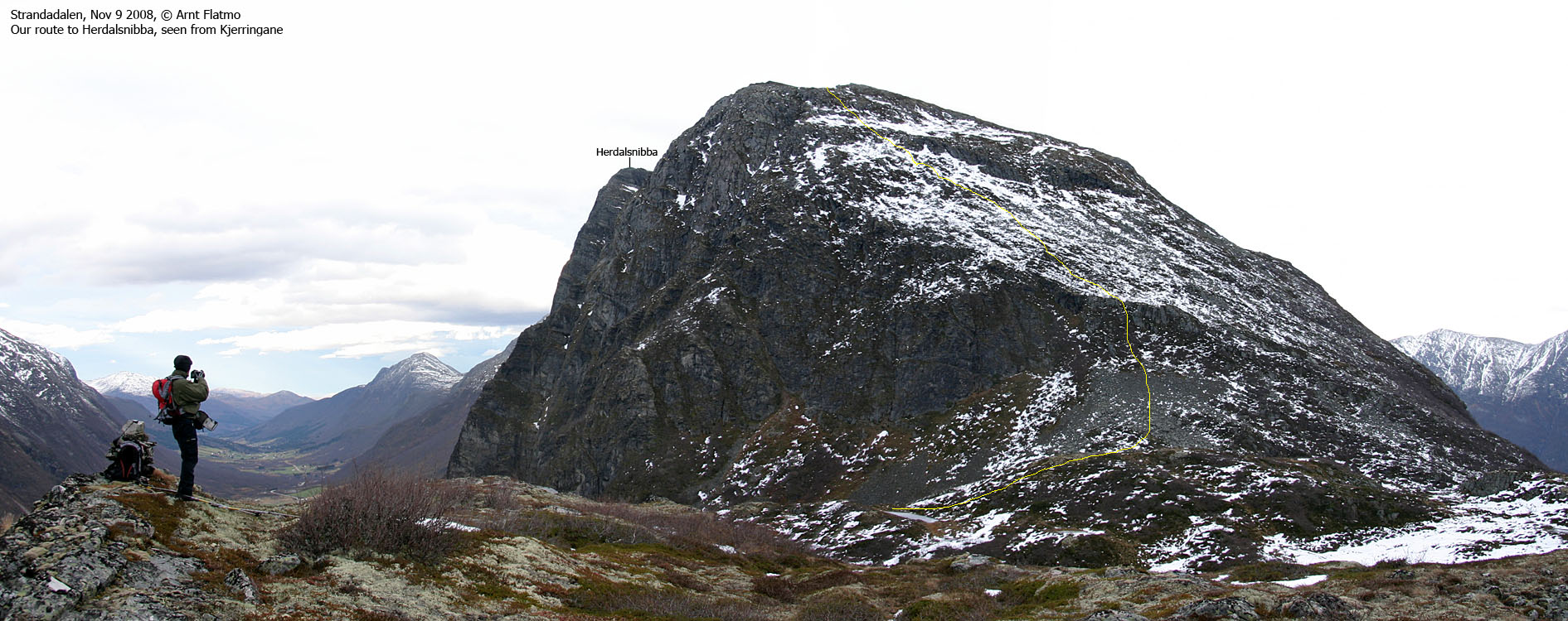
Route to Herdalsnibba
(Click for larger image)
Sætrenibba
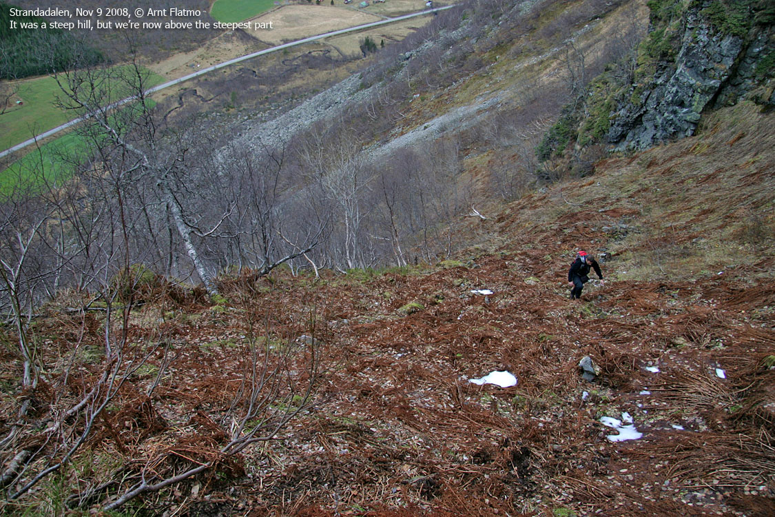
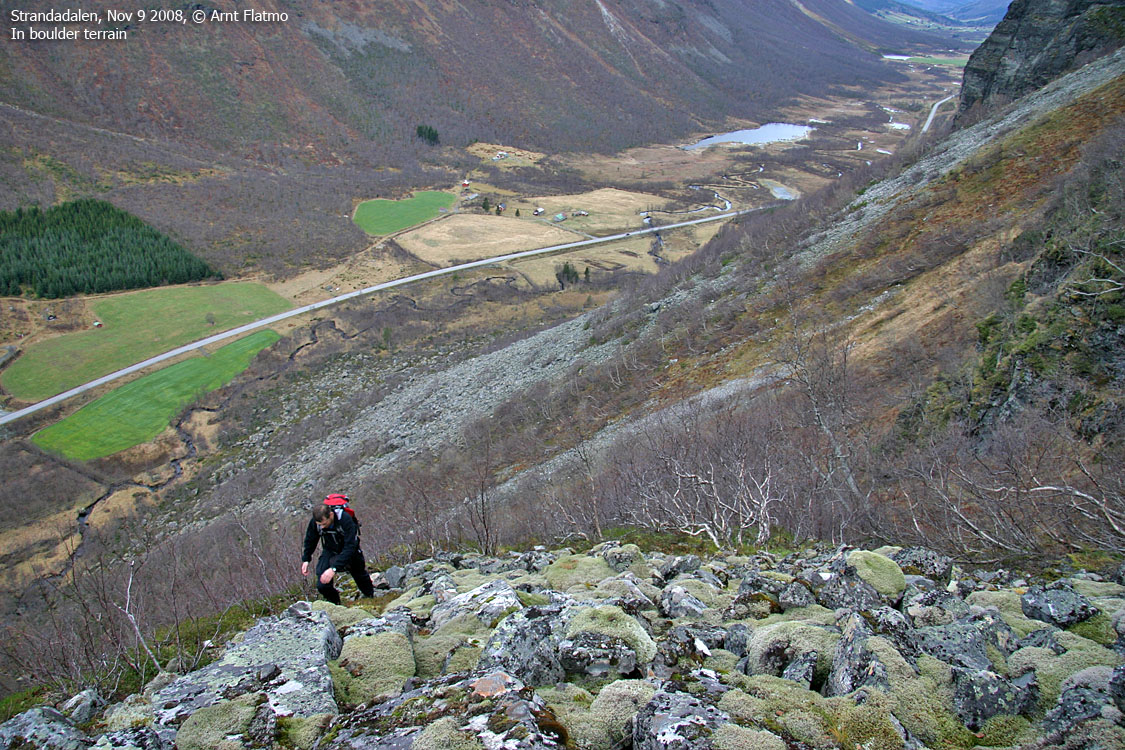
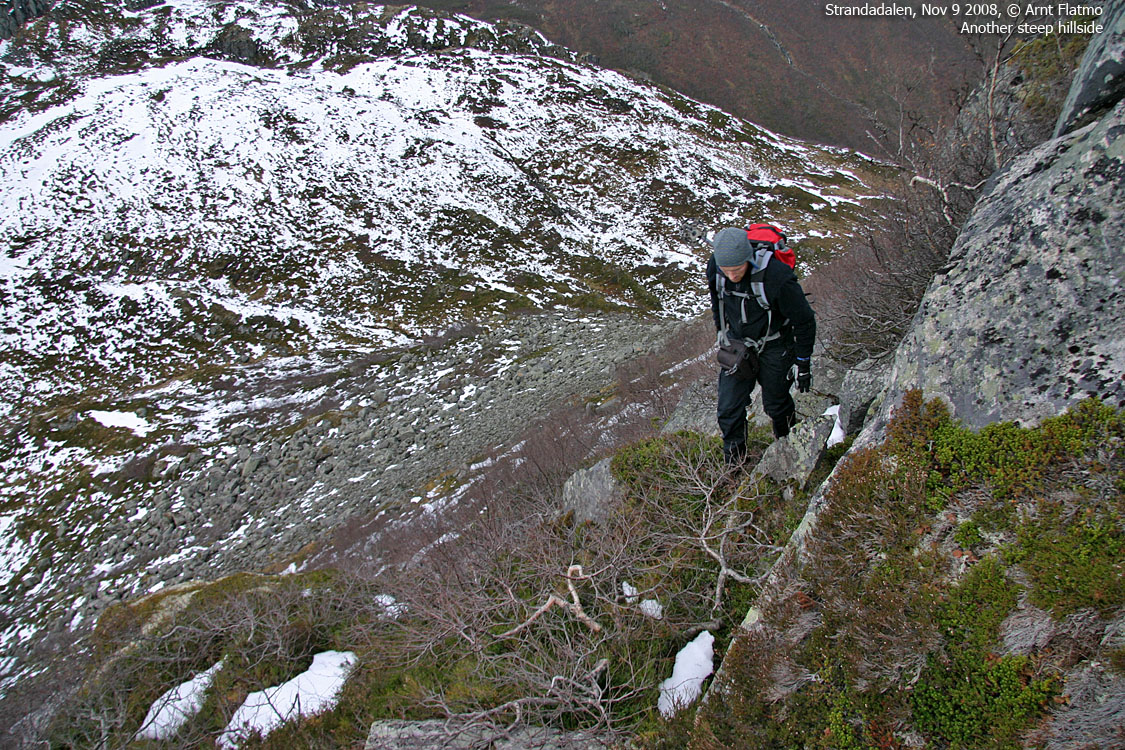
From your trailhead, aim for the obvious route up the mountain. You need to cross a creek before you begin your ascent. A tree has been chopped down for this purpose. A vague path runs up a forest ridge. At the end of this ridge, turn right and cross above the waterfall (you don't see it as you cross). When you reach a boulder field, follow the vague path to the right, in the outskirts of the boulder field. Proceed up to the pass between Herdalsnibba and Kjerringane.
You have now approx. 400 vertical meters of rough terrain ahead of you. Head straight up. The route presents itself. You then arrive point 1213m, marked by a few rocks. Proceed towards Herdalsnibba, passing an amazing couloir along the way. Herdalsnibba is marked by a proper cairn, but you've already passed the high point before you reach the cairn.
Upon descent, you can also visit Kjerringane, a short hike
from the pass at 890m. You could also proceed across Båsenibba and return via
the postal road down
Herdalsbrekka.
 westcoastpeaks.com
Other Møre & Romsdal mountains
Other Norwegian mountains
westcoastpeaks.com
Other Møre & Romsdal mountains
Other Norwegian mountains


