
|
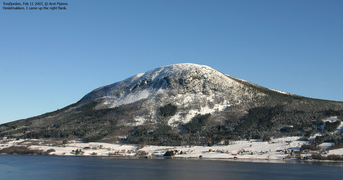
Helsetnakken is a rather independent top, located above Tresfjorden in Vestnes. Via Daugstadsetra and Stavvatnet, you can follow the valley all the way to Måndalen. You will have the Trolltinden - Svartevasstinden massif up to your left, and the Sandfjellet - Storbua ridge up to your right (this ridge continues all the way to Innfjorden).
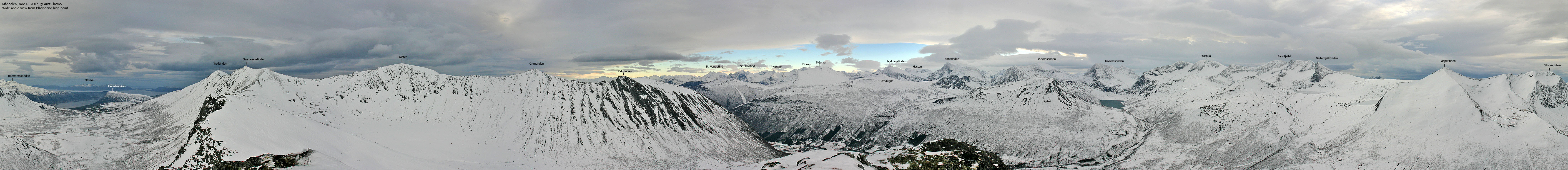
This is of academic interest only. The majority of visitors come to enjoy the fine views from the top. Towards the north and the east, you have a superb panorama that include Otterøya, the tops north of Molde, Reinsfjellet, and Romsdal peaks such as Kyrkjetaket, Klauva, Sjøvdøla, Juratind and Store Venjetind. You can even see Innerbergssalen on Stabblandet on a clear day.
To the south, you will have a fine view towards Trolltinden/Svartevasstinden, Storknubben, Rollsbotnskorka, Brudefølget, Lauparen and Kvitnyken. On the other side of the bay, you see Næremstindan/Høgsvora, Sprovstinden and Trolltinden/Ytstetinden. In-between these tops, you see Skruven and Smørskredtindane and further west - Blåbretinden on Rånahalvøya.
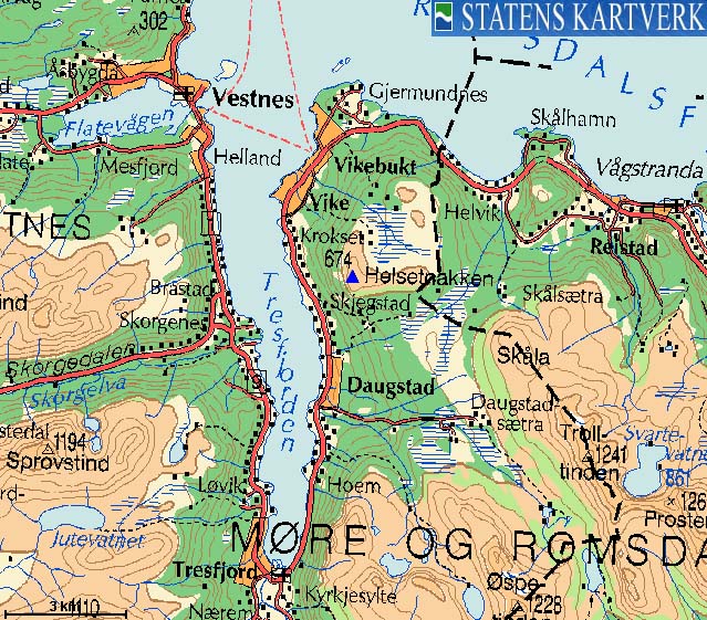
The normal route to Helsetnakken runs from Vikebukt, via the north ridge. A forest road takes you up to Vikesetra (320m elevation). This trailhead is documented here. A route from the south is the Villa - Brattmyra forest road (closed in winter). Another fine route - at least for skiing - runs from Åsen on the east side. See the Trolltinden page for trailhead information.
The Skjegstad route described on this page is not recommended to the public, as it runs through a field where horses are fenced in. The route is described for information only.


Helsetnakken (Norge 1:50,000: 674m, Økonomisk Kartverk: 674,23m, UTM 32 V 405874 6941030) has a primary factor of 301m, towards the higher parent Trolltinden (1241m). The saddle is found between Helsetnakken and Skåla, where Villaelva drains to the west. Ref. Økonomisk Kartverk (5m contours), the saddle is within the range 370-375m, interpolated to 373m.
Google's interactive map. You can zoom, pan and click on the markers.
Notes: Class ratings are in reference to YDS. Click here for more information.
The trails described below are not necessarily the *easiest* trails to this mountain.
|
Skjegstad - Helsetnakken (winter)
|
|


Access
From Ålesund, follow highway E136->E39 towards Åndalsnes. From the E136/E39/Olsvika roundabout near Breivka, follow E39 47,1Km (passing the place Sjøholt along the way). Turn right towards "Åndalsnes". Drive approx. 15Km (you pass the place Tresfjord along the way) and and locate a road that leads up to a red barn and a white house. Find parking down by the main road.


The route
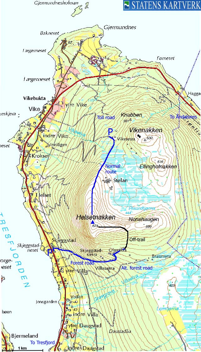
You have to walk through the farm in order to get to the tractor road. Next, you have to cross a field where horses are fenced in. Do not open the gates! Climb across instead. Continue on the tractor road, which has several forks along the way. Stay on the "main road" all the way to Olasætra.
Proceed northeast up the forest, towards the Nonshaugen - Helsetnakken pass, and then follow the ridge up to Helsetnakken. Descend your ascent route, or aim for Brattmyra and follow the road back to Villa, only 400m south of Skjegstad (the map name Skjeggstad is spelled incorrectly).


No Javascript:
 westcoastpeaks.com
Other Møre & Romsdal mountains
Other Norwegian mountains
westcoastpeaks.com
Other Møre & Romsdal mountains
Other Norwegian mountains

