
Norwegian Mountains, Møre og RomsdalHeida, 239m
|
| Fylke/Kommune : | Møre og Romsdal/Herøy | ||||||||
| Maps : | 1119-II Volda (Statens Kartverk, Norge 1:50 000) | ||||||||
| Primary factor : |
Heida: 126m Kleppeåsen: 98m |
||||||||
| Hiked : | Dec 2008 | ||||||||
| See also : |
| ||||||||
| See also : | Other Herøy mountains |

Heida seen from Lidaveten
(Click for larger image)
Heida is one of the lower tops on Gurskøya island. Nevertheless, the views are quite good and the top is quite popular. You can start from the Leikanger school, follow a road and then a marked path all the way to the top. You can also reach Gyrinakken from the same starting point. There is also a path from Jøsok, but this page describes access from the north side.
Kleppeåsen is a forest hill just north of Heida, and doesn't seem to get a lot of visitors. There does not seem to be any form of markers on top, and the path is faint - at best. If you want a good overview of the place Leikong, then Kleppeåsen is a good vista point.
Heida (Norge 1:50,000: 238m, Økonomisk Kartverk (ØK): 239m, UTM 32 V 333272 6903829) has a primary factor of 126m towards the higher parent mountain Gyrinakken (365m). The defining saddle (approx. UTM 32 V 332212 6903732) is found between the two tops. Ref. Økonomisk Kartverk map (5m contours), the saddle is within the range 110-115m, interpolated to 113m.
GPS measurement on top of the trig. point (2m) read 239m, averaged over a 5-minute period (error margin +/- 1,1m). This top is called Herda on Økonomisk Kartverk.
Kleppeåsen (Norge 1:50,000: 146m, Økonomisk Kartverk (ØK): 151m, UTM 32 V 333716 6904851) has a primary factor of 98m towards the higher parent mountain Heida (239m). The defining saddle (approx. UTM 32 V 333608 6904403) is found on a meadow, near the road between the two tops. Ref. Økonomisk Kartverk map (5m contours), the saddle is within the range 50-55m, interpolated to 53m.
GPS measurement on the ground read 153m, averaged over a 5-minute period (error margin +/- 3m).
Google's interactive map. You can zoom, pan and click on the markers.
|
|
|
|
Route 1: Vonheim - Heida (all seasons)
|
|
Access
(all distances are approx. distances)
The starting point for this route description is the RV61/RV653 junction at Garnes on Hareidlandet island, approx 6-7km south of Ulsteinvik. From this junction (N62.29162 E5.85211) , drive as follows:
The route

Route to Heida
(Click for larger image)
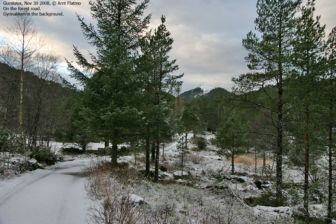
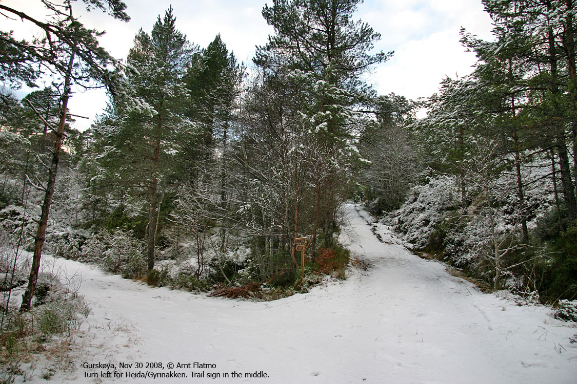
Follow the gravel road 750m up to a fork. Turn left (signposted Heida). After 120m, you reach another fork. Go straight ahead (signposted Heida). 150m later, you cross a creek and the marked forest path begins. Follow the path to the south until you get onto Heida's southwest ridge. You might see the path from Jøsokdalen come up on your right-hand side. The path climbs this ridge and leads you to the summit, marked by a trignometric point. Descend your ascent route.
|
Route 2: Jøsokdalen - Heida (all seasons)
|
|
Access
(all distances are approx. distances)
The starting point for this route description is the RV61/RV653 junction at Garnes on Hareidlandet island, approx 6-7km south of Ulsteinvik. From this junction (N62.29162 E5.85211) , drive as follows:
The route
Follow the dirt road up to a barn. The forest path begins here and runs in the direction of Heida. The path is not marked but should not be difficult to follow.
Kleppeåsen

Route to Kleppeåsen
(Click for larger image)
If you want to visit Kleppeåsen, then you can climb a fence where you parked, and make your way through the lower forest. Higher up, you might find the faint path that leads to the top. The top is not marked.
 westcoastpeaks.com
Other Møre & Romsdal mountains
Other Norwegian mountains
westcoastpeaks.com
Other Møre & Romsdal mountains
Other Norwegian mountains


