
Back to the main Hausdalshorga page.

(No Javascript) |

(No Javascript) |
I have not included this route on the list of routes on Hausdalshorga's main page. Although a forest road gets you a bit up the ridge, the rest of the route can easily get very annoying.
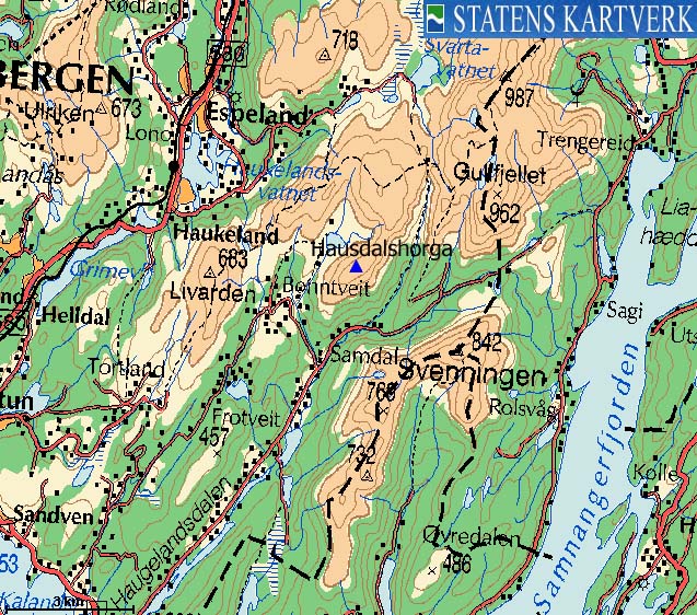
From highway E39, I turned left towards "Haugsdal", followed the Haugsdal road 8,4Km and turned left towards "Bontveit". After 500m on the road to Bontveit, I parked the car on a small turnout on the right-hand side of the road.
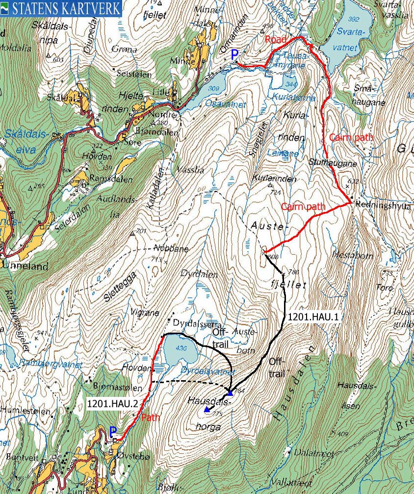
I followed a forest road from the parking area and turned left in the first junction. I also turned left in the second road junction. The road curved to the right and led me towards road end at the "sharp" end of Hausdalshorga's south ridge. You can now descend into Bjøllebotn and continue up the valley or head up the ridge in a dense forest with a lot of juniper bush above the forest.
The weather this Saturday morning was so and so. Cloudy and windy, but no rain. I decided to hike Hausdalshorgi, mostly because I hadn't written a web page for this peak, and some more pictures would come in handy. As I already had hiked this mountain (via Austrerinden), I wanted to try a new route. Going up Hausdalen, I watched the mountain from distance, and decided to hike up the south ridge.
I found the forest trail that would take me to the beginning of the ridge. And when I arrived the forest at the bottom of the ridge, I decided to avoid this forest at all cost. It was quite dense, and I walked around the ridge and found a section between two ridges that was steep, but forest-free.
After scrambling up the first level, I got stuck in bush. There was no other alternative than go straight through. Within minutes, I had needles pinning every inch of my body. But the forest on my left hand side looked less inviting, so I kept on going. When there were no more forest, I quickly aimed for the high ridge, expecting to get a comfortable ridge hike all the way to the top. Not so. The ridge was covered with bush. It was a bush jungle. And then a buck (in the midst of the bush) scared me to death. He was just 10 meters away, and didn't notice me due to the fierce wind blowing in my direction.
I fought the bush for a while until I was mentally defeated. I decided to try the couloir down to the right. It was quite steep, and I had to look around for a passage down to the col. While clinging onto roots, I was able to make a safe descent into the col. From there on, the hike up to the summit was easy.
On the high ridge, the wind was raging. If I had any ambition to hike over Austrerinden, I abandoned it right there and then. However, I wanted to take a look at the north saddle to Austrerinden, as I had heard it was quite dangerous in winter. But with this low amount of snow, the saddle was ok. But I can imagine it to be a challenging saddle when a large cornice has been built up.
I was in no mood to return the same way, and started to look for a route down to lake Dyrdalsvatnet. I could see the forest trail that ran from the lake all the way to Øvstebø and civilization. It was just a matter of getting down. The snow was hard, and in the beginning, I couldn't see if this was doable. The ice axe came in handy, until I reached a steep section with ice, covered by snow. My feet lost the grip, but as I had put the axe firmly down in the snow, I didn't slide. I carefully moved back up and put on my crampons, which I had brought along. You never know. I could now safely descend the steepest section, and the rest of the route down to the lake was easy.
Arriving the river, I couldn't see any bridge or other obvious passages. The river had ice bridges here and there, but the ice didn't hold. Just above a waterfall by Bjørnastølen, I found solid ice on both sides of the river, with open water inbetween. It was time to get wet. It didn't take long to get to Øvstebø and then to the main road. I reached the car exactly 3 hours after I left it. Interesting hike.
Move cursor to read notes, and click on the images to see full version.
Some of the thumbnails may have been cropped to fit the format.
Pictures are presented in the order they were taken.


 Other hordaland mountains
Hausdalshorga
Other Bergen K. mountains
westcoastpeaks.com
Other hordaland mountains
Hausdalshorga
Other Bergen K. mountains
westcoastpeaks.com