
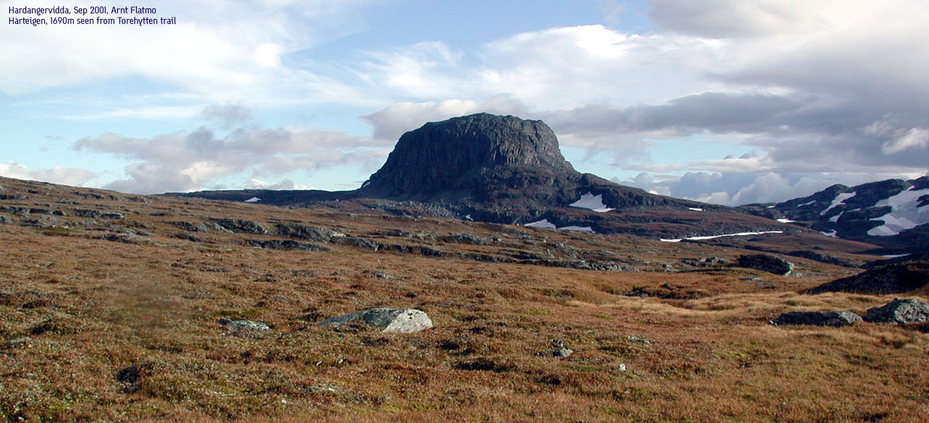
Hårteigen, 1690m
|
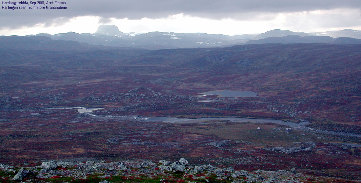
 Hårteigen seen from Torehytten |
Hjølmo - Hårteigen - Store Grananutane - Hjølmo trail
| Difficulty: | Long trail, Hårteigen climb intermediate difficult |
 |
| Risk: | Hårteigen standard route fall could be bad | |
| Distance: | ||
| Time: | 27-30 hours round-trip incl. summits | |
| Primary Factor: | 480m (Sandfloegga) | |
| Starting Elevation: | About 850m |
Introduction:
Hårteigen is without question the majesty of the central Hardangervidda plateau. Hårteigen is the highest mountain in Ullensvang kommune, and the second highest mountain on Hardangervidda, second after Sandfloeggi (1719m), further south.
Most resources will state that one needs at least two days to climb Hårteigen. This is in general true, but I would claim that very strong hikers could climb Hårteigen on a long summer's day. There is one general route up to the mountain (but DNT will not be associated with the route marking) that runs up a gully in the east side of the mountain. This page will describe a traverse that runs up the south side and down the east side gully. The class 3 moves described are based on US rating.
Primary Factor
Hårteigen's factor towards the higher Sandfloegga is 480m. The saddle is just west of lake Holmavatnet (1204m). Last adjacent 20m contour lines are 1220m, giving an interpolated saddle of 1210m. Hardangerjøkulen can not be what the factor is measured against, as there is no way to get from Hårteigen to Jøkulen without dropping below 1200m.
Access:
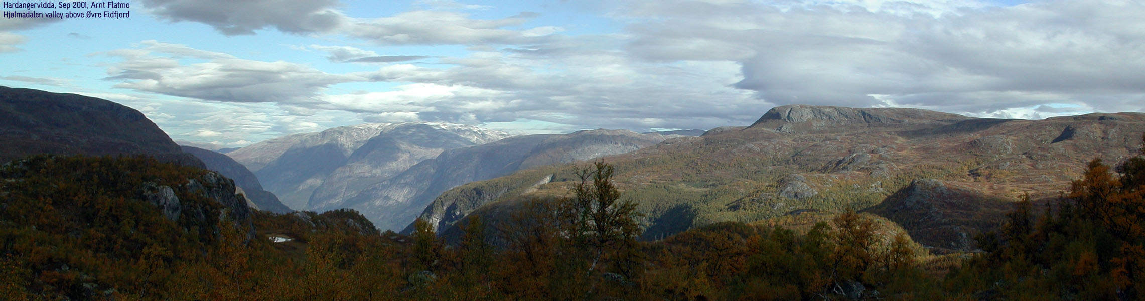
As Hårteigen lies central on Hardangervidda, it can be accessed from many sides. This description will cover the access from Øvre Eidfjord/Hjølmo.
From Eidfjord by the Hardangerfjord, follow highway 7 towards Oslo up to Øvre Eidfjord, on the north side of lake Eidfjordvatnet. At Øvre Eidfjord, locate a small exit towards Hjølmo. Follow the narrow road (first paved, then gravel) that runs up Hjølmadalen valley. The road is narrow, and curves steeply upwards to approx. 850m. A relative large parking area lies at the end of the road.
The trail to Torehytten:
This trail description will cover a summer/autumn round-trip that includes two overnight stays at DNT huts.
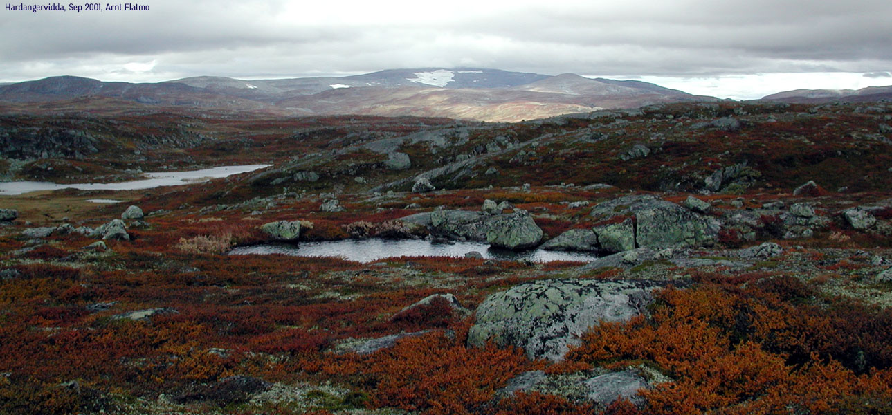
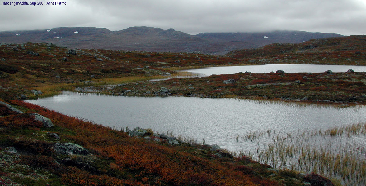
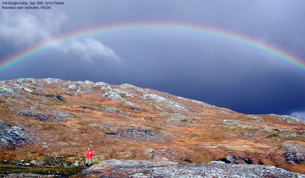
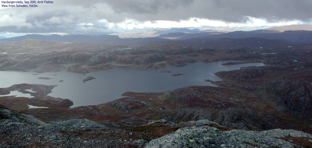
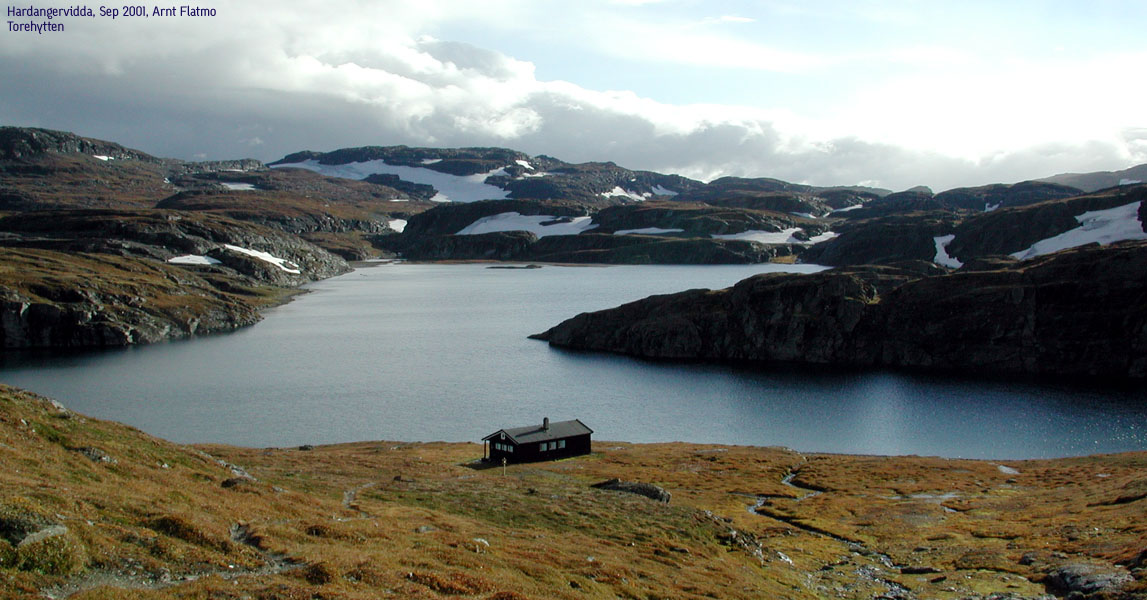
From the Hjølmo parking, follow a southern trail to Viveli. When you have Viveli to the right (on the other side of the river), locate a bridge over the Veig river, go left, and head south-west up the Vesterlii valley. The trail continues over the Sandvadet plateau, and crosses an east-west trail that comes from Hedlo. Continue straight ahead (south) down Langedalen, and cross the Olbogo river over a bridge. When you arrive the huts at Fagerli, do not cross the Olbogo river over the bridge, but locate a trail before the bridge that runs along the river on the left-hand side. Follow this valley down to the Viersdalen huts. Here you will have to cross two rivers. The first can be hiked over some rocks (balance required), but the second has to be forded (at least socks off). It might get cold, but the crossing is only a few meters. From Vierdalen, follow the trail towards Torehytten in the south-west direction. Less than 1Km from Torehytten, you can do a quick hike up to Solnuten, 1462m.
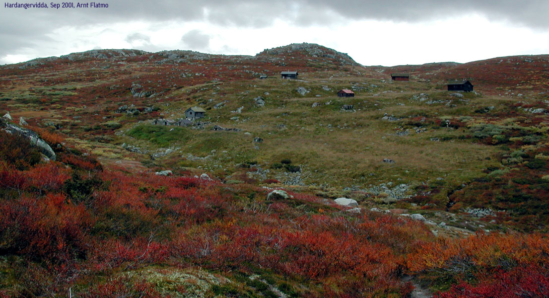
Torehytten is a small self-serving hut with one four-bed room and one 6-bed room, and has a great view towards your goal for the next day - Hårteigen.
The trail to Hårteigen:
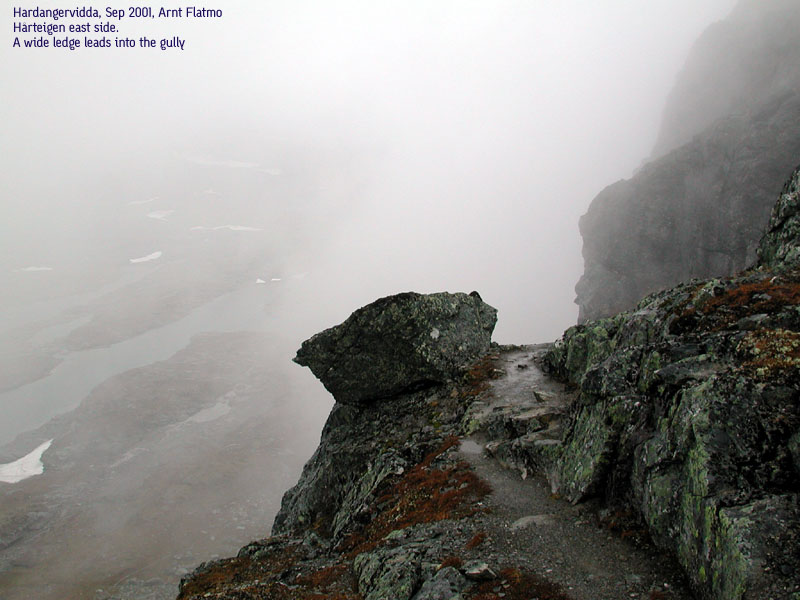
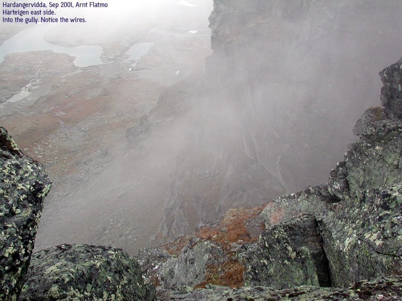
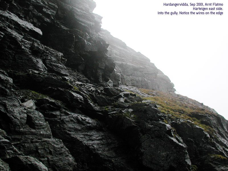
From Torehytten, follow the trail towards Litlos (south-east). The hike to the Hårteigen foothills is a one-hour quick walk. Hike to the middle of the east side of the mountain, and you will see the gully that splits the eastern face of the mountain. If you intend to hike the standard route, follow the cairns up the gully. At the upper part of the gully, the "trail" runs up to the right and out on the eastern face before it turns west up to the summit. The part from the upper gully to it turns west is secured by ropes and wires. This part also has a reputation for being exposed, but to me - (being sensitive to exposures, and not using the ropes/wires when climbing down) there were no places where I felt the adrenalin. The summit is on the south side of the gully, and the hike up from the wires only takes 5-10 minutes.
Hårteigen south side:
If you want a more challenging approach, go to the south side of the mountain. Hike up the slopes until you meet the southern wall. Go far right (east) and seek ways to advance to higher ground. You will meet a cliff that points south-east. You will have to follow a ledge to the end of the cliff and move around it (class 3 move). Advance a little higher, and from a certain point, there are two possible ways up. Choice 1 is to lift yourself up a V-shaped rock (good grip for arms and feet), and advance up a couple of ledges before going through a crack that takes you up to safer ground. This is a class 3 stretch. Choice 2 is to continue right past the V-shaped rock to some broken cliffs. Climb up the cliffs and you move around a cliff pointing south-east (class 3 move). After rounding this cliff, the hike up to the summit is a 2+ hike, without any technical moves.
From the summit, follow the cairns down the standard route as described above. The trail down the gully has a reputation of loose rocks. This would normally not pose any problem for the hiker, but perhaps for those further down.
The Hårteigen - Hadlaskard - Store Granenuten trail:
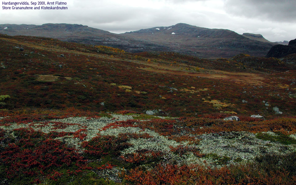
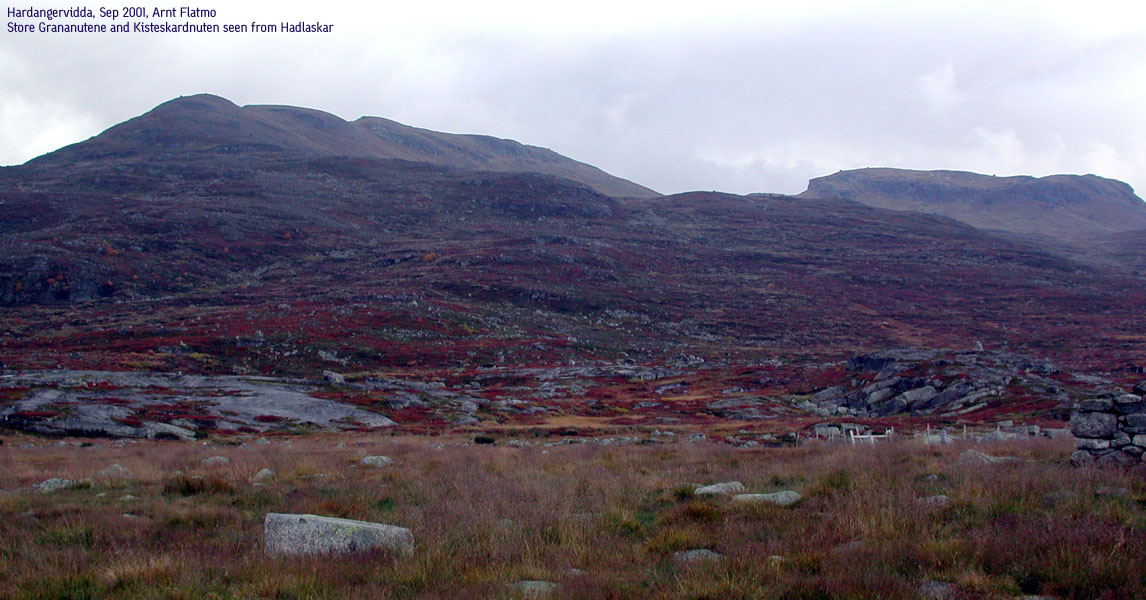
From Hårteigen, take the trail towards Hadlaskard through Smøygsdal back down to Viersdalen. But instead of hiking the northern trail (the way you came), continue north-east towards Hadlaskard. Hadlaskard is a larger hut than Torehytten, with two floors. Being at Hadlaskard, you can hike Store Grananuten (1613m). The route is simple. Head for the ridge and follow the ridge all the way upwards. Scramble over point 1512m before you reach the first 1613m summit. The summit lies above a wide wall that blocks the ridge. Scramble up on the left-hand side of the wall. From summit 1, hike over to summit 2, which is only 10 minutes away. Hike down from summit 2 the way you came, but set immediately a south-west course. If you chose the right way, you just avoided climbing down the wall blocking the pass. Then head for the pass between the ridge and Kisteskardnuten (1421m), a hat-shaped mountain neighbouring Grananutane. Then, head back to Hadlaskard on a direct course.
The Hadlaskard - Hjølmo trail:
From Hadlaskard, head north towards Hedlo. Not long after, Hadlaskarddalen valley comes down on your right. The trail now climbs up over Hadlaskardhalsen, avoiding the boggy ground down by the rivers. The trail then descends, meets the Veig river and arrives Hedlo. Continue to Filipdal, but instead of taking the Viveli trail, hike over Skrubbhamrane and when you start descending down the ridge, you see the parking. You also get a final view of Hårteigen over this ridge. Down from the ridge, you rendevouz with the trail you came up, and the parking is not too far away.
Trip report:
This weekend (21-23 sep 2001) had been reserverd for a trip with my friend Petter Bjørstad. It wasn't quite clear if the target would be Hårteigen or Store Styggedalstind in Jotunheimen. I was quite happy to see the bad weather forecast, ruling out Styggedalstinden. I wasn't mentally ready for Styggedalstinden as my first climbing experience. We left Bergen Friday morning at 7:15AM in Petter's Saab Turbo. As Petter wanted to drive with the roof down the drive was a little chilly. The drive also got - interesting - as Petter demonstrated why Turbo is good. We made the 9:30AM ferry with good margin. The drive up from Øvre Eidfjord to Hjølmo parking was a nice drive, watching the steep and mighty walls that make the valley.
On the trail:
At 11:30AM we were on our way with promising weather ahead. The weather prognosis seemed to turn out wrong. The trail was nice and allowed for a good tempo up to Viveli. After crossing the bridge, the terrain turned boggy and muddy. Petter - in his 200% waterproof plastic boots - maintained a direct approach, while I struggled behind, jumping between the dry areas. My boots were only 3 days old, and I wanted to avoid wet boots and blisters early on the trail. It was soon apparent that we kept a pace well over the average. Some hours later we closed in on Torehytten, and Petter was looking forward to a well-deserved break. I realized I had hiked half-a-day without any peaks, and talked Petter into hiking Solnuten (1462m) just north of Torehytten. Of course, the rain started pouring down, and Petter didn't quite see the necessity of hiking this mountain. Of pure courtesy - hiker to hiker - he came along. I presented him a nice rainbow as the rain started to give in, and he got a little more cheerful. At 17:45PM we checked into Torehytten. The actual hike time (minus breaks and the Solnuten hike) was 5,5 hours. Not bad for a route estimated to 8,5-9 hours.
Looking at the map, we discovered that Solnuten only was a subsidiary peak to Viernuten (1476m) and the peak was quickly erased from Petter's mind. After a nice meal of Trøndersodd, two Germans arrived the hut. They put up a tent outside as they wanted to "experience the true nature". However, they spent the whole evening inside the hut, so we failed to fully understand the principles. Nevertheless, we said goodnight to Hårteigen that had taken a bath in sunshine all evening and looked forward to the next day.
The climb:
When we awoke at 7:30AM, there were no signs of Hårteigen. We decided to wait a few hours and see how the weather developed. But the two eager beavers were on the way at 8:30AM, assuming that the fog problem would solve itself while we were hiking. It took us 50 minutes to the east gully, where we left our backpacks. Then we headed to the south side, scouting for a way up. As the mountain was totally covered in fog, there was little to do than to just head on up. The first part of the hike was a simple grade 2 (US class) hike. Out of the fog came the steep south face, offering few obvious ways up. We sought to the right and found different levels of ledges that could be advanced. Up to this point, I was totally fine with the trail, but a little nervous about what to come. Before I could dwell on nervousness, we had to walk a small ledge heading into thin air. Petter moved up and around the end of the ledge like a monkey, and I just wanted to turn back around. I hiked down a little, trying to find another route up, without success. Back on the ledge, I decided to go for the move, but as I kicked loose a rock where the grip was supposed to be, I again consulted Petter about whether this was a good idea or not. Apparently this was a good idea, and I went for the move - around and up. Petter gave me a hand as I came around, but I knew that wasn't necessary. What I also knew, was that I would have bigger mental problems going down this way, without any security. But since Petter carried a rope, I decided to put the worries to rest. As I looked up, Petter had lifted himself up a V-shaped ledge and was crawling over a few minor ledges, aiming for a crack higher up. Slippery as it was, Petter wasn't quite comfortable with the lack of good grips. After a few attempts, he decided to look further to the right. I had no objections. Further to the right we found a collection of broken cliffs that was climbable. I let Petter lead on. As I watched him do another class 3 move around a cliff pointing into thin air, I started disliking the hike altogether. But then he yelled down that the worst part was now behind us. "Yeah, right", I thought. The mountain was fogged in. How could he know? As I didn't like the idea of going down again, I decided to follow. At one point I suggested that using the rope would be a good idea. As Petter took the rope off his shoulder, a mental button switched inside my head, and I climbed around the cliff without any problems. Odd as it was, it seemed like the availability of the rope was all it took. I could stop anywhere I wanted and climb roped from there. But the climbing wasn't difficult, so the rope was never tossed down. And sure enough, from there on, the hike up to the summit was a simple grade 2+ hike (it felt sound to use the hands a couple of places). After a quick search we found the summit cairn.
The route down was harder to find. The myriad of small cairns were really confusing in the fog. But we found a wide trail on a ledge on the east side of the mountain, which led us down into the gully. The upper part was secured by wire, but Petter decided I could not use the wires, as I would lose objectivity when comparing the trails. The route into the gully allowed for some caution, as the mountain was slippery. And a fall would not be good. But after the hike up the south side, this was child play, and in no time at all I was on the safe route inside the gully. Soon after, we were down on the trail. As the fog started to lift, we hiked back to the south side to take pictures. Petter suggested we should hike it again, to better understand the route. I suggested not. (but if he had put on a little more pressure, I know I would have given in. One day later, I actually regretted the decision. I would have liked to get some detailed pictures)
To Hadlaskard and Store Grananutane:
Instead, we sat course for Hadlaskard. We left the Hårteigen base 11:30AM and arrived Hadlaskard 14:00PM (this trail is estimated to 3 hours from the Torehytten/Litlos/Hadlaskard trail junction). After a well deserved break, and checking into a two-bed room, we sat course for Grananutane at 15:00PM. We headed up the ridge, head-on, expecting a trivial way all the way to the top. But when arriving the base of peak 1512m, the terrain demanded some light fun scrambling over 1512m and up to the western 1613m summit. After summiting the eastern 1613m point, we headed down the pass between Grananutane and Kisteskardnuten. By now, the evening sun invited to a long break in the valley. We arrived the hut, satifisfied with the mountain, at 17:30, 2,5 hours after departure. By late evening, Hadlaskard was full. A bunch of hunters had arrived in groups during the evening.
Going home:
Sunday morning, we left the hut at 7:40AM, eager to get back to civilization. By now, my blisters kept me on the border to limping. Petter's pace increased proportional to the remaining distance. It was, however, a beautiful hike in bright sunshine over Hardangervidda. We arrived the car at 12:15, 4,5 hours after deparing Hadlaskard (this trail is estimated to 6 hours). We just made the 13:20 ferry, and the gate was closed behind us. Good timing. The drive along the Hardangerfjord on this warm and sunny day made a perfect ending to a perfect week-end.
Hårteigen Pictures: (move cursor to read notes, and click on the images to see full version)


The Hårteigen climb:


Hardangervidda scenery/Trail pictures:


Store Grananutane


Pictures from other hikes:


Links:
 Other hordaland mountains
Other Eidfjord K. mountains
westcoastpeaks.com
Other hordaland mountains
Other Eidfjord K. mountains
westcoastpeaks.com