
Norwegian Mountains, Nordland
Klapparfjellet (503m) from Øvredala, July 6 2010
To the main Sæterfjellet/Grøndalsfjellet/Skogmofjellet/Klapparfjellet page (maps, route descriptions, other trip reports, etc.)

Klapparfjellet
(Click for larger image)
It was the second day of our summer vacation in Nordland county. Anne Rudsengen and me had dried up after the hike to Dalaunfjellet the day before and were good and ready for a new hike. As one of my main projects in Nordland is to visit all tops on the Sømnahalvøya peninsula, why not begin with Klapparfjellet - one of very few tops left on my to-do list.
It would have been nice to know the story behind the name. I take it for granted that "clapping mountain" is a poor translation. In any case, Øvredala stood out as the natural starting point and we drove into Dalbotn to find our starting point. Along the way, we passed an information board saying "Nedre Dale Beiteområde - Fotturområde" (foot path). The board had some interesting "teasers"; a.o. a 20 meter deep hole (Værholet) and a waterfall called Kjerringmiga (this I can actually translate, but choose not to...). But there were no promises of a route to Klapparfjellet, so we stuck to our or original plan and drove to Øvredala.

Klapparfjellet
(Click for larger image)
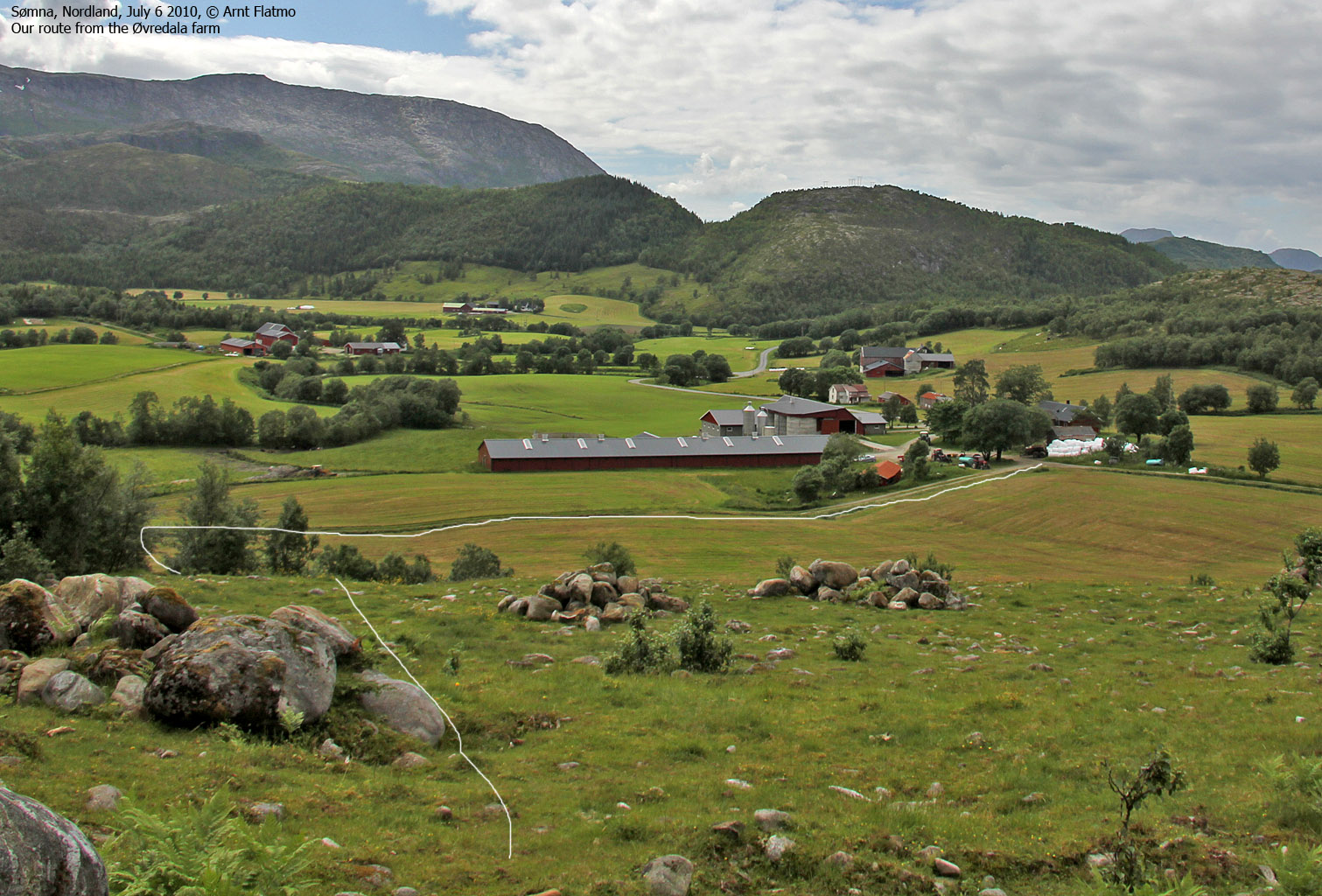
At Øvredala, we were welcomed by three dead pigs on a tractor and the farm owner who invited us to park by the barn. He told us that there was a path through the forest. As the terrain ahead looked more rugged than I had expected, this was good news. We headed out 1:10pm, followed a tractor road for a little while, then headed towards an opening in the forest.
We found the forest path right away, and this path led us to a huge boulder field. To me, boulder is even better than a foot path, and up we went...

Up the boulder field
(Click for larger image)
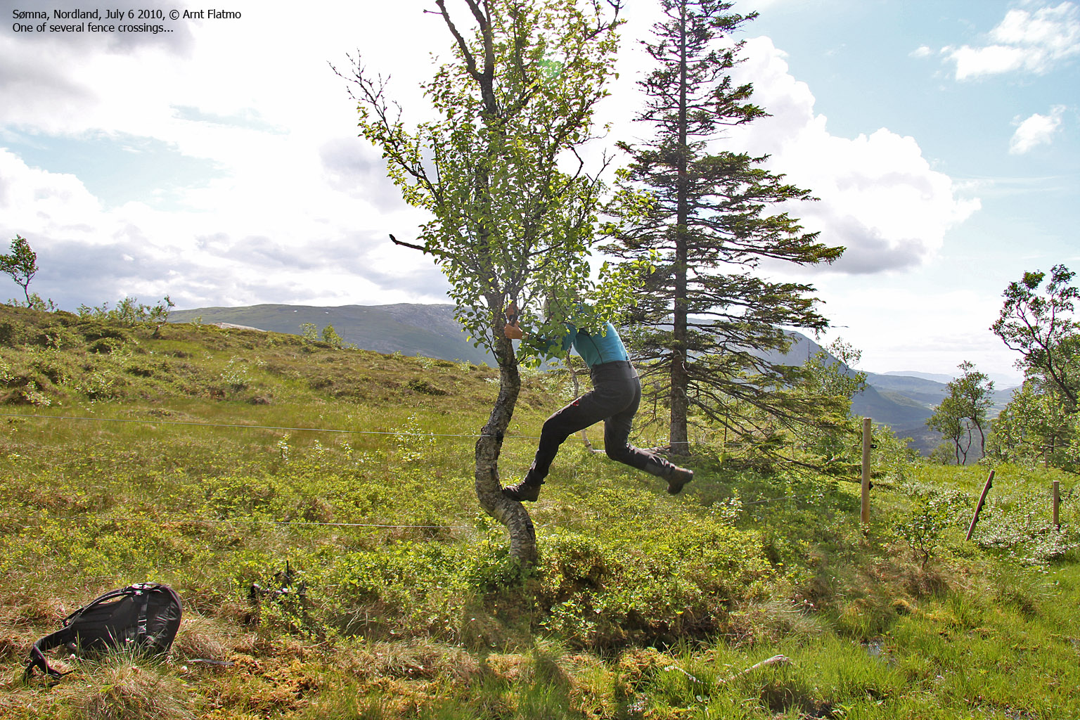
Above this boulder field was another boulder field - steeper than the first. We could have just followed the valley upwards, but then we would have drowned in grass. We topped out on a boggy meadow and had to deal with a tricky electrical fence. Both the east and west ridge seemed like natural ascent routes, but going straight ahead looked more fun. And shorter too. After yet another boulder field and some scrambling, we reached the summit plateau.

Our route to the summit plateau
(Click for larger image)
We reached the summit 2:41pm - 1h:30m after leaving Øvredala. Our stay on top became quite short, as we discovered a nest with four eggs. We descended a bit in the southwest direction (planning to return via Kaktinden) before we had lunch. There was also time for some fun...

After some hesitation...
(Click for larger image)
My map-reading capability wasn't at its peak on this day, and I confused Kaktinden with point 334m. Once we realized that we were heading for the wrong point, we decided to descend our ascent route. The crossing of the meadow did not fall into the "memorable" category, but at least we found our entry point above the steep boulder field. Back at the field, we ran into cows. I've run away from Sømna cows before, so it was high time that I became a man again.

Reclaiming my manhood...
(Click for larger image)
We were back at the Øvredala farm 4:11pm - 3 hours after heading out. Next on the to-do list was Bufjellet and the fun-looking Hestkjeften. See the trip report here.


")


")
")
")


