Norwegian Mountains, Møre og Romsdal
Otrefjellet, Apr 4 2007

This trip follows route #2 also described on the Otrefjellet main page Trip report, Apr 4 2007
The weather this Easter was not of the good sort, even if the sun was shining now and then.
I did not find the inspiration to drive far, just to get a new top in ugly weather. So it had
to be somewhere close. Ever since I visited Otrefjellet back in March 2006, I had thought of
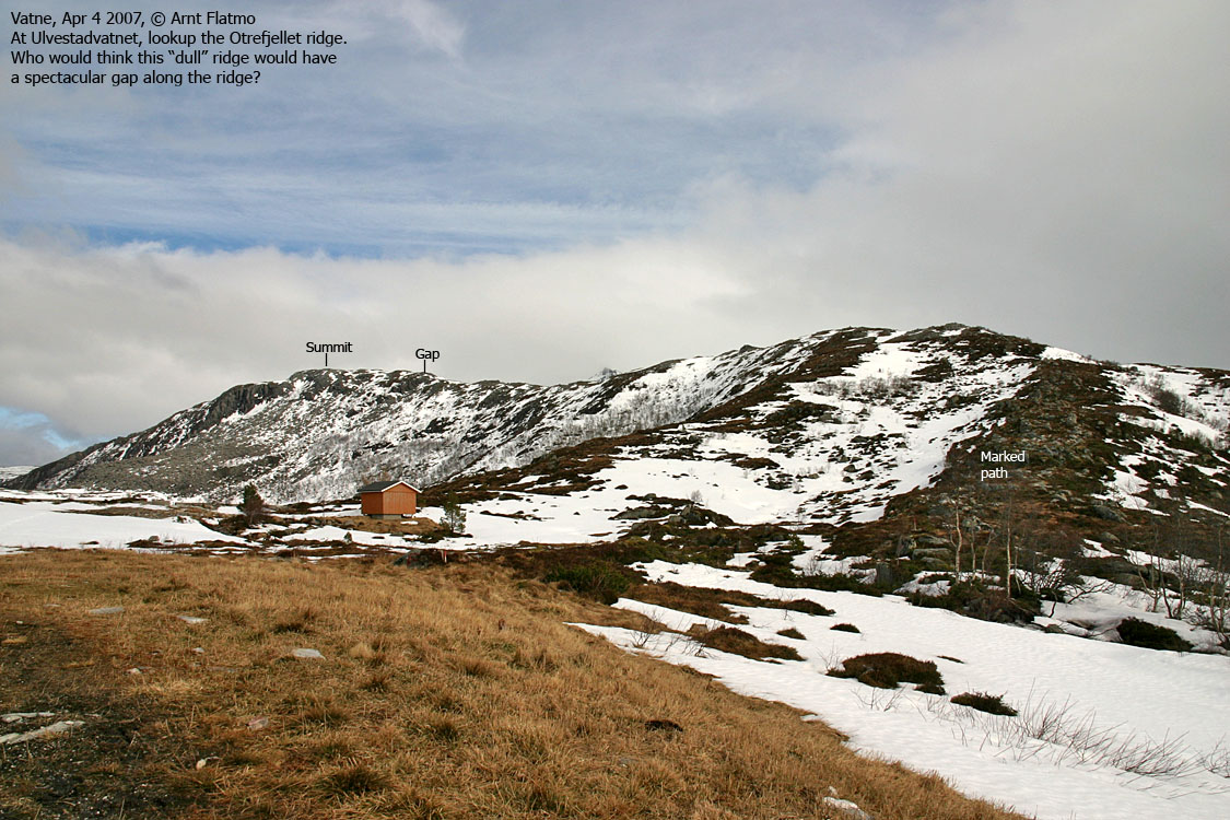
returning, in order to take a closer look at the remarkable gap (in lack of a better word), cutting
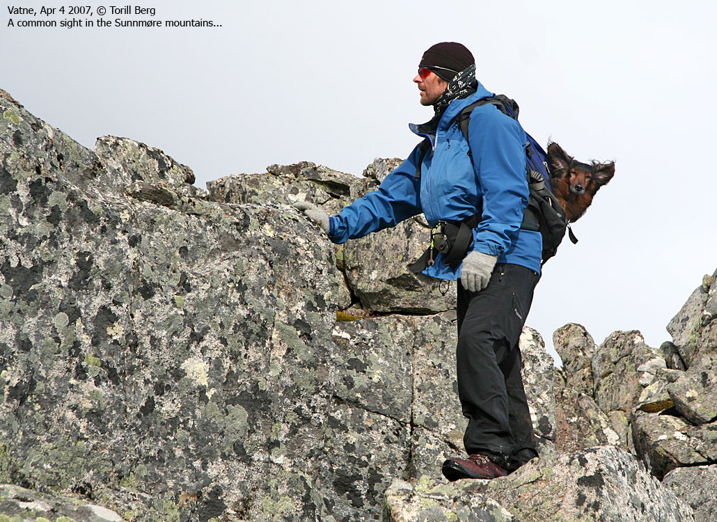
through the upper ridge. As the mountain is not located far away from Torill Berg, I called
and invited her along, promising her "spectacular" terrain. She had already been to Nihusen (438m) early in the morning, but said OK
to a second hike.
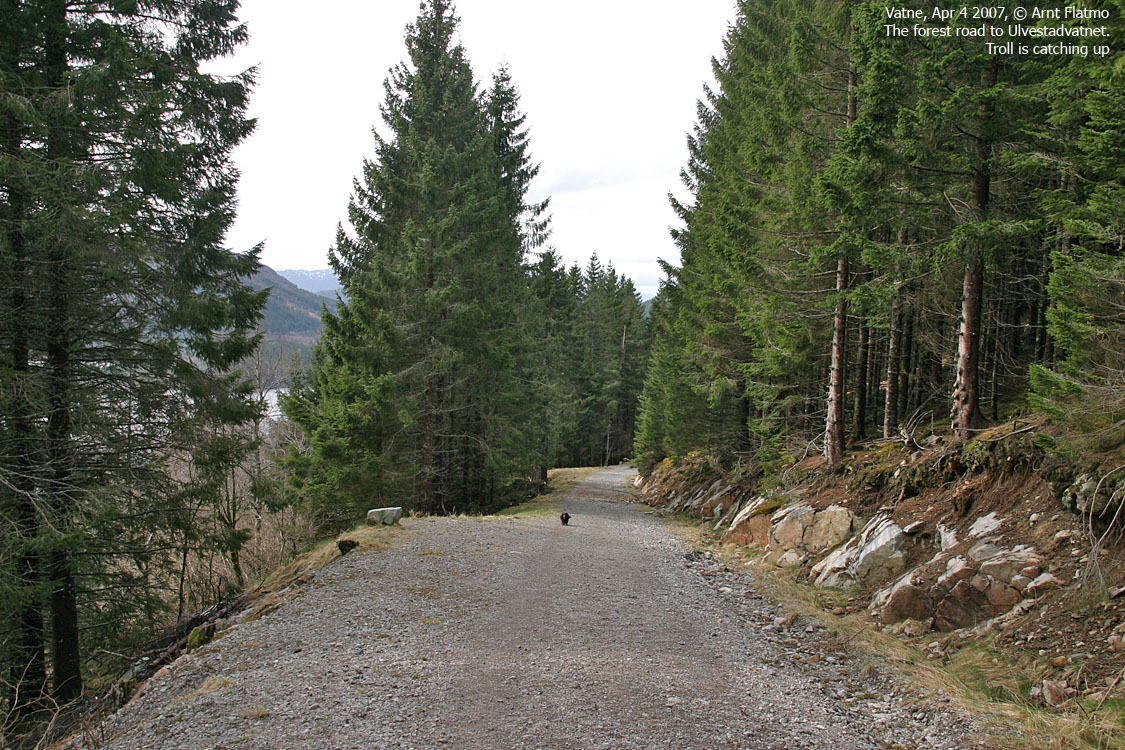
We left the Ulvestadvatnet trailhead in Vatne 12:50PM, and enjoyed almost a snow-free forest road
up to the lake. After making it across the stream, we were able to follow a snow-free path almost
up to point 519m. Torill put her gaiters on. I didn't find mine before I left home, and would have to
do without. My dog Troll had walked up to this point, but now he entered the backpack.
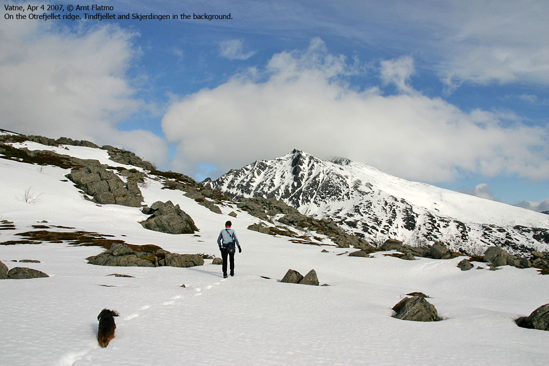
Along the ridge, we passed several sections that were spooky. The ridge is all "cracked up", and there
was no telling if we would step through something nasty. It felt like walking on a dangerous glacier,
and without safety measures. How bizzare, when you look at this ridge from distance, and think
it's one of the "dullest" ridges you ever saw.
The gap
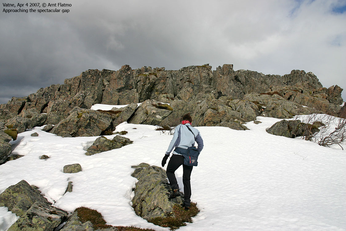
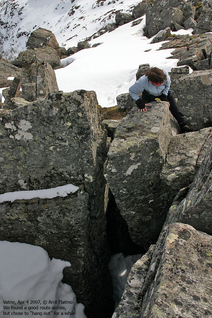
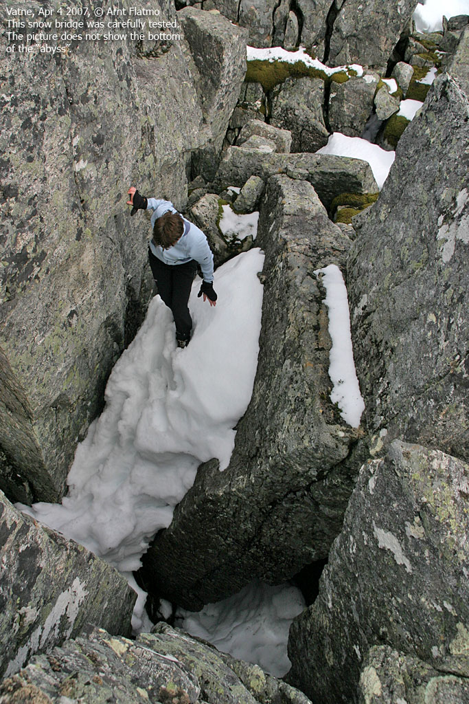
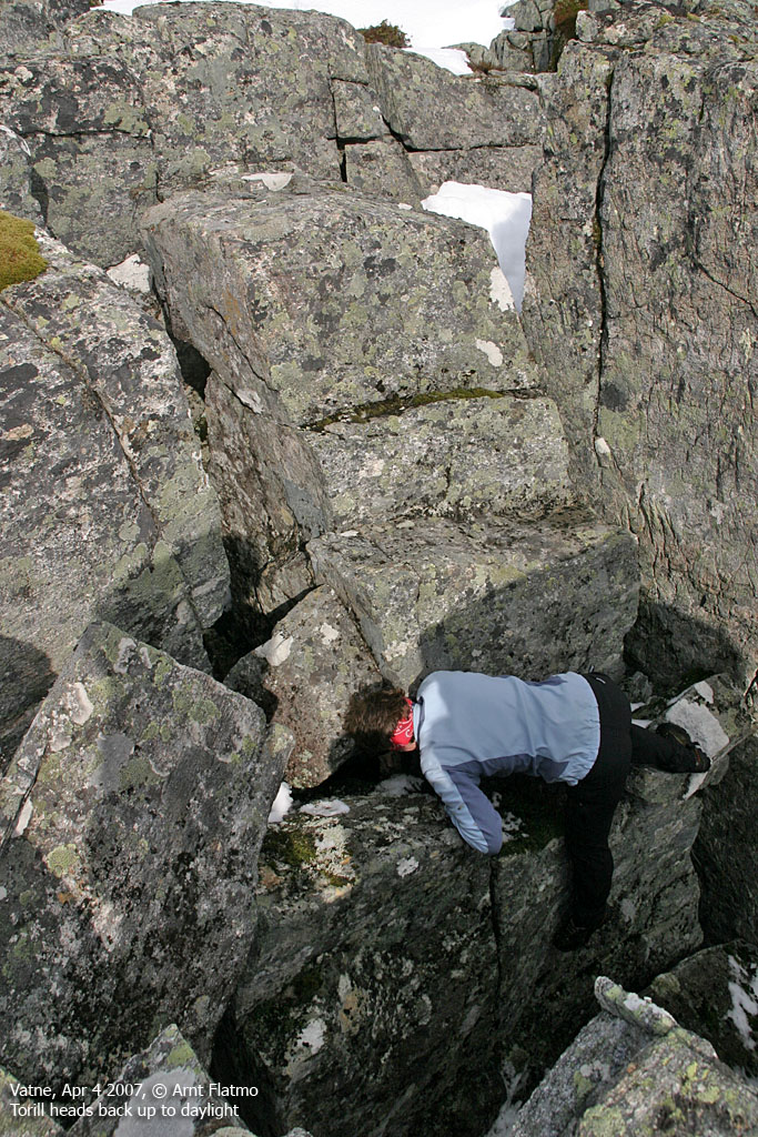
Then we entered the gap, or whatever the right word is. It seemed to be a mix of a labyrint, a ravine,
a canyon, whatever, with ugly "teeth" sticking up everywhere. The pictures have "jaws" in the filename.
I found that quite appropriate. We found a fairly easy route straight trough. Light scrambling. We paused
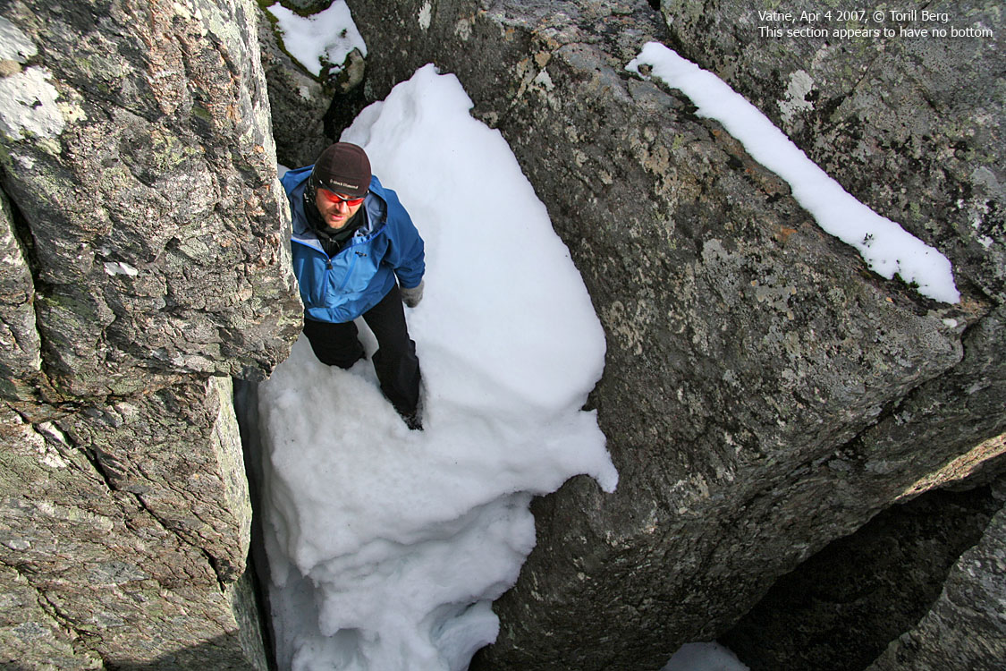
in the middle of this route, and spent some time scrambling around. There was no telling how deep the holes
went, but I'm confindent that it was at least 10 meters from the photographer's position, to the lowest
point that wasn't completely dark.
The "gap" was a nice spot to be in. The wind on the ridge was fierce, probably around 25 m/s in the gusts,
and the gap provided a temporary shelter. I was going almost deaf from the "machine-gun noise" inside
my jacket's hood. Standing on top of the gap meant that one had to hold on to something, otherwise the
wind would, for sure, knock us straight off the cliff.
Torill agreed that this was a spectacular piece of nature, located in a weird place,
and seemed to enjoy the scrambling as much I did. It feels good to be a young kid once in a while.
To the top and back again
We reached Otrefjellet summit 14:30PM. Taking pictures was very difficult, but I agree with Torill that
the wind felt LESS strong on the very top. We turned back around after just a few minutes. We took the
same route across the gap, but as the entry point was a bit steep for me (because of the dog), we had
to find another way out. We did, but not without some "creativty". I was thinking to myself, as Torill
passed me my backpack, containing Troll, and in a somewhat awkward spot - "the moments are there for grabs,
one only has to go out and be ready for them".
We were back at the trailhead 15:40PM. A short, but INTERESTING hike had come to its end.
Pictures from the Apr 4 2007 trip
(Help text (ALT) is available when your cursor is above the thumbnails. Make sure you've got the ALT switch turned on in your browser)
To point 519m on Otrefjellet


To the gap


Summit and back


No Javascript:
1
2
3
4
5
6
7
8
9
10
11
12
13
14
15
16
17
18
19
20
21
 westcoastpeaks.com
Other Møre & Romsdal mountains
Other Norwegian mountains westcoastpeaks.com
Other Møre & Romsdal mountains
Other Norwegian mountains
| 