
European Mountains, Slovakia
Gerlachovský štít (2654m) traverse,
July 5 2013
To the main Gerlachovský štít page (maps, pictures, other trip reports)
")
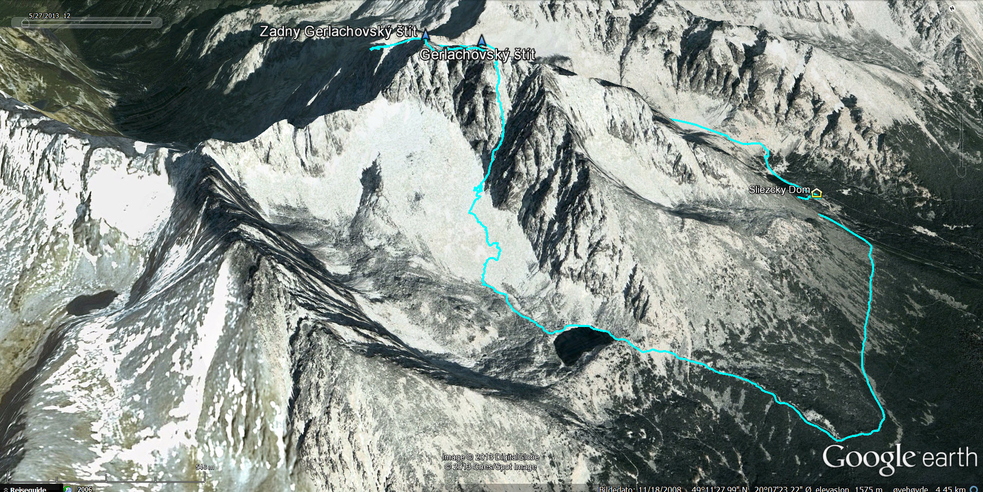
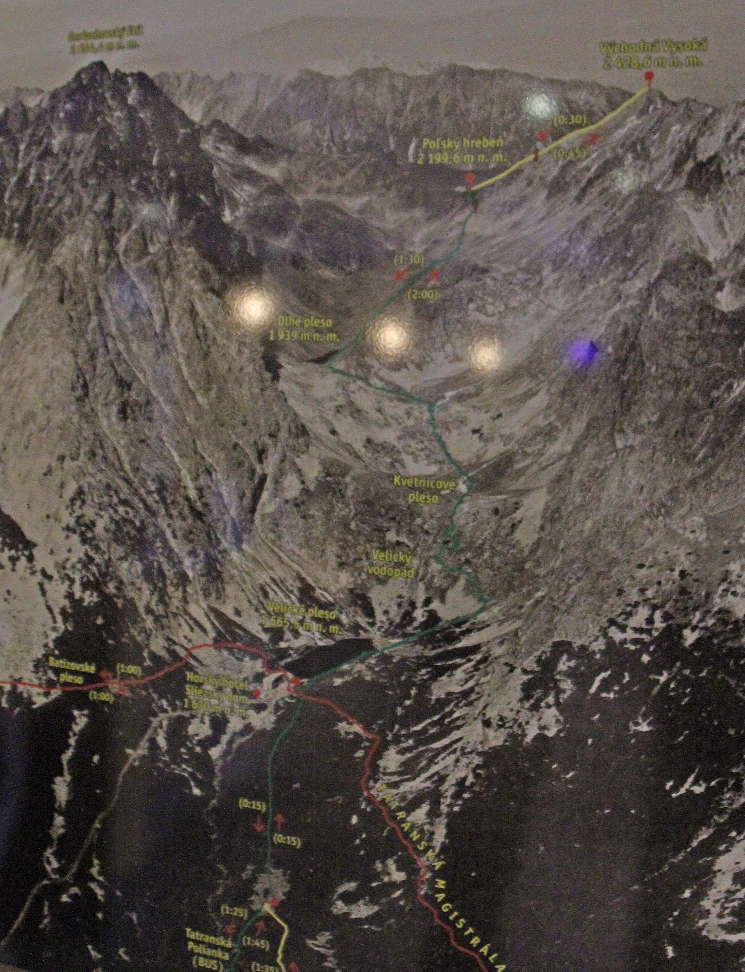
The route (Google Earth)
(Click for larger image)
Background
Normally, I would have been very sad to go on holiday for a whole week without my dear dog Karma, but after all the runaway trouble she, her sister Turte and her mother Ella caused us during the week we stayed at a mountain cabin in the Lom mountains, it didn't feel bad after all... 8|
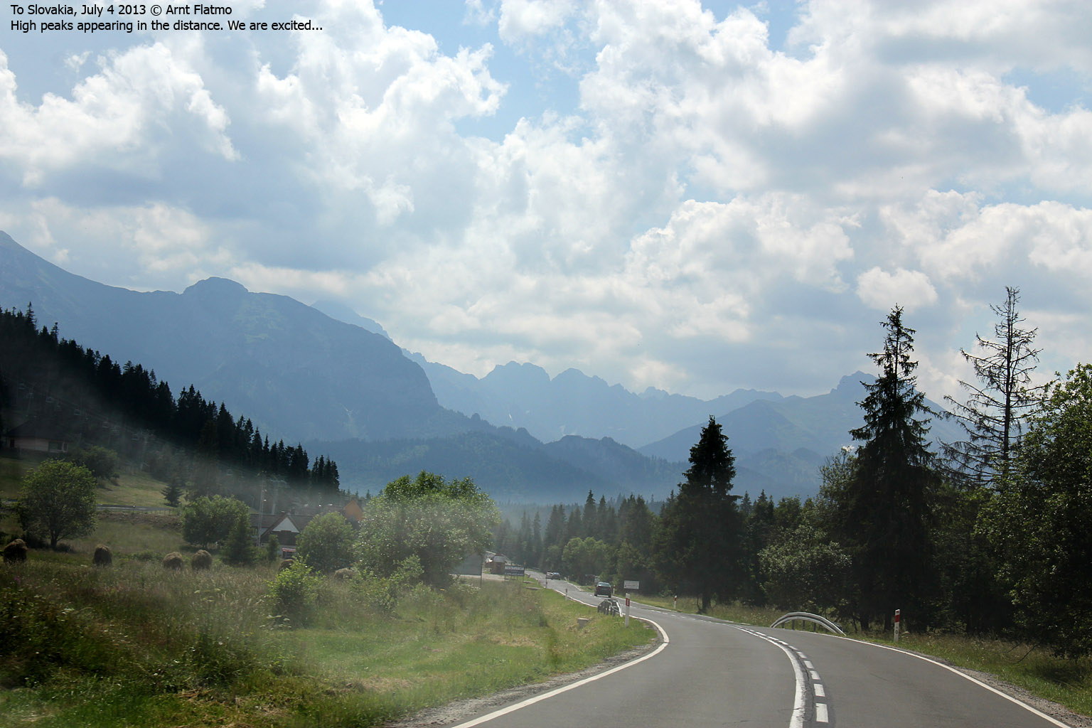
It was a practical arrangement; Anne and me looked after Ane and Jostein's dogs for a week while they were on vacation and when they returned, they looked after Karma - allowing Anne and me to go to the Tatra mountains and climb Gerlachovský štít - the highest peak in the Tatra range and Slovakia.
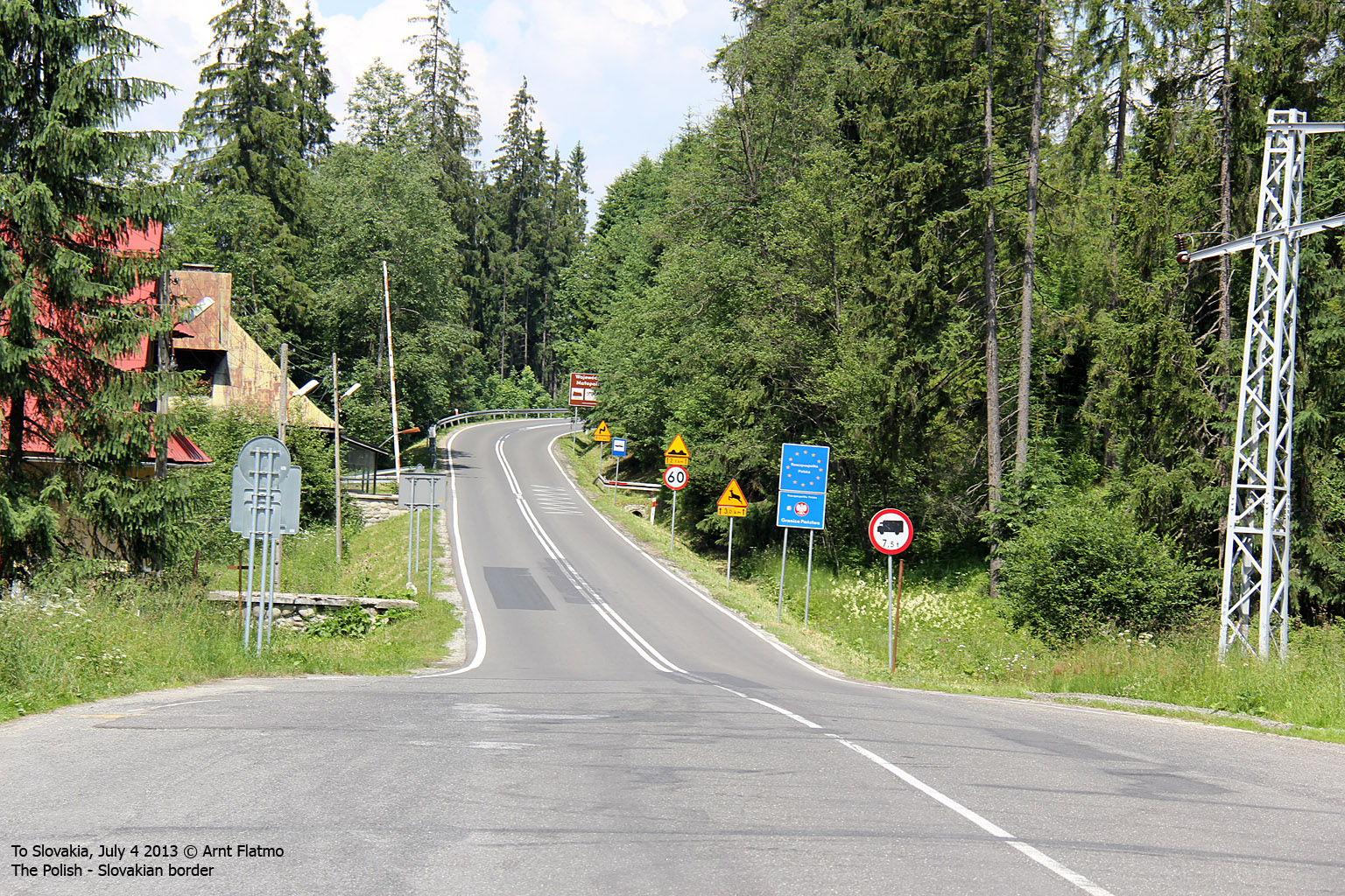
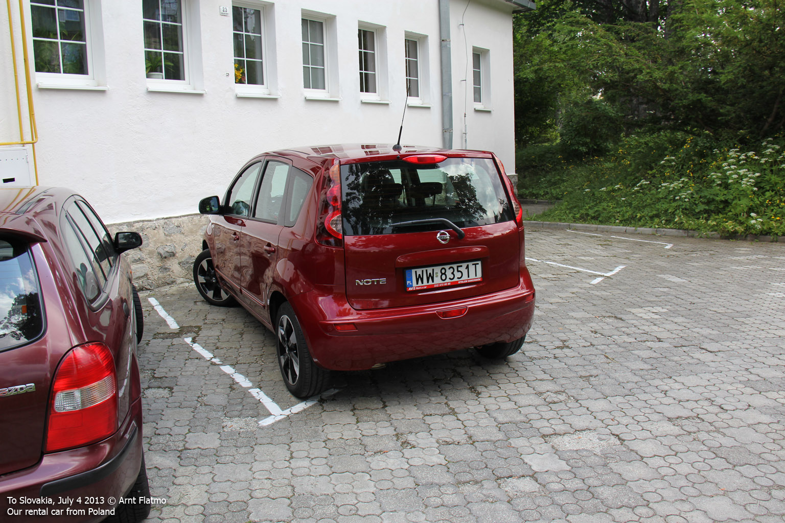
We flew from Oslo to Krakow and spent a couple days there before picking up our rental car before driving to Slovakia. Click here for the Krakow report - and pictures.

In Slovakia - with adventures ahead!

(Click for larger image)
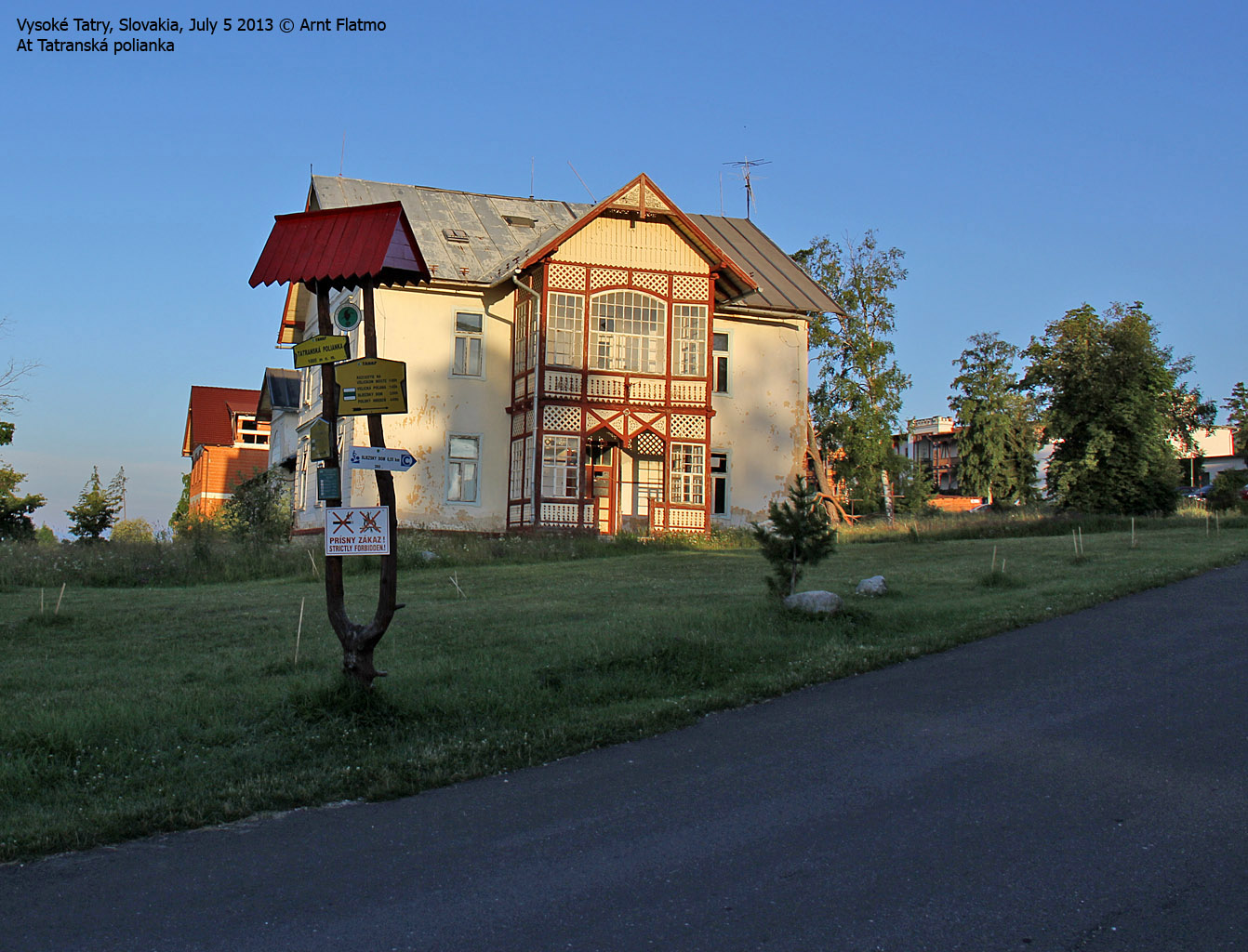
Villa Gerlach
Our base-camp for the week was Penzion Villa Gerlach - recommended to us by our guide Jan Kostka. We were obligated to have a mountain guide for this climb, and I got Jan's phone number from my friend Petter's Gerlach report and sent him a text message. Jan responded and we made the final agreements through email.
The room standard matched the reasonable price (16 Euros per night) and we had nothing to complain about. The Wi-Fi signal didn't make it all the way to our room, but we could always go to the breakfast room and get a good reception there.
Jan came to Villa Gerlach in the afternoon on July 4th. He didn't speak much English but we felt we were able to communicate well enough in German. And we used Google Translate to make sure that there were no misunderstandings. The price for a Gerlach traverse was 246 Euros for a couple and he would pick us up at 5:30am the next morning.
I fear that Anne and me possibly "oversold" our mountaineering capabilities. The intention was simply to make Jan understand that we were not completely rookies. Words like "Rockies", "Mt. Blanc", "Elbrus", "Greenland", etc. were probably mentioned but since none of them seemed to impress our guide the least, we didn't think anymore about it. That is - until the next day...

Villa Gerlach
(Click for larger image)
Und wohin gehen wir?
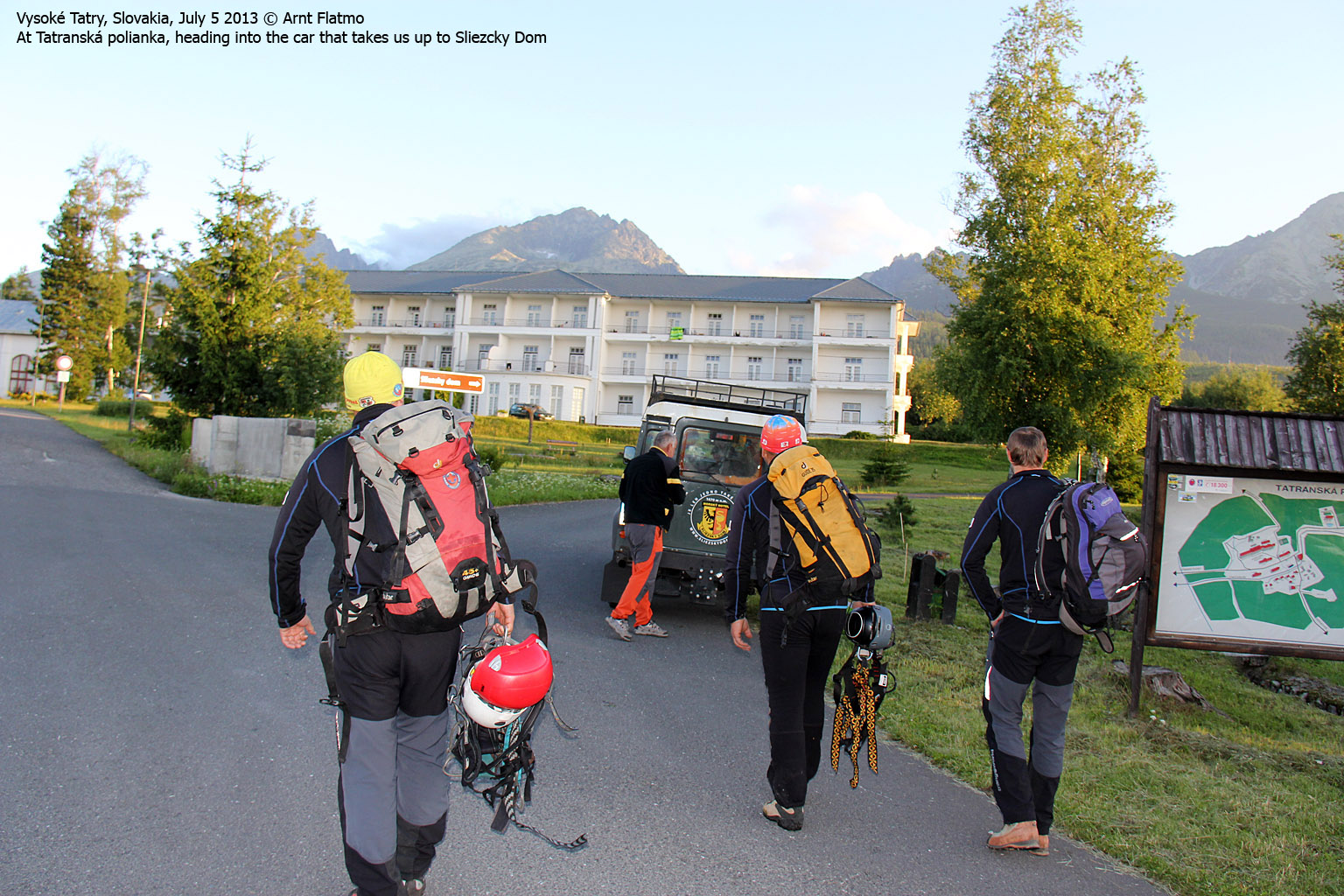
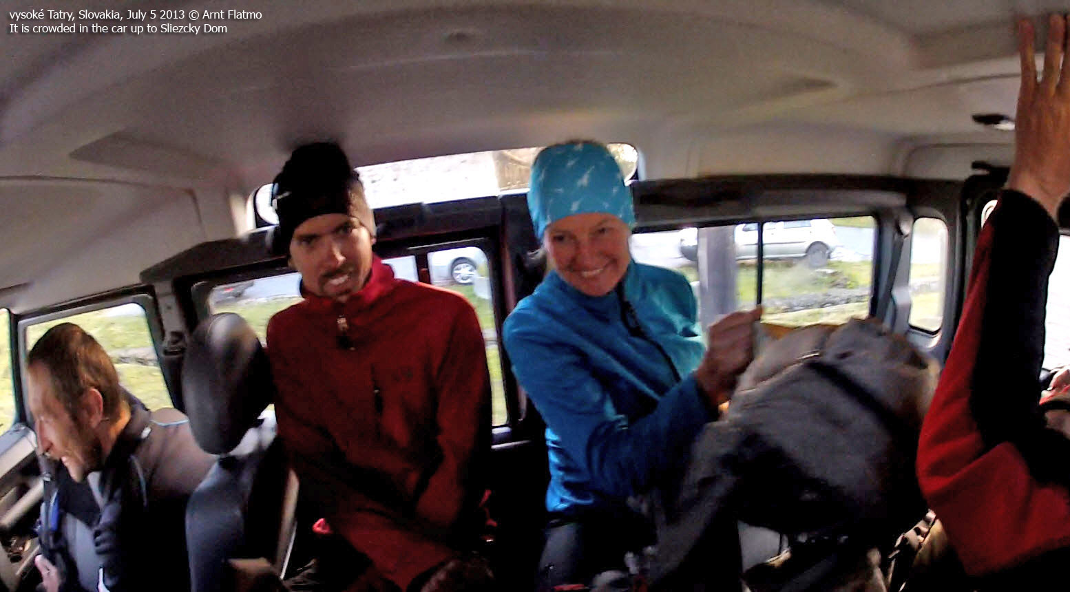
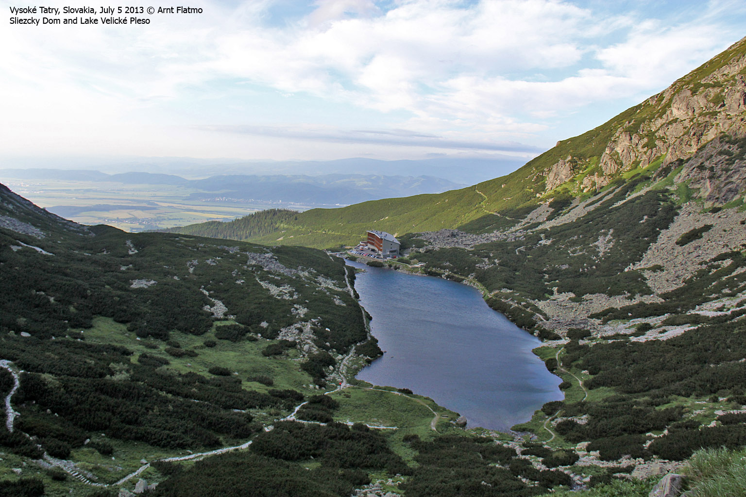
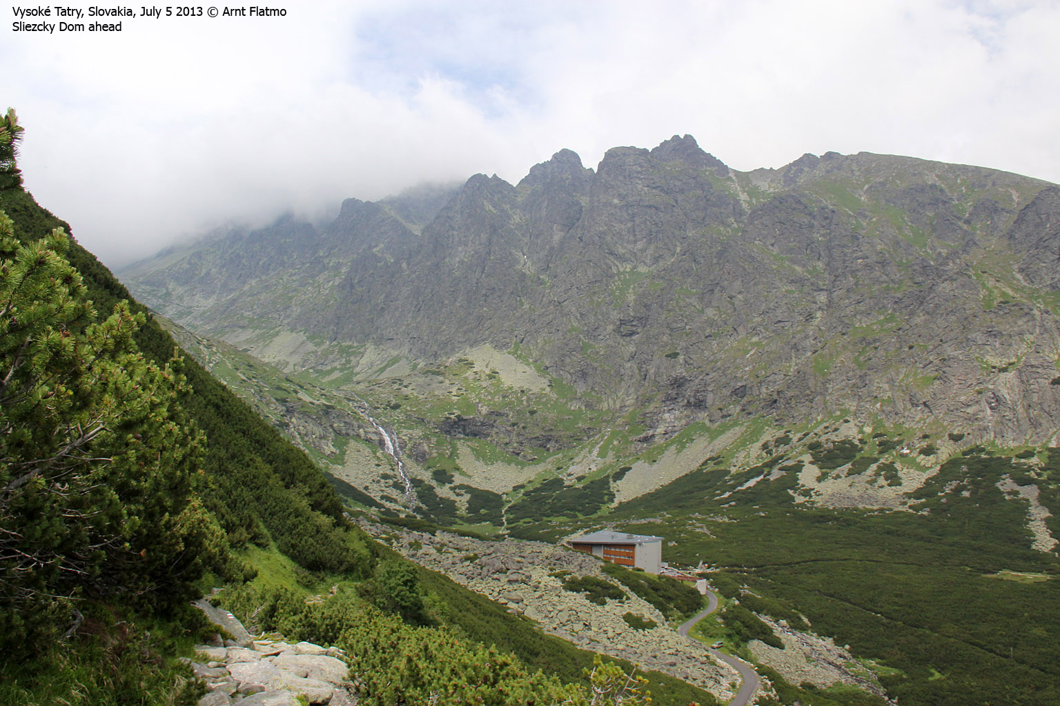
Jan came a bit earlier and the time was only 5:25am when we arrived at Tatranská polianka - a few kilometers to the west. The plan was now to go up to Hotel Sliezcky Dom (1670m - the trailhead) with the shuttle bus. But it took a while for the shuttle bus to arrive and we didn't get going until 5:55am. The shuttle bus was packed full of climbers. We arrived at Sliezcky Dom 6,9km and 17 minutes later.
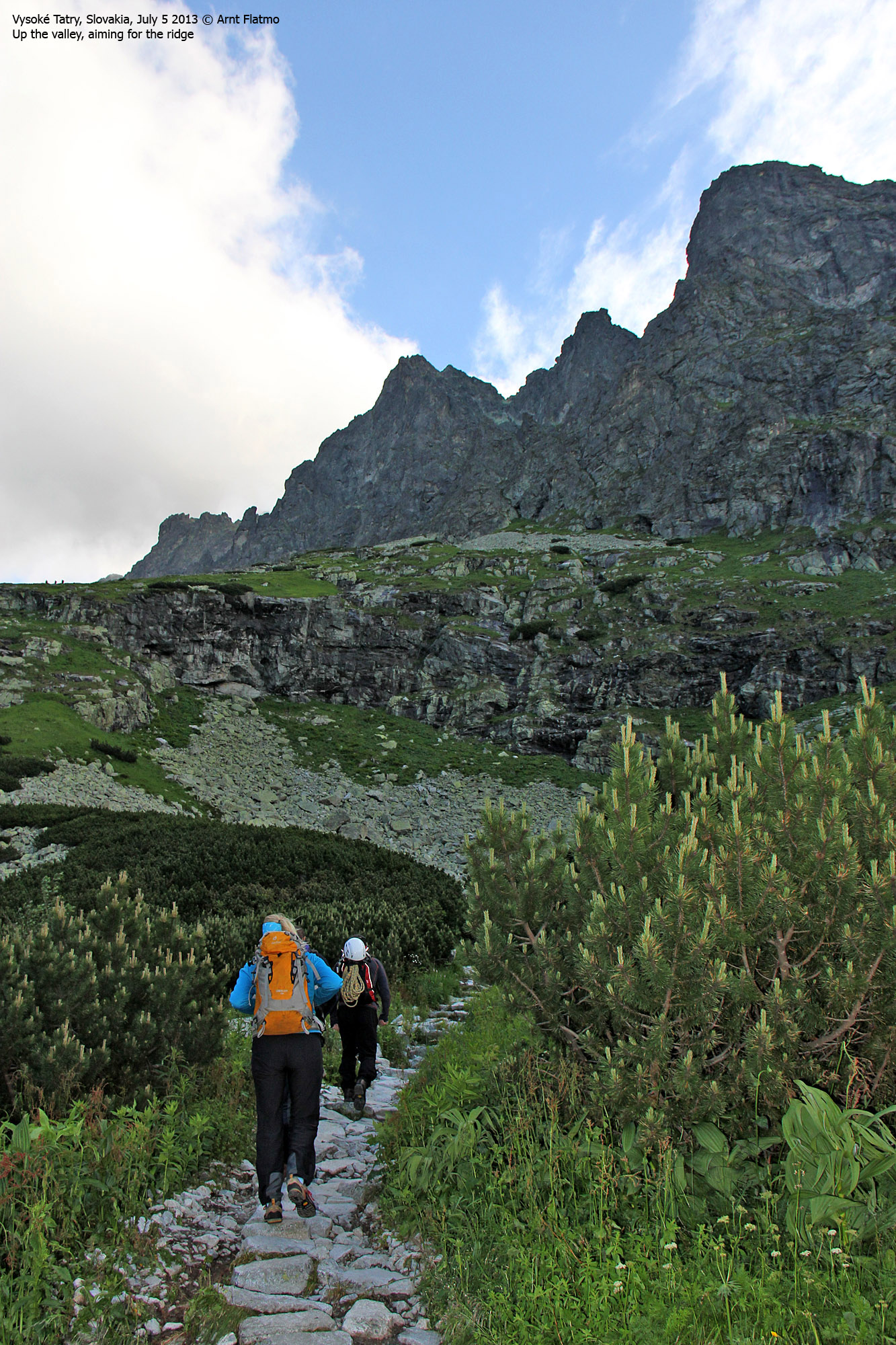
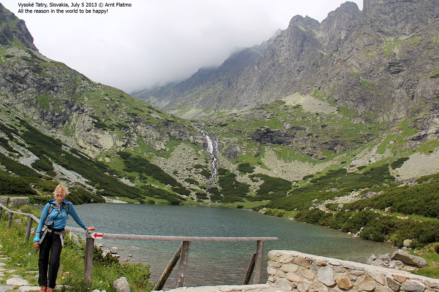
The time was 6:13am when Jan, Anne, me and 3 other climbers headed out along Lake Velické Pleso. One of the other climbers spoke English and I understood that they had done "our route" the day before and would go on a different route today. There was however something strange about this. I didn't quite understand why three rock climbers had done Gerlach's normal route. A bit later, it all became very clear...
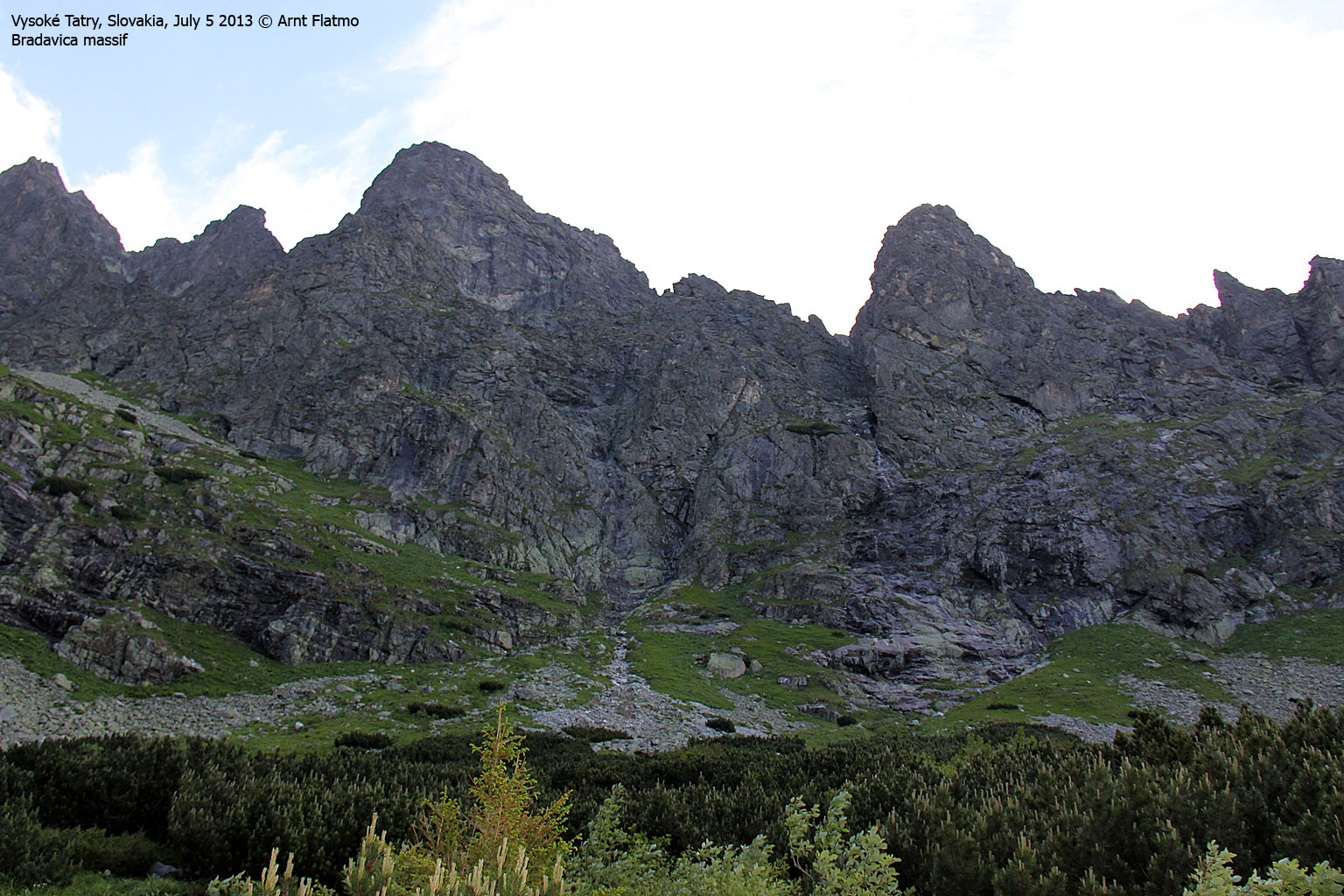
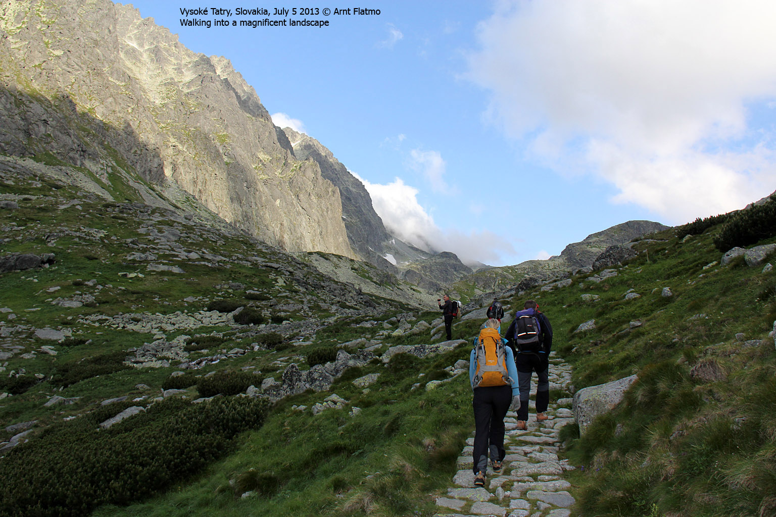
After ascending along the waterfall into the upper part of the Velické valley, I noticed a group of climbers high up to our left. I asked Jan where they were heading and he told us that they were going up the normal route.
My next question was inevitable; "Und wohin gehen wir?" ...
Things fell quickly into their right place. Now we understood what Jan meant with "schwieriger route". "Vie viel schwieriger?", I asked and I -think- he said something about "grade IV". UIAA scale. After rolling our eyes for a few seconds, Anne and me gave each other a "good luck" look...
")
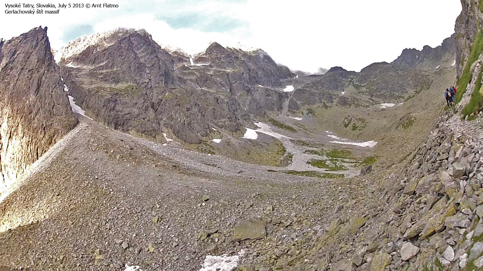
The normal ascent route (in center)
(Click for larger image)
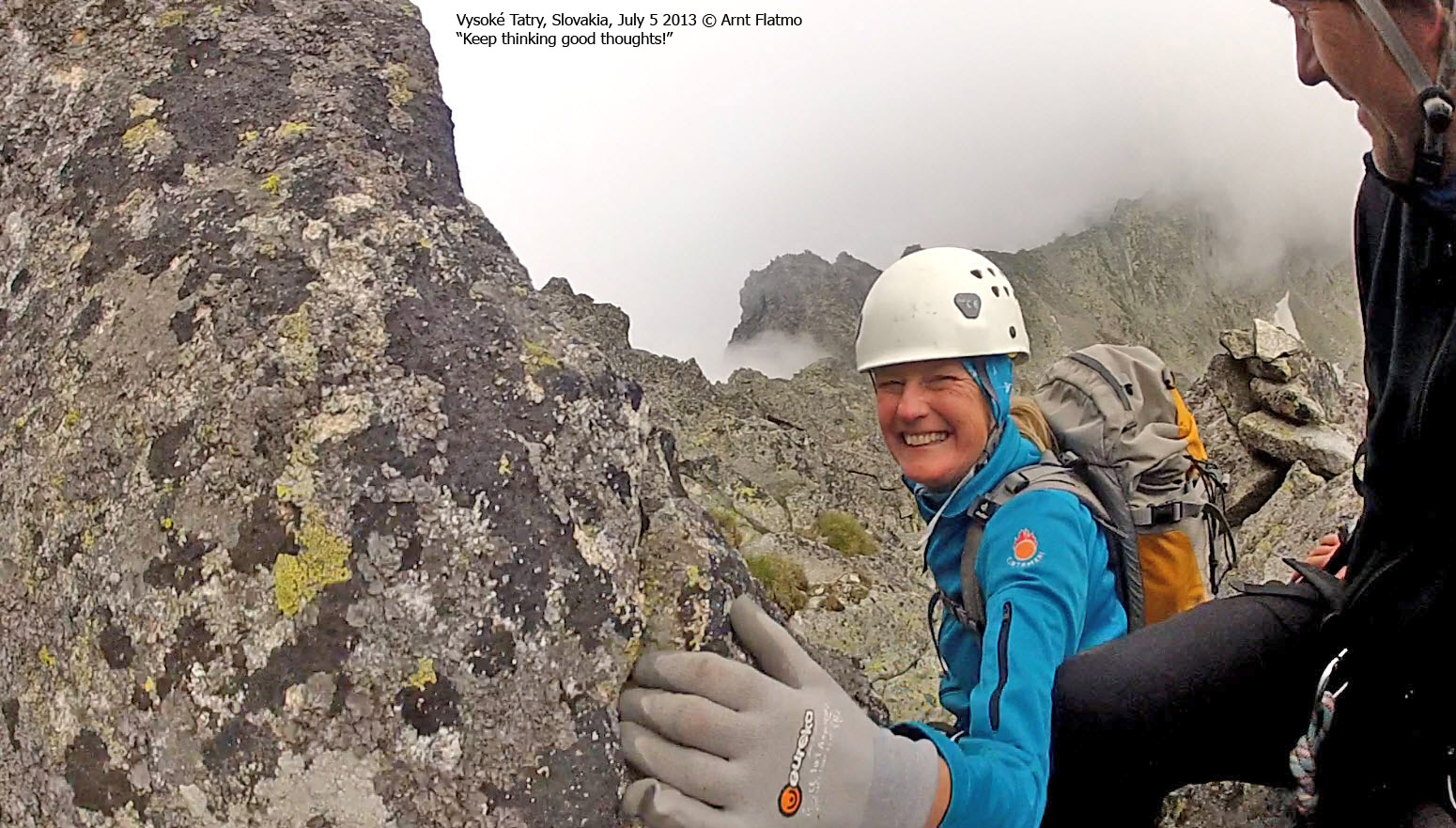
The traverse
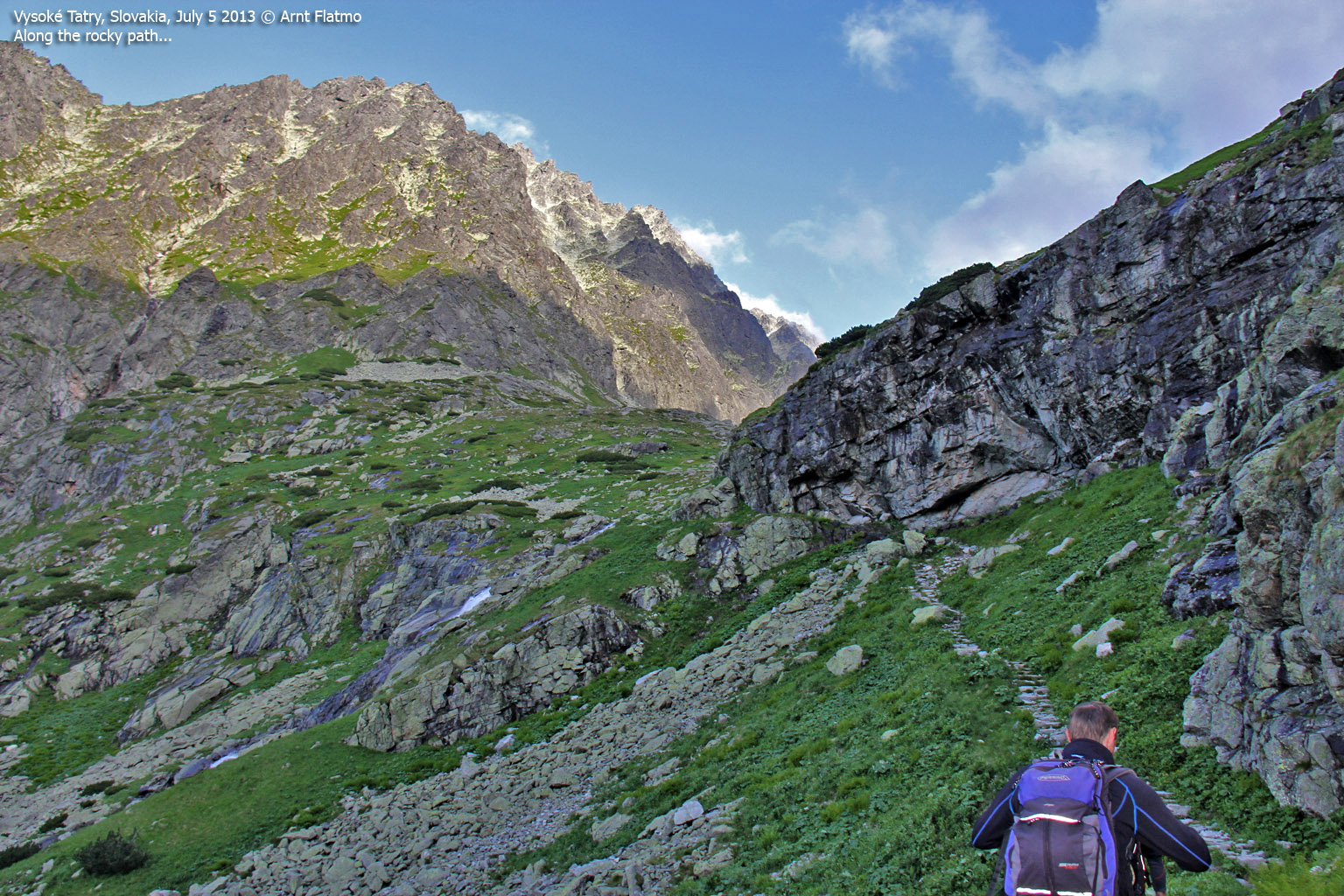
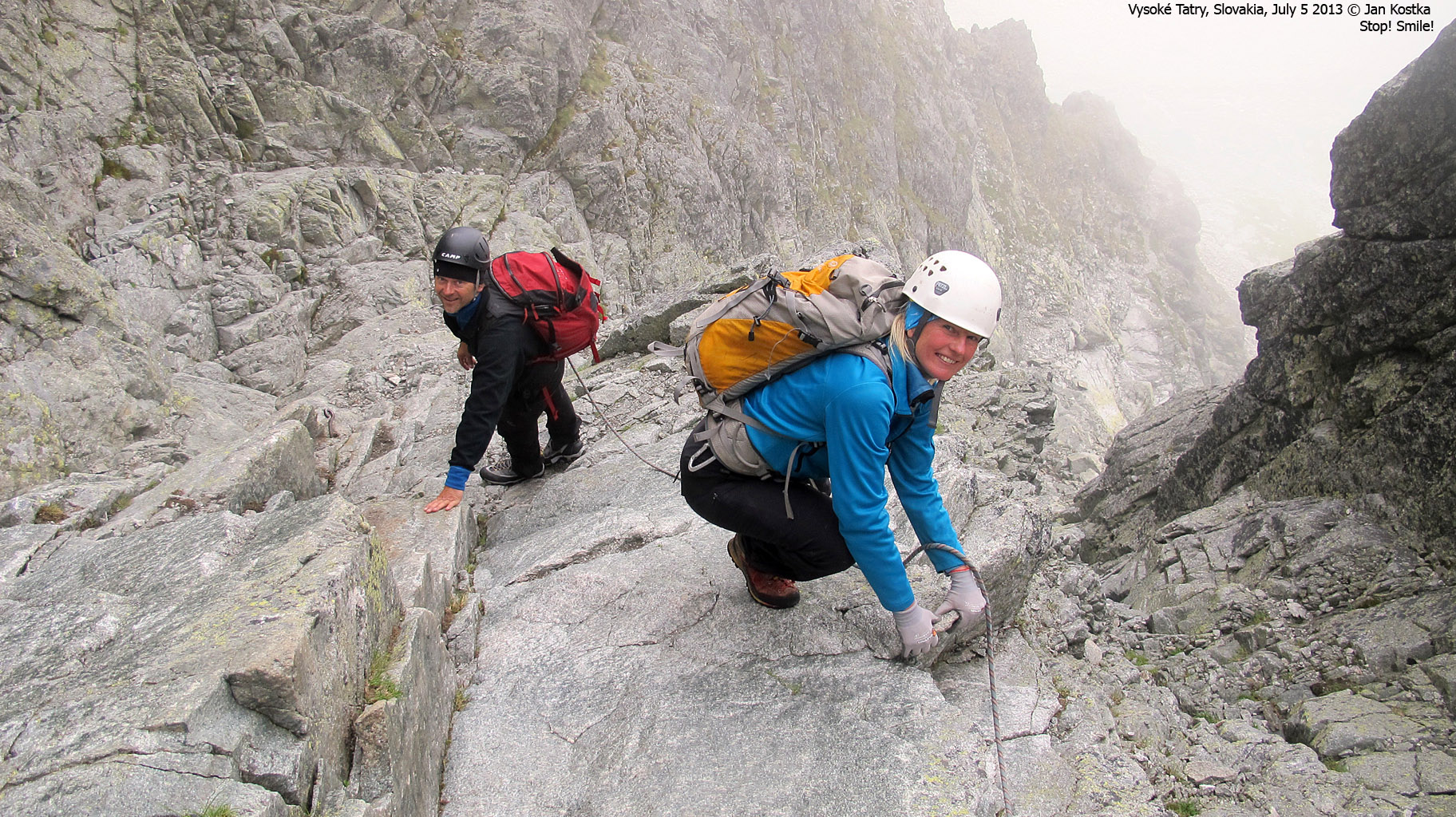
At 2100m, we left the trail that continued across the Pol'sky Hreben pass (2200m). We followed a vaguely marked route that led us up to the Litvorovo Sedlo pass - just south of Litvorowy Stit (2413m). Our climb would begin in this pass and this was also where we put on our climbing gear. Jan tied us into his rope and we started walking.
The first part of the route was easy scrambling along a broad ridge. But I had a feeling that this was about to change. Soon. Up there. In the fog...

An easy start...
(Click for larger image)
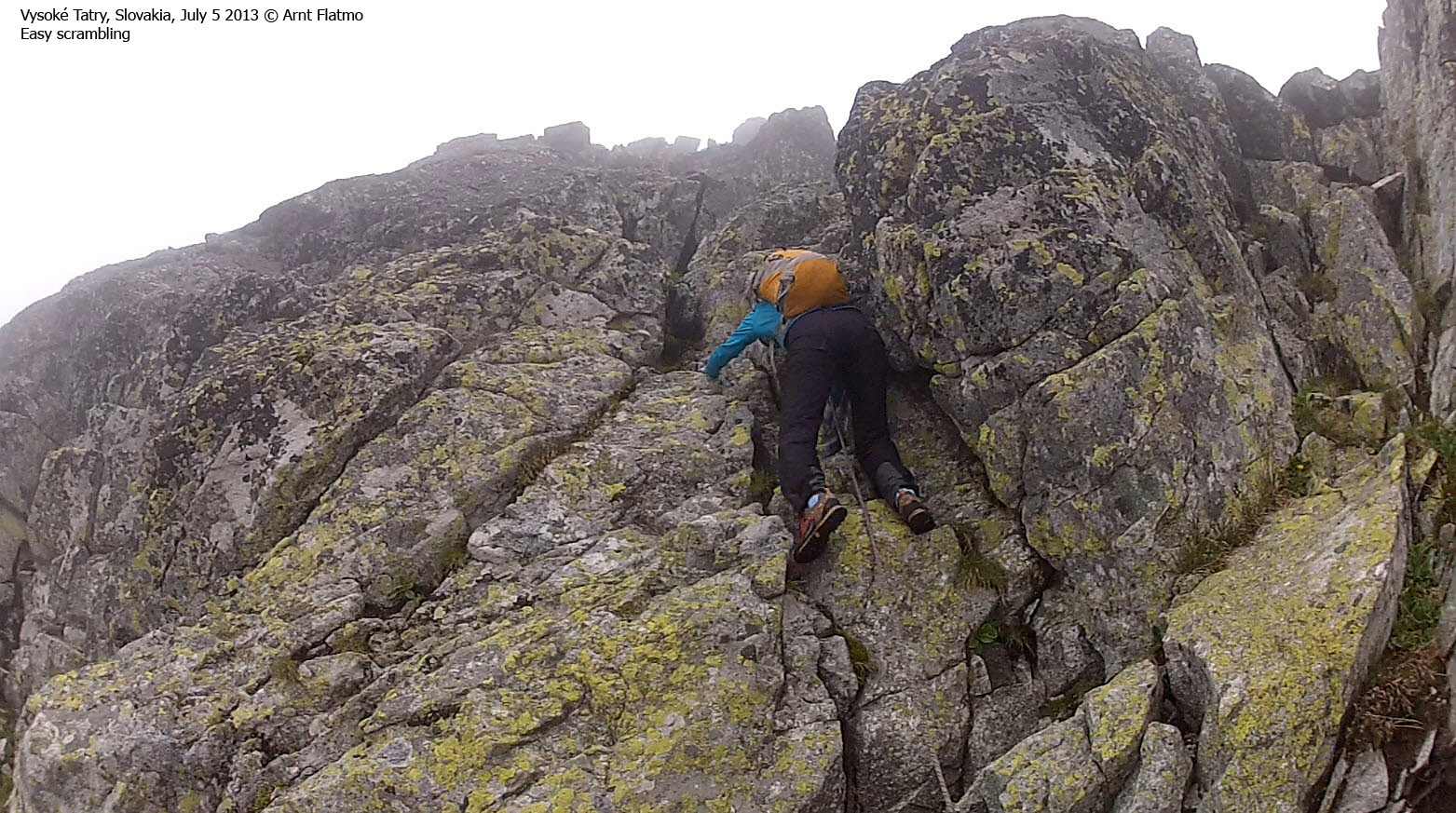
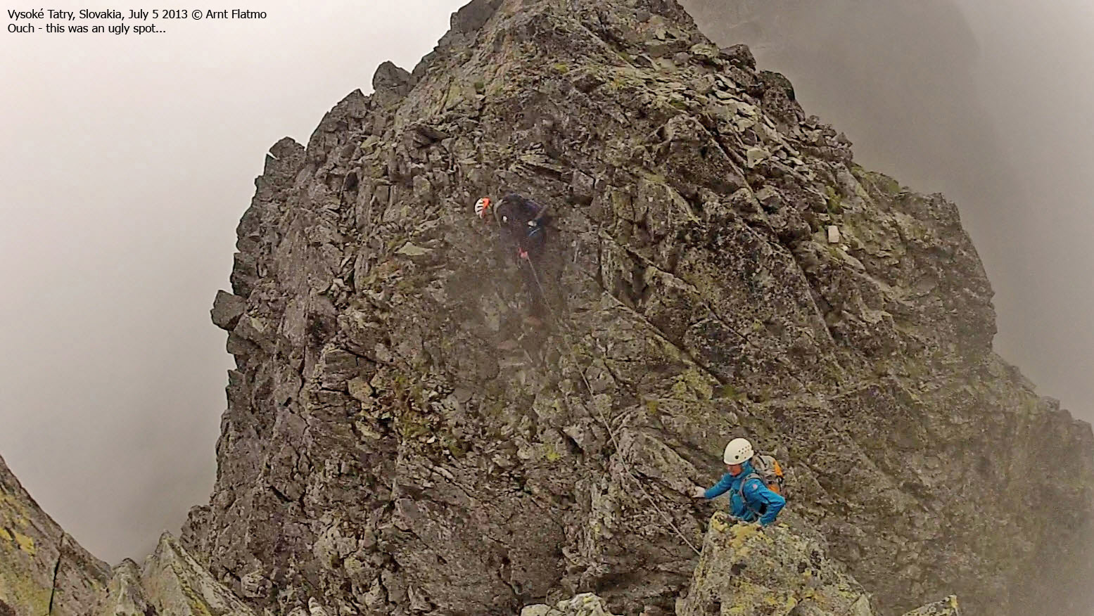
And it did change. Soon. The route was so - overwhelming - that I can remember the details independently, but not put them in their correct order of sequence now that I am writing this report.
One thing was for sure - Anne and me did not enjoy this type of running belay. In many situations, it was simply not possible to "jump out on the other side" and if one fell, we were quite sure that we all would fall. Of course, the mountain guides would disagree to this, otherwise they wouldn't have done it this way. And there is the dilemma...
But not a bad word said about Jan. He's as professional as they come.
3 or 4 spots made Anne and me yell "anchor, bitte!" and I didn't care what it's really called in German. Jan clearly understood what we meant. As the route got increasingly more challenging and airy, Anne had a couple of moments where she needed to give her head a good shake and go back to focus mode. I was damned proud of my dear girlfriend!

Holy Macaroni...
(Click for larger image)
I surprised myself by feeling "on top of the situation" for the most part. Everything was just great fun as long as I found good handholds. The exposure didn't bother me one bit then. Worse were the sections were handholds were lacking...

Not one of my favorite spots
(Click for larger image)
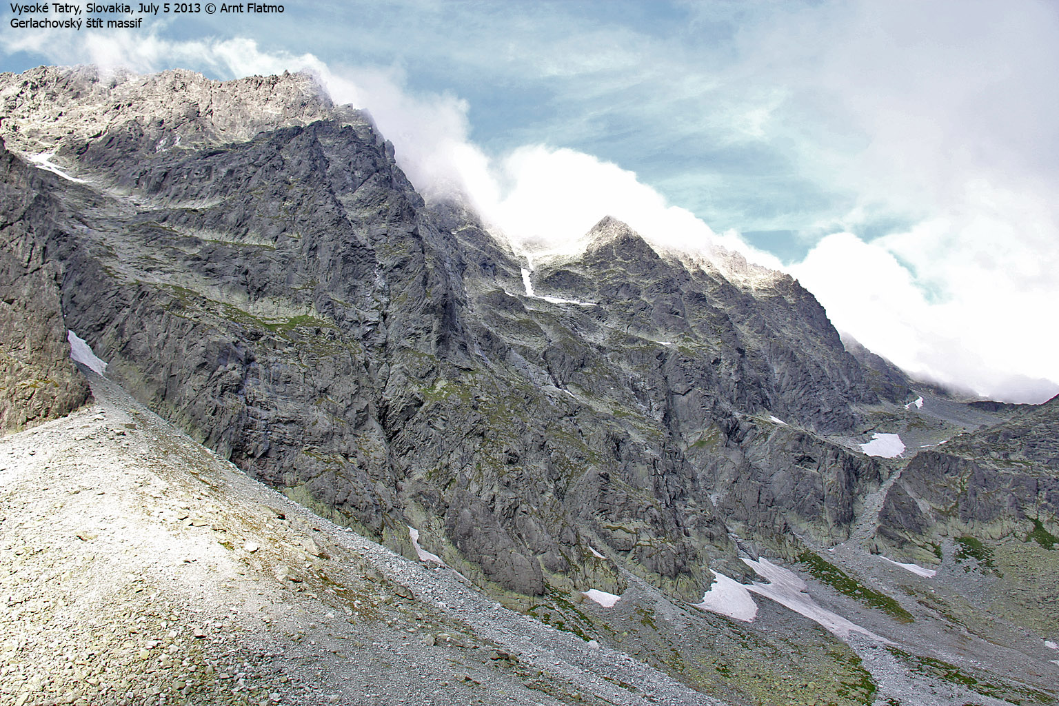
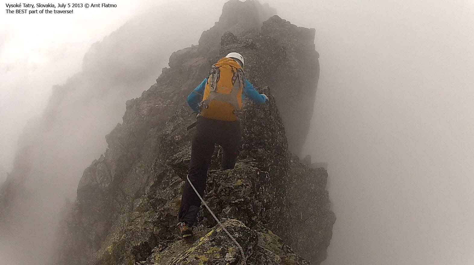
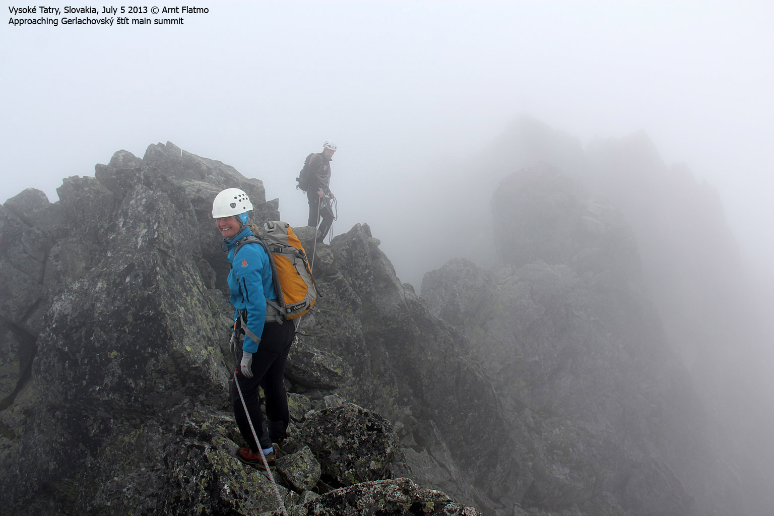
Eventually, we arrived on Zadny Gerlachovský štít - the "hinter peak", and 2640m according to Summitpost. Everything was so overwhelming, but we felt that the main summit was close. The direct distance between the peaks is only 300 meters, but the hiking distance is of course a bit longer.
The descent into the Tetmajerovo Sedlo saddle (2590m according to Summitpost) was easy enough, but we got a big spook when we saw the ridge coming out of the fog and rising up to the main summit. But I could soon tell that this ridge had plenty of good handholds and that it would be just good fun altogether. I don't have a picture of this ridge, but you can see it here.
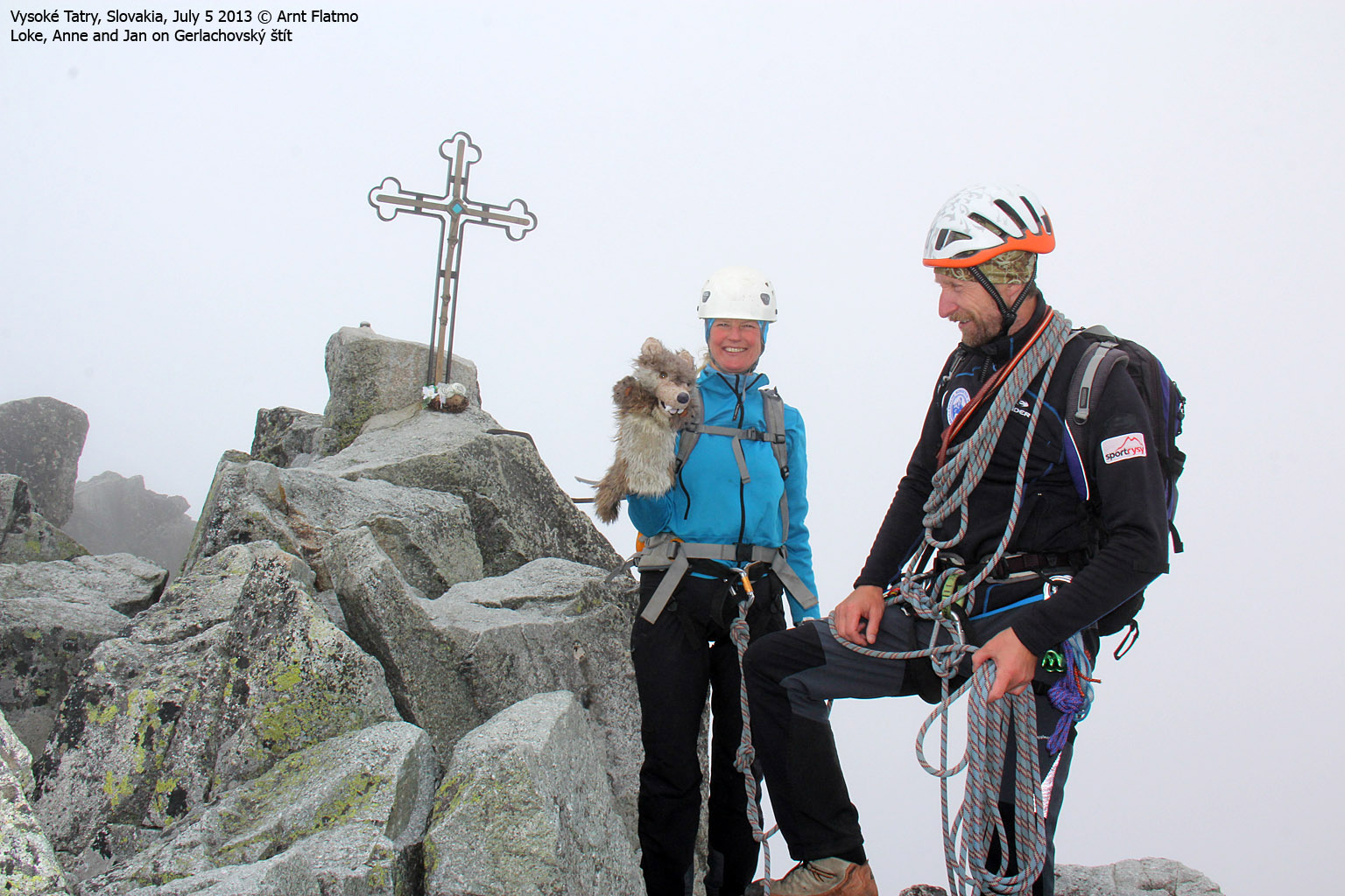
We arrived on Gerlachovský štít summit at 11am sharp - approx. 4h:45m after heading out from Sliezcky Dom. I was happy, but wasn't able to celebrate. For three reasons; a) I never celebrate on top of the mountain (long story...), b) a steep descent awaited us and c) I had a strong headache - a combination of too little water and feeling the altitude. I didn't get those altitude genes at birth....

On top of Gerlachovský štít!
(Click for larger image)
Our rag wolf Loke was of course with us on this epic trip. We carry him around for good fortune and ... no wait ... that's just BS. He's just so cool...
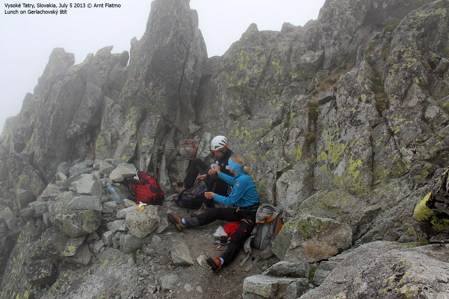
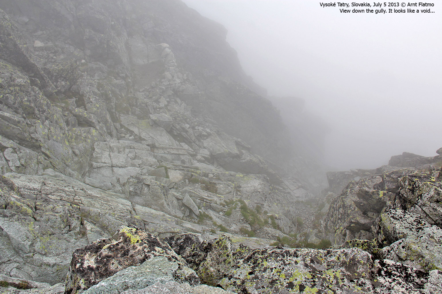
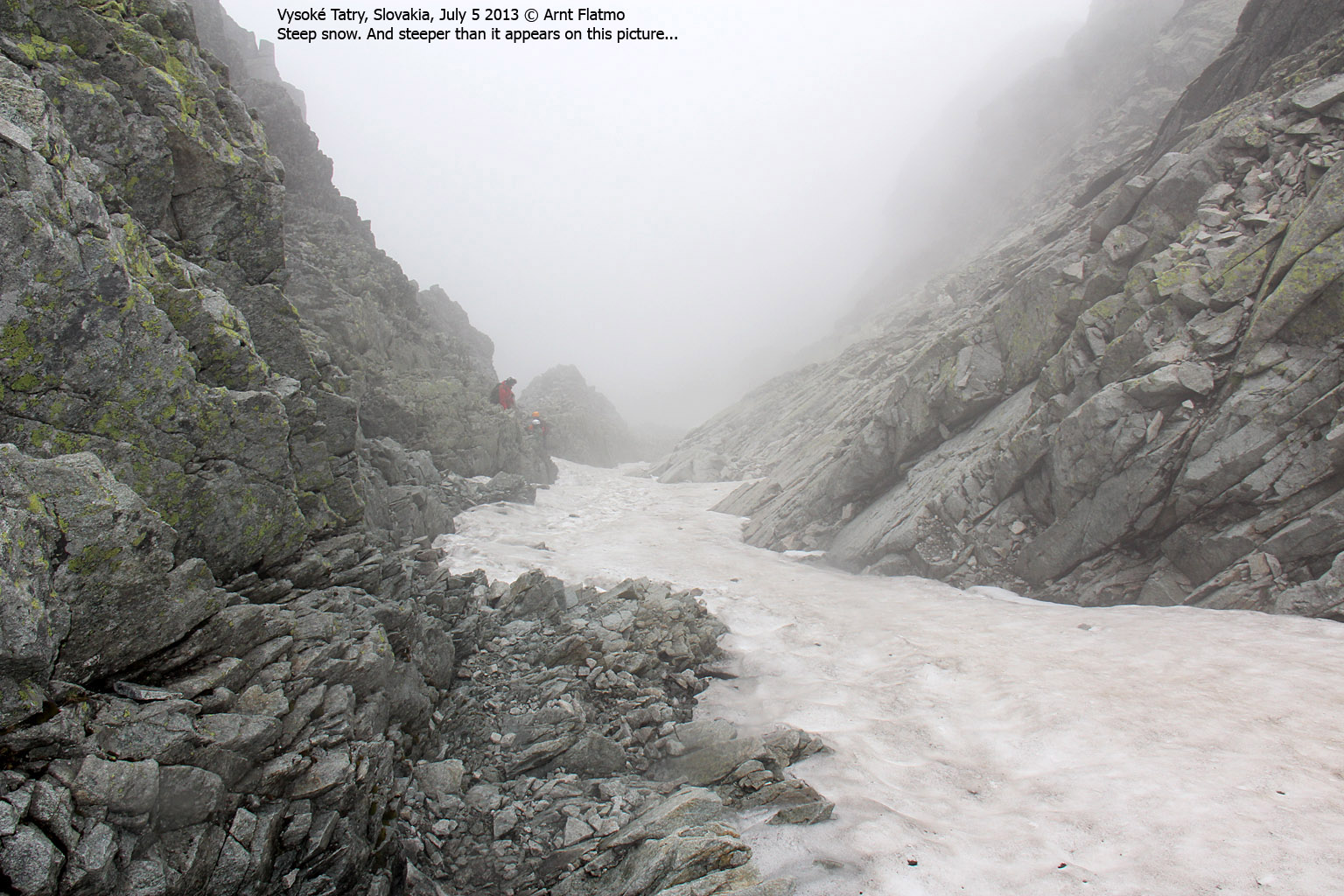
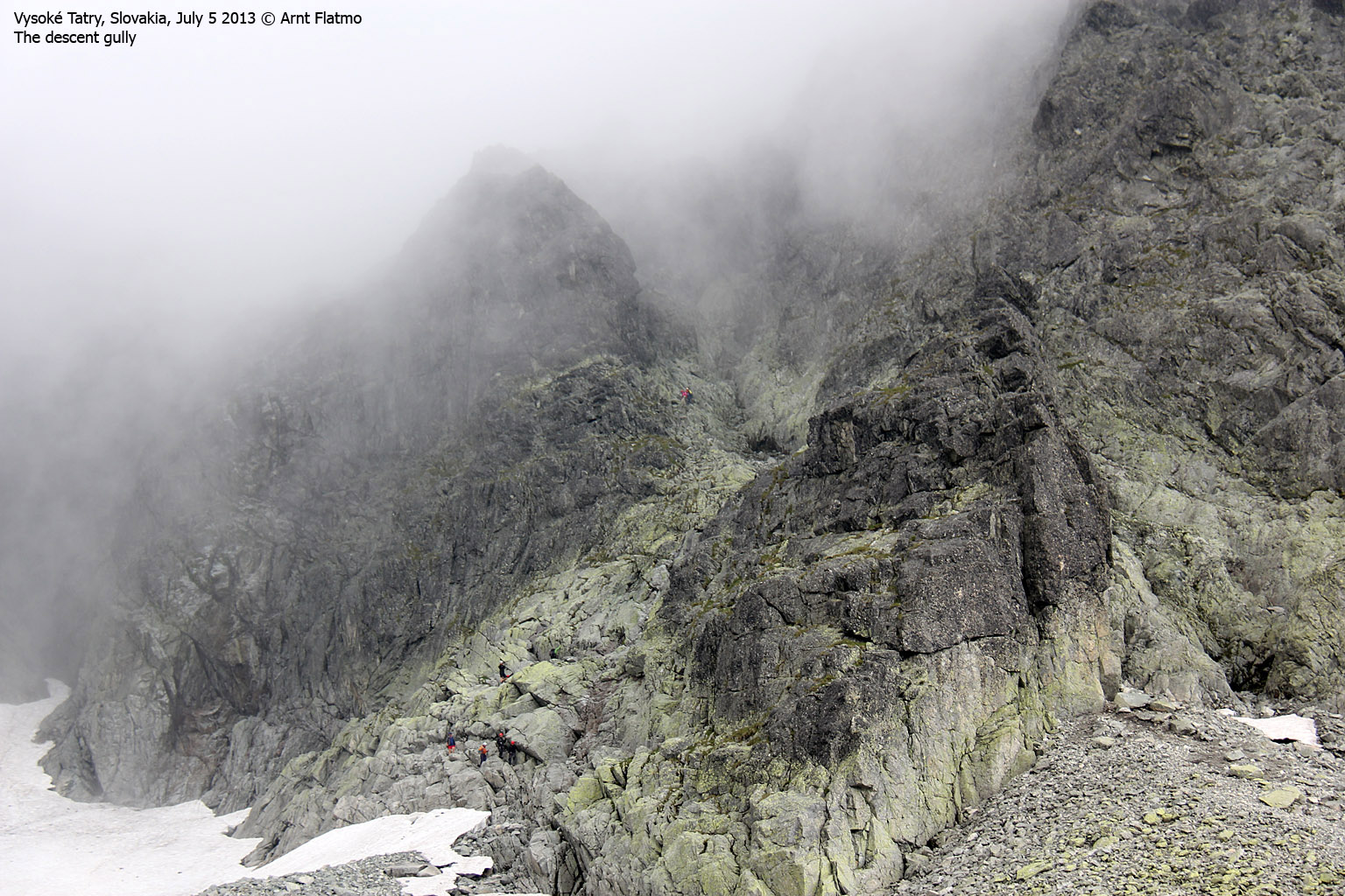
We had lunch below the summit cross and I must admit I was in a hurry to a) descend to a lower elevation and b) get hold of some water. We started moving at 11:30am and descended into a steep gully and there were quite a number of people in it. Focus was of course on not kicking any loose rocks, but also not to fall.
Then the gully went from steep to vertical and I gasped before realizing that there were fixed aids in place...

On top of Gerlachovský štít!
(Click for larger image)
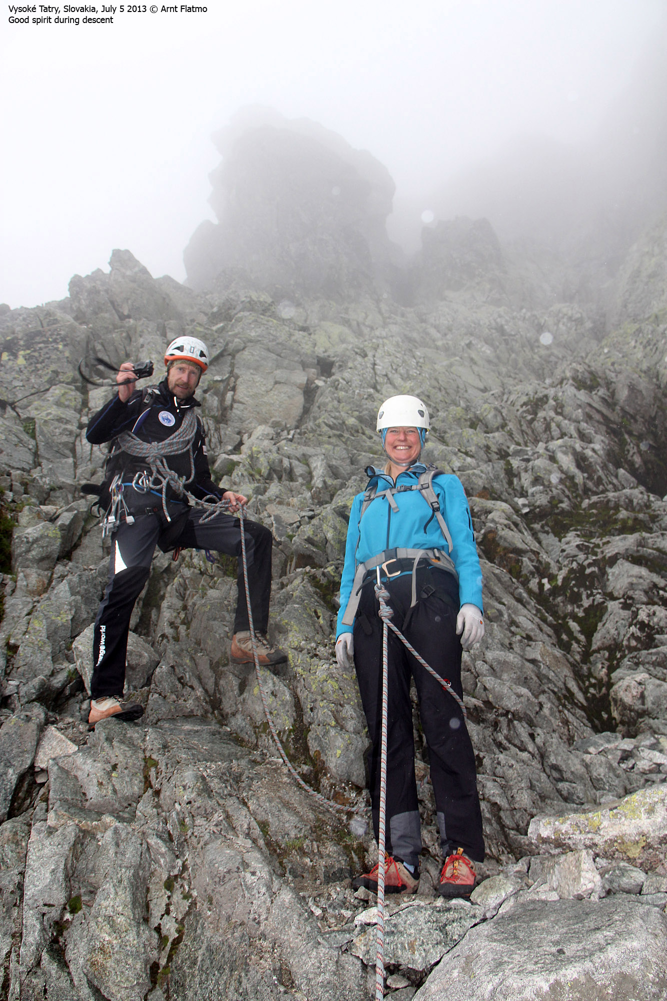
The descent went well. We passed numerous people and I really felt sorry for some of the guides - in terms of their clients. We would be having dinner while they were still on the mountain.
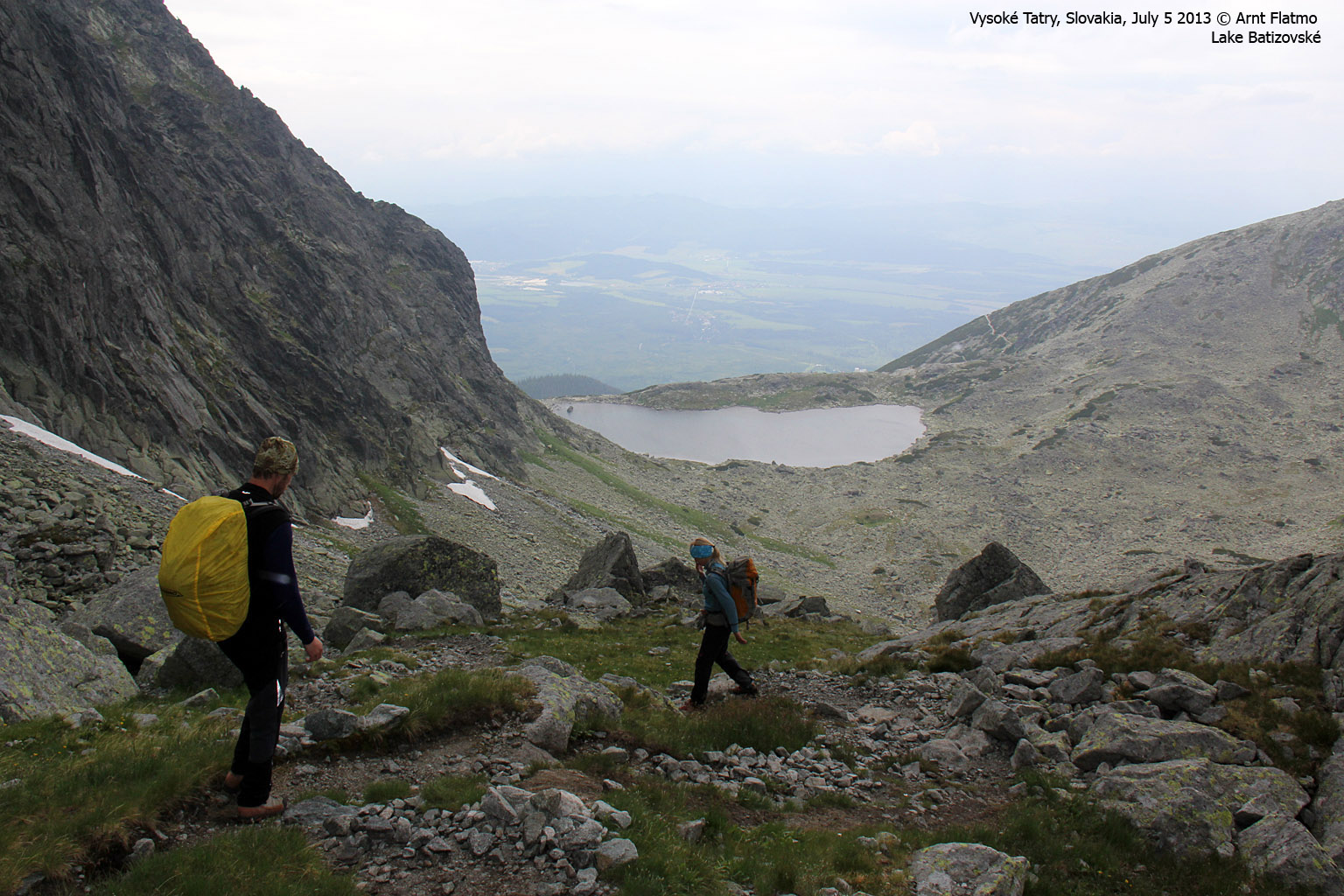
The very lower part of the descent route (before entering Batizovské valley) called for some caution. Rain had made the rock wet and it was slippery. Down by lake Batizovské Pleso, we took our climbing gear off and followed the marked path back to Sliezcky Dom. My thirst had been satisfied and the altitude was much more humane, and the headache was slowly letting go.

The lower part of the descent route
(Click for larger image)
We returned to Sliezcky Dom 2pm sharp - 7h:45m after heading out. The shuttle bus wasn't leaving for a good while yet, so there was time to go into the hotel and enjoy something to drink. Afterwards, Jan drove us to the mountain guide's office in Starý Smokovec, where we received our diploma. That was a very nice gesture of him!

Anne's diploma and a celebration drink - given to us by friends in Norway
(Click for larger image)
And after that... dinner out! Not to mention debriefing! This had clearly been one of our most spectacular hikes ever, and we had a need to go over it - one more time. We had a lot of thoughts and emotions that we needed to share.

Dinner and debriefing
(Click for larger image)
Next trip report is Slavkovsky štít


