
|

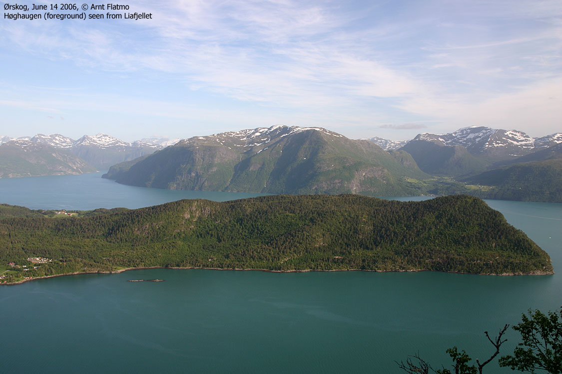
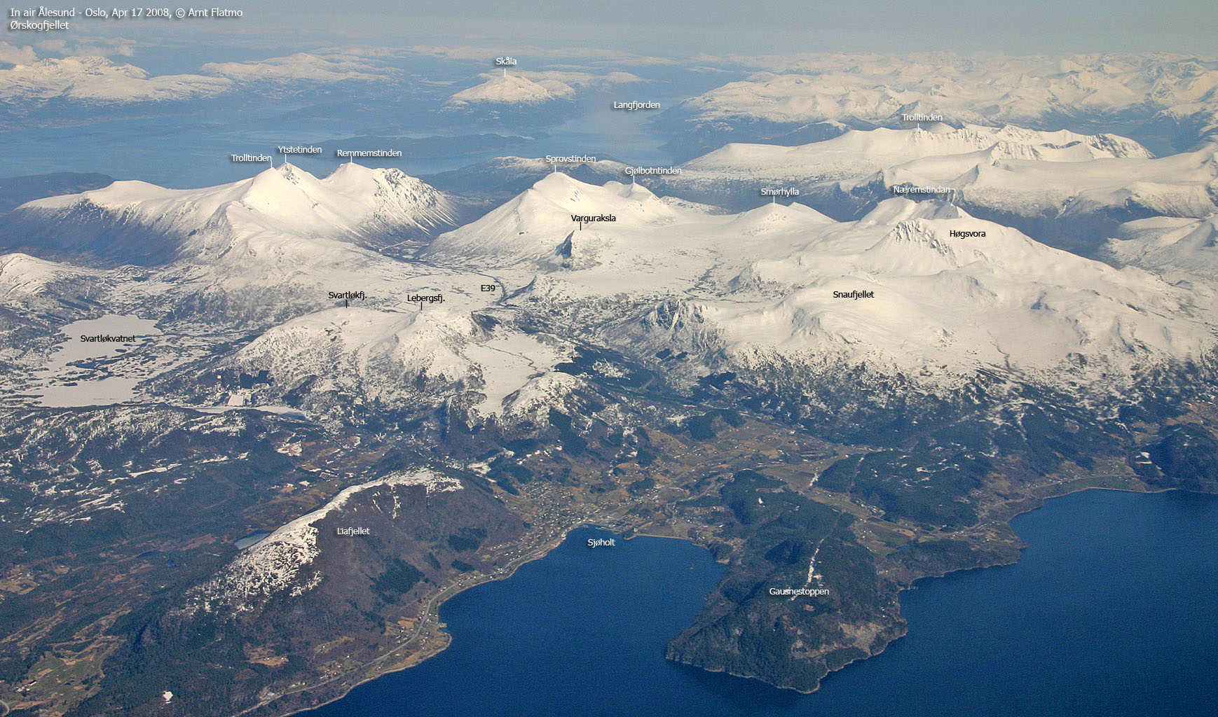
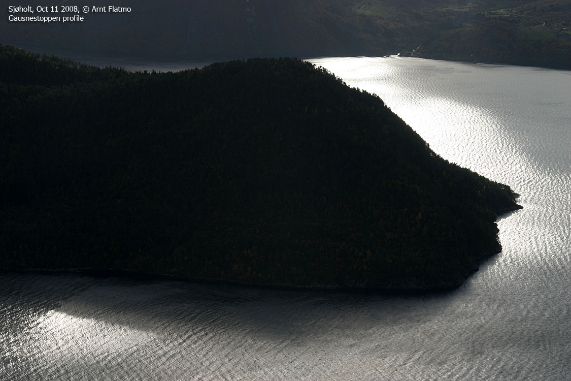
Gausnestoppen is the highest point on a long forest ridge (4Km), defining the south side of Ørskogvika bay by the place Sjøholt. While the forest ridge may be an interesting walk, this page describes the shortest route up to the top.
Most of the route is trivial, and runs on tractor road. Then follows a short section on a vague forest path, before you reach the high point.
In good weather, you can get some good views towards Storfjorden, if you take the time to look for openings between the trees.
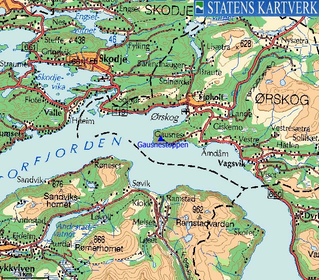
Gausnestoppen (Norge 1:50,000: 287m, Økonomisk Kartverk: 287,05m, UTM 32 V 385540 6927780) has a primary factor of 224m towards the higher parent Snaufjellet (893m). The defining saddle (approx. 32 V 388894 6929157) is found by the Giskemo road junction. Ref. Økonomisk Kartverk (5m contours), the saddle is within the range 60-65m, interpolated to 63m.
Google's interactive map. You can zoom, pan and click on the markers.
Notes: Class ratings are in reference to YDS. Click here for more information.
The trails described below are not necessarily the *easiest* trails to this mountain.
|
Gausneset - Gausnestoppen
|
|
Access
From Ålesund, follow highway E136->E39 towards Åndalsnes. From the E136/E39/Olsvika roundabout near Breivka, follow E39 28Km to the RV650 junction just after Sjøholt. Turn right onto RV650 (Geiranger/Stordal) and continue approx. 2,6Km on this road. Turn right towards "Gausneset" and drive 2,3Km. You should now see a tractor road on the right hand side. You can find parking 50m ahead, on the left-hand side.
The route
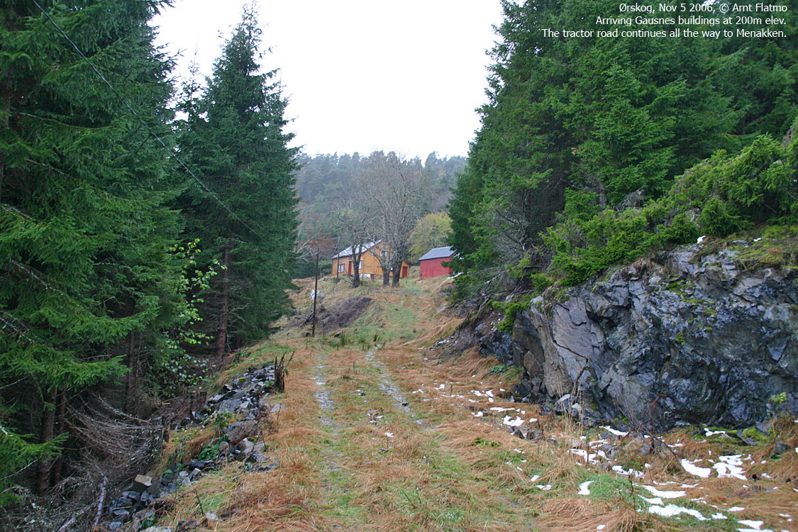
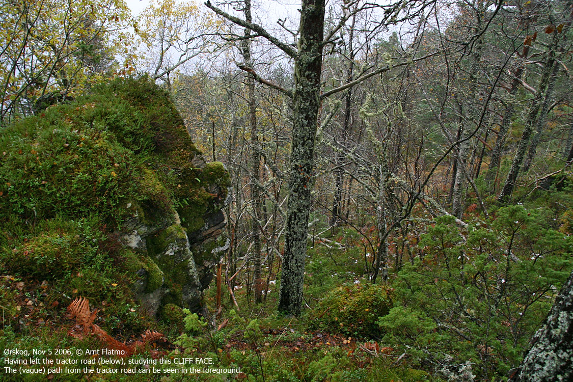
Follow the tractor road up to the Gausnes buildings at 200m elevation. The road continues up to the Menakken hill. 50m BEFORE Menakken, look for a vague path up to your right. You may see the results of a small landslide, and this is just after a distinct boulder area. This path will take you up to the upper forest, and you pass a cliff face along the way. Once past the cliff face, turn left and head off-trail (don't spend time looking for the path) and head northwest up to the high point, marked by a naked rock with two bolts.
In case of low visibility, use the highest power mast for reference. Descend your ascent route.


No Javascript:
 westcoastpeaks.com
Other Møre & Romsdal mountains
Other Norwegian mountains
westcoastpeaks.com
Other Møre & Romsdal mountains
Other Norwegian mountains

