
Norwegian Mountains, Møre og RomsdalGamlemsveten, 791m

Gamlemsveten
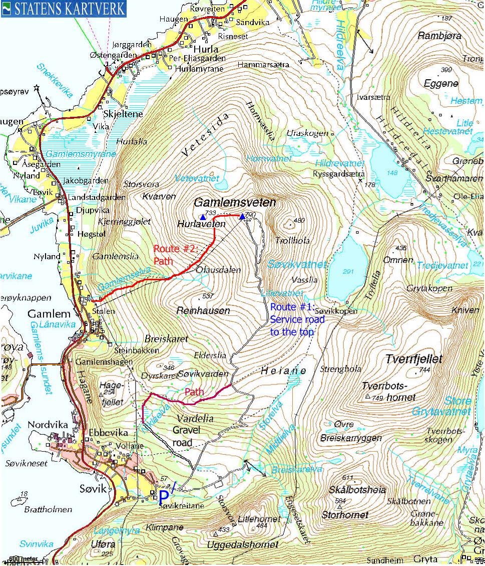
SignalenGamlemsveten is foremost known as a mountain with a lot of transmitting equipment on top, and a road up to it. The mountain is the westernmost of the Haram kommune mainland mountains, and is the 5th highest independent mountain top in Haram kommune (municipality). The summit has equipment for TV and radio (built in the early sixties and is feeds signal to the greater Sunnmøre and Romsdal districts), naval/maritime, air traffic, cell phones, pagers and more. Camping on top might not be healthy... The name reflects the place Gamlem, located west of the mountain. "Veten" is a common name for mountains and hills that were part of the old coastal defense system. In older times, you would here find a vete, that is to say a signal-fire (beacon), designated by the king. In times of war, the vete would receive light-signals from the signal-fires further out by the coast. Ålesund is the nearest city, and while the Gamlemsveten summit is located only 14Km northeast of downtown Ålesund, you have to drive (nearly) all the way to Vatne before you can turn west towards Søvik, where the normal road to the top begins. The main Gamlemsveten trailhead is also the trailhead for Tverrbotshornet, which has a very fine and distinct southwest ridge. The trail to Tverrbotshornet leaves the Gamlemsveten road at approx. 400m. There are several trails up to Gamlemsveten. In addition to the service road leading to the top, this web page will also describe a route on path from Gamlem.

Gamlemsveten
Gamlemsveten (Norge 1:50,000: 790m, Økonomisk Kartverk.: 790,77m ~ 791m, UTM 32 V 362146 6941118) has a primary factor of 598m towards the higher parent mountain Storfjellet (950m). The defining saddle (approx. UTM 32 V 367655 6936982) is found south of Lake Gjersetvatnet, located between Hildrehesten and Håvikhornet. Ref. Økonomisk Kartverk (5m contours), the saddle is within the range 190m-195m, interpolated to 193m.
Google mapGoogle's interactive map. You can zoom, pan and click on the markers.
Trail descriptions
Notes: Class ratings are in reference to YDS. Click here for more information.
The trails described below are not necessarily the *easiest* trails to this mountain.

Gamlemsveten and the mountain road
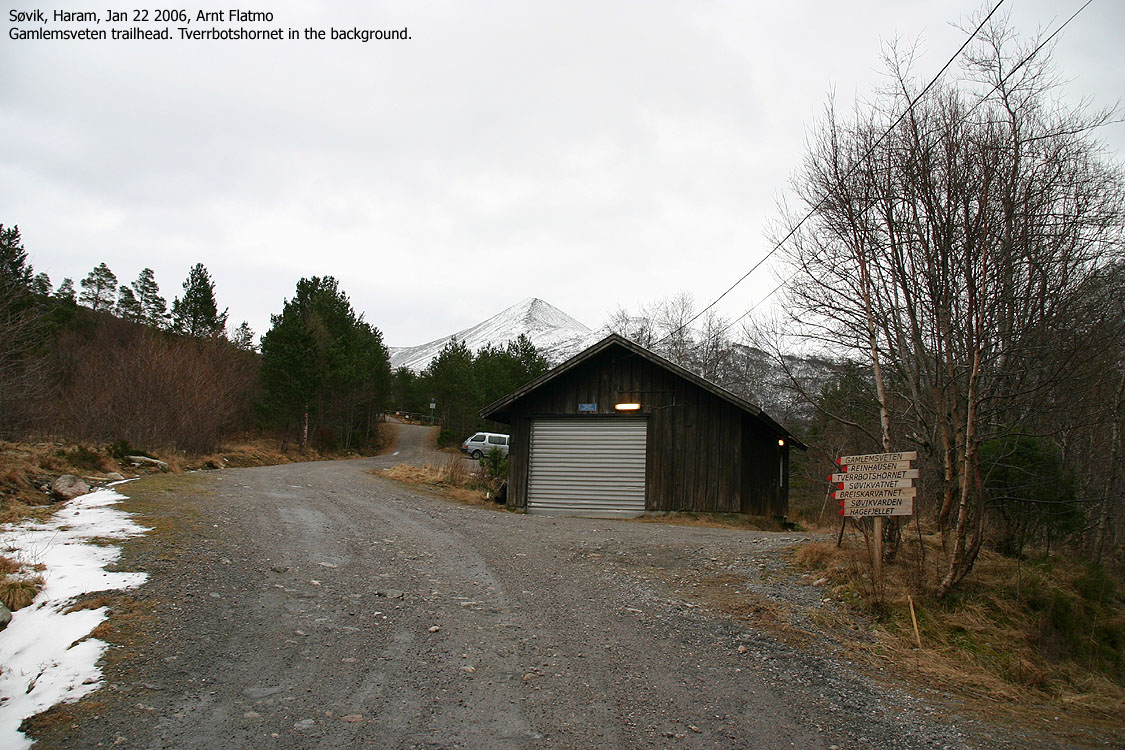
Access (all distances are approx. distances) From Ålesund, follow highway E136->E39 towards Åndalsnes. From the E136/E39/Olsvika roundabout near Breivka, follow E39 approx. 13,3Km. Turn left onto highway RV661 (Skodje/Brattvåg/Vatne). After 1,5Km, pay toll at an unmanned toll booth (coins + credit cards + AutoPass). Approx. 9,7Km after you left E39, you reach the RV659 (Brattvåg)/661(Vatne) junction. Turn left here. Follow 659 4,3Km and turn left towards "Søvik/Grytastranda". Drive 14,4Km along this road and turn right when you see the "Sentrum" sign in Søvik. Follow the main road 500m and turn 90 deg. left when you see a large, red barn on your right-hand side. You're now on the road to the trailhead. Stay on the main road for 600 more meters (you cross a creek along the way) until you reach a 3-way junction. Follow the middle road and follow the gravel road up to the trailhead (the road gate). Don't attempt to drive further, even if the gate is open. You will find parking just before the gate. An alternative driving route from Ålesund is to drive via Ellingsøya. The Ellingsøytunnelen toll is (per Jan 2006) NOK 60,- (passenger cars, one person) thus, NOK 30,- more expensive than by driving E39. The route Follow the road to the top. Consider including Tverrbotshornet on your hike. The (large) summit cairn is located just west of the summit buildings. Pictures from this route can be seen here and here.

The Gamlemsveten path from Gamlem
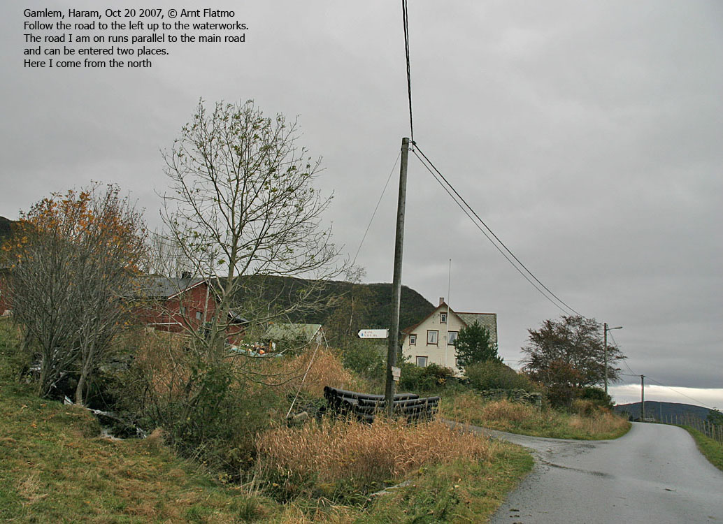
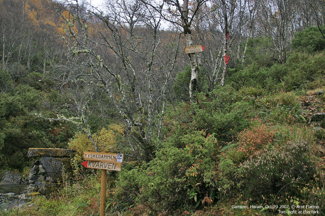
Access (all distances are approx. distances) From Ålesund, follow highway E136->E39 towards Åndalsnes. From the E136/E39/Olsvika roundabout near Breivka, follow E39 approx. 13,3Km. Turn left onto highway RV661 (Skodje/Brattvåg/Vatne). After 1,5Km, pay toll at an unmanned toll booth (coins + credit cards + AutoPass). Approx. 9,7Km after you left E39, you reach the RV659 (Brattvåg)/661(Vatne) junction. Turn left here. Follow 659 4,3Km and turn left towards "Søvik/Grytastranda". Drive 15,9Km along this road and turn right when you see the "Pyrofabrikken", 1,5Km after you've passed the "Sentrum" sign in Søvik. Take the first road to the left, drive 500m, and turn right onto a narrow road signed R.ANL. (Renseanlegg, picture is taken from the north). Drive up this road. At the first fork, turn right and park the car at road end. An alternative driving route from Ålesund is to drive via Ellingsøya. The Ellingsøytunnelen toll is (per Jan 2006) NOK 60,- (passenger cars, one person) thus, NOK 30,- more expensive than by driving E39. The route Just before the parking, follow a road leading up to a building. Turn right by this building and follow a path into the forest, marked with red paint on rocks. Follow the forest path along the river up to a fork at 150m elevation. Turn right. There is another fork at 370m elevation. Turn left. Cross the creek at 400m elevation and follow the path below the powerline up to 630m elevation, where the path now runs in the direction of Hurlaveten. The path fades away on the meadow between Hurlaveten and Gamlemsveten. Pay a visit to the Hurlaveten cairn, before following Gamlemsveten's west ridge up to the top. A faint path takes you around on the south side, avoiding the worst boulder terrain. Pictures from this route can be seen here.
Trip reports and pictures
|


