European mountains
|
| Location : | Vidzemes, Latvia |
| Maps : | Topo Latvia (Garmin GPS) |
| Primary factor : | >100m |
| Hiked : | May 2010 |
| See also: | www.gaizinkalns.lv (external link) |
Gaizinkalns is the highest point in Latvia, and is located in the Vidzemes Highlands (Uplands) in eastern Latvia. Beyond the capital Riga, Latvia has four regions; Vidzeme, the northeast, Latgale, the southeast, Zemgale, the south; and Kurzeme, the west. Highlands is of course a relative term, as Latvia is quite flat throughout. And as there are no mountains in Latvia, the Latvian language does not have a word for a mountain either. The word kalns is used to describe hills that slightly rise above their surroundings.
Gaizinkalns is not a very challenging hill; After a 900 metre, 10-15 minute walk (60 metres elevation gain), you are on top of Latvia, and on the 2nd highest point in the Baltic. Suur Munamägi (Great Egg Hill") in Estonia rises 6 metres higher than Gaizinkalns.

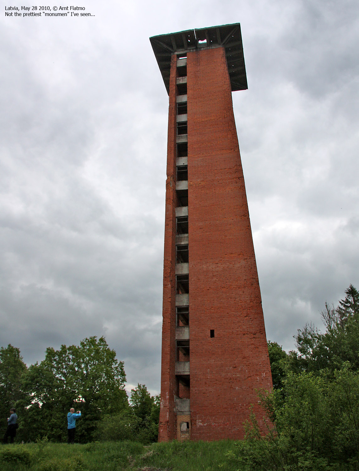
A 45m high watchtower from the cold war rises above Gaizinkalns' highest point. It is not allowed to enter, and for your own safety, you should not challenge this restriction.
In winter, people come to this area for skiing and snowboarding, and there is even a ski-lift. Gaizinkalns is a popular skiing destination in the Baltic region. The slopes (such as Lielais Golgats and Mazais Golgats) are - by any standards - moderately steep and long...

Gaizinkalns (Internet & map sources: 312m, N56.87024 E25.95995) has a primary factor of more than 100m. The saddle towards a higher mountain has not yet been identified, but the 200m contour completely encircles the hill, so by international standards, Gaizinkalns is an independent mountain/hill.
GPS measurement read 309m (on the marker - ~60m high), averaged over a 5-minute period (error margin +/-4m).

Google's interactive map. You can zoom, pan and click on the markers.
|
|
|
These route description are valid per May 2010. All distances are approx.
|
Route 1: Gaizinkalns
|
Access
If you start out from Riga, a rental car is a practical option. You can also get to Gaizinkalns by bus. Check out the Gaizinkalns page on summitpost.org for more information.
The best route from Riga is perhaps the A6 to the east. This road follows the Daugava river to Plavinas. Just east of Plavinas, the A6 continues south towards Daugavpils, while P37 continues to the northeast. In this fork (N56.61892 E25.82288), turn left on P37 and then follow this road approx. 28km to the P37 (Vestiena) /P81 (Madona) fork (N56.61892 E25.82288) just east of Berzaune. Turn left onto P81, follow this road 800m into Berzaune, then turn right towards Gaizinkalns (signposted). Follow a 12km unpaved road to the Gaizinkalns visitor centre and find parking. The total driving distance from Riga is approx. 170km.
An alternative, and more direct (129km) route from Riga runs via Ergli and Vestiena, but the road quality (mostly unpaved per May 2010) is not so good. Both routes are shown on the below picture from Google Earth.

The route

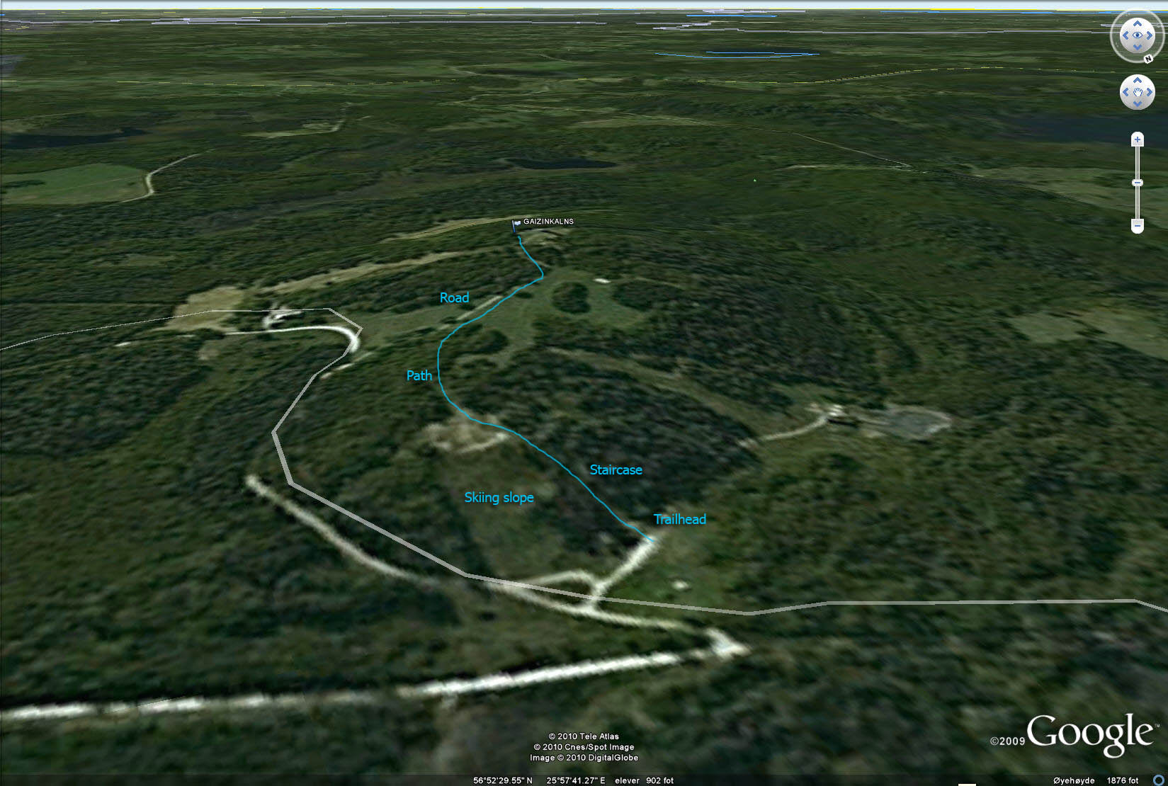
From the visitor centre, follow staircases up to the top of the Golgata slope. Then locate the "Zaka pastalas" path that descends to an unpaved road coming up from the northwest. Follow this road to the top. In addition to the watchtower (which seems to collapse any day now), there is a also a marker with inscriptions. Do not enter the watchtower.
 westcoastpeaks.com
 Other European mountains
 Other Norwegian mountains