
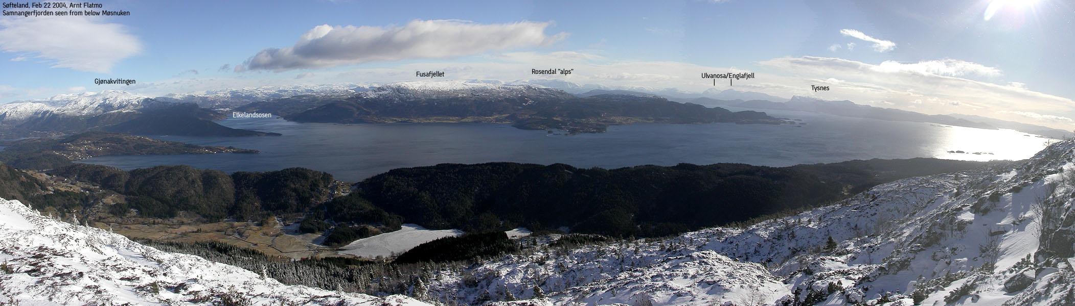
|

Bogafjellet to the right of Fusafjellet(No Javascript) |
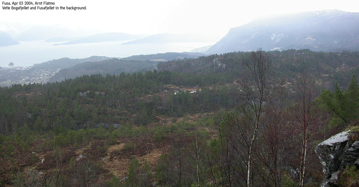
Bogafjellet is a forest hill on the Fusa peninsula (Fusahalvøya), and the southernmost mountain (as defined on this web-site) on this peninsula. The summit barely makes it above the timberline, but Bogafjellet is a popular destination for people living in the area (as seen in the summit register).
The Bogafjellet map height is 438m, but this is the trig. point. The high point is located 300m northeast, and is measured to 443,5m on the Norgesglasset 5m contour map.
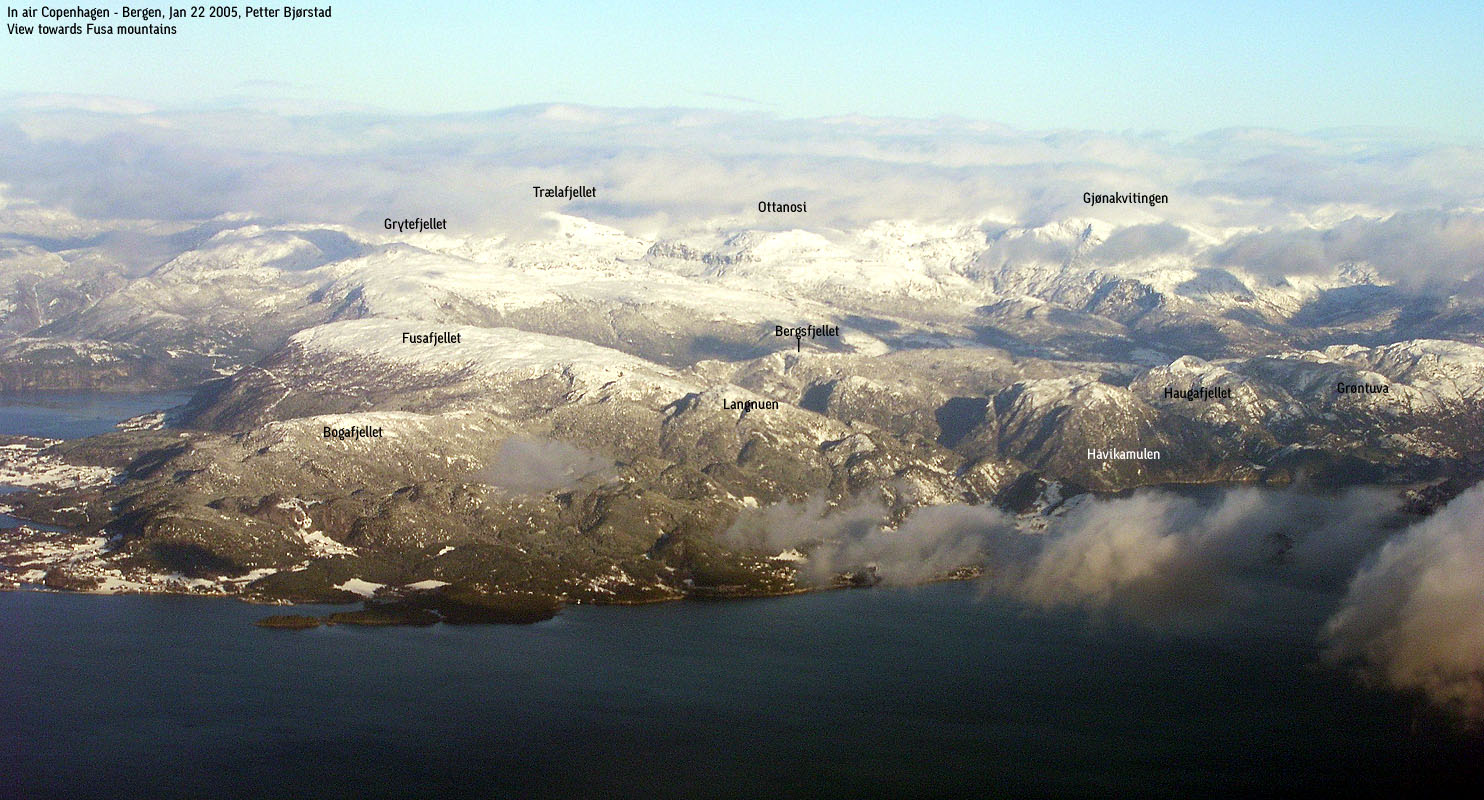
Bogafjellet (M711: -, Ø.K: 443,5 ~ 444m) has a primary factor of 145m towards the higher Fusafjellet. Ref. Økonomisk Kartverk (5m contours), the saddle is a 299m fixed point near Grautkjerringa. On the M711 map, you will see a 438m trig. point, but this is not the high point.
Note: Class ratings are in reference to YDS (Yosemite Decimal System).
Note: The trail described below is not necessarily the easiest trail to this mountain.
|
Haga/Storli - Bogafjellet (summer)
|
|
Access
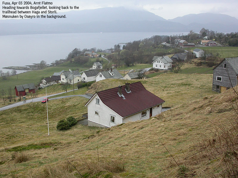
From Bergen, follow highway E39 southbound towards Osøyro. From Osøyro continue towards Hattvika (4,6Km) and take the Hattvikka - Venjaneset ferry. From Venjaneset, drive approx. 1,3Km and exit right towards "Strandvik/Håvik". Drive approx 1,1Km until you see a rack of mailboxes on your right and a bus-stop sign on your left. Just before the bus-stop sign, you will see a gravel road going up towards a few houses. You will be going up here. Find parking down by the road or nearby.
The route
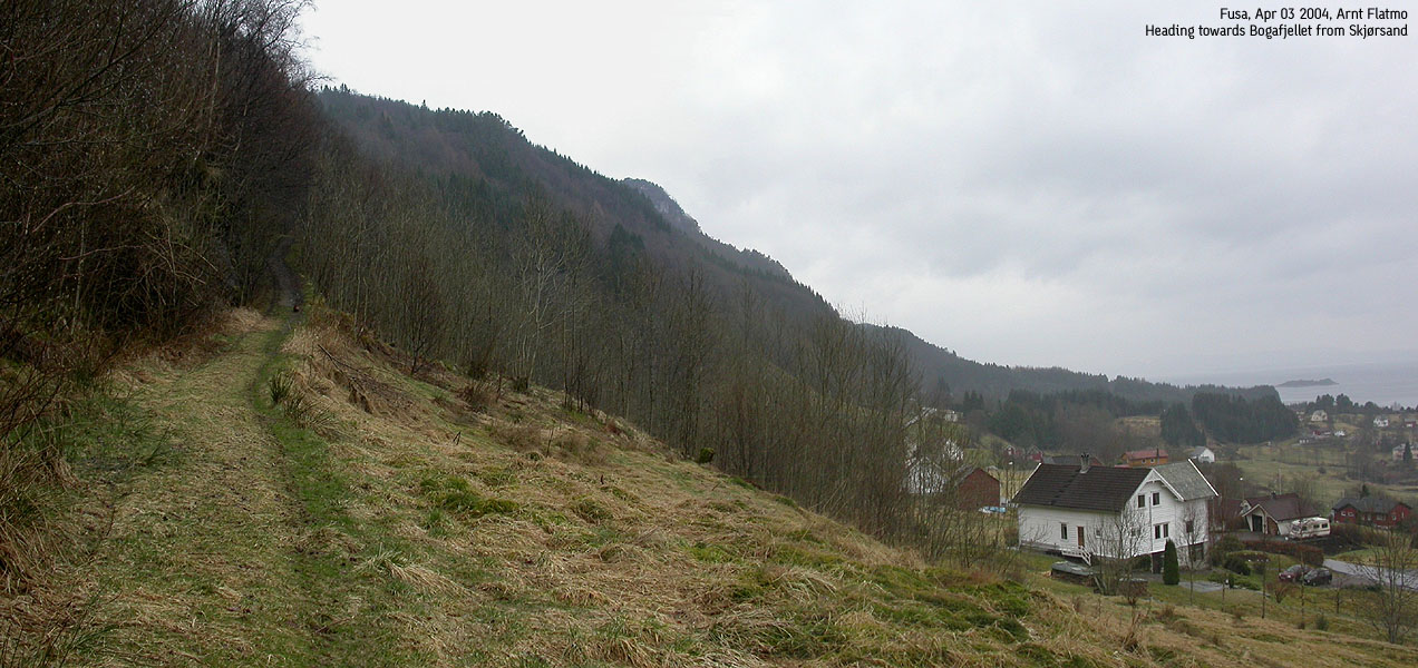
Continue up to the houses. A forest road begins just behind the houses. Follow the forest road upwards until you have a fence on your right hand side. Notice a forest trail going up along the fence. Leave the forest road and follow the forest trail.
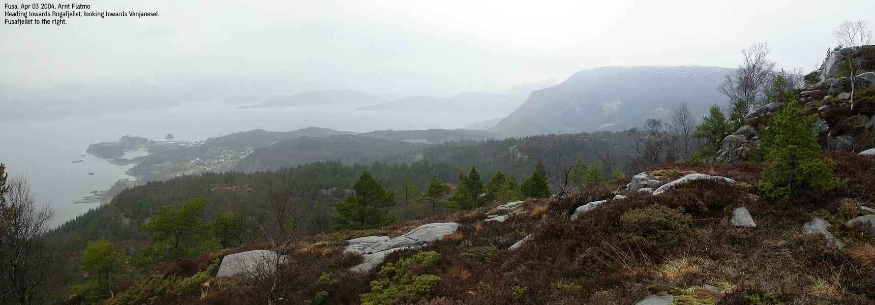
Follow the forest trail until you join another forest road at 190m elevation. Turn right and follow the forest road until it ends. At road end, turn sharp left and follow a path up through the forest. The path turns towards the right and soon takes you above the timberline. Follow a vague path across a meadow.
The path takes you down to a boggy field where you have cliffs on your left. Stick with the cliffs up to the next plateau. You may lose the path here. At the next plateau, you are facing the cliffs below Bogafjellet. Straight ahead, you see a distinct gully. If you go up here, you will have a class 3 section ahead of you. You will find a fixed rope there, but you may not need it. If does not appeal to you, seek 50m further left and you will find a path that takes you safely up.
Once up continue to the 638m trig. point and then towards the 444m high point 300m further northeast. Descend your ascent route.
After a week with spectacualar weather, the week-end just *had* to turn out shitty. Rain was the dominant factor this Saturday, and I just decided to go for a walk across Vidden. I prepared the backpack and just as I was heading out the door, I grabbed the Fusa map. I would decide on the destination by the time I turned the car key.
My choice fell on Bogafjellet in Fusa, not really a long drive. A quick drive to Osøyro, a short ferry across Samnangerfjorden and 5 minutes drive on the other side. I had not found any trails on the map and asked a few (3) locals at Skjørsand. They all shook their head and suggested I should hike from Fusa or Strandvik. It would be steep and a lot of bush. They did not think going up from Skjørsand would be a good idea.
Because of the depressing weather, I wanted a quick hike and ignored any kind of advice. I found a forest road, started walking 15:15PM and noticed a forest trail that branched from this road. I decided to follow it. Then I ran into a larger forest road, clearly running in the right direction. At the end of the road I picked up another forest trail. "This is going quite well", I was thinking to myself. I had reached 300m elevation on trail. I wondered why they were so pessimistic. My mind wandered off, and I pictured I would stumble across a moonshine factory up in the forest. I snapped out of it. Fusa is not Kentucky.
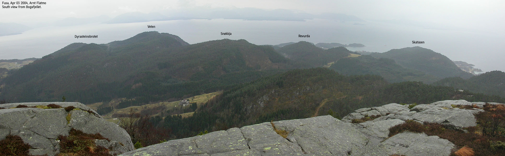
When I ran into some wetlands by some characteristic cliffs, I lost the trail. I noticed a distinct gully much higher up, and decided to follow the cliffs towards this gully. It is much easier to backtrack when there are familiar signs. I expected the gully to be trivial, but ran into noteworthy obstacles high in the gully. A rope was hanging down. Somebody had been here before. For an eager hiker, the obstacle was fairly unproblematic (class 3), but you would get pretty banged up if you were to fall. It was more problematic to ascend this cliff with a dog. I ignored the rope, as it did me no good anyway.
I pushed the dog up to the first ledge and climbed after him. Then I moved him to ledge further to my left. Once in place, there was no more room for the owner, and I had to climb up the cliff, then descend again to haul the dog up. I decided that I would find another way down. We arrived the trig. point 16:25PM, and I was convinced we had hit the summit. I looked around, and nothing looked higher. At this point, I should have checked the map, and found a 640m contour further northeast.
I didn't, and turned back around. It was cold and windy, and we both wanted to get back to civilization. On my way down, I stumbled across a path that took us safely down 50m further east of the troublesome cliff. I wondered why the heck someone had put up a rope when a safe route was available nearby. After a quick hike down the forest, we were back at the car 17:00PM. Since the plan was just to hike a local mountain in Bergen, I hadn't brought any extra clothes. This was stupid. The ferry was just 5 minutes away, which is not enough to warm my car. Besides, it is bad ethics to keep the car running while waiting for the ferry. I was steaming, and the windows fogged in. I opened the window, and me and the dog was freezing for a good thirty minutes. And then additional 15-20 minutes on the ferry across the fjord. Dogs have some recipies for a cold day. They form a circle with their nose buried up their ass, and through hyperventilation, it seems they come up with a satisfying condition. Difficult for humans, I concluded, looking forward to get the engine running.
Move cursor to read notes, and click on the images to see full version.
Some of the thumbnails may have been cropped to fit the format.
Pictures are presented in the order they were taken.


No Javascript:


No Javascript:
 Other hordaland mountains
Other Fusa K. mountains
westcoastpeaks.com
Other hordaland mountains
Other Fusa K. mountains
westcoastpeaks.com

