
|


Along with Blåhorna (Heimste and Fremste), Overvollshornet and Flosteinnibba dominate the mountain region east of Strandadalen and west of Synnylvsfjorden. As Flosteinnibba rises more than 1500m above the fjord and its central location on Sunnmøre, the views are indeed extensive. From point 1378m and up to Flosteinnibba, you can watch boats on Synnylvsfjorden, 1400-1500m below you.
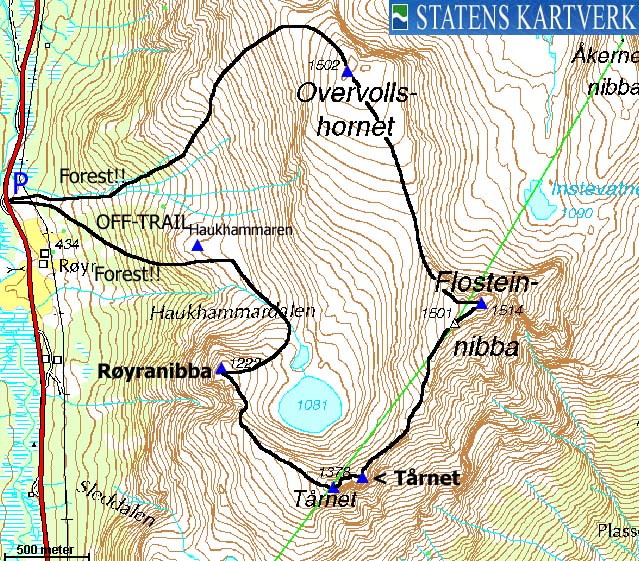
Tårnet and point 1378m (no name) are twin tops located southwest of Flosteinnibba, while point 1222m (called Røyranibba in the local region) is almost to the west of Flosteinnibba. All these tops form a "horseshoe" around Lake 1081m which drains to Haukhammardalen valley.
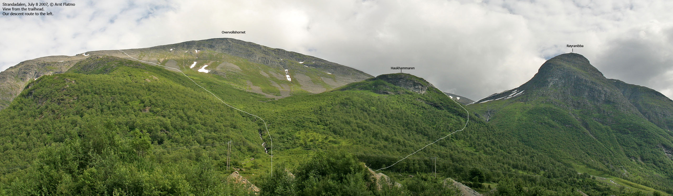
Due to rocky terrain on the mountain and dense forest below, it is perhaps more convenient to visit Overvollshornet and Flosteinnibba on skis. Strandadalen is the mandatory starting point, but there are various routes up to the mountains. A frequently used route to the mountain region is via Fjørstaddalen valley, between Blåhorna and Overvollshornet/Flosteinnibba.
This web page will describe an off-trail roundtrip hike (summer/autumn) from Røyr, via point 1222m (Røyranibba), point 1378m, Tårnet, Flosteinnibba and Overvollshornet. Finding a good route through the forest is the challenge for this roundtrip. You can also read about this route in the book Fotturrar på Sunnmøre.


Flosteinnibba (Norge 1:50,000: 1514m, Økonomisk Kartverk: 1515,64m ~ 1516m, UTM 32 V 394681 6896402) has a primary factor of 748m, towards the higher parent mountain Skruven (1584m). The saddle (approx. UTM 32 V 392189 6892451) is found 4,7km to the southwest, between Kjerringane and Tindbjørgheiane. Ref. Økonomisk Kartverk (20m contours), the saddle is within the range 760-780m, interpolated to 770m.
Overvollshornet (Norge 1:50,000: 1502m, Økonomisk Kartverk: 1502m, UTM 32 V 393922 6897819) has a primary factor of 152m, towards the higher parent mountain Flosteinnibba (1516m). The saddle (approx. UTM 32 V 394274 6896808) is found between the two tops. Ref. Norge 1:50,000 (20m contours), the saddle is defined within the range 1340-1360m, interpolated to 1350m.
Røyranibba, Tårnet and Point 1378m have primary factors less than 100m (less than 70m too) and are not considered as primary tops on this website. Tårnet's height (no map height) is estimated to be approx. 3m lower than point 1378m. As for Flosteinnibba, personal GPS measurement on top of the cairn read 1519m, which may indicate that the ØK height (1516m) is more accurate than the 1:50,000 height (1514m). GPS measurement on Overvollshornet read 1502m (on the ground).
Google's interactive map. You can zoom, pan and click on the markers.
Notes: Class ratings are in reference to YDS. Click here for more information.
The trails described below are not necessarily the *easiest* trails to this mountain.
|
Strandadalen - all tops via Haukhammardalen (summer/autumn)
|
|
Access
(all distances are approx. distances)
From Ålesund, follow highway E39 towards Bergen, and then highway RV60 (Stranda) to the Magerholm - Ørsneset ferry. This ferry runs quite often; every 20 minutes in the busy hours of the day. From Ørsneset, follow RV60 (Stranda) approx. 34,4Km to Stranda. Turn right and follow highway RV60 southbound approx. 14,5Km until you have piles of sand (Fonnvern on your left-hand side. If you come from the south, this is 3,7Km north of the northern entrance to the Ljønibbtunnelen tunnel. Find parking alongside the road.


The route
The forest section of this roundtrip is cumbersome and only recommended to those who understand exactly what that means...
To Røyranibba:
From the piles of sand, you need to find a good route up Haukhammaren's south side. Initially, the forest is open, but the ground can be cumbersome (holes, turfs, high grass). As you gain elevation, the terrain gets steeper and the forest gets more dense. If you're not able to find the easiest route up to Haukhammaren, the route's grade can easily increase to YDS class 3.
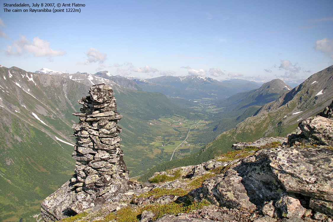
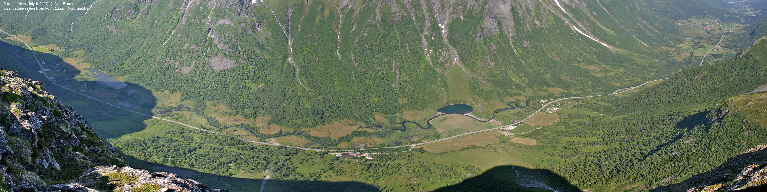
Once you rise above the forest just below Haukhammaren, your ascent problems are over. Follow the drain from Lake 1081m and reach Røyranibba via its eastern ridge. Røyranibba has a proper cairn and offers great views towards Strandadalen valley.
To 1378m & Tårnet:
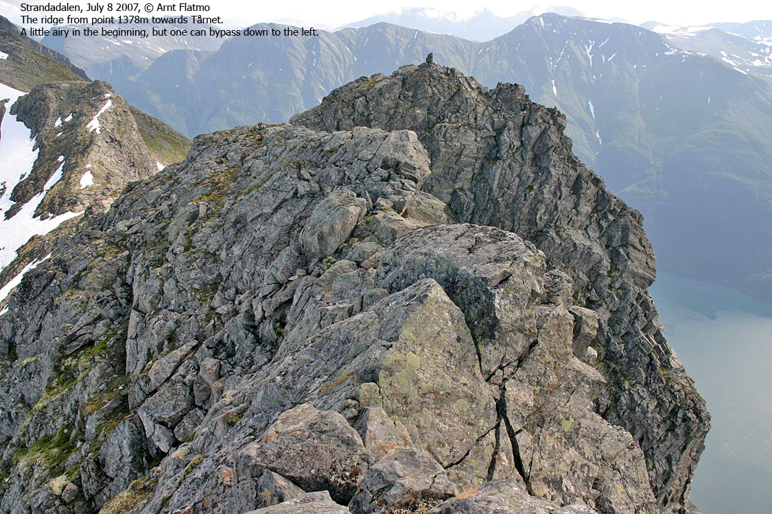
From Røyranibba, follow the obvious ridge towards point 1378m. On this top, you have a good overview of the high route. You can follow the ridge towards Tårnet, which is a little airy in the beginning. You can bypass this section on your left-hand side.
The route up to Tårnet is easy scrambling. The overall route is actually YDS class 2 (on the easiest route), but has been set to 2+ in case of forest problems, and to emphasize that the route between point 1378m and Tårnet is somewhat more advanced than just an off-trail walk. Both 1378m and Tårnet are marked by cairns.
To Flosteinnibba & Overvollshornet:
The ridge from Tårnet to Flosteinnibba is uncomplicated. Flosteinnibba is marked by a proper cairn and you have exceptional view down towards Synnylvsfjorden. Continue towards Overvollshornet on small-boulder terrain. Overvollshornet's summit is flat, and it can be difficult to determine the exact high point. There are viewpoint cairns all around. UTM point 32 V 393922 6897819 should be very close to the high point.
Descent:
Follow Overvollshornet's north ridge down to 1380-1400m, where you turn southwest and descend along a broad ridge. Gradually descend into the valley north of Haukhammaren. Proceed along streams if you find that useful. Expect to fight your way through the birch forest.
 westcoastpeaks.com
Other Møre & Romsdal mountains
Other Norwegian mountains
westcoastpeaks.com
Other Møre & Romsdal mountains
Other Norwegian mountains

