
Norwegian Mountains, Sogn og Fjordane
Flistrahornet, Sandvikhornet & Venøya, Mar 3 2012
To the main Kvamfjellet/Flistrahornet/Sandvikhornet/Venøya page (maps, pictures, other trip reports)

The Flistrahornet route, as seen in Google Earth
(Click for larger image)
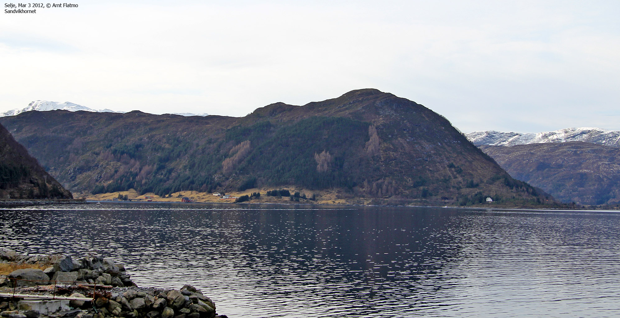
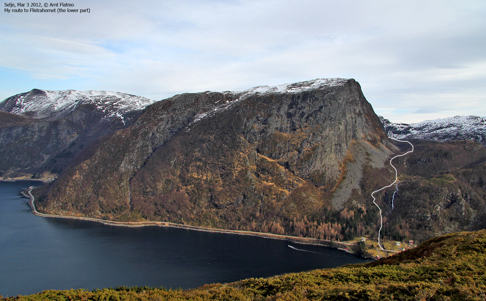
This was the 5th weekend in 2012 that I headed in the direction of Vanylven/Stadlandet/Selje. Lots of tops still to do down there. The goal for this weekend was to make some serious progress on my list of Selje tops, and I had my eyes on Flistrahornet, Sandvikhornet and Venøya.
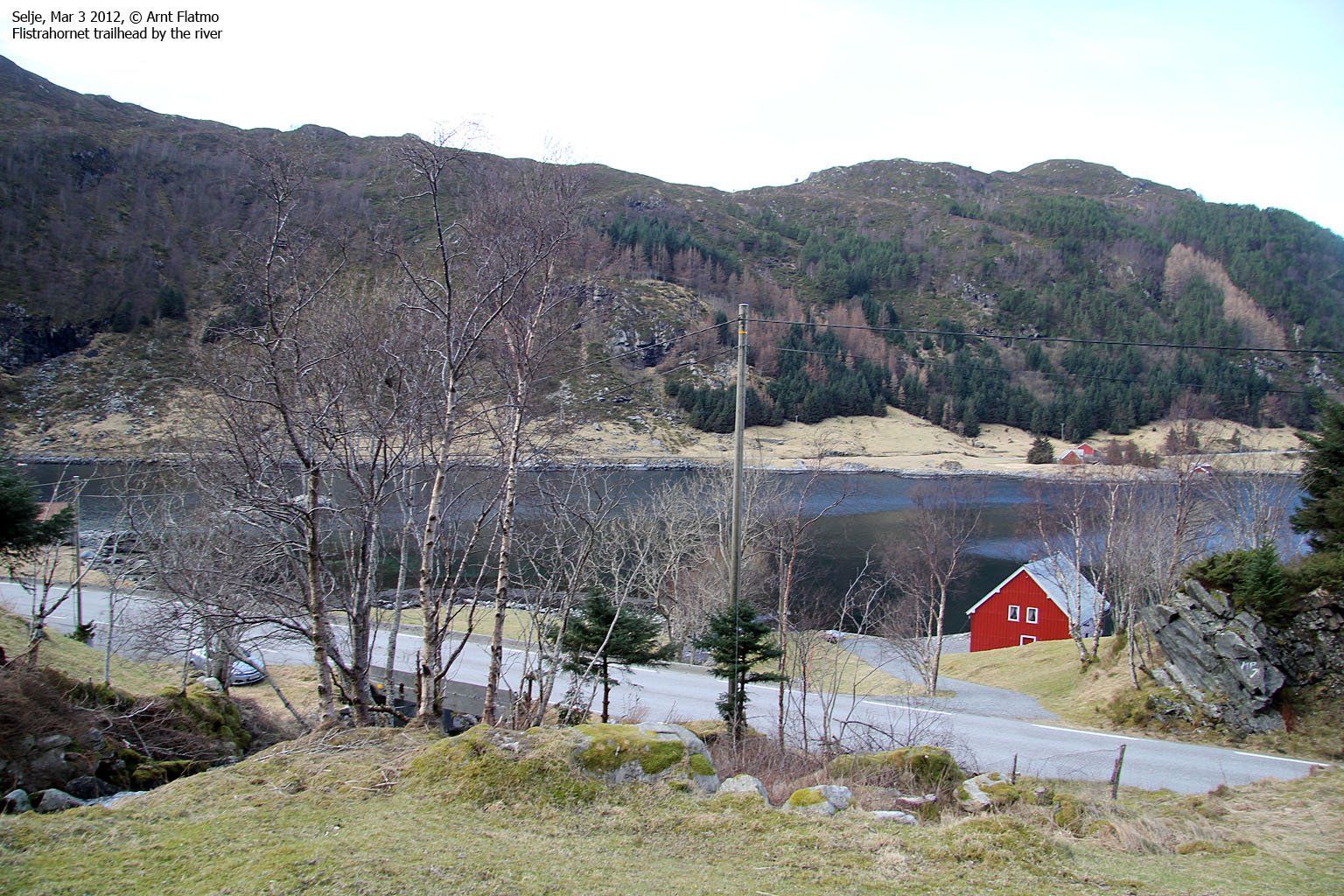
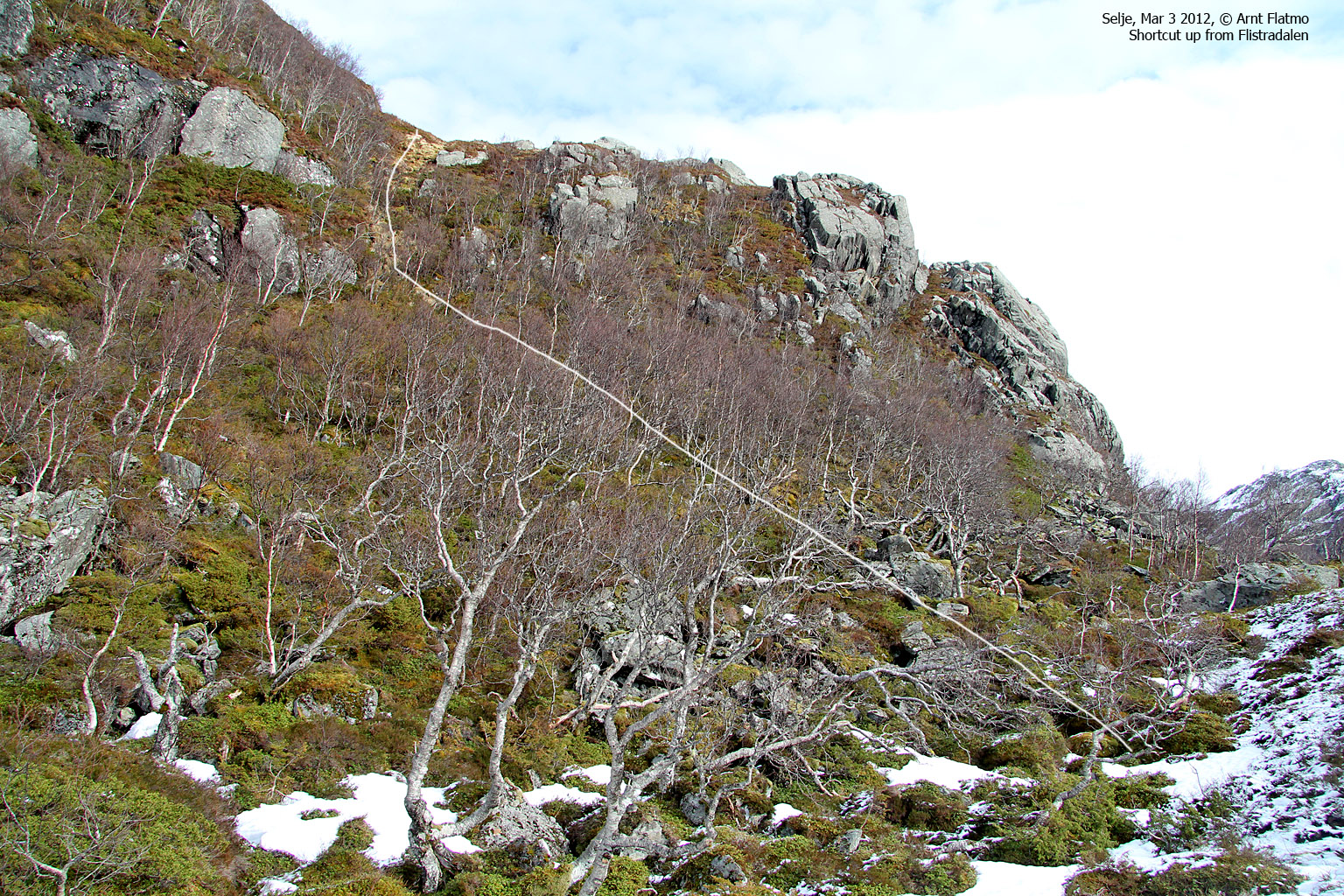
The weather was just great, and I decided to start with the highest top (Flistrahornet) first. I drove to Øyra and after having a nice chat - asked a couple of (senior) locals if there was a path up the forest. I got a long answer which contained, yes, no, maybe, good trail, hard to find, etc. etc. I decided to try my luck along the river and after walking 5 meters I found a most excellent path and a fat T. It was probably some years ago they were up on the mountain....
It was a most impressive rock face I had above me, and the man I spoke to said that B A S E jumpers had come here to check out the mountain, but concluded that the local winds were too dangerous.

Flistrahornet
(Click for larger image)
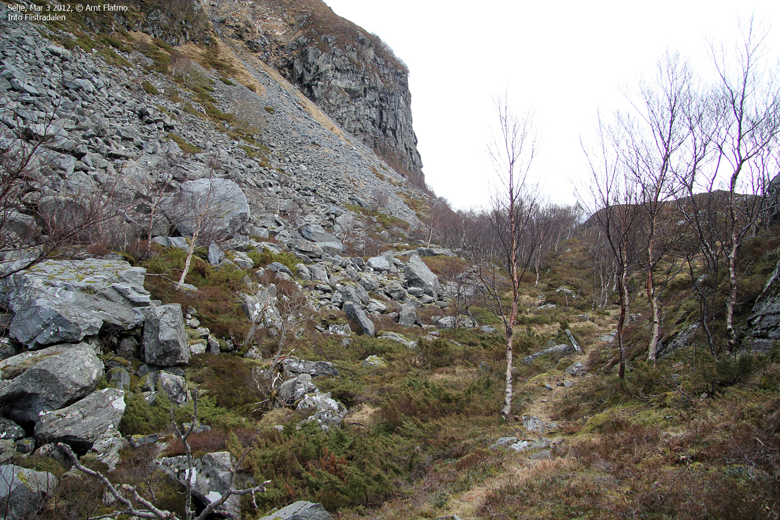
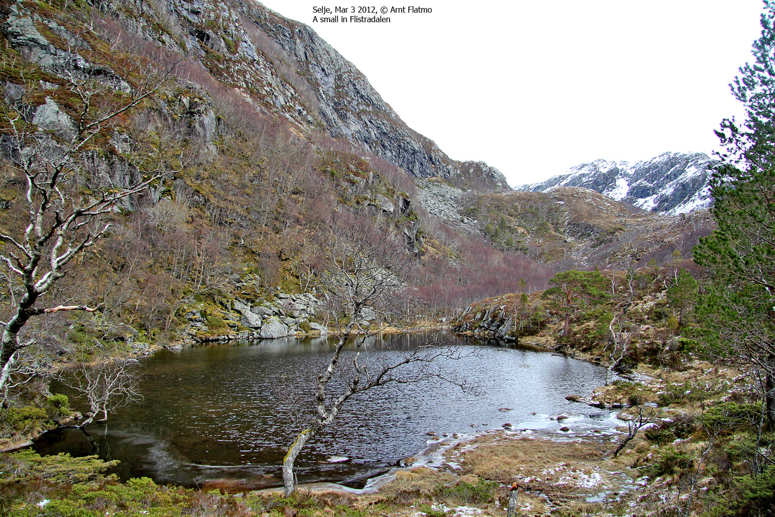
I left the trailhead 11:30am and had a nice walk up the forest and arrived at a rocky bridge which gave me a good fjord view. I did not cross the bridge, but continued upwards through a boulder area. The path gradually faded away, but I didn't really need one. I followed the ridge above the valley floor, passed a small lake and aimed for the first place where I could get to the flank above me. Once on the flank, I found a path which I followed upwards. After a little while I reached snow, but it never amounted to anything more than being a beautiful layer in the sunshine. 12:50pm - 1h:20m after heading out, I reached the top of Flistrahornet.

On top of Flistrahornet
(Click for larger image)
From the top, I had a good view towards my next goal - Sandvikhornet. I descended along my ascent route and was back at the trailhead 1:31pm - 2 hours after heading out. The locals I had spoken to said that if I also wanted to visit Sandvikhornet, I ought to drive to Sandvik and try my luck there.
At Sandvik, I drove up to a house and was met by a German Shepherd which did NOT seem to be inviting me into the house. I decided not to leave the car, and as no one came out for the first couple of minutes, the situation felt a bit silly. Eventually, a woman appeared and I could state my business. The woman told me to where I should start but also said that I would most likely not be able to follow the path up the mountain. I decided to give it a try...

My route down Sandvikhornet
(Click for larger image)
I headed out 1:46pm and learned after a few minutes that the woman was right. I was not able to follow the path and decided to just go straight up the west ridge. The terrain was a bit cumbersome, but not difficult. I crossed a number of tracks - all probably used by deer. 2:26pm, I arrived on top of Sandvikhornet. There was no cairn on Flistrahornet and no cairn here either. Very odd...

Jumping for world peace on Sandvikhornet
(Click for larger image)
My day was progressing according to plan, and now I had only one stop on my to-do list - Venøya. I returned to my Sandvikhornet trailhead 2:50pm and drove 1,1km to Langeneset - the place I figured would give me the shortest route to the island high point.
I reached the top of Venøya 3:07pm - 14 minutes after heading out. I was probably the most aggravating 14 minutes I've had outdoors in 2012. If you're eager to know why, take the trip!

My route to Venøya high point
(Click for larger image)
At 3:15pm, I had 3 new Selje tops in the bag, and looked forward to a nice drive back to Gurskøya - with the top down!

Going home!
(Click for larger image)


