
|

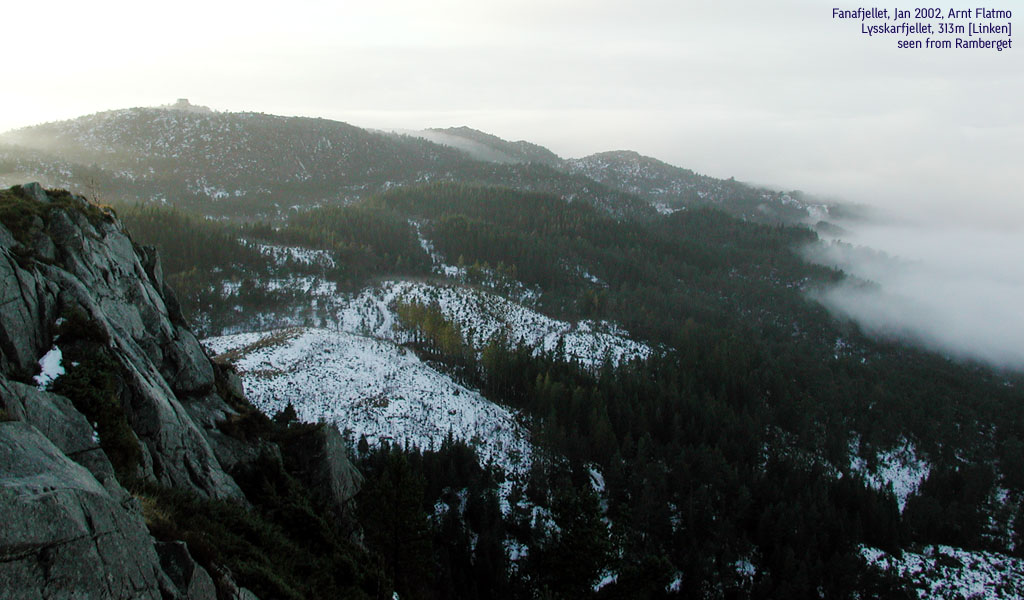
Lyseskarfjellet seen from Ramberget(No Javascript) |
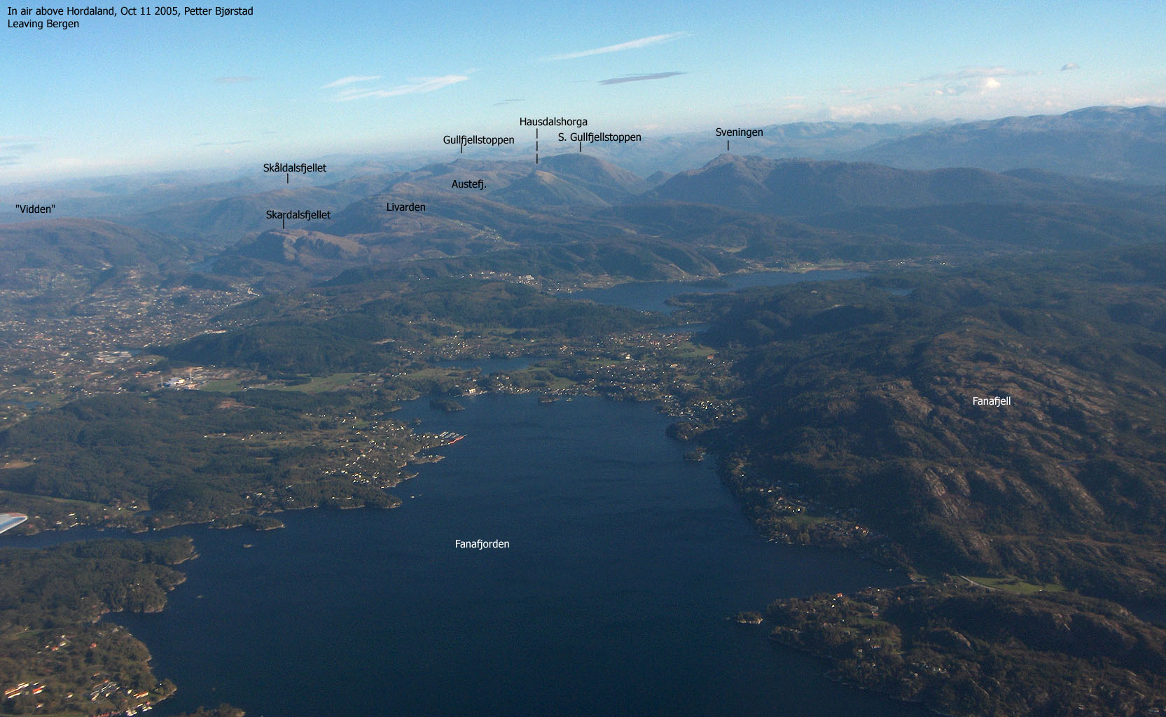
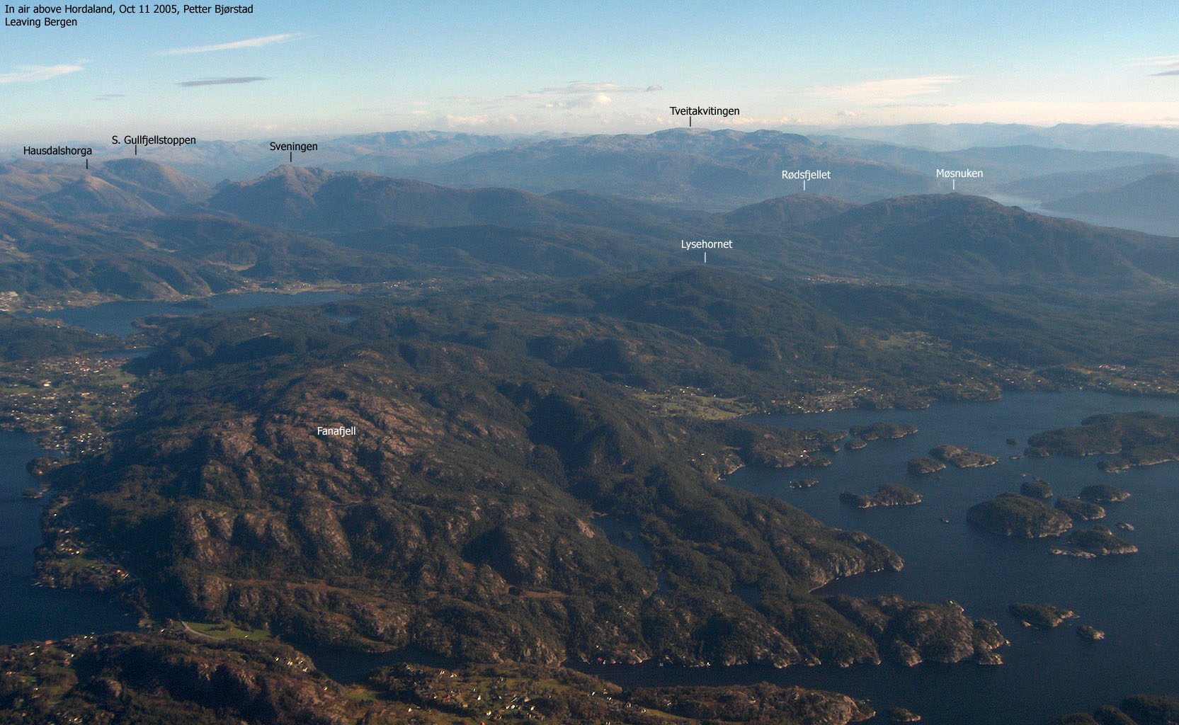
Fanafjellet is the common name for the high forest area east of Fana, northeast of Krokeide and west of Søfteland. A number of trails run across this vast forest area, and is a popular hiking area for people in the district.
Lyseskarfjellet (also known as Lyseskarfjellet and Linken) is not named on the M711 map (1:50 000) from Statens Kartverk. Based on the M711 map, one might get the impression that Høgeåsen (309m) is the highest point on the massif. Based on my own GPS findings, and height used on other local maps, I have assigned the height 313m to the summit. I have also checked the 309m height for Høgeåsen with my GPS. It seems to be fairly correct.
On the Økonomisk Kartverk maps (5m contours), one see that the 300m contours are the highest contours for both Lyseskarfjellet and Høgeåsen. The contours on Høgeåsen seem incomplete. The name Lyseskarfjellet is derived from Økonomisk Kartverk.
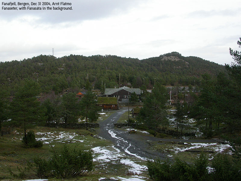
On this page, I will describe a very popular round-trip with Fanaseter as the starting point. The major part of this trail system is also known as Bjargløypen. The booklet "Tyrløyper i Bergens-området", which can be purchased in most bookstores in Bergen, has several pages about this area. There is also a story about the history of Fanaseter.
Lyseskarfjellet (M711: -, Ø.K: - highest contour is 310m, Other maps: 313m) has a primary factor of 160m towards the higher Lysehornet (405m). The saddle is found N of Lake Ulvvatnet. Ref. Økonomisk Kartverk (5m contours), you cross the 155m contours on the high route, but not 150m. The saddle height has been interpolated to 153m.
Høgeåsen (M711: 309m Ø.K: - highest contour is 305m) has a primary factor of 51m towards the higher Lyseskarfjellet (313m). The saddle is found between the two tops (Lyseskaret) Ref. Økonomisk Kartverk (5m contours), you cross the 260m contours on the high route, but not 255m. The saddle height has been interpolated to 258m.
Notes: Class ratings are in reference to YDS. Click here for more information.
The trails described below are not necessarily the *easiest* trails to this mountain.
|
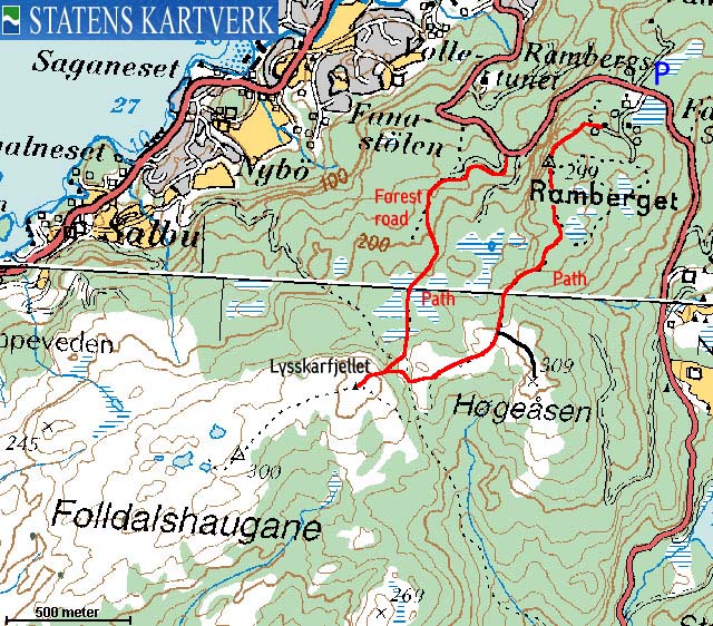
Fanaseter - Ramberget - Høgeåsen - Lyseskarfjellet round-trip (all seasons)
|
|
From Bergen, follow RV580 towards Flesland (airport). After passing Lagunen shopping mall, turn left onto RV553 (Fana/Krokeide). Follow RV553 for approx. 3,7Km. RV553 makes a sharp right turn here. Drive straight ahead and up towards Fanaseter. After 1,6Km from this junction, notice a turn-out on the right hand side of the road, with room for 3 cars. A big rock has red paint on the side. This is where you'll be coming down. Follow the road additional 600m to Fanaseter on top of the hill. Parking is plentiful up here.
Alternative:
From Bergen, follow highway E39 towards Stavanger. At the RV580/E39 junction near Nesttun, follow E39 for 4,4Km. Turn right onto "Hamrevegen". Follow Hamrevegen along lake Kalandseidvatnet for 2,7Km to the Hamrevegen/Kismulvegen junction. Follow this road 1,7Km to the RV553 junction. Turn left and drive approx. 2Km up to Fanaseter. A large parking area is found on the left hand side. Park here.
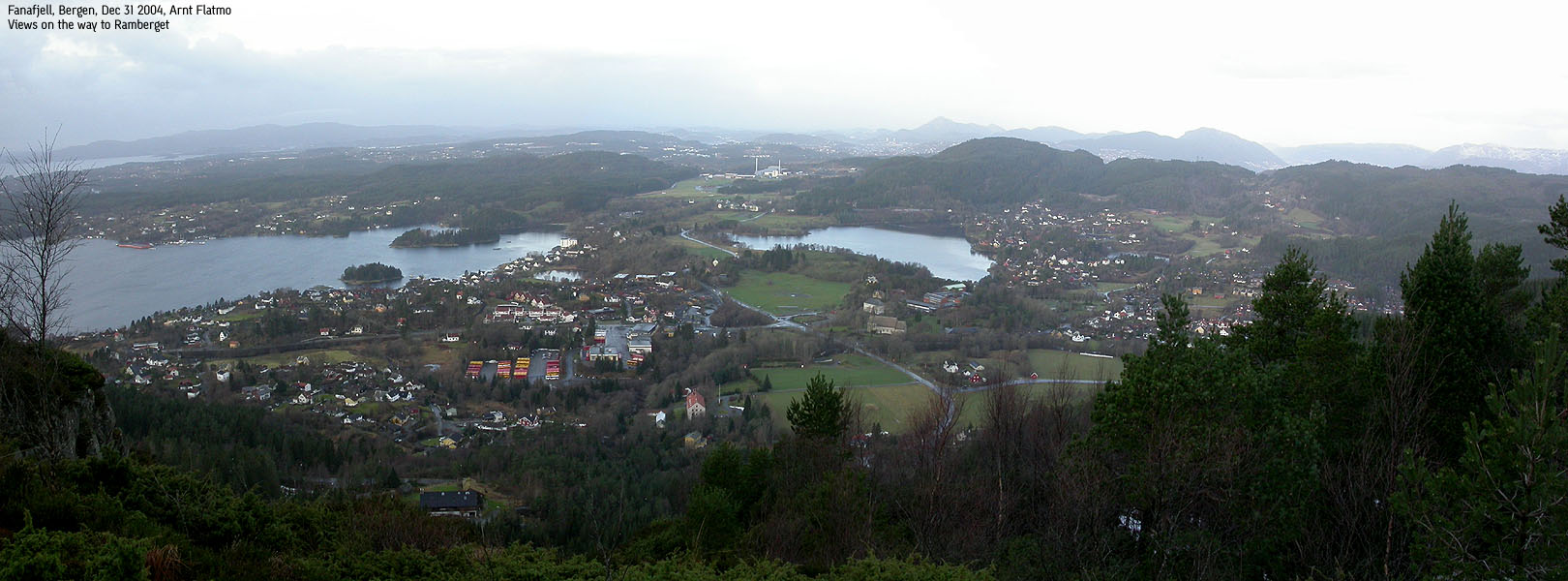
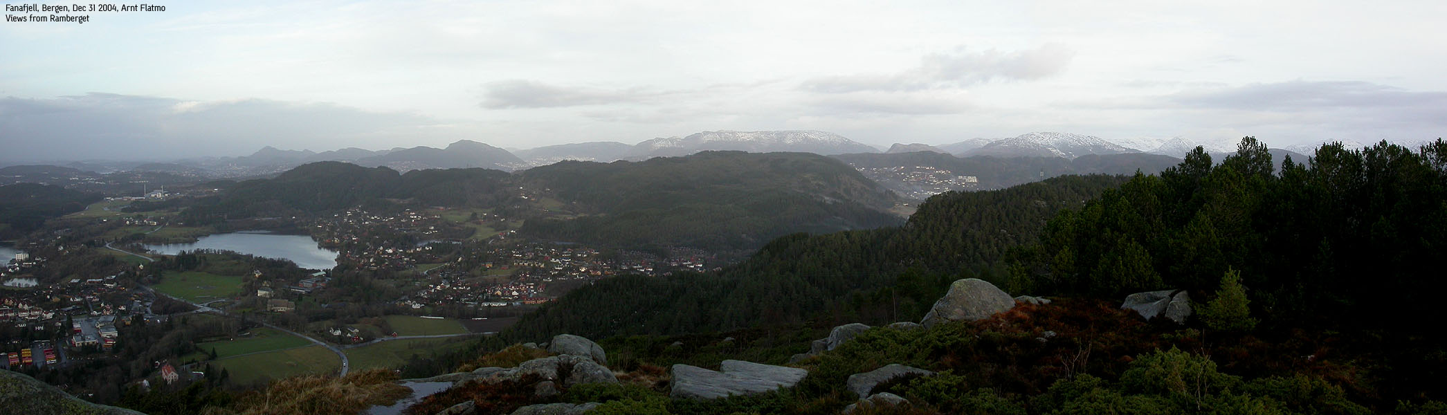
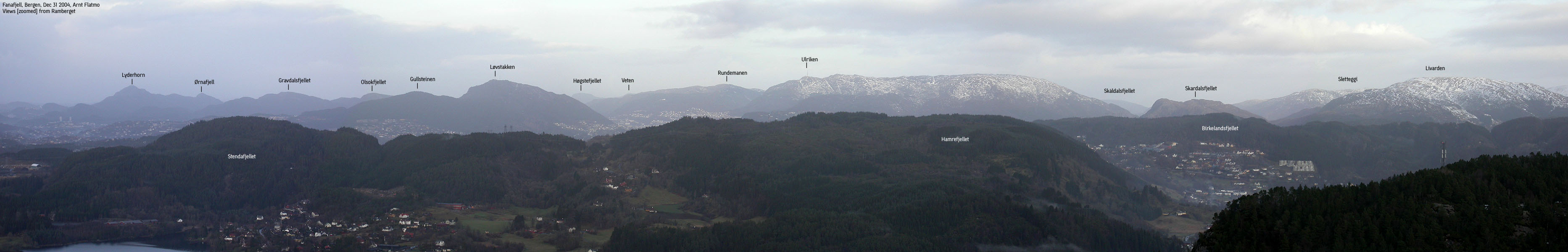
Cross the road and pass Fanaseter to the left. Pass a sheep gate and follow the forest road upwards. The road forks just after Fanaseter. Turn right, and follow the road to road end. From here, follow a visible forest path upwards. This path takes you to Ramberget (299m elev.) A fine viewpoint.
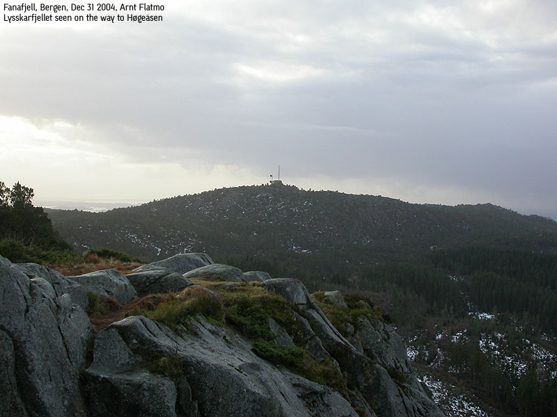
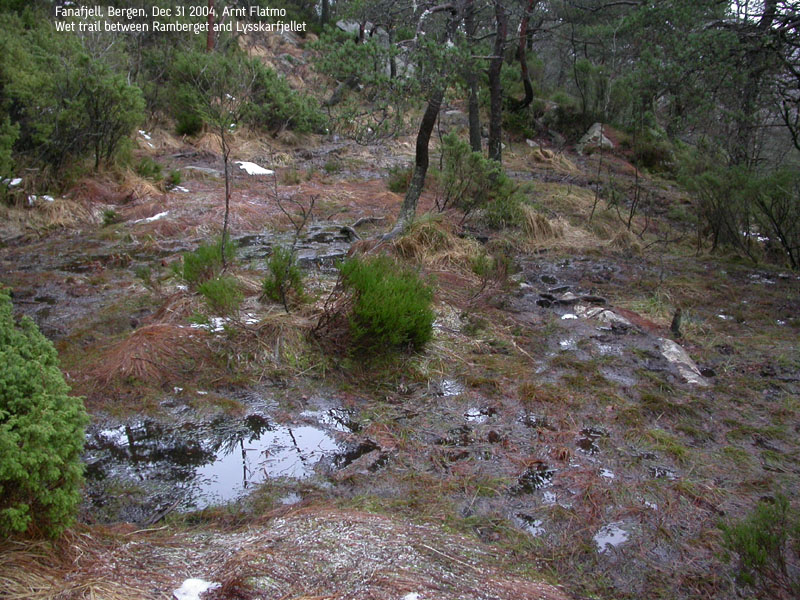
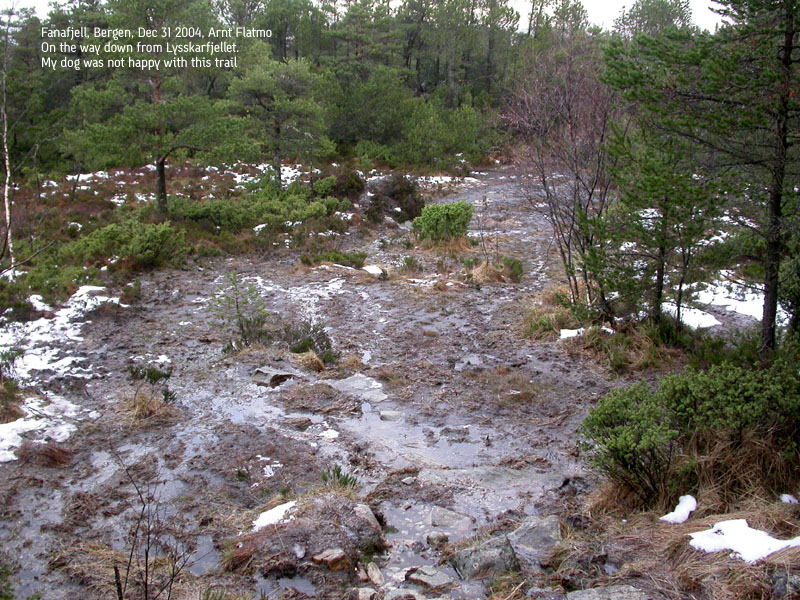
Locate the trail from Ramberget to Lyseskarfjellet. Follow this trail (which can be extremely wet and boggy) until you are at the Høgeåsen foothills. I have not seen any visible trails to Høgeåsen, so if you want to include this hill on your hike, you have to go off-trail. The highest point on Høgeåsen is not marked in any way (providing I've been on the right spot) A GPS that can give you the elevation, would be useful. The spot I nominated as being the high point, is a huge rock/boulder, and I could see no other higher point nearby. This boulder was precisely where my Garmin map has the 309m waypoint.
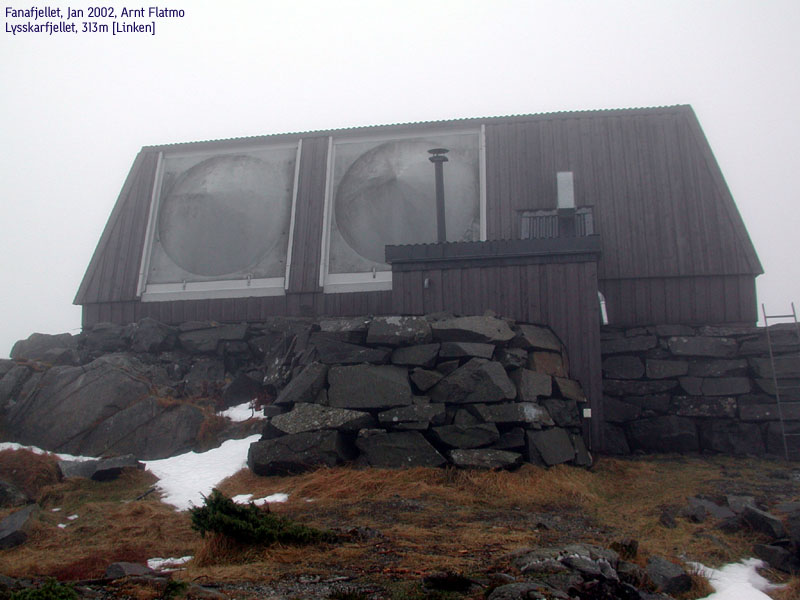
Seek back to the trail where you left it, or make a shortcut in the direction of Lyseskarfjellet and join the trail closer to the mountain. You have a fairly steep mountain side ahead of you when you get close to Lyseskarfjellet. One trail turns south and takes you around the mountain. Don't follow this trail. Instead, locate a trail that runs straight up the east side of Lyseskarfjellet. This trail has a rope as handrail. This section is slippery when icy. The radio link building ("Linken") on top marks the high point.
Upon return, head down to the start of the rope trail. Head back in the direction you came for a short distance, before you get on a trail heading northwest. This trail is visible and easy to follow. Make sure you don't immediately turn left at the end of the rope trail. That trail leads somewhere else. The trail you are on will eventually run into a small forest where the trail is faint. Seek to the other end of the forest and locate the beginning of the old forest road that will take you all the way down to the car road. Follow the car road upwards to Fanaseter.
|
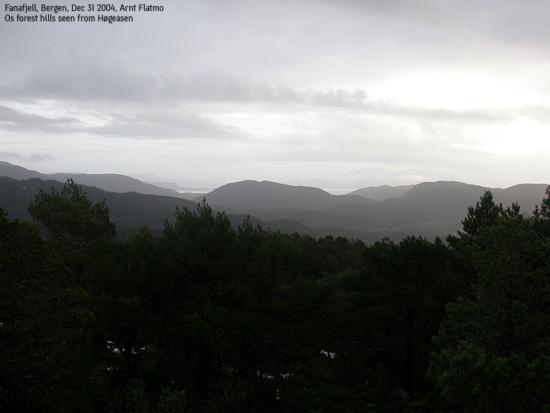
Trip report Dec 31 2004The last hike in 2004, and I chose Fanafjellet. It was a fairly OK day, and I decided to visit the Fana hills on a fog-free day. My last hike back in Jan 2002 ended up with me getting totally lost. After a major detour, I was able to find the top of Lyseskarfjellet. Another reason for visiting Fanafjellet today, was to let the dog get a good, long walk.We left Fanaseter 12:45PM. I was surprised to find a flock of sheep behind Fanaseter. They looked as if they were used to harsh environments. We do get snow in Bergen, even if the winter is less hard along the coastline. Sheep make me smile. They look at you with great interest until you are just *too* close. Then they run 20 meters in panic, before they stop and continue to study you. Since they don't leave the road, this scene repeats itself. After a few minutes, we were on top of Ramberget, where I spent a while talking to other hikers. The kids were trying to get Troll's attention, but he was only interested in what the hikers had brought along in their backpacks. After a while, we moved on, only to find the muddiest trail ever. I put Troll in the backpack and tried to manoeuver around the worst spots. We arrived the Høgeåsen foothills, and I left the trail. It was difficult to determine the highest point, and used my GPS to locate the location marked as 309m. Once on that big rock, I agreed to this being the high point. My GPS shifted between 308m and 309m. I concluded that the hill height was most likely correct. We left Høgeåsen 13:45PM and took a shortcut to the trail towards Lyseskarfjellet. We reached the top 14:00PM and I was curious about the elevation reported by the GPS. The radio link building would always block for some satellites, and the GPS took some time to settle. On my track profile, 313m was recorded as the highest elevation. We then left Lyseskarfjellet. Troll was now walking. I found the right trail that would take us back to the road, and the hike down got quite muddy. I had to lift Troll across the worst pits. We were back at Fanaseter 14:55PM.
Pictures from the Dec 31 2004 hike
Move cursor to read notes, and click on the images to see full version.
No Javascript: 1 2 3 4 5 6 7 8 9 10 11 12 13 14 15 16 17
|
|
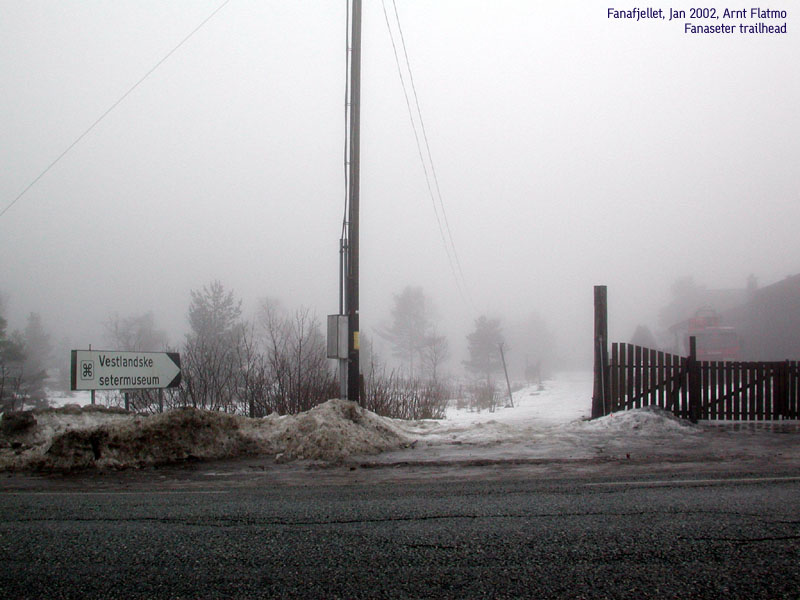
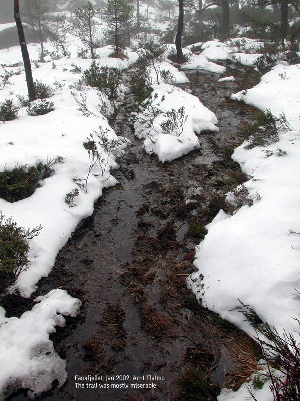
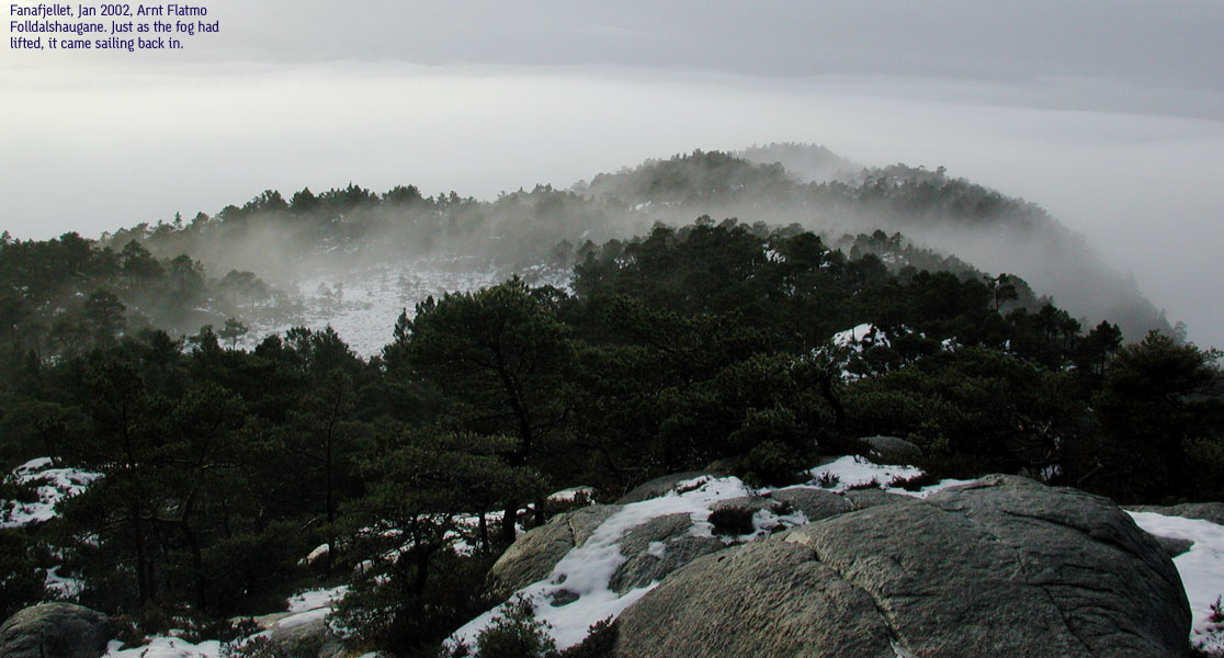
Trip report Jan 06 2002There was a lot of snow in the mountains, and I had to locate lower mountains for a period. But since I've done most all around Bergen, Fanafjellet was no longer possible to avoid. I've been avoiding the Fana area ever since the Lysehornet (405m) hike. Everything went wrong on that trip, and I've had a feeling that a evil spell was hanging over me and Fana.But it was supposed to be such a nice day, so I drove to Fanaseter and started to hike. I believed the fog would clear up. I didn't have a map, so I just planned to "play it by the ear". The view from Ramberget, which was just 15 minutes away from Fanaseter, was wonderful. I met a guy at Fanaseter who said there was no trail to Lyseskarfjellet, but that didn't sound logical. Such a popular hiking area must have trails connecting the two mountains, was my conclusion. After some scouting, I found a small trail leading the right way. It seemed like the spell over me and Fana was broken. Then, the fog really set in. Just below Høgåsane, the trail started to descend. That didn't feel right at the time. I was leaving the high point behind, I thought. I could see Høgåsane above me, and assumed that it was Lyseskarfjellet. It wasn't. From up there, I got a small break in the fog, and saw that Lyseskarfjellet was still a long way to go. Back at the trail, I followed it willingly wherever it was leading. After another hour, I really felt that something was wrong. The trail was descending down through a large forest, and I had the feeling I would soon be at Krokeide. I turned back and hiked up the forest again. I searched the highest point, which I believe was Foldalshaugane. I got another break in the fog, and found that I must had passed Lysskardfjellet with a couple of kilometres. I had this feeling - "I am not lost, but I have no idea where I am." And then it started to rain. I managed to reach Lyseskarfjellet and the radio link building before we were fogged in again. I was in doubt whether to go back the same route or try to find the trail (I saw from Ramberget) down through the forest and back to the road, close enough to Fanaseter. It was getting late, and I was wet to the bone, and fed up with Fanafjellet. Fortunately, a hiking party came along and pointed out the trail that led to the road. Back at the car, I had hiked steady for more than 4 hours. No reason to go back. I've done the Fana mountains. And I think the spell is still there.
Pictures from the Jan 06 2002 hike
Move cursor to read notes, and click on the images to see full version.
No Javascript: 1 2 3 4 5 6 7 8 9 10 11 12 13 14
|


No Javascript:
Other hordaland mountains
 Other Bergen K. mountains
westcoastpeaks.com
Other Bergen K. mountains
westcoastpeaks.com


