
|


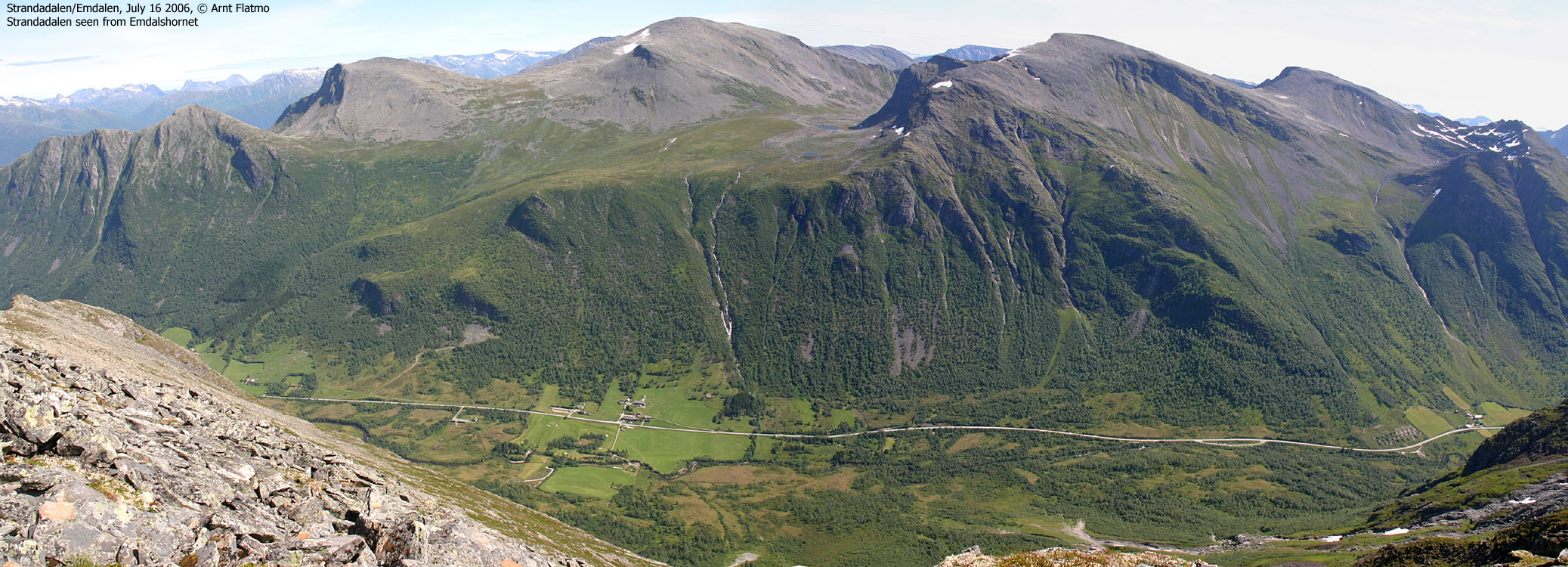
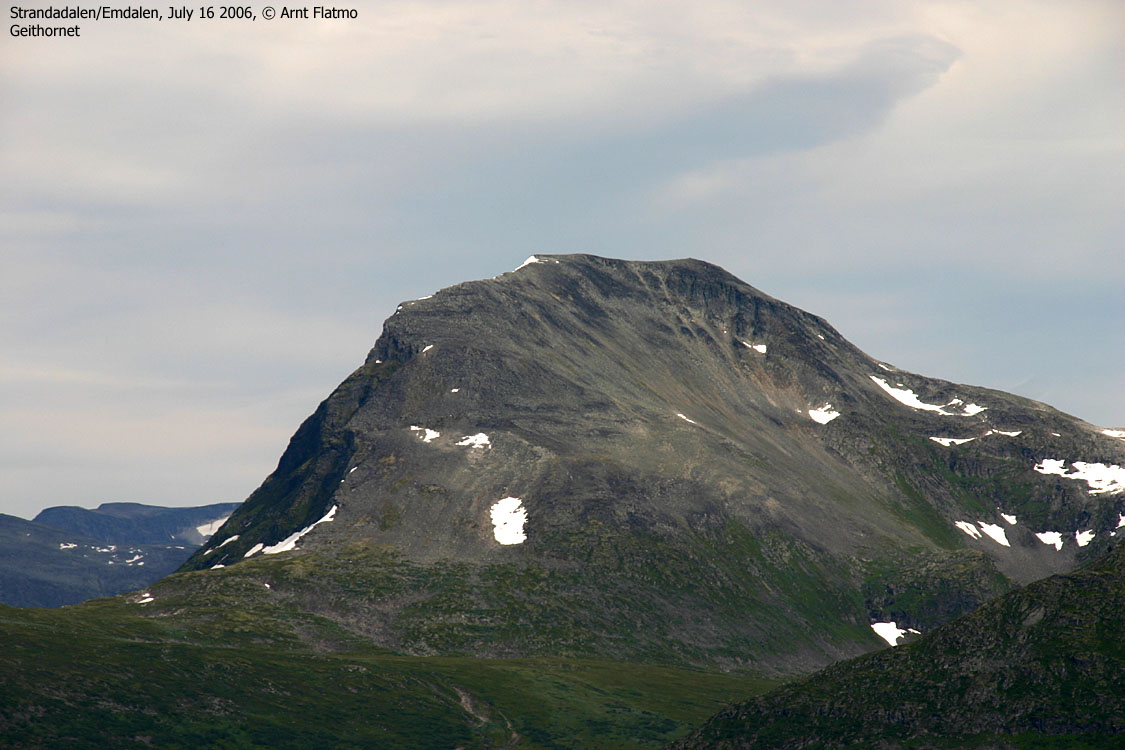
A large mountain massif is located between the valleys Strandadalen, Strandamoldskreddalen and Synnylvsmoldskreddalen. The dominating mountain on this massif is Blåfjellnibba (1479m), while the high point is found on Kvitegga (1489m) further south. East of Blåfjellnibba is Vatnedalsegga. Svartetindane + Kvitfjellsegga form the northwest branch, while Emdalstindane form the northeast branch. These are the primary mountains on this massif.
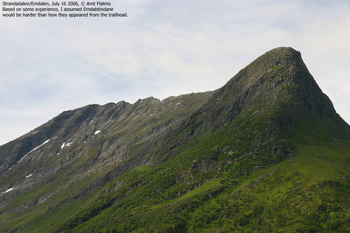
There is not much literature about Emdalstindane on the internet. A couple of books briefly mention that the ridge is narrow in a few places. This is indeed an understatement. This page will give a more thorough description of Emdalstindane, describing a complete traverse from Emdalen to Stølsdalen. Only experienced hikers should attempt this ridge traverse, which can be done without a rope.
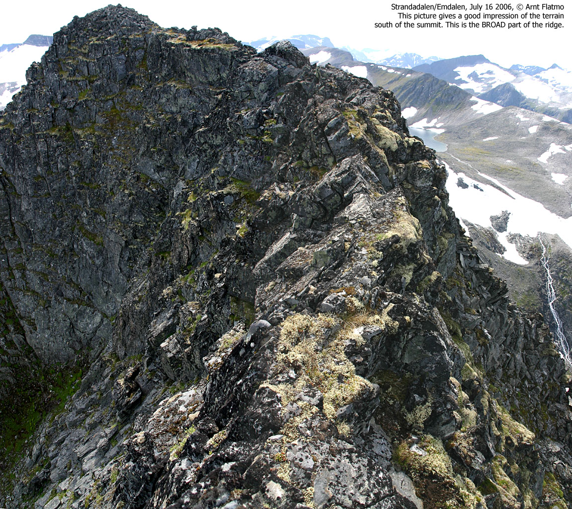
Emdalstindane are normally accessed via Emdalen (north) or via Litledalen or Stølsdalen (south). *Ridge* access to the high point (1452m) is easiest from the south, although this section has probably the most exposed point(s). This does not mean that the northern approach isn't exposed, but there is more scrambling involved on the north side.
If the high point is the primary goal, then I would recommend that you investigate a wide couloir from Lake Instevatnet up to the col between Emdalstindane points 1434m and 1452m. Once on the ridge, the summit is fairly easy reached by staying east of the ridge (facing Strandadalen). This is the only section where the ridge proper requires serious climbing. Fortunately, it is easy to scramble around.
Some will limit their hike to Emdalshornet (1306m), which is the pointy top seen from Strandadalen. This top has the same access route as the ridge traverse, and does not have any airy sections. Strictly speaking, map-wise, Emdalshornet is point 1184m, but it shouldn't be wrong to refer to point 1306m as Emdalshornet.

Emdalstindane (Norge 1:50,000: 1452m, Økonomisk Kartverk: -, UTM 32 V 390152 6896713) has a primary factor of 182m towards the higher parent mountain Blåfjellnibba (1487m). The defining saddle may be 3 alternatives; UTM 32 32 V 389917 6895570, 32 V 389722 6895210 or 32 V 389437 6894507. Ref. the 1:50,000 map (20m contours), these saddles are within the range 1260-1280m, interpolated to 1270m.
Emdalshornet (UTM 32 V 389944 6898267) is just a spur on the north side of the massif, with a saddle height in the range 1260-1280m.
Over a 10-minute period, my GPS averaged Emdalshornet's height to 1309m and Emdalstindane to 1457m. I did not pay notice to the error margin, probably in the range 2-5 meters.

Notes: Class ratings are in reference to YDS. Click here for more information.
The trails described below are not necessarily the *easiest* trails to this mountain.
|
Emdalstindane traverse (summer)
|
|
Access
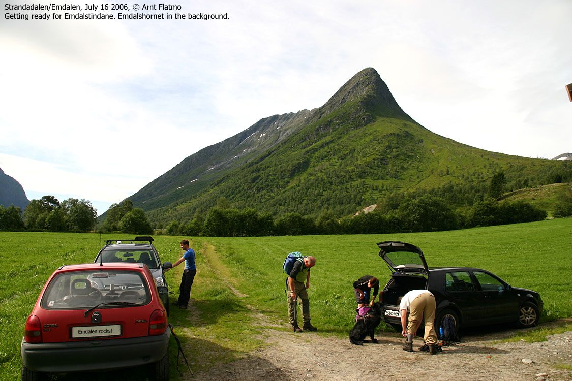
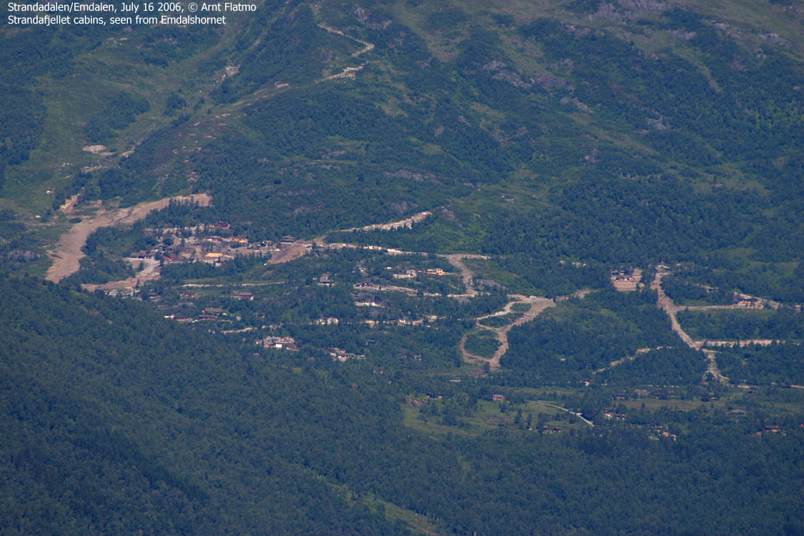
From Ålesund, follow highway E39 towards Bergen, and then highway RV60 (Stranda) to the Magerholm - Ørsneset ferry. This ferry runs quite often; every 20 minutes in the busy hours of the day. From Ørsneset, follow RV60 (Stranda) approx. 34,4Km to Stranda. Turn right and follow highway RV60 southbound approx. 10,3Km and you will where the road to Emdalen forks. Either park along the highway, or drive up to the southernmost farm and ask for permission to park.
If possible, drive a second car up to Herdalen, for instance at the trailhead for Den Trondhjemske Postveg, as you really don't want the extra 7Km on foot down Strandadalen after the traverse.
The route
Emdalshornet:
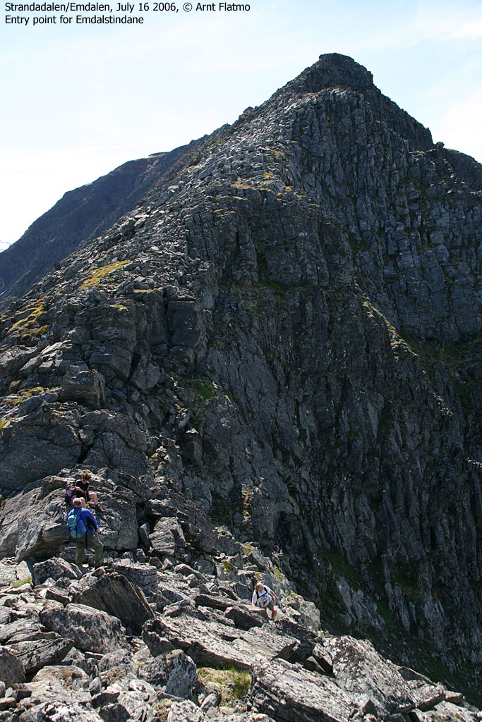
Locate the tractor road that runs on the north side of the river from Emdalen. This tractor road turns into a path at 680m elevation. Follow this path into the valley until you reach the OBVIOUS place to cross the river. You see two couloirs above you. The rightmost (and widest) couloir leads to the col between Emdalshornet and Emdalstindane. The upper part of the couloir has loose scree and rocks. Caution is mandatory here, both for your own party and other parties (if there are any) further down the couloir. From the col, turn left and walk the remaining yards up to Emdalshornet.
Emdalstindane traverse
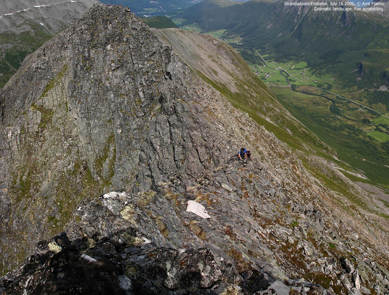
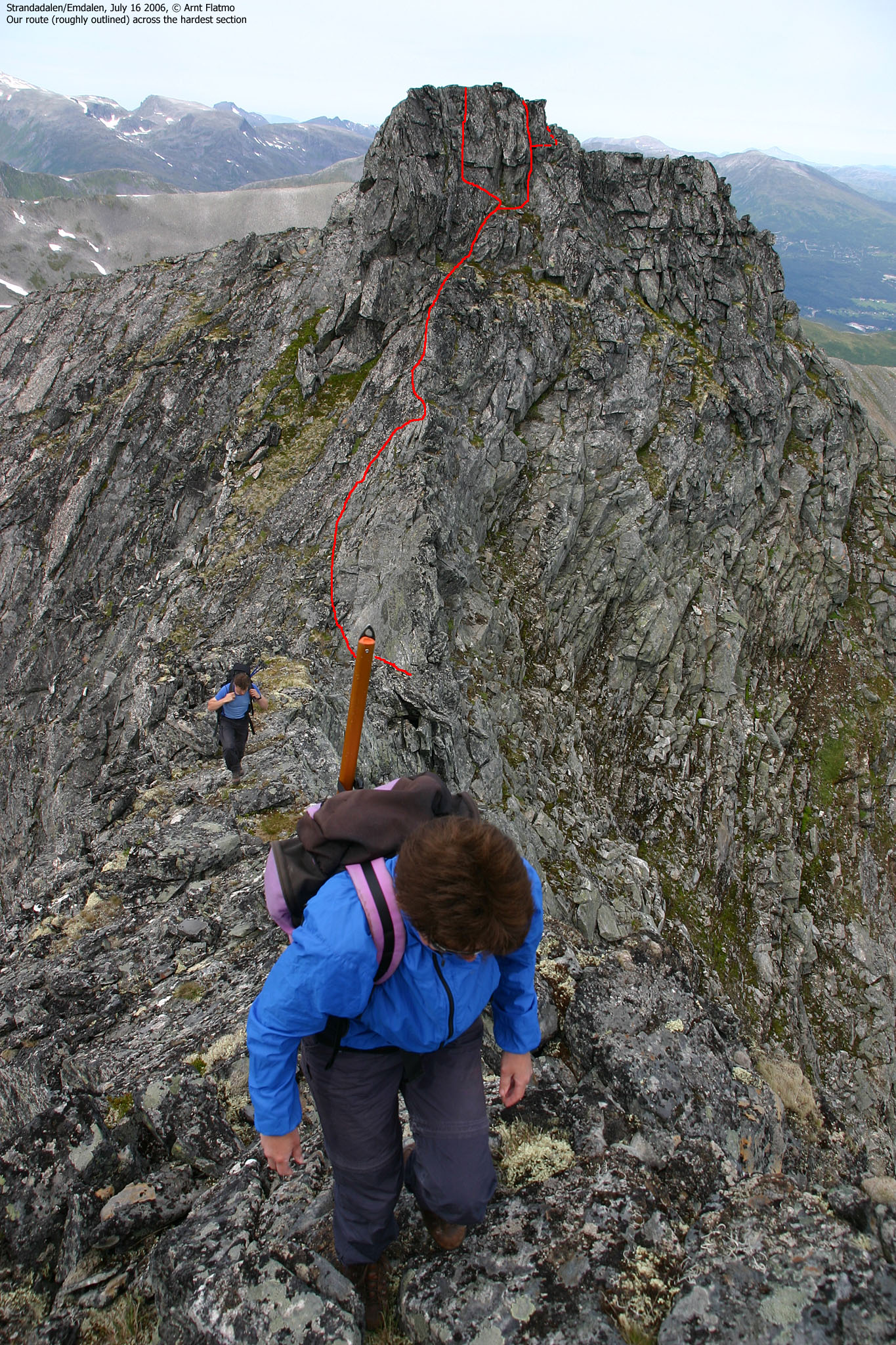
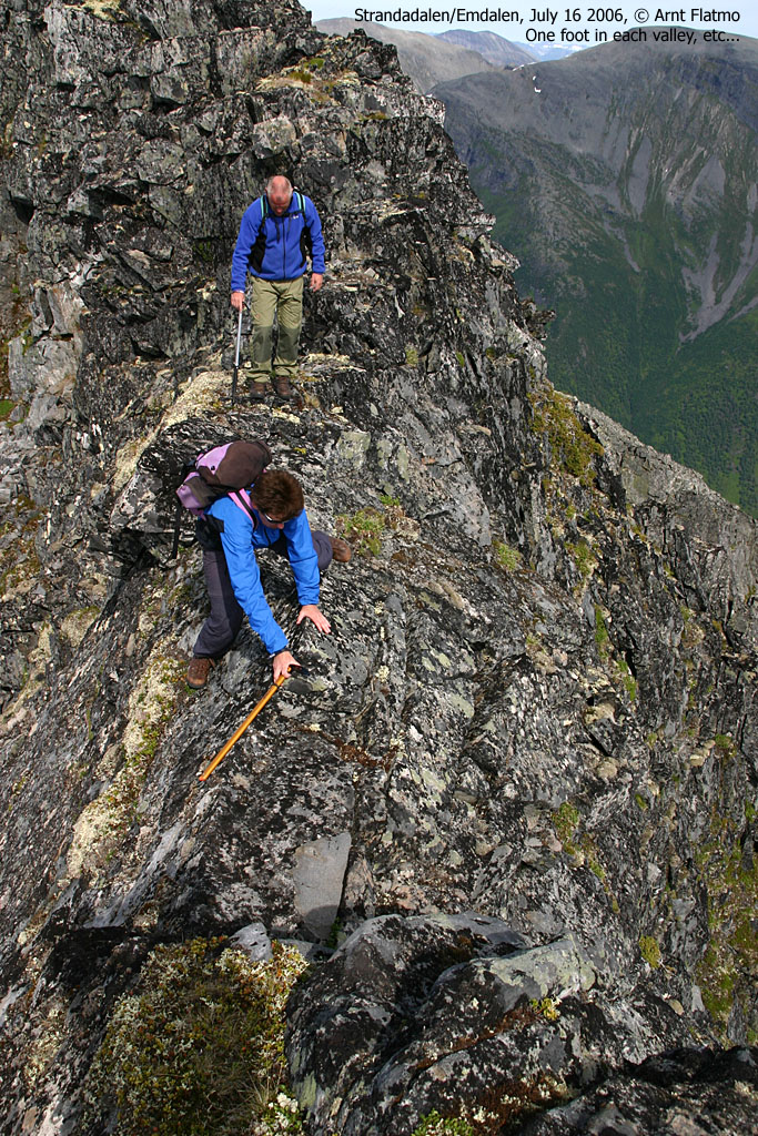
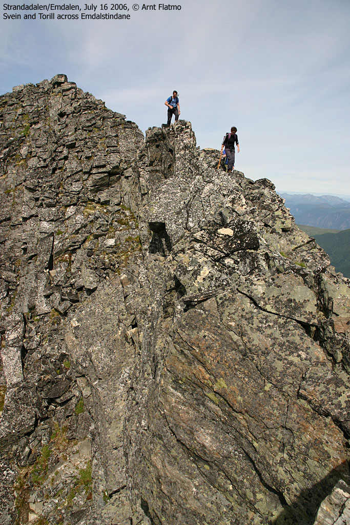
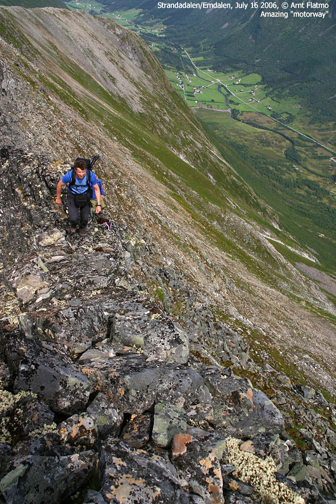
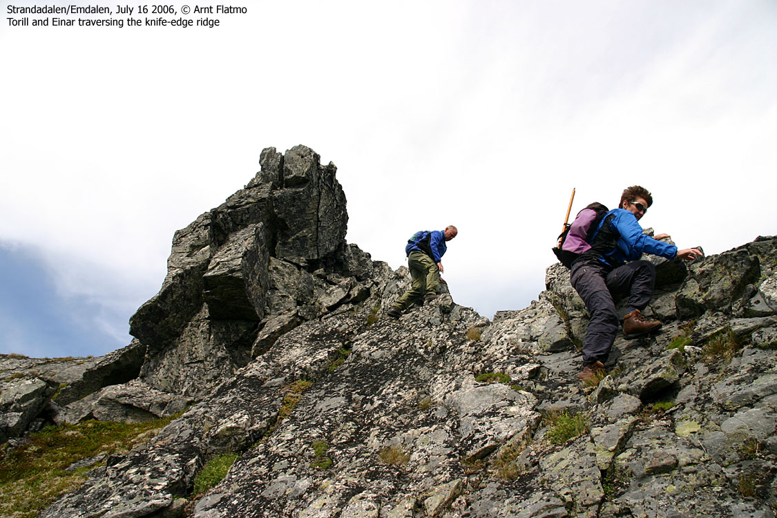
Most parts of the ridge traverse allow you to move swiftly across. The climbing is easy in terms of grade (YDS class 3, Norwegian 2/2+). The first "problem" emerges when you reach the top encircled by the 1400m contour. Getting from this top and onto point 1434m involves a couple of sections where you have to decide on how to proceed. This is the most time-consuming part of the entire route.
First you have to get down to the knife-edge ridge-crest. The obvious route is to descend on slabs, but this is a dangerous approach without a rope for support. If you backtrack just a few meters, you will find a narrow chimney down to your left, and even a ledge further left, allowing you enter the chimney at the bottom. If you are wearing a backpack, use the ledge.
The tricky part about the knife-edge leading into the saddle, is that it's slanting downwards. Either scramble the knife-edge backwards, or pass the ridge-crest on the right-hand side. This involves crossing slabs, and caution is needed here.
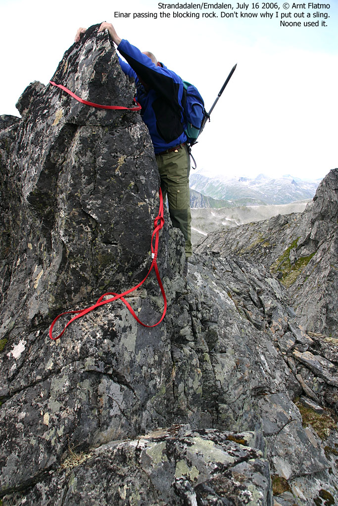
Next, a large rock blocking the ridge must be bypassed by holding your hands on top of the rock, while you curve around it. There *may* be a way around it, down to your left. Alternatively, put a wide sling around the rock. Ascend from the saddle through a short, but steep climb with GOOD handholds.
Pass point 1434m and proceed towards point 1452m This section is much easier. When you approach the 1452m summit, the ridge becomes much more difficult (rope climbing), but you can easily bypass the ridge pillars on the left-hand side (facing Strandadalen). The summit does not have any cairn, but is fairly obvious if there is no fog. If there is "steam" or fog, a GPS with a map or pre-defined waypoints is recommended.
Descent
500m to the south, the ridge begins to descend. You will cross a few narrow, and very exposed sections here. Prepare to sit across the ridge with your feet above two different valleys. I still rate this section easier than the traverse leading to point 1434m. Descend the ridge, traverse over point 1324m and then southbound to the small lake E of Lake Brevatnet. Enjoy running water here. Descend Stølsdalen by traversing the valley until you are south of the southernmost stream. It is difficult to give a good route suggestion here. Apparently, a sheep track runs through dense bush and forest, but I don't know on which side of the streams it runs. It may be wise to ask around in Herdalen for good advice. By staying on the south side, you will avoid river crossing, but you won't escape the forest. One suggestion is to follow the southernmost stream down into Herdalen.
Having parked a car near the tunnel entrance (by Den Trondhjemske Postvegen entry point) saves you from a 7Km walk down Strandadalen, back to the Emdalen trailhead.


This trip was Einar and Torill's idea. I was free to join in, if I wanted to. I mentioned the trip to buddy Svein Myhre, who wanted to join in as well. This was a good opportunity for me to get to knew a mountain region that I had only been watching through the zoom lens from coastal mountains. Grete, a friend of Einar, was coming too. And of course her dog "Emma". We were now the same group as on Saksa earlier in the summer, except for Svein.
We met in Stranda, and then drove to the Emdalen trailhead. Einar and Torill drove up to Herdalen to leave Einar's car behind. Einar had done research about the route, and learned that "there was a narrow point south of the summit". He asked if it is was possible to bring a dog across. "No problem", he was told. His source had crossed Emdalstindane several times. An inner voice told me that there was something "wrong" about this information, but as I knew absolutely nothing about the mountain, I hoped the source was right.
Emdalshornet:
We left the Emdalen trailhead 09:50AM and came on the wrong track right away. We didn't get onto the tractor road until we passed Framfjørstadsætra on the opposite side of the river. The river crossing higher up in the valley was trivial, and now we were on our way up the steep couloir, towards the ridge.
The upper part of this couloir was dangerous in terms of screen and loose rock, and we had to ascend in a "disciplined order". We reached the col, turned left and arrived Emdalshornet 12:40PM. I took a lot of pictures, as I expected the weather to gradually get less sunny throughout the day. After a short break on top, we moved on. The ridge up to Emdalstindane, looked interesting. A narrow ridge it was, but the scrambling looked easy. Already at the col, Grete had problems getting "Emma" across a slightly awkward section of the ridge. Grete wondered if things would get further complicated, and considered turning around. We agreed that it was perhaps a wise decision. The mountain seemed as if it would have bigger challenges ahead. Grete and "Emma" turned around and the rest of us proceeded along the ridge.
Emdalstindane:
Although not always strictly necessary, we chose to scramble the very top section of the ridge, which was a good way to get accustomed to the airy surroundings. The scramble was easy. It was just a matter of taking it easy, and make sure that every handhold was secure. Without any problems, we arrived the first top (1400m contour). The saddle over to the next top made me feel slightly uncomfortable. First of all, the descent towards the saddle was exposed and far from straightforward. The ridge across the saddle was a knife-edge (slanting downwards) and the climb on the far side looked steep. It was time to slow down and consider.
We tossed down a rope, making access to the ridge easier. Svein went over to have a look. He didn't seem to have any major problems crossing the saddle and we communicated over cellular phone, between the two tops. Svein continued for a while, checking out the terrain ahead. If it got WORSE than this, then we should perhaps not push our luck. We had a short rope, and a few slings, but not the equipment needed for safe climbing. Svein called back and said that things were easier on the far side. I climbed down to the saddle, traversed it and agreed that it was safe for everyone to cross. Svein climbed back down to the saddle, and I went back to Einar and Torill, asking how they felt. They were highly motivated to continue, and climbed down towards the saddle. Svein had discovered a chimney that allowed for safe descent. I went up for the rope, tossed it down to Einar and then downclimbed the chimney. In other words, the rope was never really needed here, had we taken the time to look around.
We carefully traversed the saddle through bypassing most of the knife-edge to the right. The knife-edge would have been the preferred choice, had it not been the downwards angle. We climbed up to the next top, and personally, I hoped we would not have to descend this way. The route up to point 1434m was much easier, and after a while, we had a clear view towards the high point.
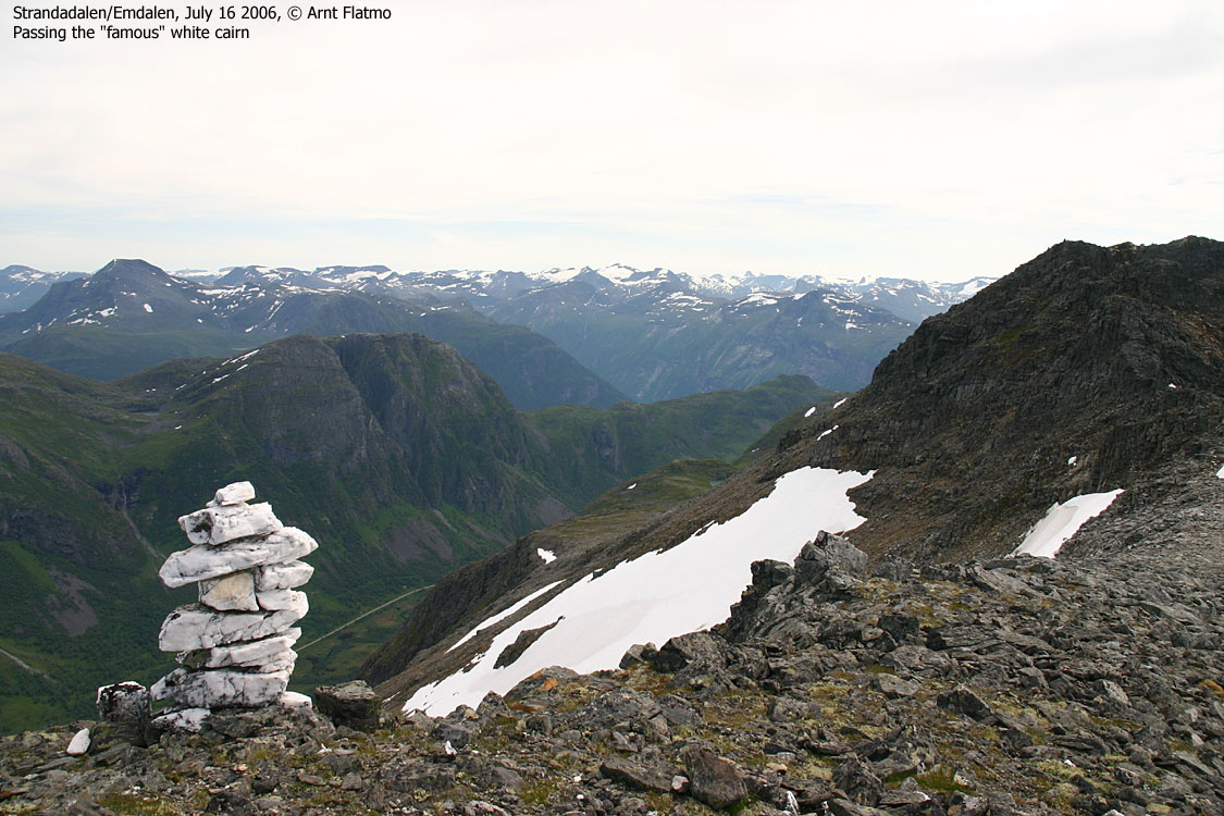
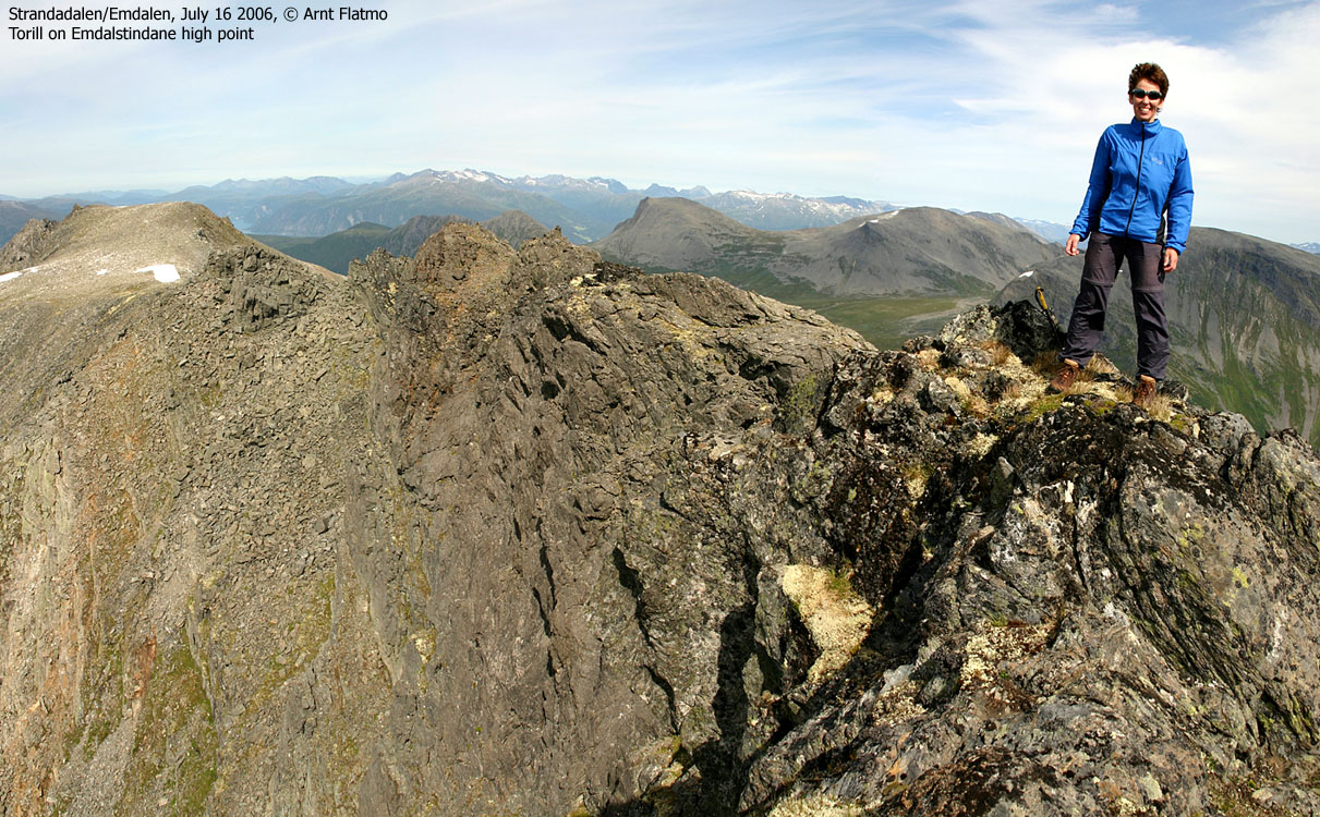
Getting to the high point involved trivial scrambling in exposed terrain. We couldn't climb the ridge up to the high point, as the high pillars required rope climbing, but found a good route on the left-hand side, facing Strandadalen. On the way to the high point, we noticed a couloir on our right-hand side and concluded that this was a good descent route, if we weren't able to complete the traverse. We reached (and celebrated) the high point 14:55PM. We had now been on the move for 5 hours, and were curious about the - assumed - most airy section of the route, south of the summit.
Descent:
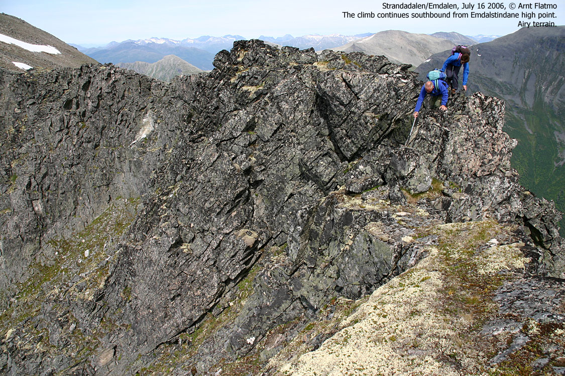
After a well-deserved break at the summit, we moved on. The wide summit plateau quickly turned into the "usual terrain", a high, narrow and tremendously exposed wall heading southbound. It didn't take long before we reached the, possibly, most narrow part of the route - a point where we were sitting on the ridge with our feet above two different valleys. By now, we were so accustomed to this type of terrain, that we hardly gave the crossing much thought. But we did agree on that this was certainly not "dog terrain".
On the way across point 1324m, I reflected on the ridge traverse. It had been great fun, and the challenging part was the lenght of it, combined with the zero knowledge about any possible problems. It reminded me of the Bjørndalstindane - Juklavasskruna traverse in the Rosendal region, a few years earlier. The perception of length much likely came from the time spent, including the long pause at the most complicated section. It is accurate to claim that this ridge should only be attempted by experienced hikers with scrambling experience and head for heights. As such, I am willing to claim that a rope is not needed for this traverse. That said, it is always a good idea to bring proper equipment for safety, should you be in doubt.
I was impressed by Torill and Einar, neither having much experience in this type of exposed terrain. But after having seen them scramble on Saksa, I was quite confident that they would do well. They better had to, as their plan was to climb Store Skagastølstind 4 days later. In that respect, Emdalstimdane was a brilliant "warm-up" hike.
Svein's initial plan was to leave us at this point, and return to Emdalen via Svartetindane and Kvitfjellsegga. But because of the time spent, he decided to descend Stølsdalen with the rest of us. We were grateful for the "extra service" provided by Svein earlier on the hike, and hoped it was a decision he was comfortable with. I'm not confident that we would have made it across, if I was the "point man".
We enjoyed fresh water east of Lake Brevatnet before we began the descent down Stølsdalen. After a couple of stream crossings, we found a path that we followed down a morene. We lost the path after a while, and being located in the middle of two streams that formed a river, we decided to make our way down the forest.
The forest part was NO FUN. Since I had been the loudest spokesman for getting out of the river system, I volunteered to lead the way through the bush. We were able to follow channels dug out by small creeks, but didn't escape the dense pine forest near the road. With sore (and steaming) feet and grass and needles up our butts, we arrived the car in Herdalen 17:35PM. 15 minutes later, we were back in Herdalen where Grete was waiting. She had been sleeping for hours, she said, which was good. She had probably been waiting 3 hours or so. A FUN traverse had come to its end.
Postnote Jul 20 2006: Torill and Einar successfully climbed Store Skagastølstind today. Congratulations. Unfortunately, Grete turned ill and had cancel.
To Emdalshornet


360 deg. wide-angle panorama from Emdalshornet, vaguely annotated

Other pics from Emdalshornet


Moving on the first "crux" on Emdalstindane


The route's "crux"


To the high point


360 deg. wide-angle panorama from the summit

50mm panoramas, 2 parts, medium resolution


Other pics from the top


Across the airy south ridge


Descent


No Javascript:
1 2 3 4 5 6 7 8 9 10 11 12 13 14 15 16 17 18 19 20 21 22 23 24 25 26 27 28 29 30 31 32 33 34 35 36 37 38 39 40 41 42 43 44 45 46 47 48 49 50 51 52 53 54 55 56 57 58 59 60 61
 westcoastpeaks.com
Other Møre & Romsdal mountains
Other Norwegian mountains
westcoastpeaks.com
Other Møre & Romsdal mountains
Other Norwegian mountains

