
Norwegian Mountains, Møre og RomsdalDrynjahatten, 201m (Drynahatten)

Drynjahatten
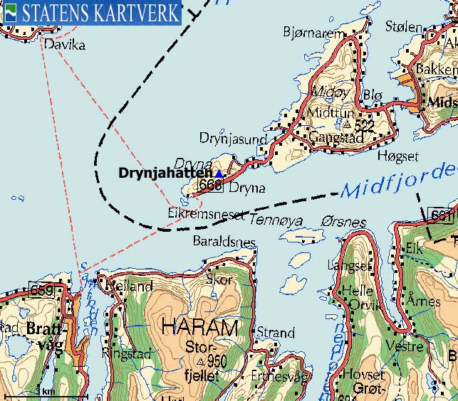
IntroductionDrynjahatten is the high point on Dryna island, just a 20 minute ferry ride from the village of Brattvåg. This coastal top offers a good view towards the Haram mountains, as well as Nordøyene (Skuløya, Fjørtofta, etc..) The top seems to be seldom visited. No marked path leads to the top, but a vague path will at least take you through the forest. If you have time to kill while waiting for the ferry to Brattvåg, perhaps visiting Drynjahatten is an option? On the west side of the island, you will find Franskhelleren - a cave that served as hiding place for four Frenchmen during the War from 1944 to 1945. See this link for pictures and map.

Drynjahatten seen from Bløkallen
Primary factor:Drynjahatten (Norge 1:50,000: 200m, Ø.K.: 201m, UTM 32 V 373994 6948765) has a primary factor of 201m, being the high point on Dryna island.
Google mapGoogle's interactive map. You can zoom, pan and click on the markers.
Trail descriptions
Notes: Class ratings are in reference to YDS. Click here for more information.
The trails described below are not necessarily the *easiest* trails to this mountain.
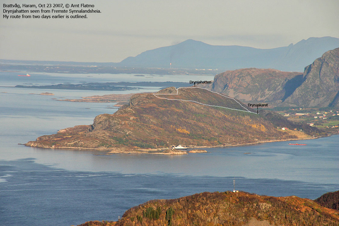
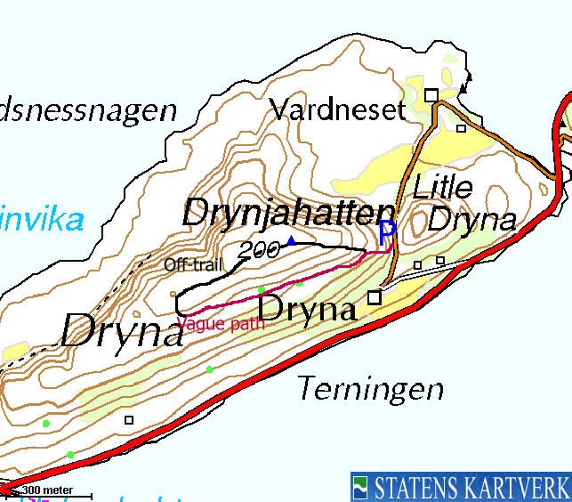
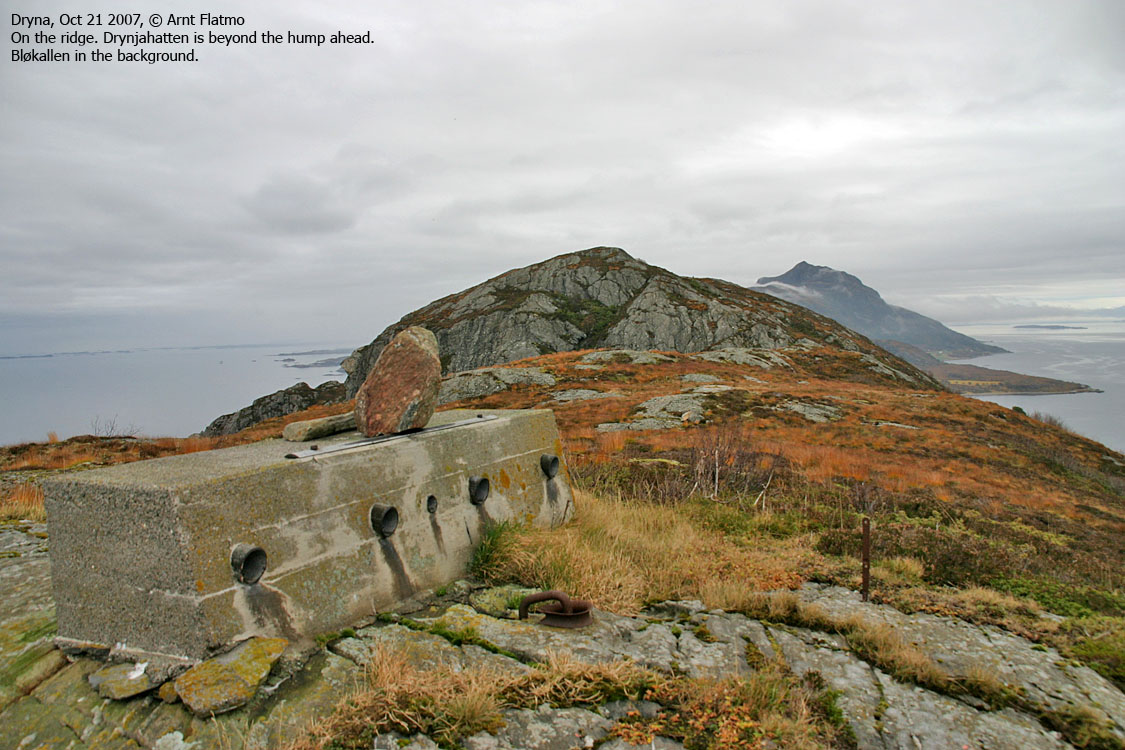
Drynjahatten and the route
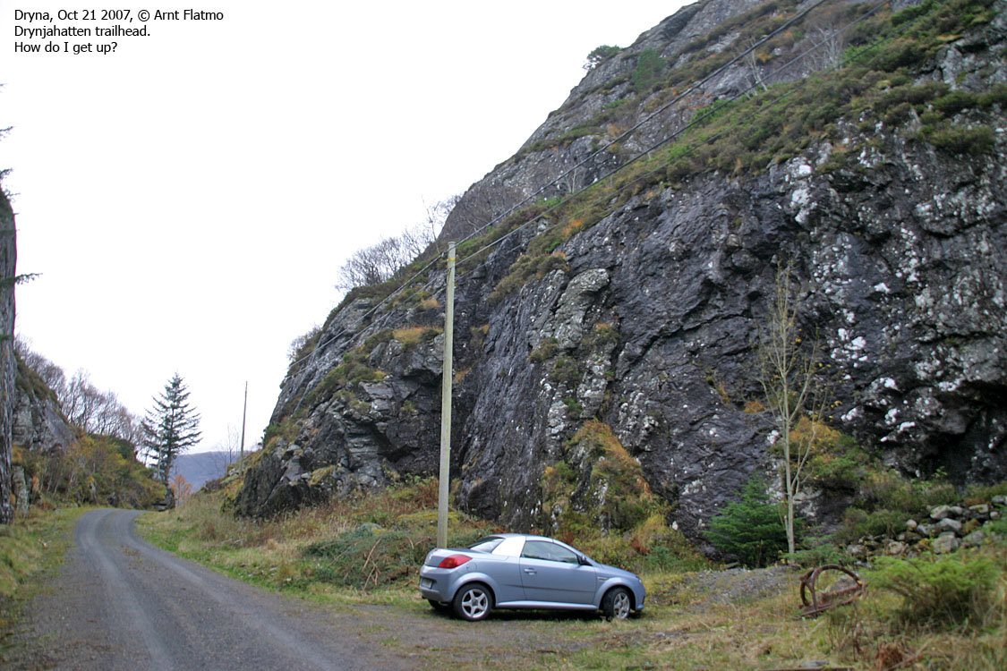
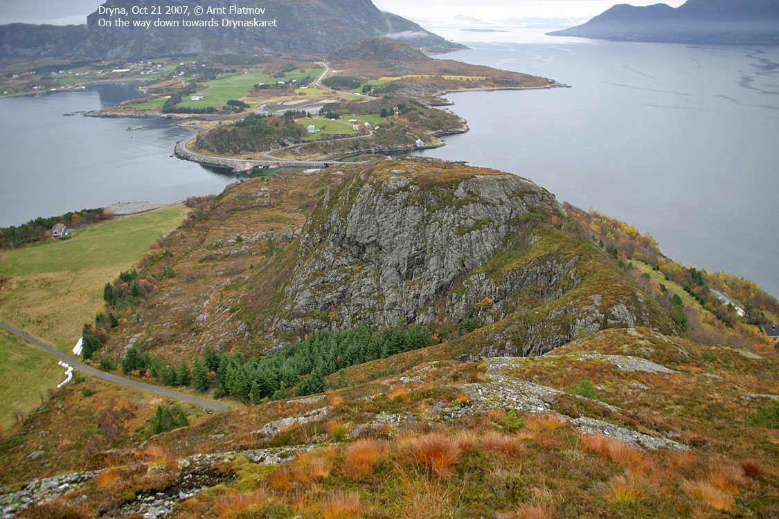
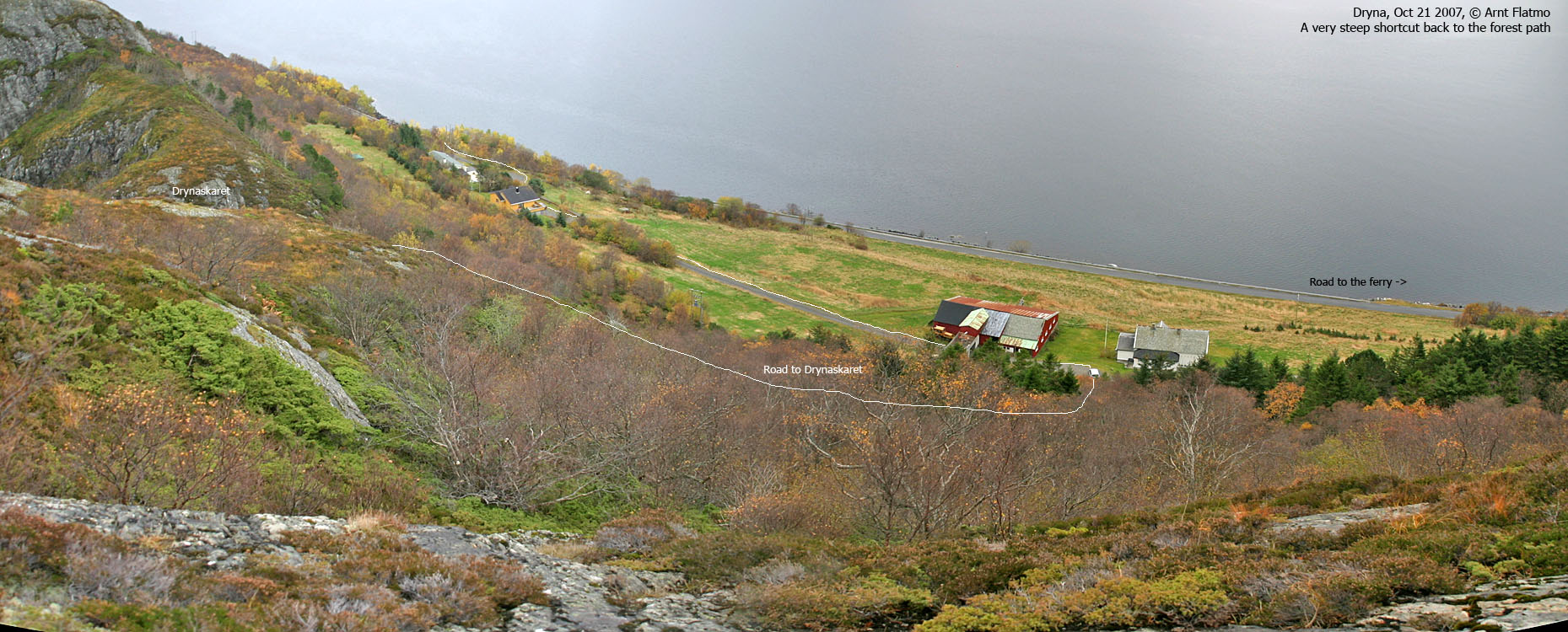
Access From Ålesund, follow highway E136->E39 towards Åndalsnes. From the E136/E39/Olsvika roundabout near Breivka, follow E39 13,3Km. Turn left onto highway RV661 (Skodje/Brattvåg/Vatne). Pay toll at an unmanned toll booth (coins + credit cards, AutoPass) 1,5Km later. 8,7Km after you left E39, you reach the 659(Brattvåg)/661(Vatne) junction. Turn left towards Brattvåg. 13,6Km later (from this junction), turn right towards the ferry to Dryna, and continue 600m down to the ferry harbor. On Dryna, turn right and drive 1,8Km. Turn (sharp) left onto a gravel road and follow this road 500m up to Drynaskaret (you pass through a farm on the way upwards). You'll find parking in Drynaskaret. The route Ascent Walk back the road you came until the downhill (towards the farm) begins. To your right, locate a vague forest path that will take you through the forest, and then up a long meadow. Enter the ridge above where you see fit. It's a lot of juniper bush between you and the ridge. The higher up the meadow you go, the easier access to the ridge gets. Once on the ridge, follow it E/NE towards the high point. Descent Continue eastbound towards Drynaskaret. A small cliff will force you to the right, and you'll have to get past the cliff on the south side before you get back onto the ridge. This passage is a bit steep and slightly exposed. Not very difficult, though. Proceed a bit further on the ridge before you descend off-trail towards the forest path (aiming for the farm below).
Trip reports and pictures
Other pictures
No Javascript:
|


