
|

Daurmålsegga seen from Skjelbreidvatet(No Javascript) |
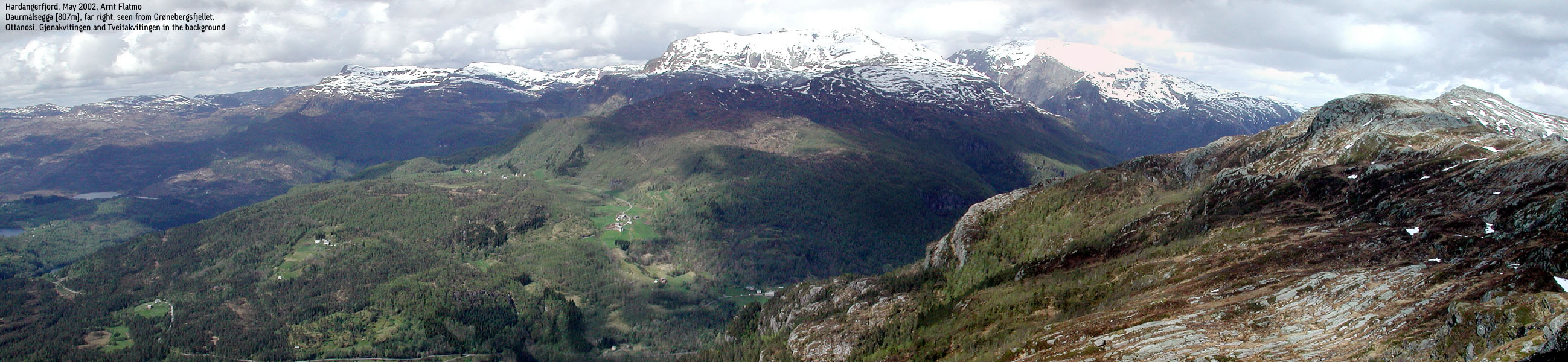
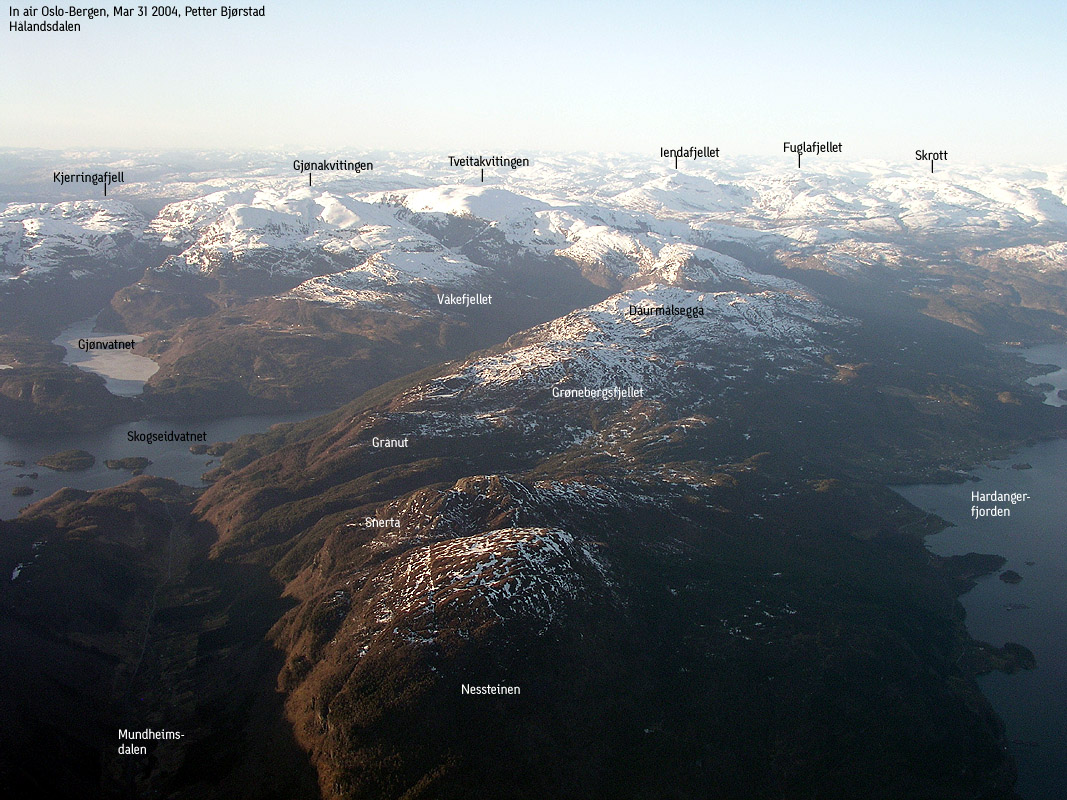
Daurmålsegga is a long ridge just south of the Kvamskogen mountains. The mountain area is known as "Strandebarmfjellet", and the Fusa/Kvam kommune border runs on the high Daurmålsegga ridge.
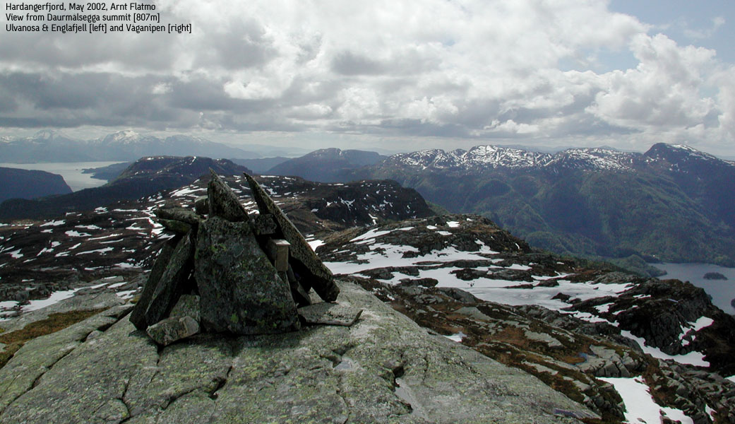
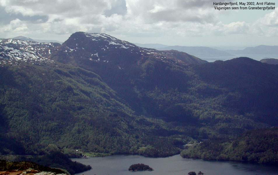
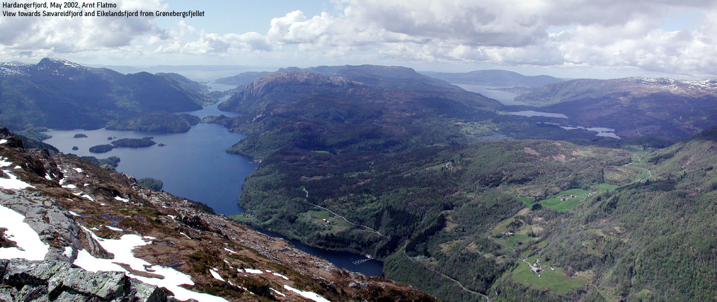
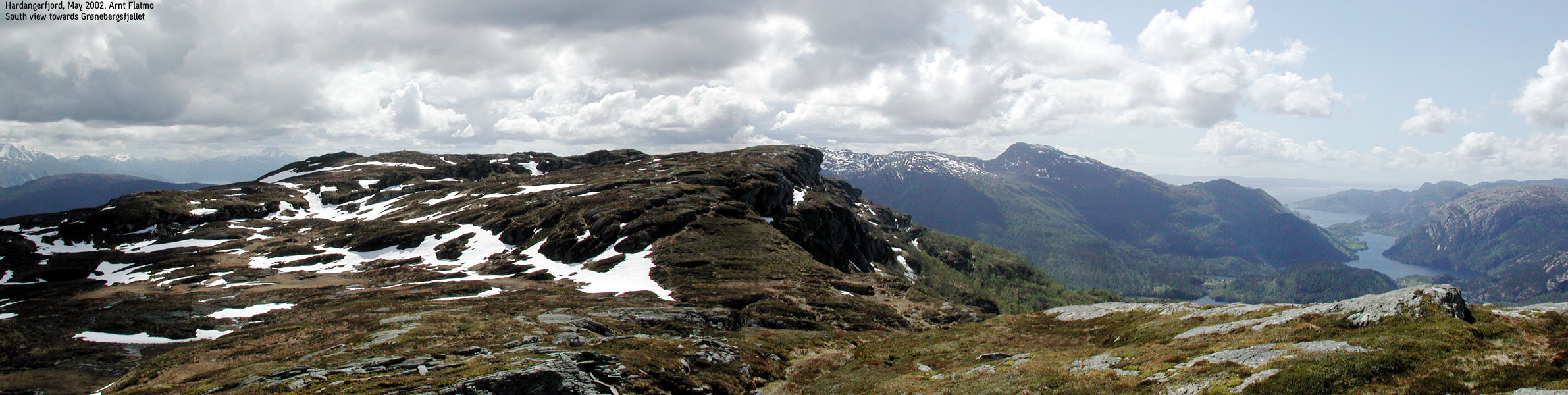
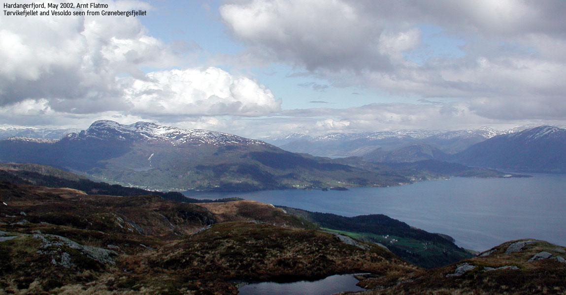
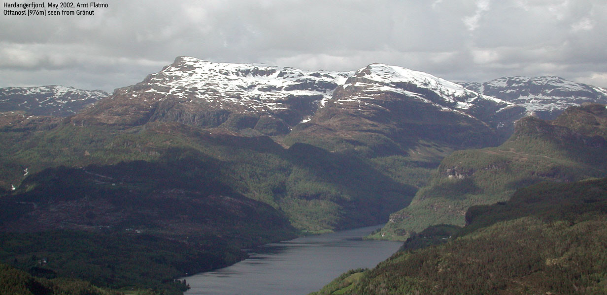
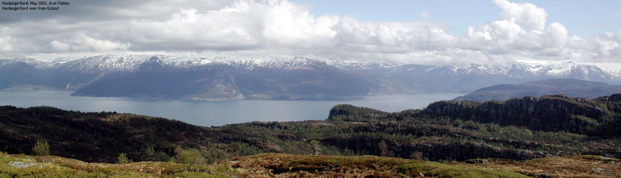
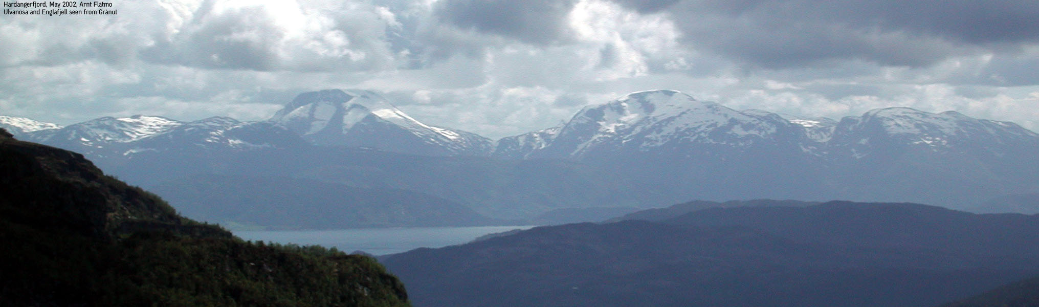
The high point (807m) is shared between Fusa and Kvam, Grønebergfjellet belongs to Kvam while Grånut belongs to Fusa. Neither Grønebergfjellet nor Grånut are considered independent mountains (primary factor >= 100m) but the views from the ridge is spectactular. The mighty Kvamskogen mountains in the north, Folgefonna glacier and the surrounding alpine peaks in the east and Fusa mountains in the west. The view from Grånut over Sævareidsfjord, Eikelandsfjord, lake Holdhusvatnet and lake Skogseidvatnet is fantastic.
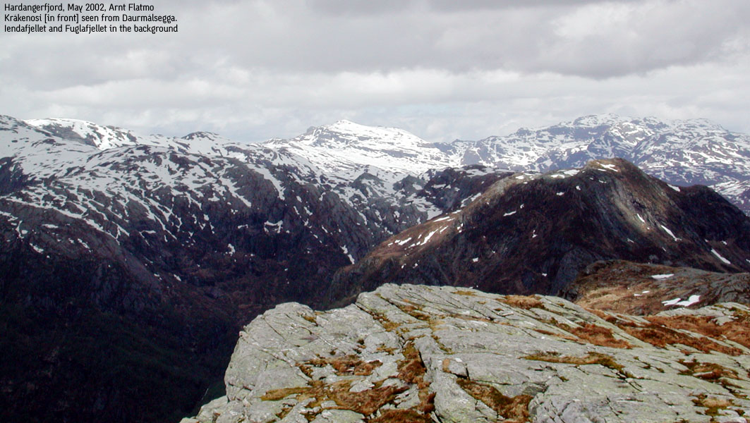
From Daurmålsegga, one may descend north to lake Røyndalsvatnet (317m) and begin the climb up a ridge that runs over Kråkenosi (814m) and heads straight towards the south-east foothills of Tveitakvitingen (1299m).
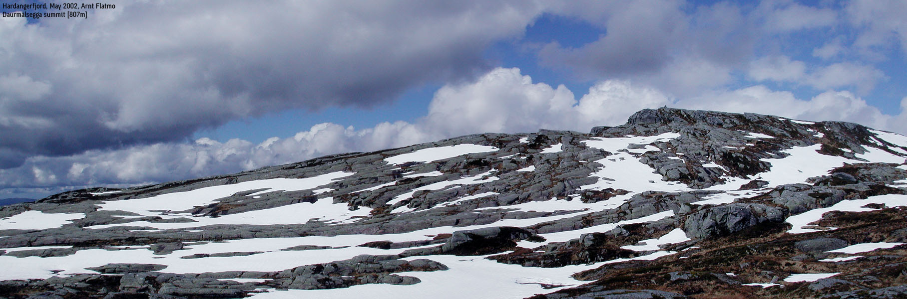
Daurmålsegga (M711: 807m, Ø.K: -) has a primary factor of 429m towards the higher Kråkenosi. The saddle is found north of lake Storevatnet. Ref. Økonomisk Kartverk (5m contours), you cross the 380m contours on the high route, but not 375m. The saddle height has been interpolated to 378m.
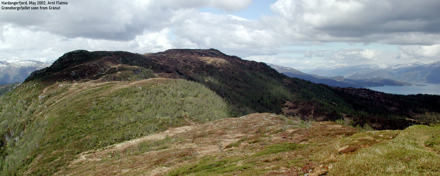
Grønebergsfjellet (M711: 690m, Ø.K: 690,26m) has a primary factor of 52m towards the higher Daurmålsegga (807m) The saddle is on the high ridge between the two mountains (Dalaskaret). Ref. Økonomisk Kartverk (5m contours), you cross the 640m contours on the high route, but not 635m. The saddle height has been interpolated to 638m.
Grånut (M711: 595m, Ø.k: 595,38m) has a primary factor of 72m towards the higher Grønebergsfjellet (690m). The saddle is on the high ridge between the two mountains. Ref. Økonomisk Kartverk (5m contours), you cross the 525m contours on the high route, but not 520m. The saddle height has been interpolated to 523m.
Notes: Class ratings are in reference to YDS. Click here for more information.
The trails described below are not necessarily the *easiest* trails to this mountain.
|
Åsa - Nyasete - Daurmålsegga - Grånut - Nystøl - Åsa (summer/winter)
|
|
From Bergen, follow highway E16 (Oslo). At the Trengereid junction (approx. 25 minutes from Bergen), turn right onto highway 7. When you arrive Bjørkheim by the Samnangerfjord, continue through two tunnels, and turn right onto highway 48 (Tysse/Rosendal) immediately after the second tunnel.
Follow highway 48 for approx. 42,1Km to Mundheim. Turn left (north) on highway 49. Approx. 8,6Km after Mundheim, and just after Oma, turn left onto a narrow paved road marked "Åsa - Oma". The turn is sharp, more than 90 deg. to the left.
Continue up the narrow and curved road for approx. 1,7Km. At the end of the road, you're on the farm owned by John Olav Måge and family. Ask for permission to park there. John Olav is a Kvam Turlag mountain and glacier guide, and has great knowledge about the surrounding mountains.
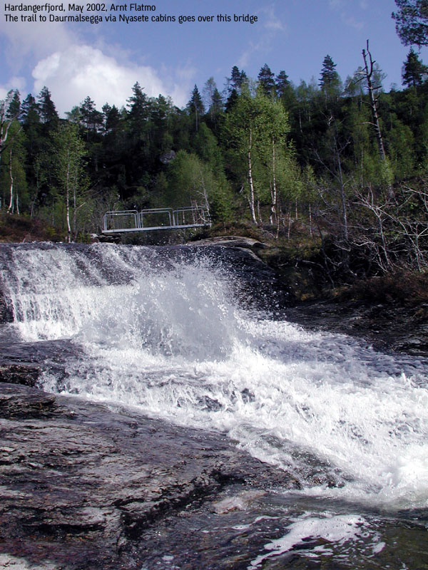
The trail begins as a forest road by the farm. Continue upwards until you reach a forest road junction. Follow the road up to your right, which is marked "Nyasete". Soon, the forest road turns into a forest trail and crosses a creek over a bridge. Continue in north-west direction through the open forest up to "Nyasete" cabins (approx. 430m elevation).
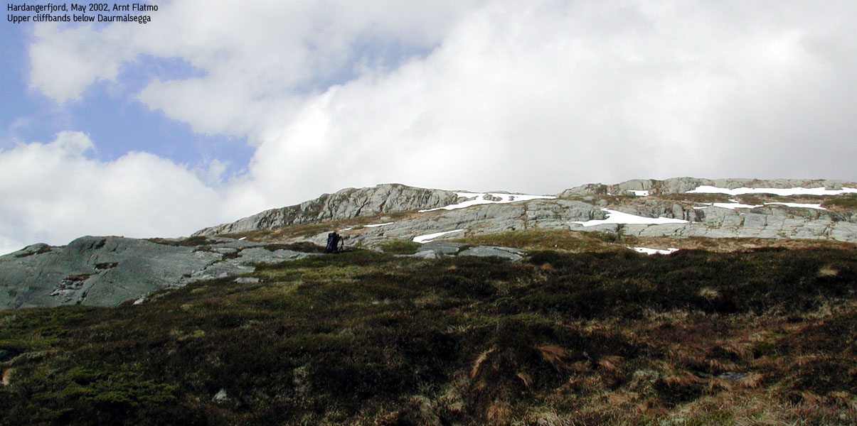
At Nyasete, it is difficult to find further trails. The summit lies just east, behind the upper cliffbands you see higher up. Find a sensible path up the forest towards the lower cliffbands. At the cliffbands, seek left (southwest) and find a way around the bands further ahead. After you've passed the upper cliffbands (opportunities for some fun scrambling here), the summit comes into sight, 5 minutes away. The summit is approx. 4,5Km from the Åsa trailhead. From the end of the forest road, the soil is wet or muddy almost all the way to the top, after rain.
If the weather permits, you have clear view towards Grønebergsfjellet in the south-west direction. The trail can still be hard to find. Stay high on the ridge, but not on the very top, and you should see the trail here and there. The trail however follows a logical path in terms of "obstacles" along the way. On Grønebergsfjellet, enjoy the great west views from point 686m before you head directly south towards the high point (690m), also known as "Vikevarden". Reminders from an old shed is not favourable for the scenery.
From Vikevarden, follow the ridge descending south-west down to the small Vindfatetjørna lake. It is best that you locate the forest trail before you start descending. Follow the trail downwards, which runs to the left of the lake. When you meet a creek coming from the small lake, cross the creek and locate the trail leading up to the Grånut viewpoint (595m). Early on this trail, you see a trailsign pointing to Vikevarden and Grånut. Apparently, there is a second trail to Vikevarden, as the sign is pointing a different way.
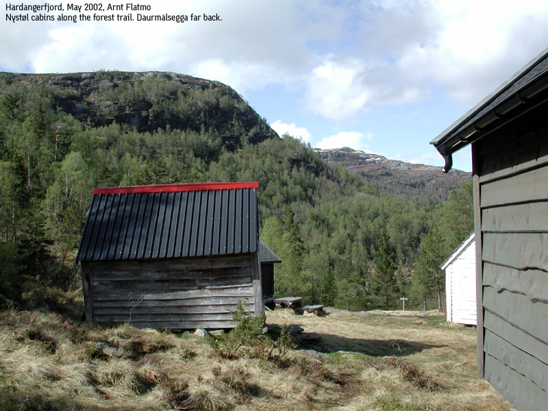
After spending quality time on Grånut, head back the same way you came, cross the creek at the same place, and pick-up the small trail you were on. This trail will take you back to Åsa and is marked with yellow paint on trees, here and there. Random red "T" paint on some rocks can also be seen. The forest trail is however not hard to see, but it is incredible muddy or wet after rain, as it crosses over several wetlands. The forest trail is not indicated on the 1215-II map, but stay close to the 500m contour line until you're parallel to Grønebergsfjellet. Then the trail drops down to the two cabins on Sjoarshaugen and continues northeast up to the Nystøl cabins. Follow the trail northeast until you meet a forest road making a sharp right curve at approx. 300m (approx. 14,4Km from the trailhead). Follow the forest road downwards. When you see a shed (and possibly a lot of timber), a newer forest road continues downwards and meets the road you drove up to Åsa at 16.0Km (from the trailhead). At this point there is a sign pointing towards "Raudkleiv". Walk up the road 500m to the trailhead.
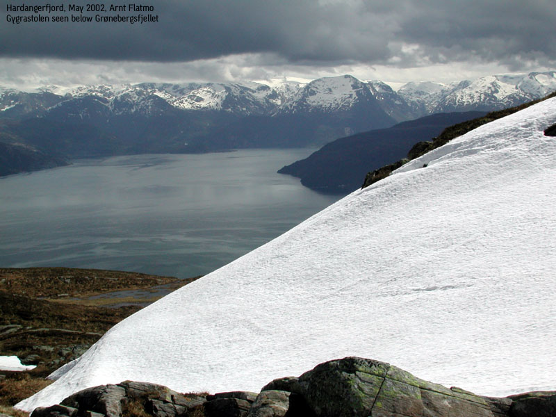
After some great may hikes over Hardangerjøkulen glacier and up the Gygrastolen and Laurdalstind summits, it was time to "go back to work", visting and documenting the mountains you don't find much information about, on the internet. The destination eventually became Daurmålsegga, after I realized that my first choice - Tåkenuten/Tåganuten didn't have the necessary primary factor. Tåganuten (John Olav Måge explained that the name "Tåkenuten" on the map, is wrong), is one of 6 named points on a ridge leading up to Tveitakvitingen. None of them are independent mountains.
I love hiking by the Hardangerfjord in spring, when the sun is shining, the sea is blue, the grass is green and the mountains are white. This was that kind of day. After a nice chat with John Olav, I headed up the mountain. I expected the forest to be wet and muddy, due to the all-day-long rain the day before. I was right. But up on the upper cliffband this was no longer a concern, and I spent some time scrambling on the bands. A little too optimistic about my climbing abilities, I got stuck almost on top of one of the band. The handhold had changed from solid rock to loose lichen. I really wanted to avoid downclimbing, so I had to do a long jump upwards, clinging onto everything I could find. After this slightly embarassing moment, I decided to do what I do best - hike.
I had the most fantastic time on the summit, enjoying the marvellous views towards Tveitakvitingen and Gjønakvitingen - the dominating mountains in the southern Kvamskogen mountain area. After hiking the ridge to Grånut, I decide to make my way through the forest, instead of hiking all the way back. Some 6-7Km bushwacking isn't on my priority list, but I thought that I should get some forest experiences once in a while. Right away I picked up a narrow trail which seemed to lead in the right direction. The trail was not marked on the map, but I had a feeling the trail would take me all the way to the trailhead. My assumption turned out to be correct and I had a great hike through the forest. The only thing out of the ordinary was a meeting with a buck that resulted in a mutual scare.
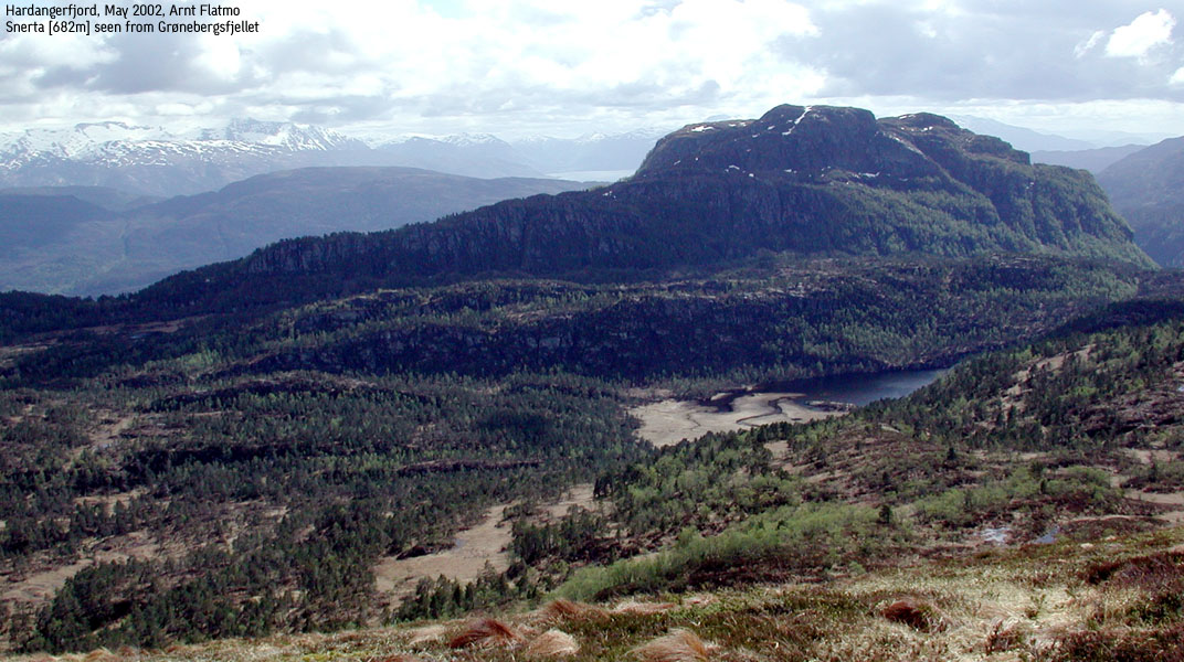
Back at the trailhead, 4 hours, 45 minutes lates, I chatted some more with John Olav. He gave me advice on how to climb the nearby Snerta and Nessteinen summits. So I guess I'll soon be back in the area.
Move cursor to read notes, and click on the images to see full version.
Some of the thumbnails may have been cropped to fit the format.


No Javascript:
1 2 3 4 5 6 7 8 9 10 11 12 13 14 15 16 17 18 19 20 21 22 23 24 25 26 27


No Javascript:
Other hordaland mountains
 Other Kvam K. mountains
westcoastpeaks.com
Other Kvam K. mountains
westcoastpeaks.com

