
|

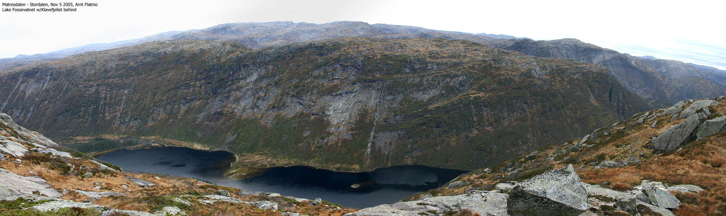
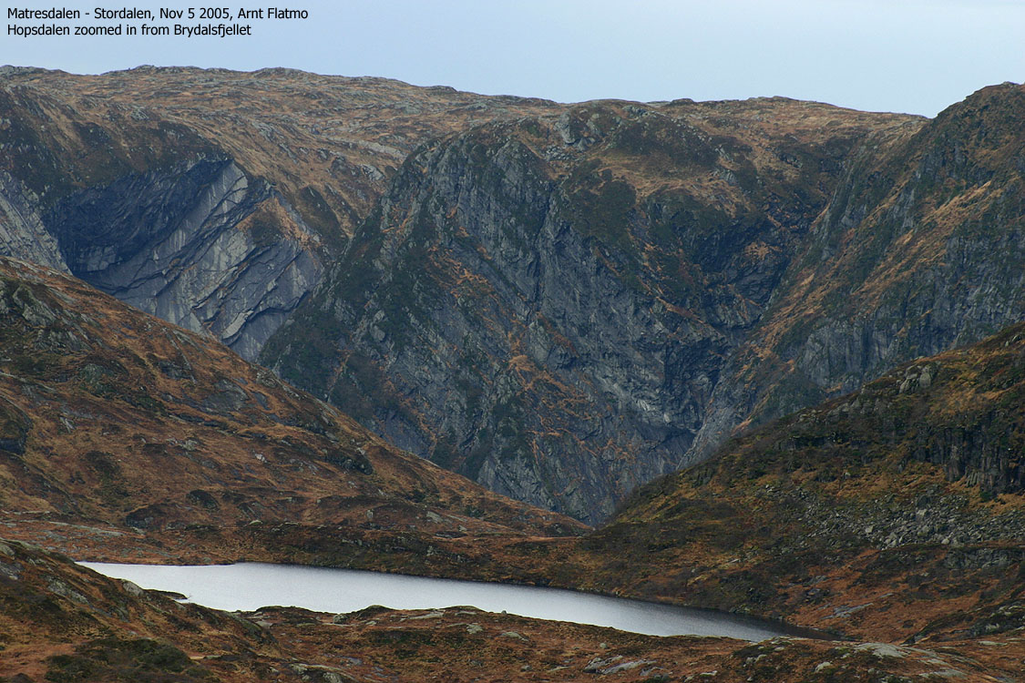
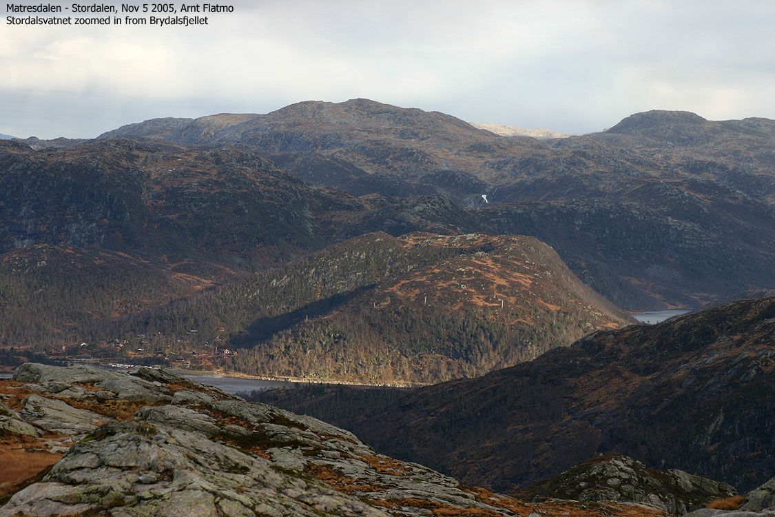
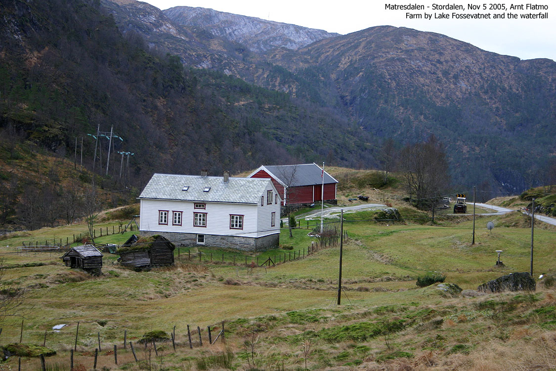
Brydalsfjellet is found along the road from Matre (Masfjorden) to Ortnevik (Sognefjorden), located above Lake Fossevatnet which drains to Matresdalen via the spectacular Fossen waterfall. This is not one of the best viewpoints in this region, but you are able to see mountains such as Eldhusfjellet, Storevasseggi, Rustefjellet/Dukefjellet, Ulvedalseggene, the mountains around Årsdalsryggen and the steep mountains that arise from Masfjorden.
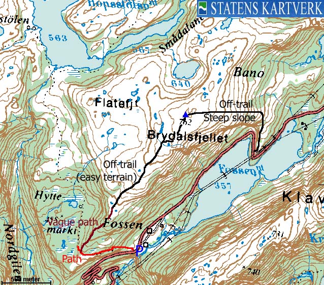
This web page describes a round trip that offers an easy route (mostly on path) up from Fossen and an optional descent to Lake Fossevatnet for those who don't need a trail. You'll then have to walk 2Km along the road, back to the trailhead.
Brydalsfjellet (M711: 762m, Ø.K: 762,29m) has a primary factor of 132m towards the higher Vardane (771m). The saddle is found just W of point 705m (32 V 318114 6760286). Ref. 1216-IV (20m contours), you cross the 640m contours on the high route, but not 620m. The saddle height has been interpolated to 630m.
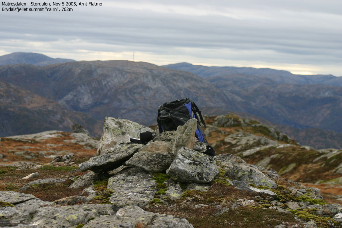
Over a 10-minute period, my GPS reported the summit elevation to be 768m (2-3m accuracy) on point 32 V 317742 6758772.
Notes: Class ratings are in reference to YDS. Click here for more information.
The trails described below are not necessarily the *easiest* trails to this mountain.
|
Fossen - Brydalsnipa round trip (summer/autumn)
|
|
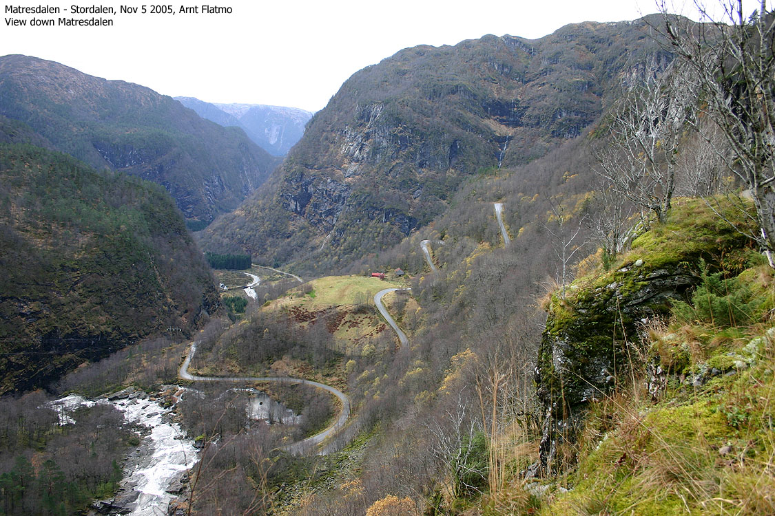
From Bergen, follow highway E39 northbound. After the Nordhordlandsbrua bridge, pay (NOK 45,- for passenger cars per Nov 2005) at the manned Toll station. Continue approx. 56,4Km and turn right towards Ortnevik/Stordal. Follow the Ortnevik road 7,1Km and find parking on a small turnout by the Fossen waterfalls.
Ascent
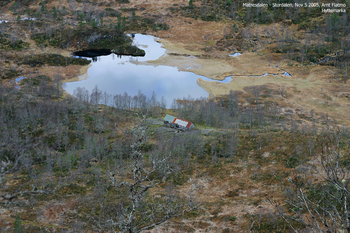
The path begins directly opposite the parking. The path is vague at first, but gets more and more visible. Follow this path until you see the cabins at Hyttemarka. Leave the path and head up Brydalsfjellet's southwest ridge (also known as Geitefjellet). Try to locate the vague path on this ridge. For the most part, this vague path runs on the west side of the ridge (your left).
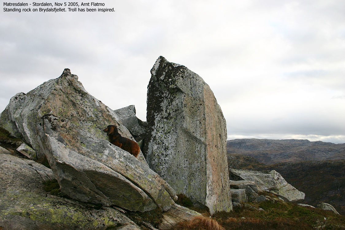
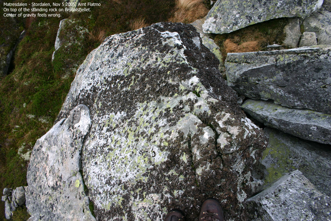
The path fades out into easy terrain. Follow the main ridge all the way to the top, which is marked by a few rocks. On the way towards the top, you can also visit a standing rock (32 V 317684 6758544, 645m elev.) approx. 230m S of the summit.
Descent
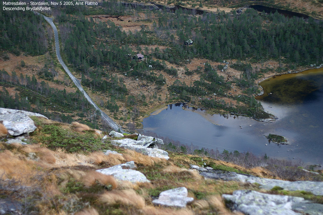
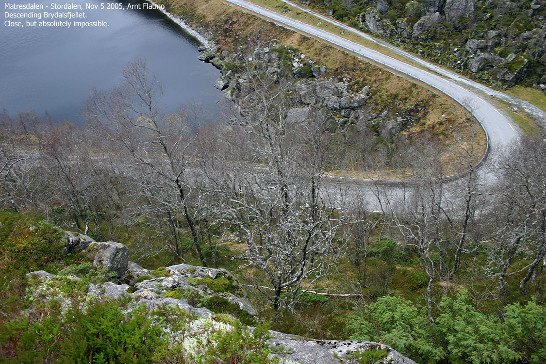
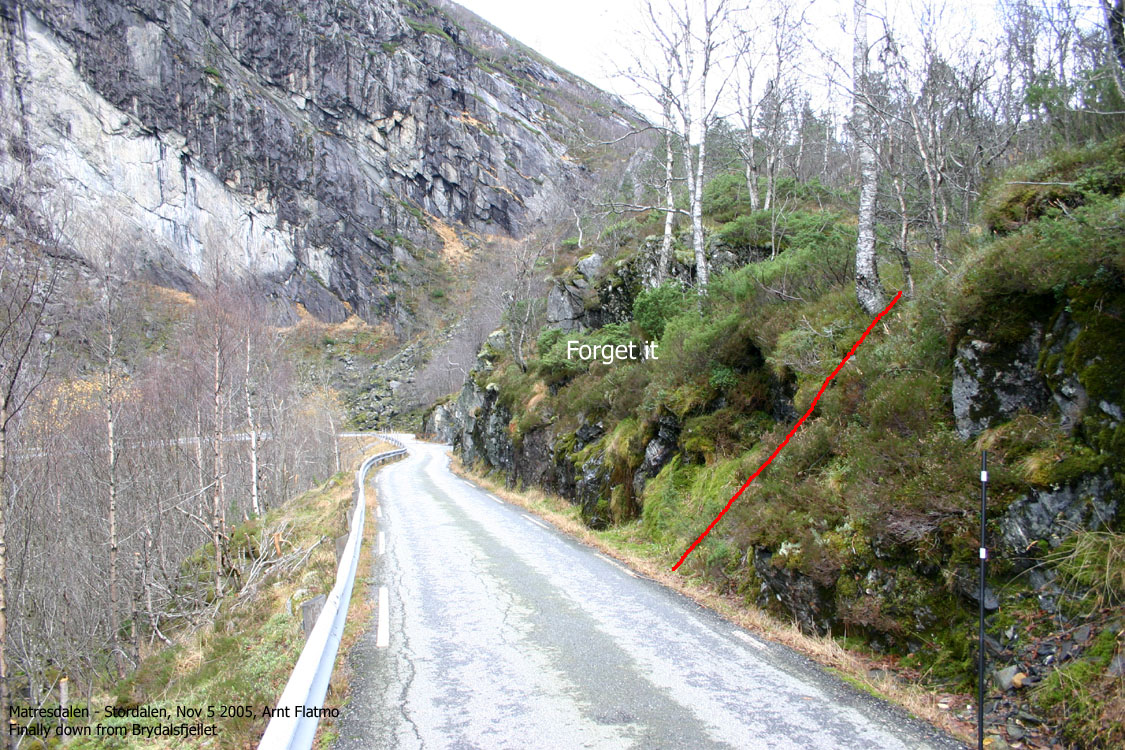
Head eastbound from the summit towards the ridge south of Bano. It is best if you stay on the ridge so you can see into Bano at all times. Aim for the forest ridge that stretches towards Lake Fossevatnet, and move towards the south end (close to the lake). You will run into a cliffband that blocks your way. Do not cross above it, but continue directly towards the road. You will need to look for the short, grassy pitch that takes you down to the road.
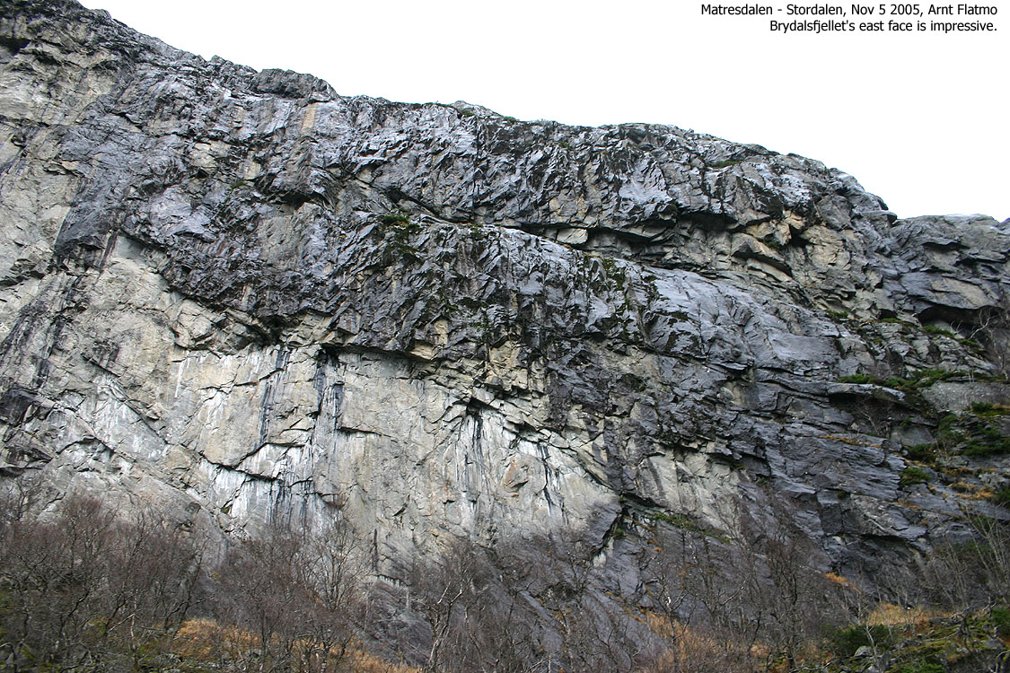
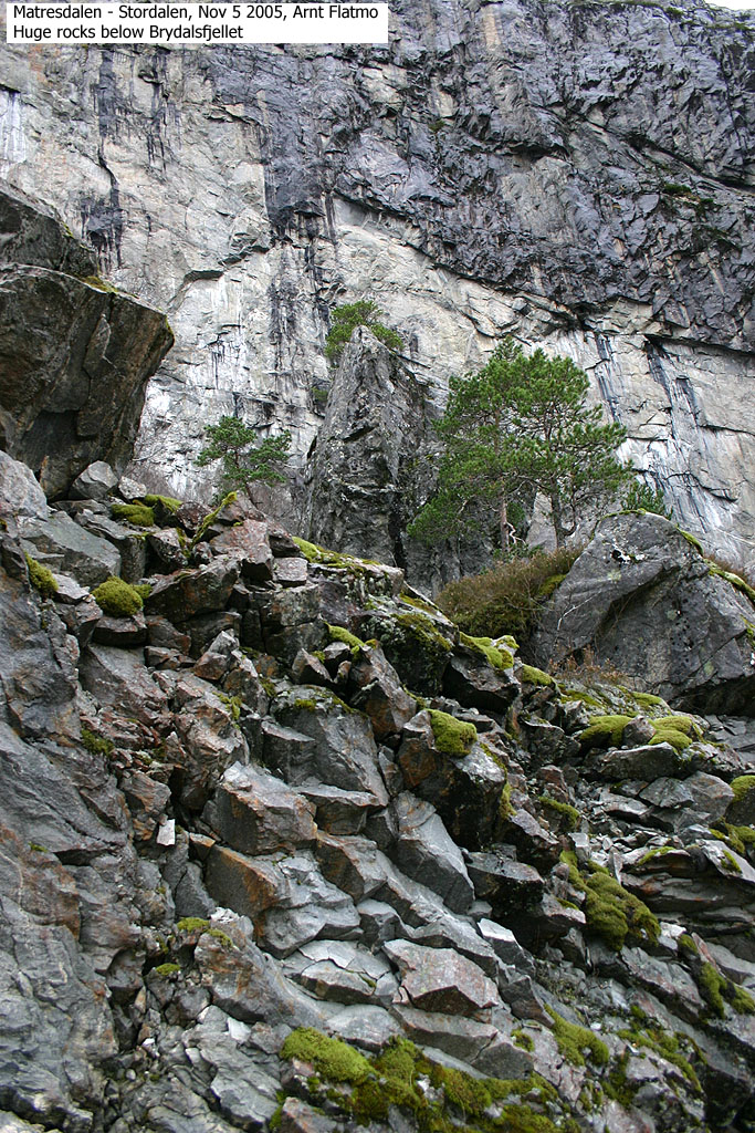
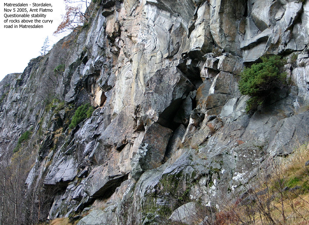
Trip report Nov 5 2005No big plans for this Saturday. I was trying to give tired feet a break, and besides, it was supposed to rain. I did a mental scan (where to go? where to go?) and ended up with Brydalsfjellet. I was almost done with the Masfjorden mountains, so why not tick yet another off the list. I had recently started to record large rocks around the county, and when I drove up Matresdalen, I found dozens. It was almost "big rock heaven", and I have gathered some rock pictures from Matresdalen on this page. I continued up to Fossen, drove up to the nearest house and rang the doorbell. The owner (Jan Olav) was a nice chap and we talked for a while. On my way home after hiking Bjørnshiklanten back in June 2004, I talked to some hikers by Fossen. They told me that Brydalsfjellet could be hiked from here, although not exactly where. Jan Olav filled in the missing link and pointed out the path for me. 11:55AM, we headed upwards. My dachshund "Troll" didn't approve of the wet trail and sat down in protest. To maximise the comfort zone, he actually went OFF the trail before he sat down. I carried him up to 600m elevation on Geitefjellet and dropped him off. Dry grass and a lot of flat rock was much better, and he headed up the mountain without any further objections. High on the mountain, my eyes fell on a characteristic rock. It was slightly out of my route, but I wanted to take a closer look. It wasn't high, 3-4m from its base, but it wasn't trivial to ascend. By standing on another rock, I managed to haul myself up, and there were absolutly no places to put the feet along the way. I had to reverse this procedure in order to get down. All this, while Troll was crying for lunch, being under the perception that this was the summit. We moved on, and reached the summit 13:00PM. I noticed rainshowers towards the east, but the local weather seemed to be stable for many more hours. No need to rush. At the summit, the usual events took place; I took pictures while Troll was eating his lunch. Once done, there was no reason to linger, and we began our descent. I had considered several alternatives for a round trip, but decided on heading straight down a ridge towards Lake Fossevatnet. Fairly soon, I found myself in steep terrain, and slippery slabs made things complicated. I put Troll in the backpack and traversed the slopes northbound until I got a more gentle slope on the ridge. As soon as the terrain let me, I turned right and proceeded along a distinct ridge that led me down to the road. I was curious if I was walking into a dead end. The cliffs above the road can often be just too awkward for descent, but I was fortunate to find an opening. Down by the lake, I met Jan Olav again (preparing to get his sheep back to the farm) and we talked some more. He offered me a lift, but I figured Troll needed the exercise. Troll, with a will on his own, tried to sneak into the car, but was "caught red-handed". As I passed a small forest, I noticed some huge rocks in the forest. I "parked" Troll down by the road while I went in for some closer pictures. On my way back to the road, I had to jump across a hole, and thought I would land safely. Instead, I went straight into a narrow trench, covered up with branches. My leg hit a rock, and it was a classic "leg-breaker" situation. But I was fortunate, and got away with an aching foot.
We reached the trailhead 14:20PM and I
took a trip down to the waterfall before returning back to Bergen. The plan was to hike yet another
mountain, but the trench changed this plan.
|
Move cursor to read notes, and click on the images to see full version.
Some of the thumbnails may have been cropped to fit the format.
Ascent


Summit views


Descent


The waterfall and Matresdalen scenery


No Javascript:
1 2 3 4 5 6 7 8 9 10 11 12 13 14 15 16 17 18 19 20 21 22 23 24 25 26 27 28 29 30 31 32 33 34 35 36 37 38 39 40 41
Other hordaland mountains
 Other Masfjorden K. mountains
westcoastpeaks.com
Other Masfjorden K. mountains
westcoastpeaks.com

