
Norwegian Mountains, Sogn og Fjordane
Veten, Brurahornet, Gottrøysa, Nov 28 2009
To the main Veten/Brurahornet page (maps, route descriptions, other trip reports, etc.)
")
The route seen from Google Earth (poor image quality)
(Click for larger image)
It was time to "get going" with the mountain range on the north side of Nordfjord - a region which was completely new to me. I decided to begin (almost) as far away from home as possible, which meant that I would be going to Måløy on this Saturday. The weather could have been better. Snow had fallen down to 300m on Hareidlandet island, and I traded rain showers for slightly better weather in Volda. Thus, I had high hopes for even better weather in Måløy, but when I crossed the Måløy bridge, the summits were hidden in fog. But at least, it wasn't raining.

Veten & Gottrøysa seen from the Måløy bridge
(Click for larger image)
I had planned to head out from Skramsvatnet, but decided to drive into town and ask around first. I wanted to do a round trip across the three tops, and I needed some more information about the trails. I stopped two women and one of them told me she lived next to the trailhead. I could just follow her car and she would point out the trailhead for me. I got some info about the round trip, but I gathered the route would present itself along the way. By 11:52am, I was on my way from Gate 8 and up the Veten path. And a few minutes later, I had a fine view towards Måløy.

Måløy view
(Click for larger image)
On the way up Veten, the path became very icy. A guy came running down the mountain and we talked for a little while. He described the round trip in detail, and the picture I had of the route matched his description quite well. I reached the top of Veten 12:46pm, and the wind was cold. But the summit was no longer fogged in, which was a big bonus!

The final yards to Veten
(Click for larger image)
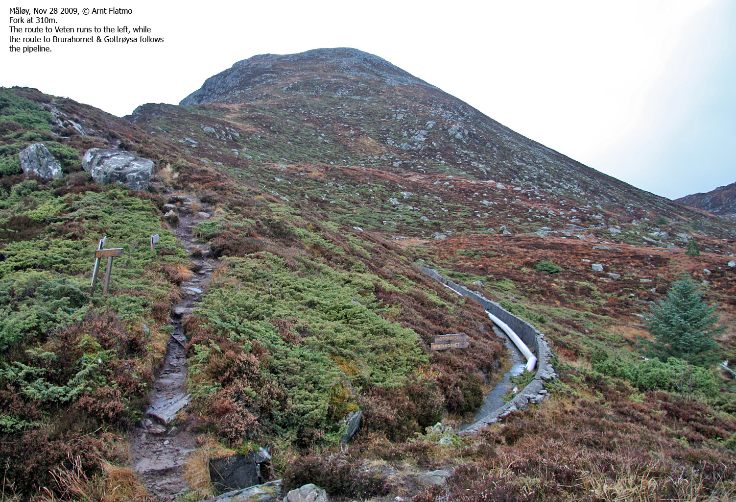
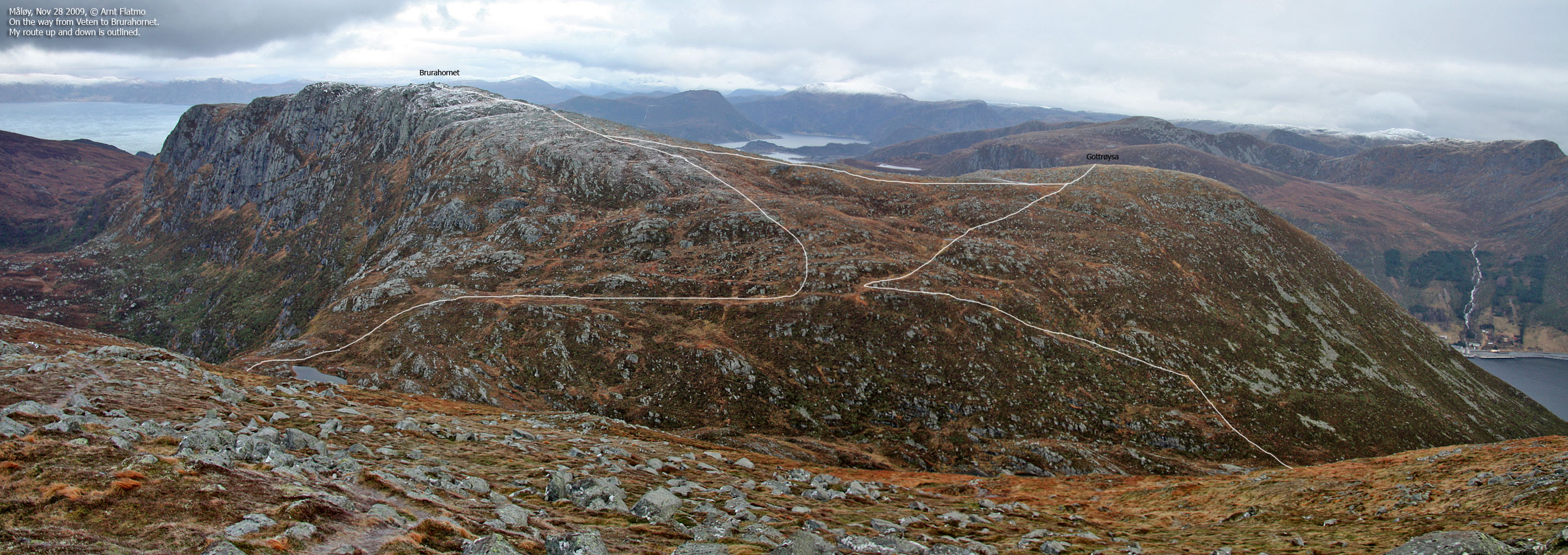
Next stop was Brurahornet. I headed down Veten's north ridge and followed a path that ran in the direction of Gottrøysa. This was obviously the wrong direction, but I decided to stick to it. At 480m, the path forked and I followed a marked path (sticks) north towards Brurahornet. By the time I reached the summit (1:29pm), I had moved into thick fog and there was little to seen from the summit.

On Brurahornet
(Click for larger image)
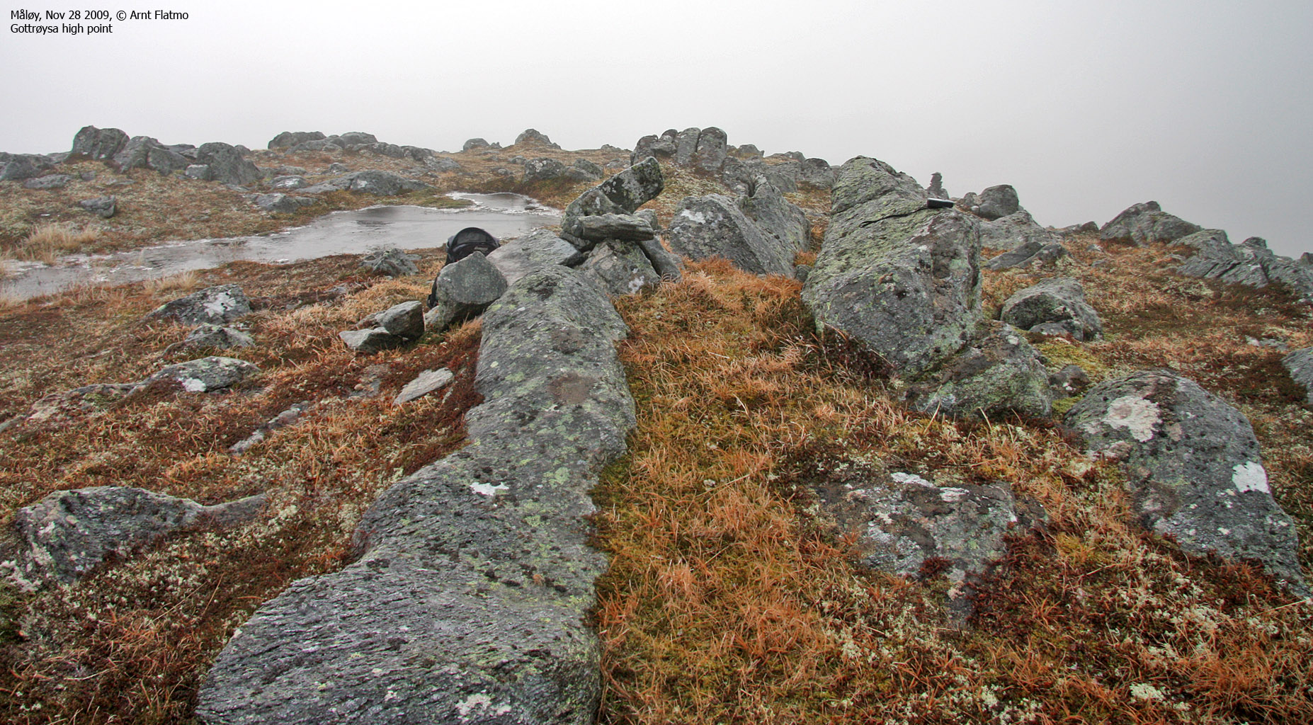
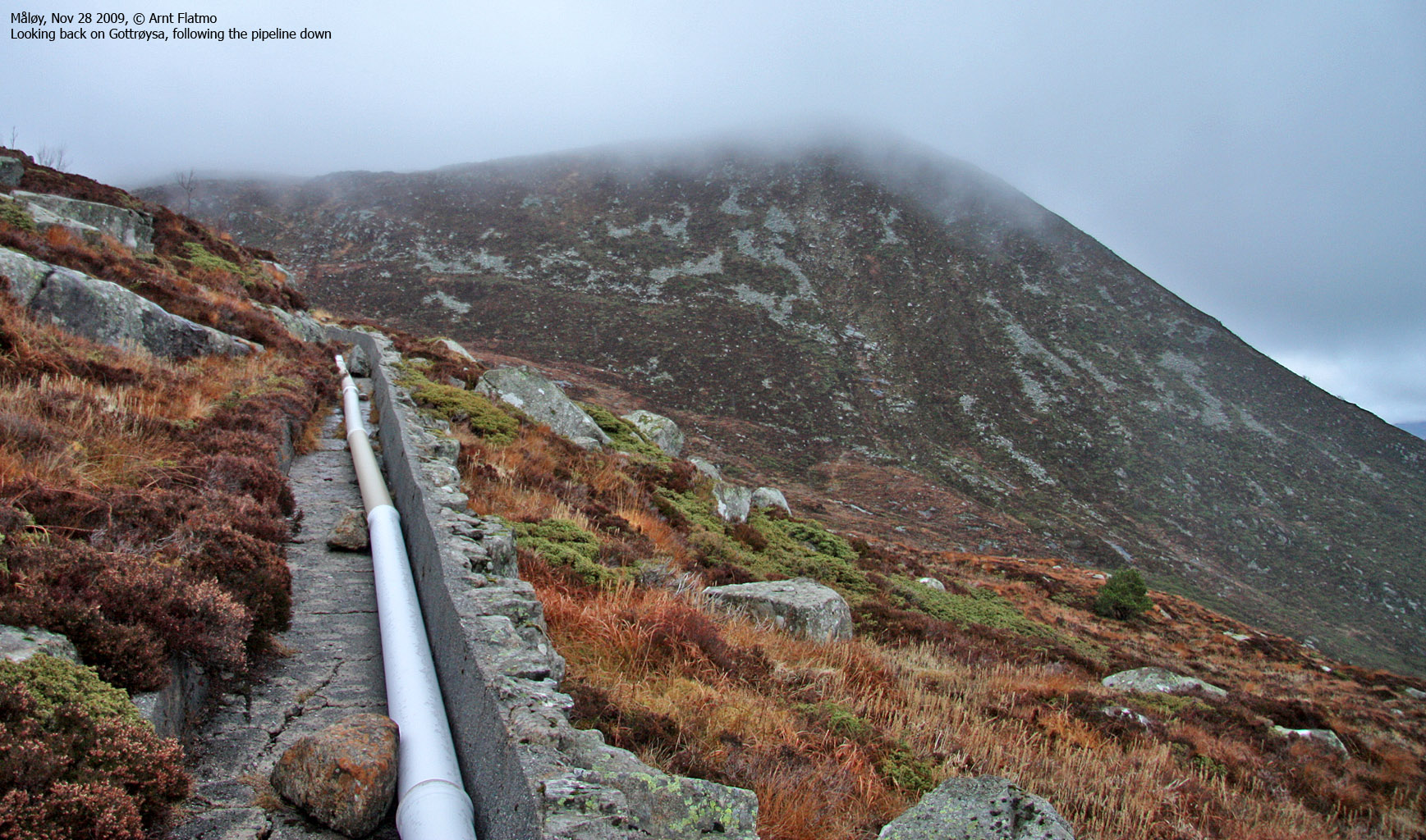
My last stop was Gottrøysa (1:47pm). After stopping by the (unmarked) high point, I continued down to the viewpoint cairn. The fog seemed to lift and after waiting around for a few minutes, I was "rewarded" with a nice view towards Måløy. I then followed a path which took me into the valley between Gottrøysa/Brurahornet and Veten, but this path seemed to continue along the creek from lake 385m. I headed (off-trail - 120m) over to the pipeline and followed it back to my ascent route. By 2:25pm, the round trip was over and my Nordfjord project was well on the way.

Måløy seen from Gottrøysa
(Click for larger image)


