
Botnanuten, 1024m
|
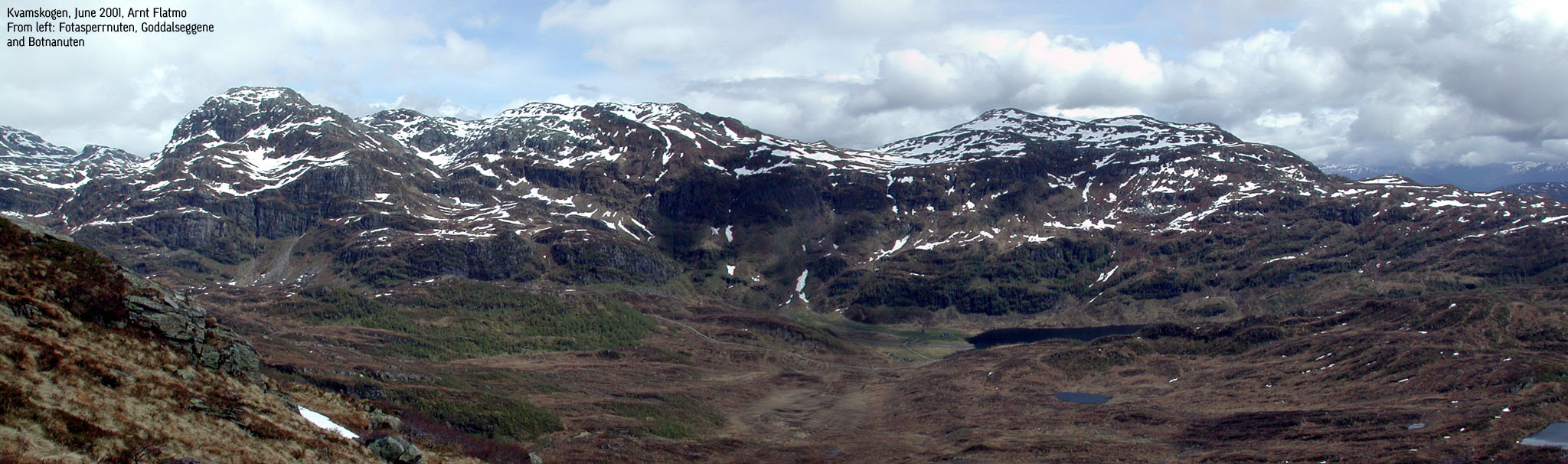 Botnanuten (right) seen from Byrkjefjellet |
Access:
On highway 7 over Kvamskogen, just before the road desceds towards the first tunnel
towards Norheimsund, locate a large parking area and a gravel road that leads to
Byrkjesete. The gravel road begins by a house, and the road is gated.
Botnanuten (M711: 1025m, Ø.K: 1024m) has a primary factor of 116m towards the higher Goddalseggene (1117m). The saddle is found on the high ridge between the two mountains. Ref. Økonomisk Kartverk, you cross the 910m contours on the high route, but not 905m. The saddle height has been interpolated to 908m.
Solhellanuten (M711: 908m, Ø.K: 906,5m ~ 907m) has a primary factor of 79m towards the higher Goddalseggene (1117m). The saddle is found N of Solhellanuten. Ref. Økonomisk Kartverk, you cross the 830m contours on the high route, but not 825m. The saddle height has been interpolated to 828m.
The trail:
|
Follow the gravel road all the way up to the old houses by Byrkjesete. By the old houses, look towards the Nipen mast. Look for the trail up through the forest on the right side. Follow the trail up to Nipen. On the right-hand side, you have the Bårfjellet cairn at 801m. From here, the route up to Botnanuten summit is obvious. Head for the mountain straight on. After you have been to Botnanuten, head back down to Bårfjellet the same way. From Bårfjellet, head straight east down to Dusgjelet pass. Cross the river and begin climbing up Solhellanuten (908m). Soon you will find the trail that runs between Byrkjesete and lake Myklavatnet. After your visit to Solhellanuten, follow this trail back to Byrkjesete. |

|
Notes:
Allow 4-5 hours for this trip. I would extend this round-trip to include a couple of
additional summits, but on this day I had heavy rain and heavy fog. I did the trip in 3
hours and allowed no time for breaks. One option is to continue from Botnanuten, pass
Fotasperrnuten, 1194m (see separate description) head for the Gråurdi pass and
head down Steinkvanndalen valley.
Pictures: (move cursor to read notes, and click on the images to see full version)

 Other hordaland mountains
Other Kvam K. mountains
westcoastpeaks.com
Other hordaland mountains
Other Kvam K. mountains
westcoastpeaks.com