
|

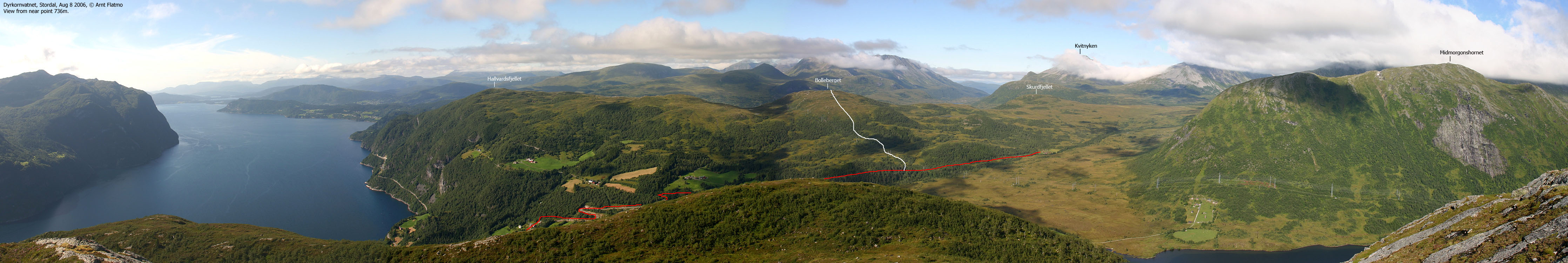
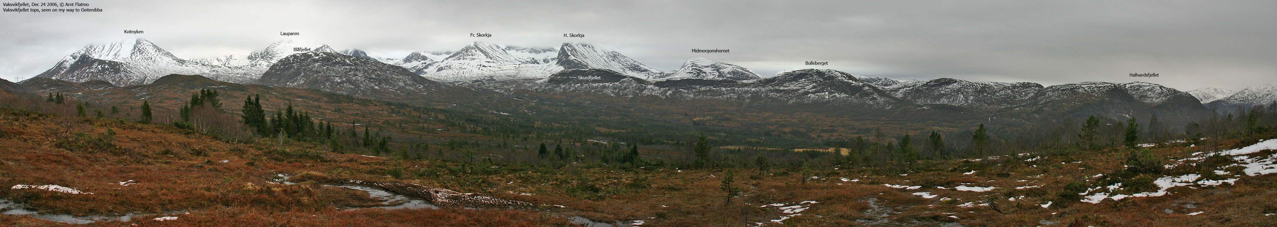
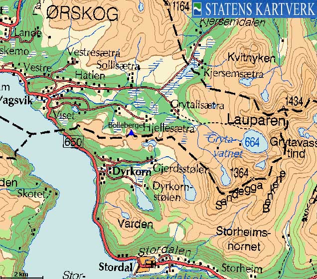
Bolleberget is located on the Stordal/Ørskog kommune border just northeast of the place Dyrkorn by Storfjorden. If you head eastbound from Bolleberget, and walk across Skurdfjellet, you'll end up at Grytalisætra on Vaksvikfjellet - the trailhead for many fine tops, including Lauparen.
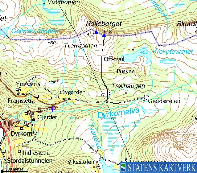
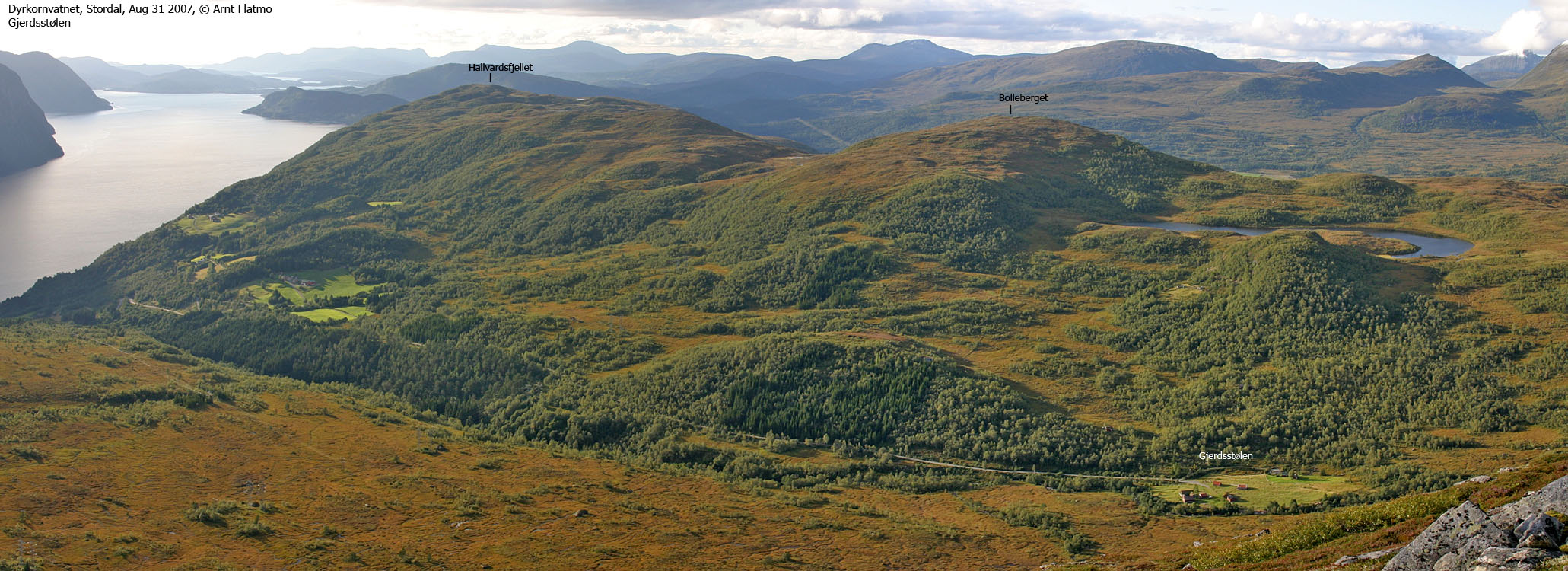
Bolleberget has a steep north side and a fairly gentle south side. The normal approach would be from Dyrkorn, towards Gjerdsstølen and then directly up to Bolleberget. This is the route described on this page. No distinct paths seem to lead up to the top.


Bolleberget (Norge 1:50,000: -, Økonomisk Kartverk: 618m, UTM 32 V 395834 6924449) has a primary factor of 102m towards the higher parent Heimste Skorkja/Sandfjellet (1322m). The defining saddle (approx. 32 V 396820 6924269) is found NE of Lake Kroketevatnet. Ref. the Norgesglasset map (5m contours), the saddle is defined through a fixed point - 516m.
Personal GPS measurement averaged to 618m (on top of cairn, 2m high) over a 5-minute period. Point 612m on the Norge 1:50,000 map is not the high point.
Google's interactive map. You can zoom, pan and click on the markers.
Notes: Class ratings are in reference to YDS. Click here for more information.
The trails described below are not necessarily the *easiest* trails to this mountain.
|
Dyrkorn - Bolleberget
|
|

Access
From Ålesund, follow highway E136->E39 towards Åndalsnes. From the E136/E39/Olsvika roundabout near Breivka, follow E39 28Km to the RV650 junction just after Sjøholt. Turn right onto RV650 (Geiranger/Stordal) and continue approx. 12,1Km on this road. At Dyrkorn, just after Dyrkorntunnelen and in a 50-zone, turn left and follow a hairpin road 1,4Km upwards. You've now reached a road junction. The road to your right becomes a toll road up to Dyrkornvatnet. Go left and continue yet another 800m. Find parking on a turnout on the right-hand side just before a sharp left-turn.
The route
Continue up the road to the Gjerdsstølen/Ytresæter junction (signed). Turn right and follow the road 300m upwards. The road to Gjerdsstølen is a toll road, but may be closed. Follow the Gjerdsstølen road 800m until you pass under the powerlines. Leave the road and pick a northbound route towards Bolleberget. There is a path marked on the map, but it isn't easy to see in the beginning, because of boggy ground.
You'll do just fine off-trail. As you reach the forest, take time to find the best route. It may become a little awkward in places, but only for a short section. Once above the trees, it is an easy stroll up to the high point, marked by a tall cairn.
Point 612m is located 140m NW of the high point. Per Jan 2007, there was a broken trig. point at point 612m. Descend your ascent route, or head eastbound to Skurdfjellet and descend to Gjerdsstølen.


No Javascript:
 westcoastpeaks.com
Other Møre & Romsdal mountains
Other Norwegian mountains
westcoastpeaks.com
Other Møre & Romsdal mountains
Other Norwegian mountains

