
Norwegian Mountains, Møre og Romsdal
Blåtind via Hammarselva & Hestedamselva, Jun 30 2009
To the main Blåtind page (maps, route descriptions, other trip reports, etc.)

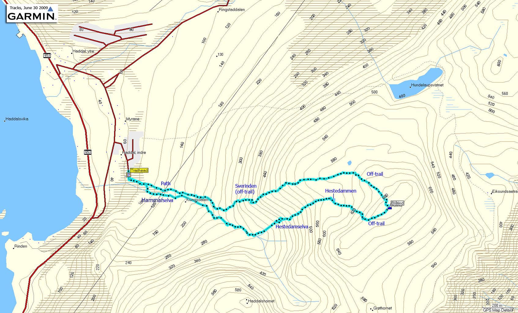
The route
(Click for larger image)
EDIT: Previous version of this page said that the river name was Haddalselva. The correct name is Hammarselva.
4 days prior to this hike, I "discovered" the Hestedamselva creek that runs between the Klungsdalen valley and the plateau just below Blåtind. My colleague Terje Øvrebø pointed out this route from a picture and asked if I had done it. I hadn't, and that needed to be sorted out right away. A few days later, I scrambled up this creek to the small Hestedammen lake below Blåtind. I fell into a pool along the way, the cell phone died and I had to spend the early hours of Saturday morning trying to get an old, old cell phone to work.
But the scramble had been quite nice, especially in one section of the creek - which was quite tall and exposed. I wanted to document this route, and asked Terje (being the discoverer) to come along. I sensed a tiny bit of reluctance, but he said yes. A bit later on, it struck me that we ought to hike along Hammarselva river (which I had never been to), and reach Blåtind through 500 vertical meters of creek and river scrambling. I'm confident that has never been done before. Whatever it's worth...

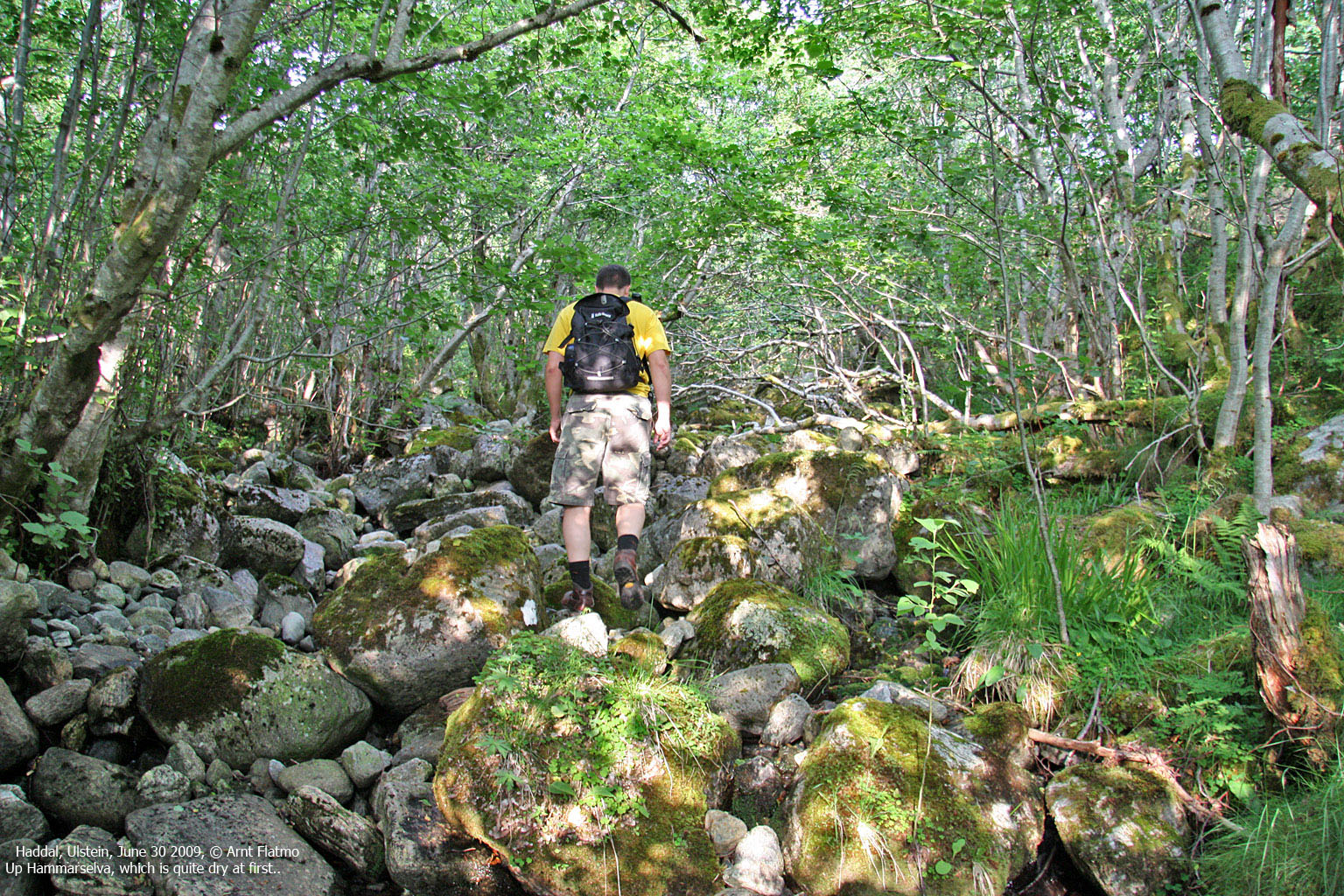
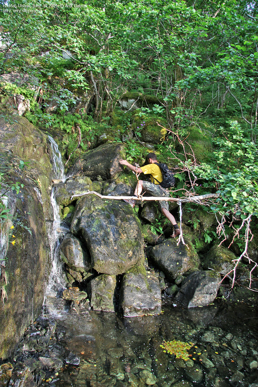
Becoming familiar with Hammarselva
(Click for larger image)
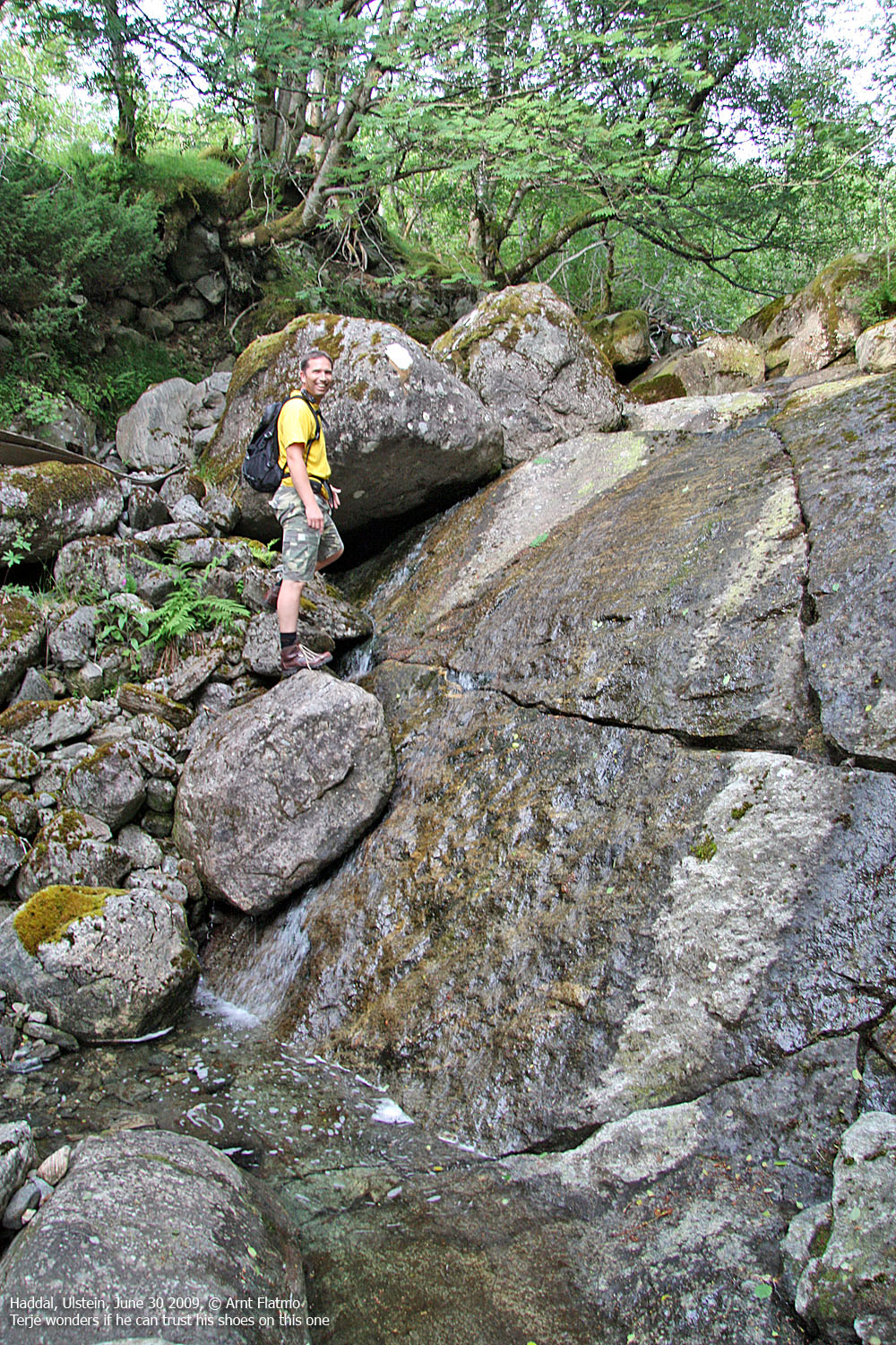
Hammarselva soon called for scrambling, and was downright fun throughout. By another colleague, we had been briefed about a 10 metre high waterfall which was supposedly difficult. With the small amount of water in the river, this section wasn't difficult at all, although a fall wouldn't necessarily be inconsequential. And that was true for other sections of the river as well.
This form of scrambling was plain fun, fun and then some. It was easy to see that Terje enjoyed himself big-time in this river. And it's such a great workout, in addition to the fun.

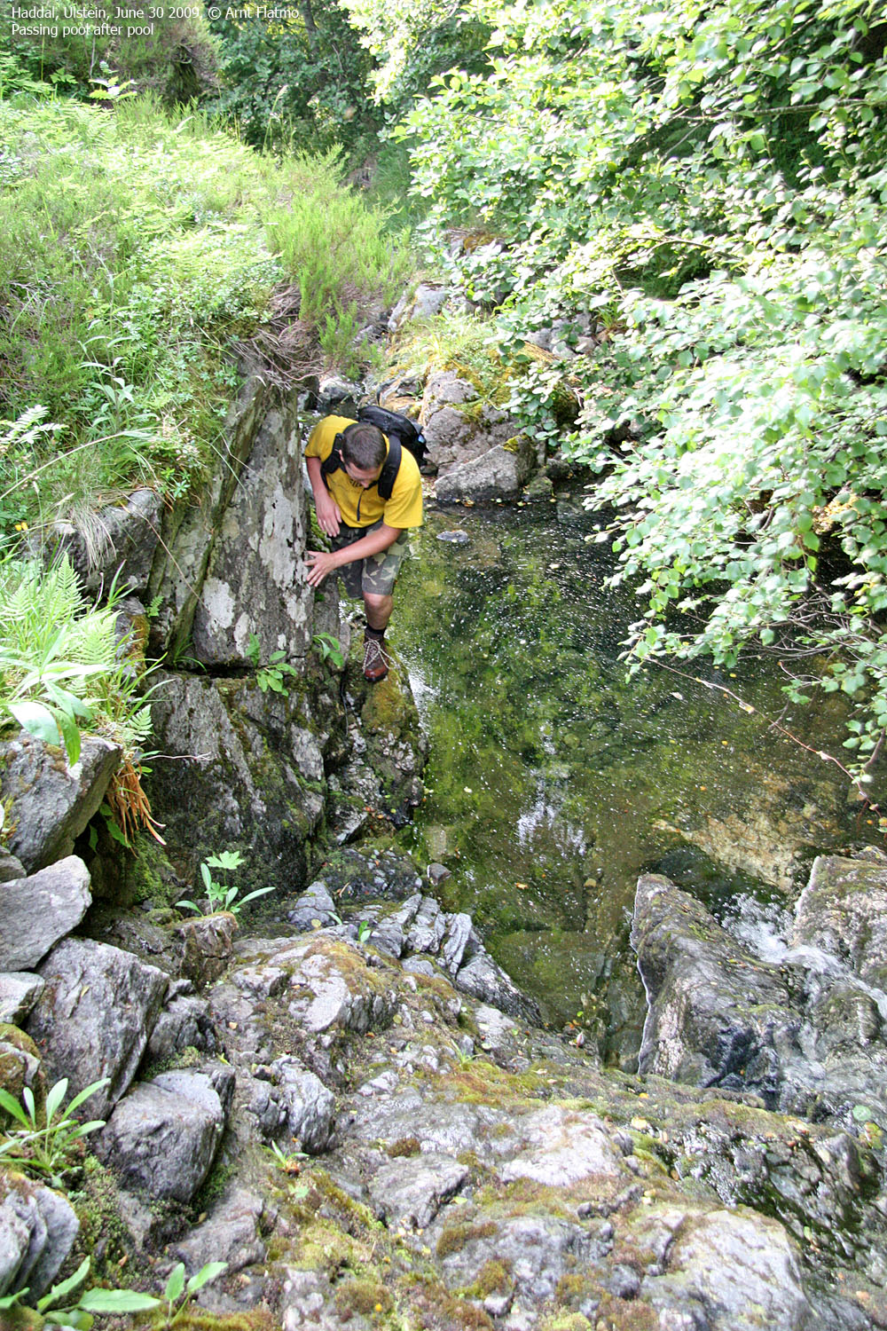
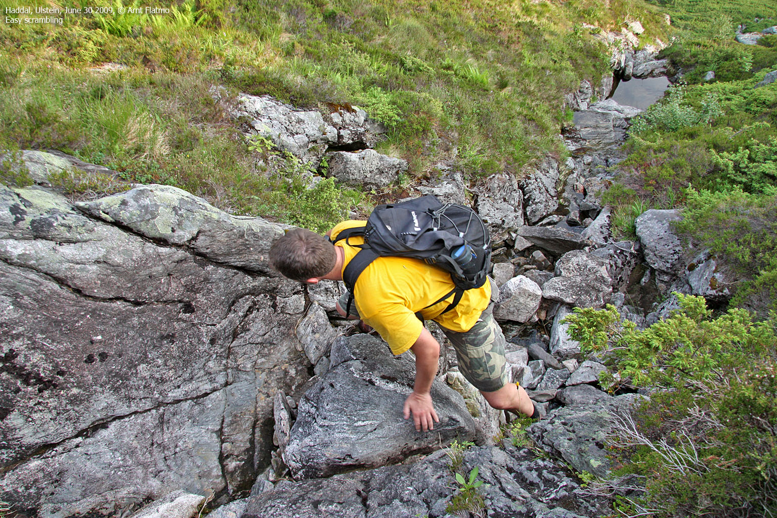
Scrambling the Hammarselva river
(Click for larger image)
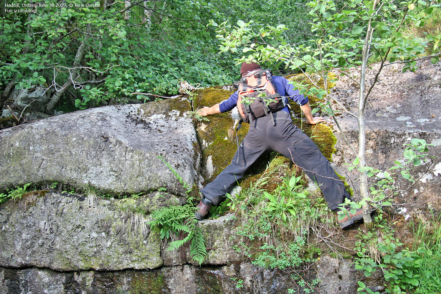
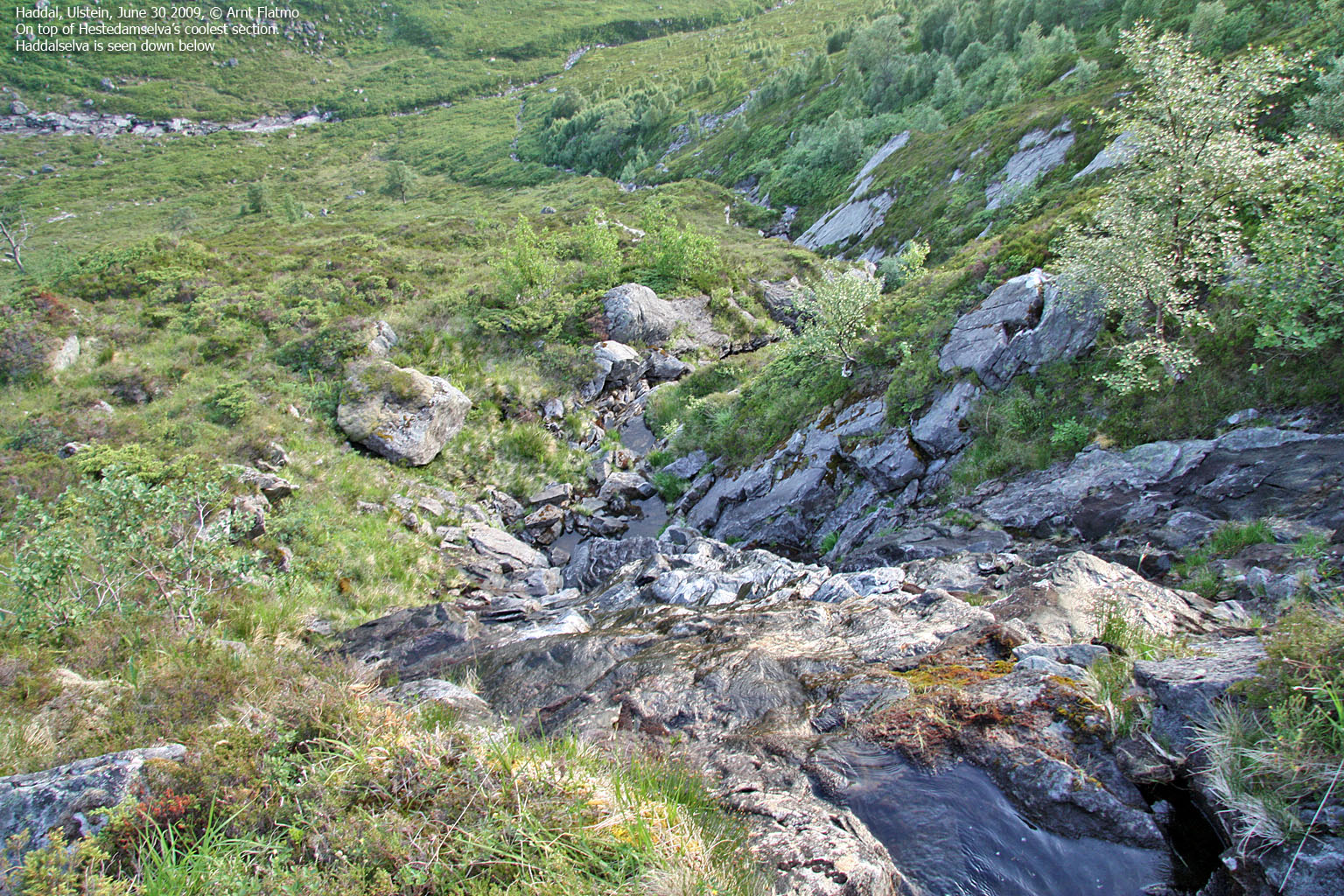
At 300m elevation, Hammarselva river turns into slabs, and we switched to the Hestedamselva creek. After some initial easy scrambling, this creek became gradually more and more fun. And Terje understood how I could have fallen into the pool.
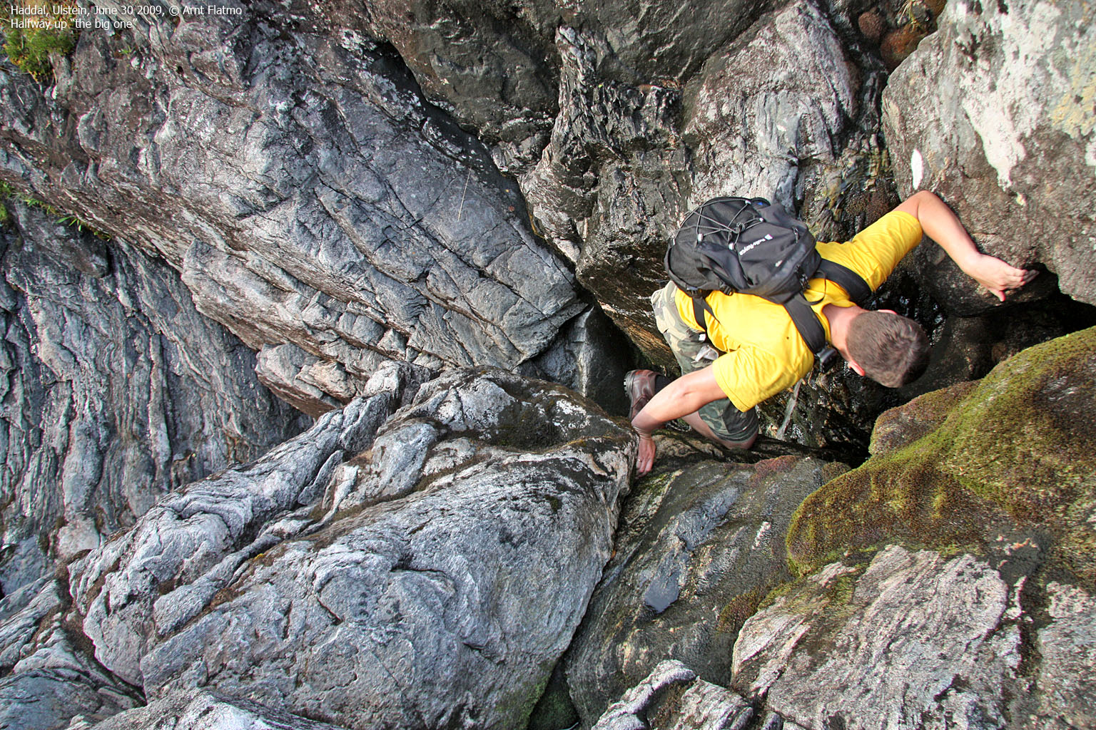
As I photographed Terje in profile in the most exposed scrambling section, it struck me that this was no longer harmless scrambling. A fall here could easily have very severe consequences. Still, it wasn't really difficult, as there were plenty of good handholds. And Terje is doing just fine in this type of terrain.

Coolest part of Hestedamselva
(Click for larger image)
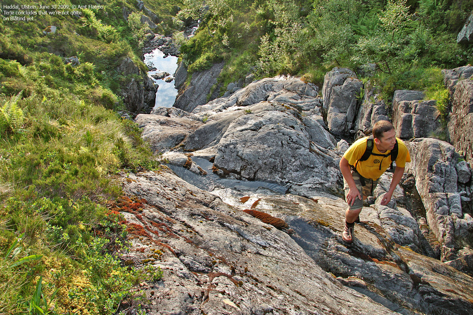
We passed Hestedammen (approx. 570m) and continued to scramble up to Blåtind. While it takes me normally 42-45 minutes to reach Blåtind, this route took 1 hour longer. We stayed 5-10 minutes on Blåtind, watching a beautiful coastline before we descended along the Sverinden route (the northwest ridge). It was a very, very nice hike which I strongly recommend to everyone!

Blåtind view
(Click for larger image)


