
Norwegian Mountains, Møre og Romsdal
Litlehornet and Blåbretinden, July 5 2008
To the main Litlehornet/Blåbretinden page (maps, route descriptions, etc.)
I had no other plans than having a nice walk up to Litlehornet. I'm sticking to this name, as the local name Itljehønnjet is both difficult to write and pronounce. ISCLHØNT! ...........No, I'm sticking with Litlehornet..
I had only pictured a short and nice walk, and didn't bring any lunch. I did carry a small bag of nuts, though. I just hate planning for food until I get hungry. On the Things-I-really-hate list, the question "what would you like for dinner this evening?" ranks high. I know what you're thinking; "Does he really keep such a list?". I might. I might not.
I located the Straumshornet trailhead and was on my way 11:50am. I really wanted to follow the Straumsheimsætra path from the trailhead, but a local farmer had told me to follow the road 150m before going left. So I did. The information was correct, although I'm sure both routes would have gotten me up there. 12:27pm, I arrived at the Straumsheimsætra ruins, after a looong walk up the forest. For the first time in years, I didn't have a shirt on. It was that warm. I rested for two minutes before continuing up the valley.

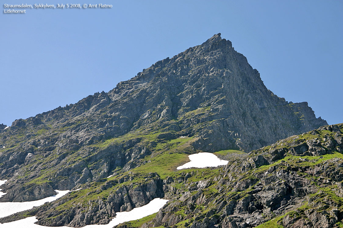
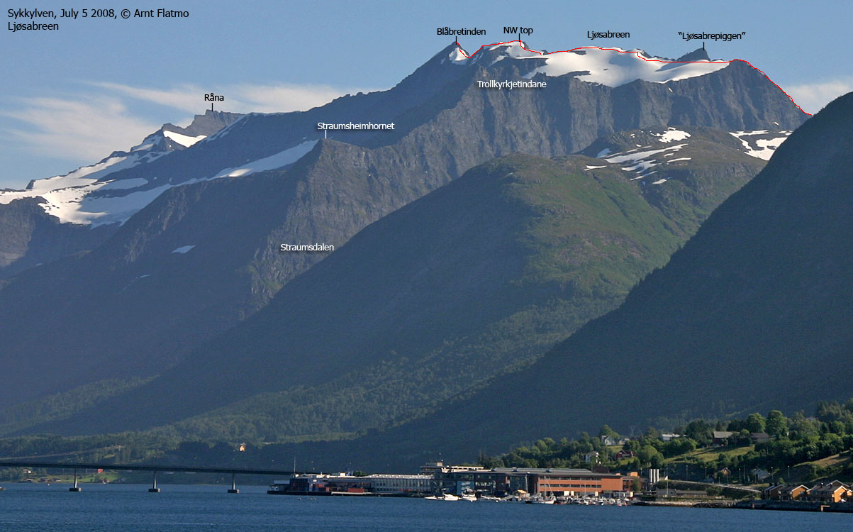
Straumsheimsætra and Litlehornet
(Click for larger image)
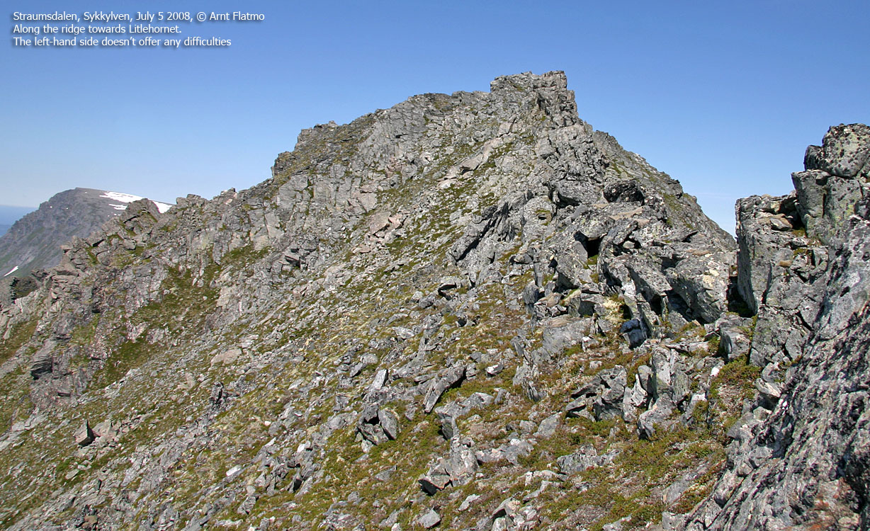
Litlehornet
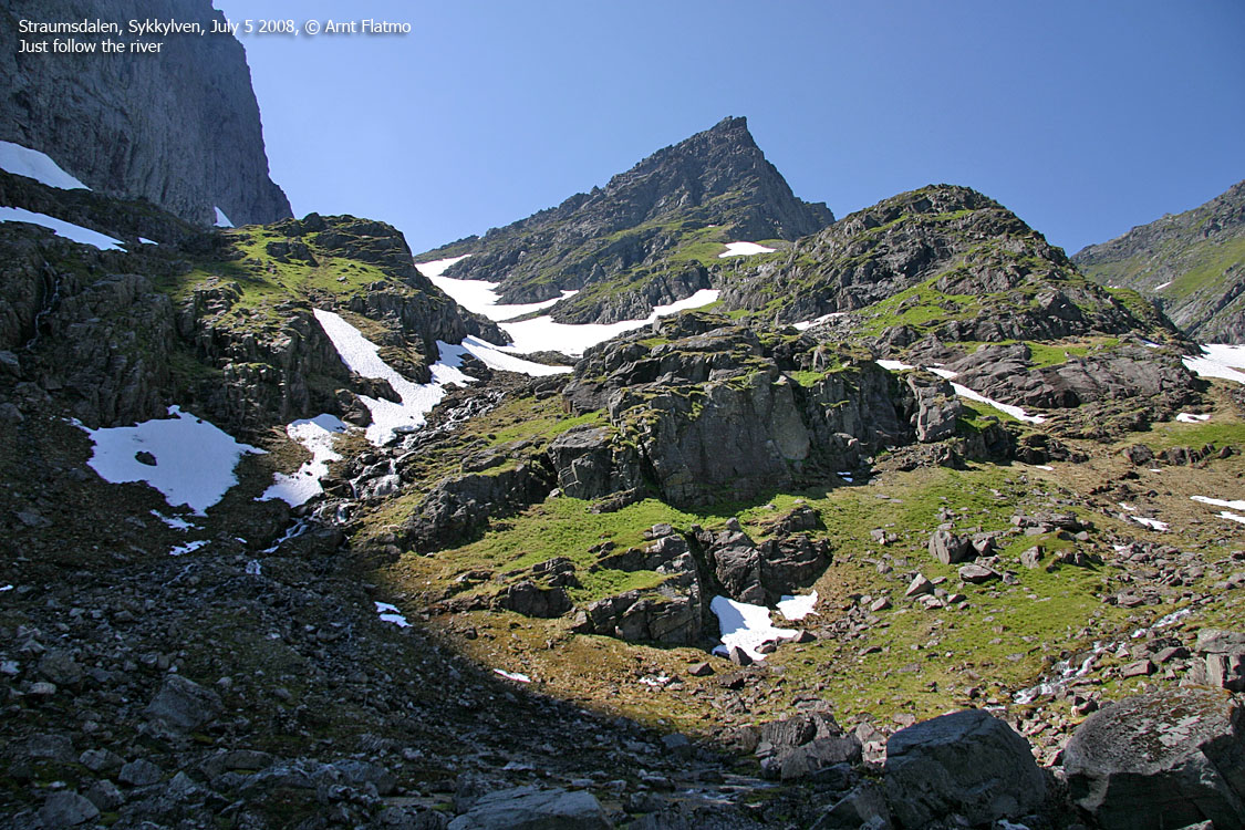
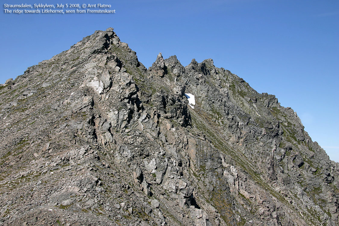
The upper valley was partly in the shade. The amount of snow revealed that the upper part of the valley doesn't get much sunlight at all. A cool (quite cool actually - brr) wind cooled me down. A friend of me told me about a short-cut up to the ridge. It wasn't hard to find, and soon I was up there. The ridge was rugged and it was difficult to get a clear understanding of the terrain. But the ridge turned out to be (disappointingly) easy. 2:10pm, I was on top of Litlehornet, where I spoiled myself completely with rasins and nuts...
Trollkyrkjetindane?
So this was it? Turn back around now? Not likely. Trollkyrkjetindane appealed to me, and I decided to pay them a visit. The ridge didn't pose any further difficulties on my way down to Fremsteskaret. Down by the pass, I wished I had taken the time to fill up the water bottle down by the river. Oh well, I'm only going "up the hill, and then some".
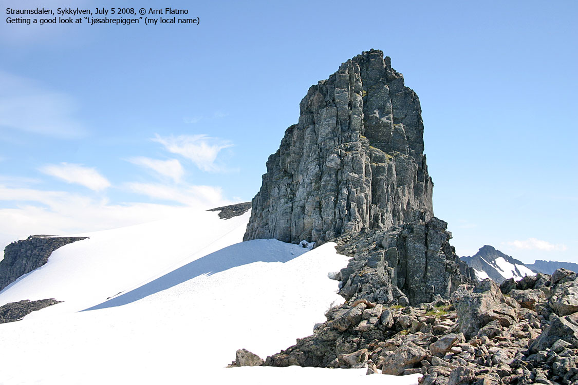
After 230 vertical meters, I had Trollkyrkjetindane in view. I had found water during the ascent and my energy was back at full strength. A cool sugar loaf-shaped cliff caught my attention. Was there a route up on the back side? I decided to go and have a look. Trollkyrkjetindane could wait.
Walking about ..
There was of course the question of whether I should be walking on a glacier or not. Not knowing how the glacier looked under the snow, I had to trust my instincts. There seemed to be plenty of snow next to the sugar loaf cliff. I needed to stay away from the bergschrund (if any) and melting gaps, naturally. But otherwise, my instincts told me this was safe. The interesting question was; does a glacier begin with a crevasse, or does it actually have to flow for a while? Until proven otherwise, I assumed the latter concept.
I came to the point where I noticed an easy route up to the sugar loaf. There was little sugar left from this angle, but I still thought it was cool. I was now at 1330m elevation. There were less than 100 vertical meters up to the top of the glacier! I decided to proceed, as it seemed I could walk outside the glacier most of the way upwards. The idea of Blåbretinden hadn't occured to me until I was on top of Ljøsabreen, 3:30pm.
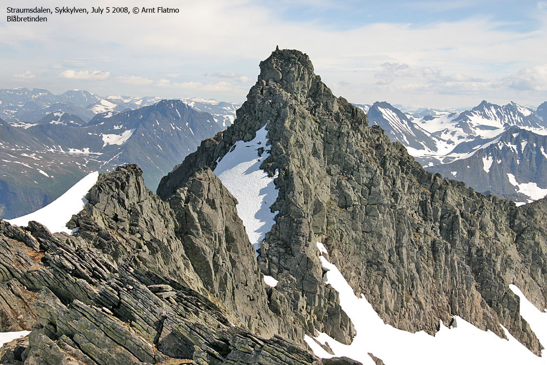
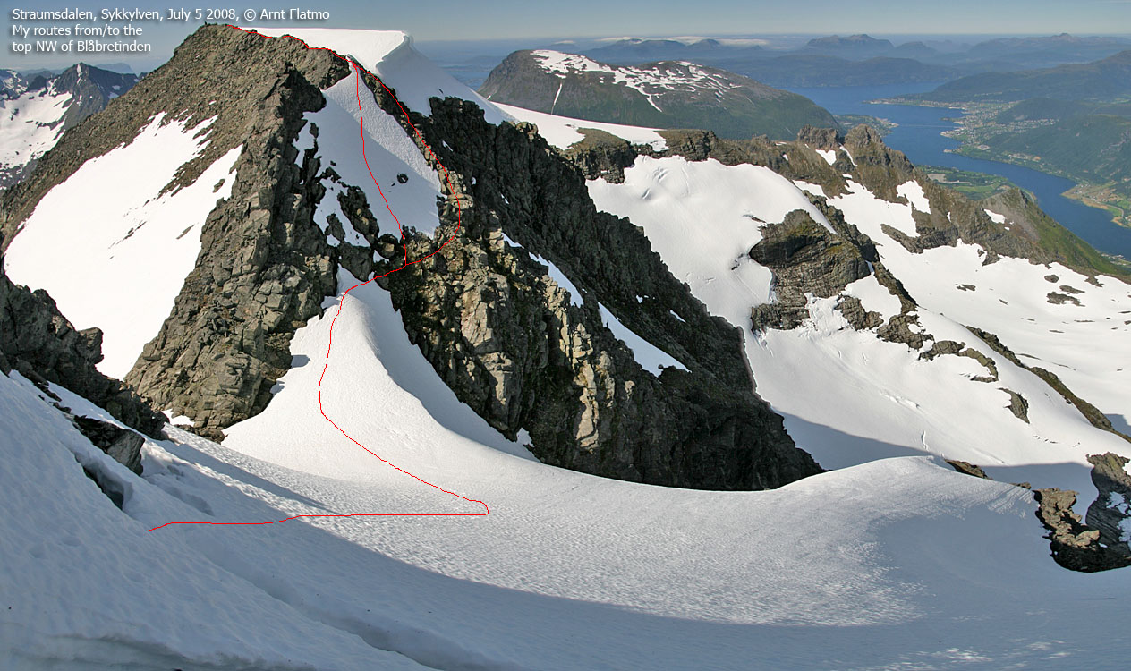
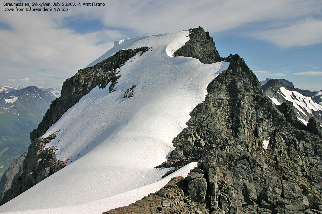
Blåbretinden
Now I had the NW Blåbretinden top in sight, and I needed to go up there to get the main summit in view. I didn't exactly know how it looked like, other than having seen a picture some time ago. I remembered to be steep. But how steep?
I passed the NW top 3:45pm, got the main summit in view and h o l y c o w was the first thing that came to mind.
Blåbretinden
(Click for larger image)
The peak was simply beautiful. For some reason, I thought looked like a miniature version of Store Skagastølstind. Click on the link and see if you agree. At this point, I couldn't quite understand how I was supposed to get up, but I had to go closer to get a better view.
Blåbretinden and Vintervindskaret
(Click for larger image)
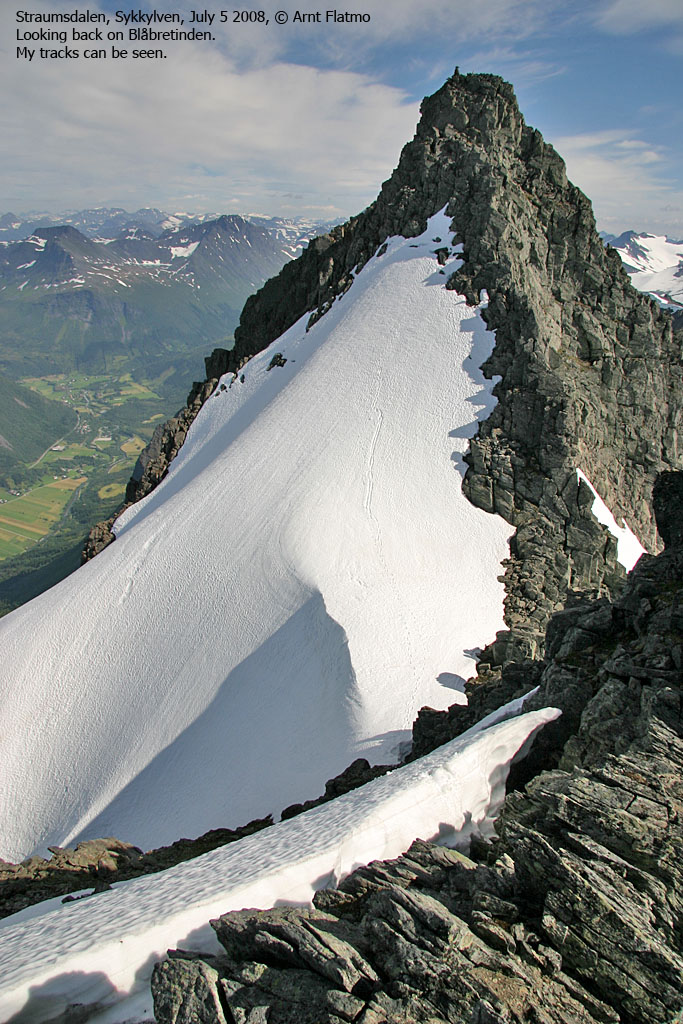
Standing on top of the Vintervindskardet pass, I was now at the m o t h e r o f a l l c o w s level. This peak really freaked me out for a minute, until I could I got my head back together. There was no way I could turn back around without having at least tried. I found a good route down to the pass and mounted my crampons (standard kit for July hiking) and headed up the snowy hill. I had two ice-axes (standard kit for those who don't like steep snow slopes).
When I ran out of snow, I was able to get onto the mountain without having too much problems with melting gaps. I started scrambling and before I knew it, I was on top. The time was now 4pm, and I chewed merrily on my few remaining raisins. "Lunch would have been nice", I thought to myself, but that was the only complaint I had in the whole wide world. My shoulders informed me that a mild sunburn was on its way, and the shirt came back on.
After a short stay on top , I scrambled back down. I was actually enjoying the steep snow now that I had the proper gear. There would be more steep snow slopes in the days to follow; Store Smørskredtind, Urkedalstinden, Råna and Midtre Regndalstind. From Vintervindskaret, I also climbed directly up the steep snow slope to the NW top.
"Ljøsabrepiggen"
I decided to postpone my visit to Trollkyrkjetindane. It was not a hard decision, given my recent bonus. But I would still stop by the sugar loaf top upon descent. I reached the top of this cool rock 4:48pm, after an easy walk up. I decided to refer to this top as Ljøsabrepiggen, and humored myself about the idea of introducing the "piggen" word in Møre & Romsdal. There's no big difference between a pigg and a hønnj, except that a pigg could be expected to be pigg-ish all the way around. Perhaps this rock didn't quite qualify in that respect, but never mind. I'm sure that this rock has a name, and through this little story, someone may actually send me an email.
The second bonus ..
of the day was the snow slide that was awaiting from Fremsteskaret. 5:15pm, I headed out from the pass at 1080m, and 10 minutes later, I was down in the valley at 580m. That's 50 vertical meters per minute. And big fun too. Inspired by the thought of a late lunch, I descended quickly down the valley and was back at the trailhead 6:04pm. It had a been a very, very, very memorable hike!


