
Norwegian Mountains, Sogn og Fjordane
Berstadhornet, 578m (Berstadeggja)
Eidshornet, 520m (Geitskarhornet)
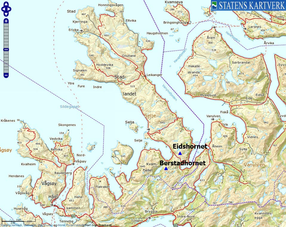
| Fylke/Kommune: | Sogn og Fjordane county, Selje municipality | ||||||||||
| Maps: | 1119-III Vanylven (Statens Kartverk, Norge 1:50 000) | ||||||||||
| Primary factor: |
Berstadhornet: 108m Eidshornet: 240m | ||||||||||
| Hiked: | Eishornet: Nov 2009, Berstadhornet: Jan 2012 | ||||||||||
| See also: |
| ||||||||||
| See also : | Other Sogn og Fjordane mountains on westcoastpeaks.com |

Berstadhornet and Eidshornet
(Click for larger image)
Introduction
Berstadhornet and Eidshornet are two tops that are located on each side of the Mannseidet pass, with Kjødspollen on the east side and Moldefjorden (no, not that Moldefjorden...) on the west side. Thanks to a moderate elevation gain and marked and well worn paths, the tops are easily accessible to the public.
The views from the tops are very good, and characteristic tops such as Blæja, Felden, Gjegnen and Hornelen will catch your attention. Those who know the Sunnmørsalpane mountain range will also be able to recognize some of its peaks. And not to forget the massive Kvamfjellet - the highest mountain top in Selje. To the north and northwest lies Stadlandet - legendary for its rough weather.
This page describes the normal route to both tops from Mannseidet.

Eidshornet
(Click for larger image)
Primary factor:
Eidshornet (Norge 1:50,000: 520m, Økonomisk Kartverk: -, UTM 32 V 314153 6881846) has a primary factor of 240m towards the higher parent mountain Tarvaldsegga (645m). The defining saddle (approx. 32 V 311284 6885451) is found on Sandvikseidet, just east of Djupedalsvatnet. Ref. Økonomisk Kartverk (5m contours), the contours are difficult to read, so the saddle has been set to 280m. At least, the saddle has to be higher than Djupedalsvatnet (279m).
Berstadhornet (Norge 1:50,000: 578m, Økonomisk Kartverk: 577,67m, UTM 32 V 312399 6879611) has a primary factor of 108m towards the higher parent mountain Storevassegga (605m). The defining saddle (approx. 32 V 312234 6878788) is found between Berstadhornet and Langevatnet. Ref. Norge 1:50,000 (20m contours), the saddle is within the range 460-480m, interpolated to 470m.

Berstadhornet
(Click for larger image)
Google map
Google's interactive map. You can zoom, pan and click on the markers.
|
|
|

Trail descriptions
|
Route 1: Mannseidet (summer/autumn)
|
|


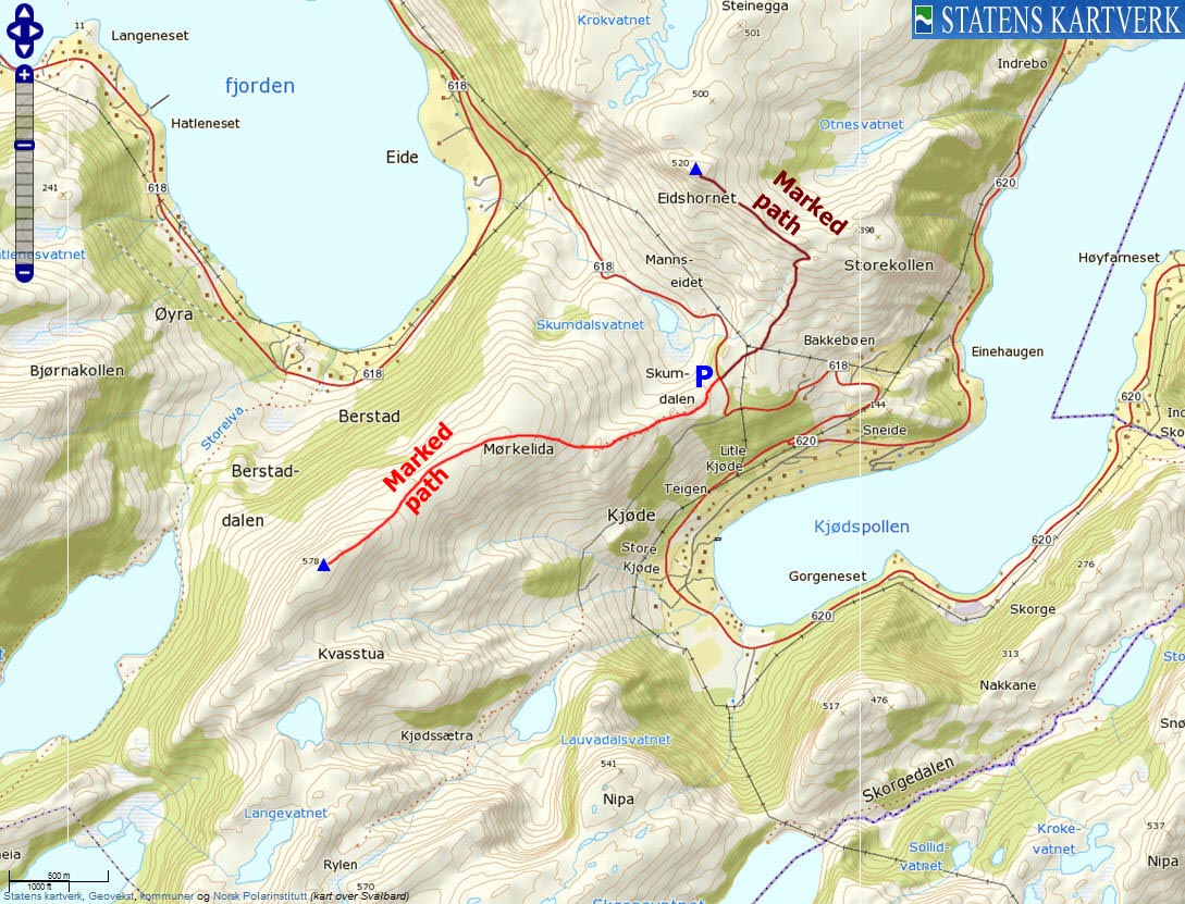
This route description is valid per Jan 2012
Access
(all distances are approx. distances)
The starting point for this description is Mannseidet - the pass that defines the Stadlandet peninsula. The nearest village is Åheim - less than a 4km drive to the east.
There is room for a 2-3 cars at Mannseidet (N62.01378 E5.45295). It is not uncommon to see cars alongside the road. You can also park in a sharp curve 180 meters down the road (in the direction of Kjødspollen).
The route

The route to Berstadhornet
(Click for larger image)
The path from Mannseidet is marked by signposts and sticks with red paint. It runs where you would expect it to run, and doesn't really need a closer description. The ridge up from the parking is known as Høgeggane. On your way up to Mørkelida, you'll pass the Berstadhornet/Tua trail fork. Go left towards Berstadhornet.
The summit (N62.00224 E5.41671) is marked by a medium-sized cairn. You'll pass a small cairn a couple of minutes before you reach the high point.

The route to Berstadhornet
(Click for larger image)
|
Route 2: Mannseidet - Eidshornet (summer/autumn) In a while.............
|
|
Pictures and Trip reports:
 westcoastpeaks.com
Other Sogn og Fjordane mountains
Other Norwegian mountains
westcoastpeaks.com
Other Sogn og Fjordane mountains
Other Norwegian mountains