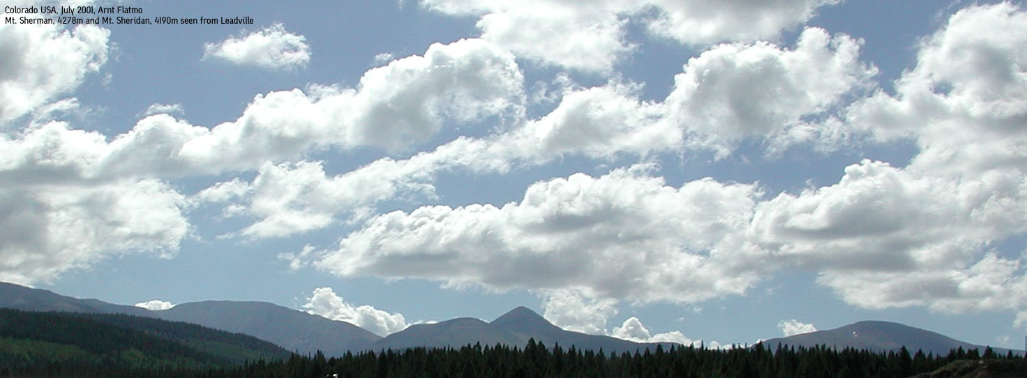
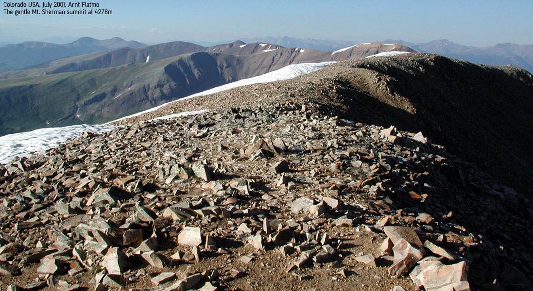
Mt. Sherman, 4278m (14036 ft)
|
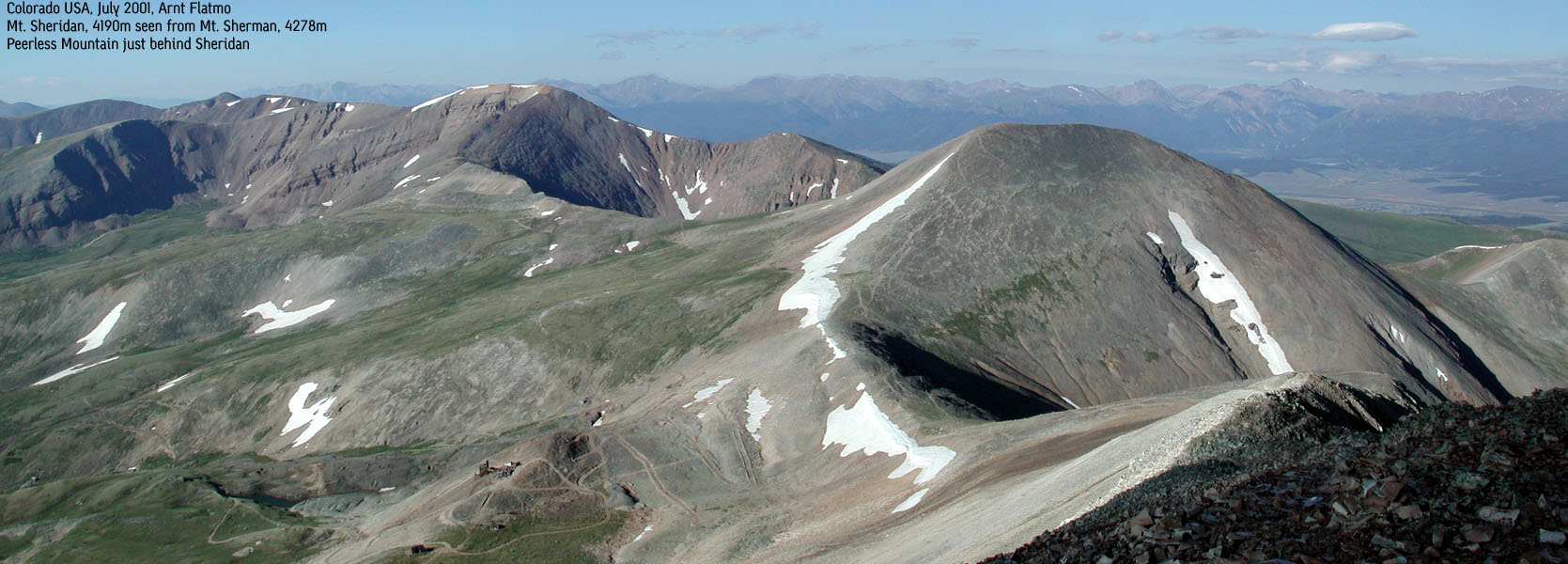
 Mt. Sherman seen from Mt. Sheridan
|
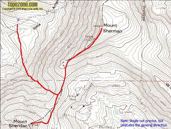
Access (Iowa Gulch Trailhead):
Please refer to the above books for more details and alternative routes
At the southeast end of Leadville, on the east side of the main street (Harrison Ave.), opposite of Elm Street, exit onto Monroe Street. Stay on Monroe 0,2 miles and turn right onto South Toledo Street. Stay on South Toledo for 3,7 miles and exit left onto a gravel road, currently marked with "Mt. Sherman". Stay on the gravel road as long as the season permits. In july, I drove this road all the way to the end, 3,3 miles from the junction.
The gravel road can be accessed by passenger cars. It is wide and permits (at least for the first 2,2 miles) two cars to pass. The road is bumpy at times, but there is no need for a 4WD. Find parking where appropriate.
The trail:
Before the road ends, locate two large pipes carrying water under the road. There is also a 4WD road going down next to them. From this road, you will find a cairned trail that leads to the gulch between Mt. Sherman and Mt. Sheridan. Elevation decreases from 12,100ft to 12,000 ft on the way to the mountain foothills. Close to the mountain, the trail up the mountain is easy to spot, when not covered with snow. The trail runs into the gulch and then climbs towards the saddle between Mt. Sherman and Mt. Sheridan, in a northeast direction.
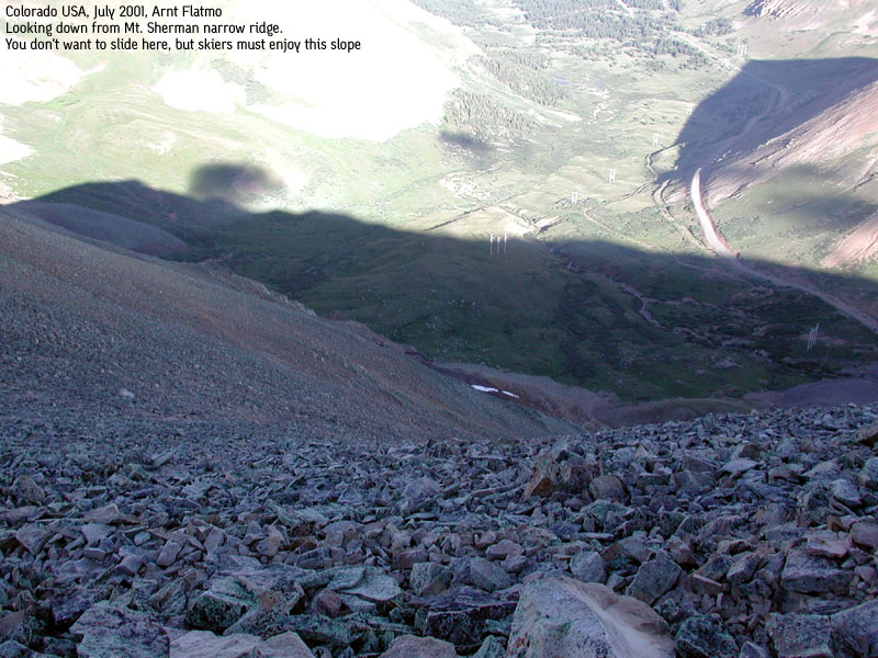
Once up on the saddle, at approx. 13,200ft. you have a clear view of the route up to Sherman. The trail follows the ridge northbound towards the summit. Before reaching the summit, you will pass a somewhat narrow saddle. At least I felt like that as I stayed on the left side. On my way back, I stayed on the opposite side and didn't notice that particular point, so there are probably multiple choices in routes. Soon you arrive on the wide, flat summit point.
Back at the saddle between the mountains, just head southwest up to Mt. Sheridan. The trails are faint, but the direction is obvious.
Notes:
Mt. Sherman is ranked the 45th highest mountain in Colorado, while Mt. Sheridan holds 126th position. This is most likely one of the easiest fourteeners, and most likely one of the fastest to hike, provided you can park at the end of the Iowa Gulch road. I started the hike at 6:30AM and reached Mt. Sherman summit at 7:45AM. I left the summit of Mt. Sheridan at 8:50AM and reached the car at 9:50AM.
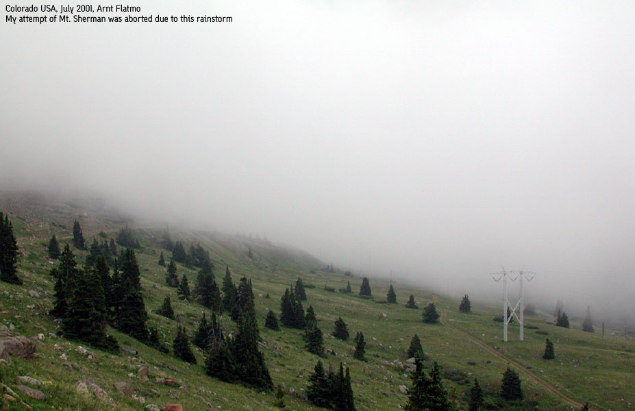
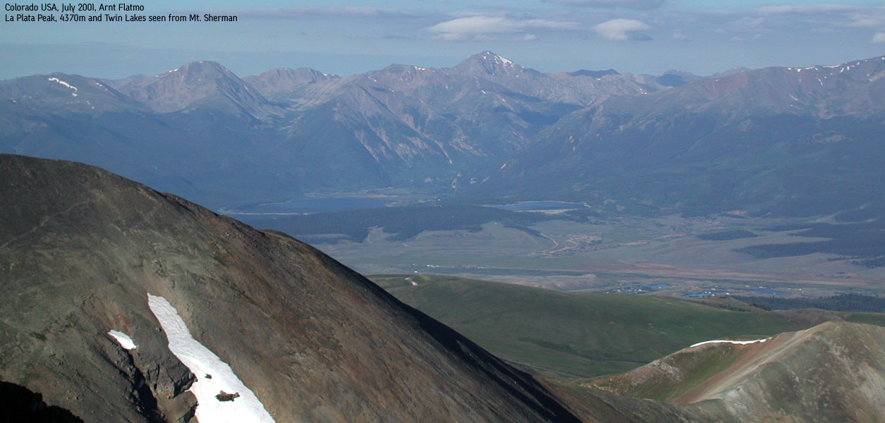
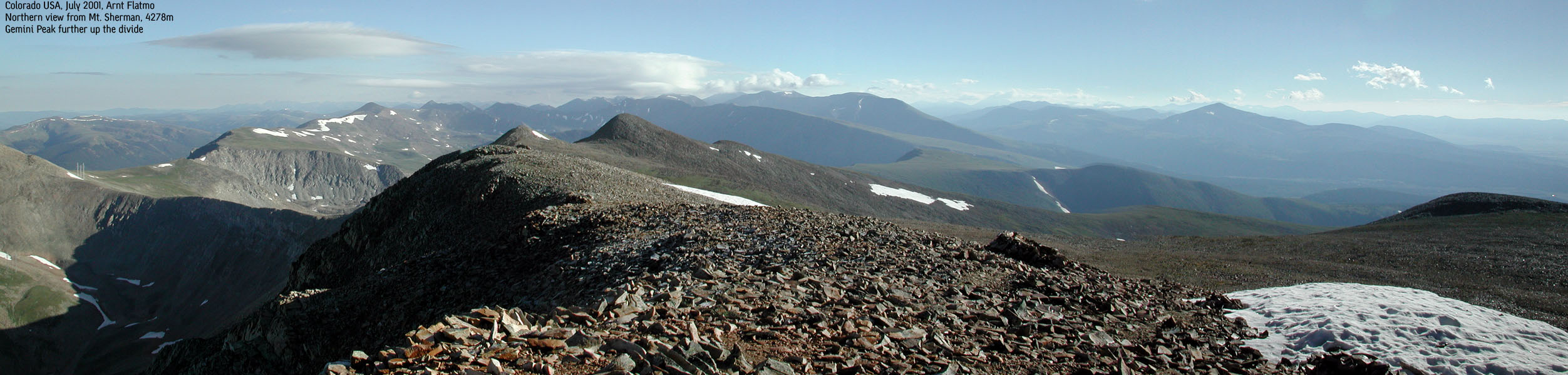
I planned to do a couple of other 4000m peaks in the area, but caved in for three reasons - headache, very strong winds and unpredictable weather. The day before, rain and thunderstorms had hammered the state all day long. The other peaks above 4000m within close reach is Gemini Peak and White Ridge. In addition, several other high peaks surround Mt. Sherman.
The reason why I paid attention to the narrow part of the ridge was because the rocks were extremely slippery. The rocks were frozen and I was slipping all the time. The strong winds made it feel very cold. I put on winter gear and wore gloves! Crosswinds, actually. One current went south down the Sawatch, while another came east from Sawatch. This is fuel for tornadoes, and a tornado had been seen in Colorado the day before. Clouds were moving in rapid speed. It was impossible to predict the weather
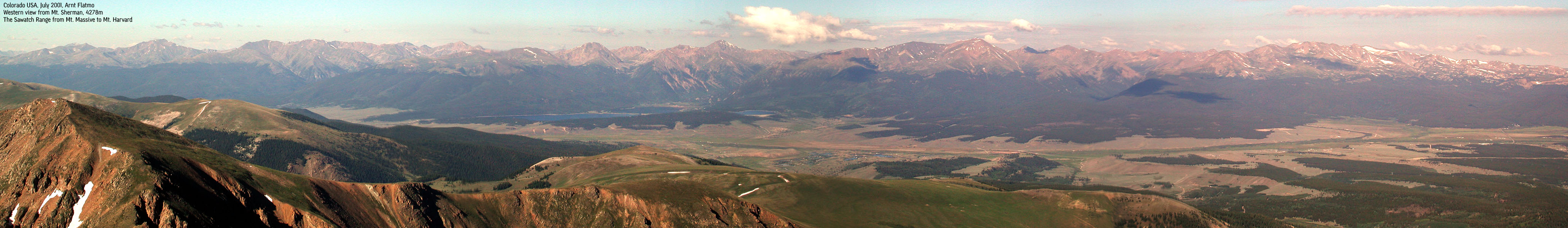
Pictures: (move cursor to read notes, and click on the images to see full version)


Other trail descriptions for this region: