
Mt. Elbert, 4399m (14433ft)Mountain area: Rocky Mountains, Sawatch Range State: Colorado USA Map: Nat'l Geographic #127 - Aspen/Independence Pass Books:
Primary Factor: Hiked: Jul 2001 |
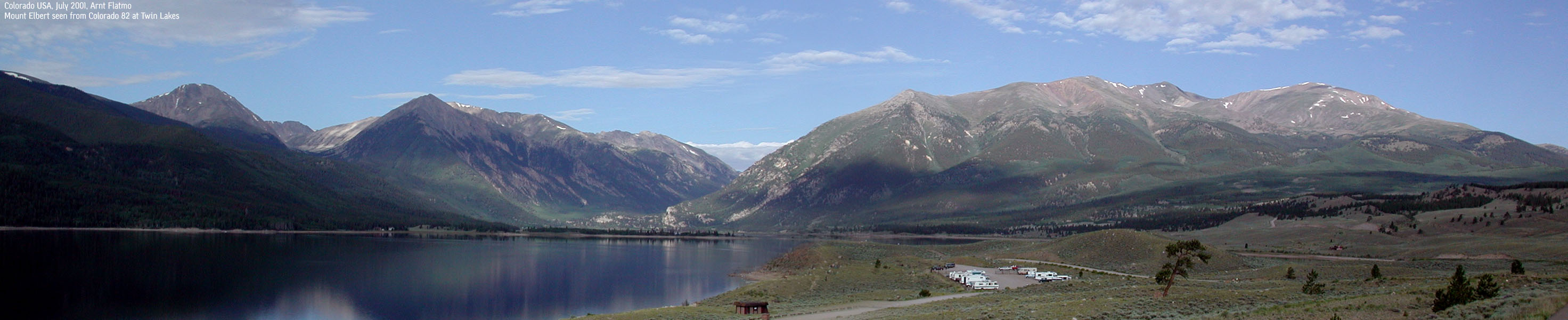
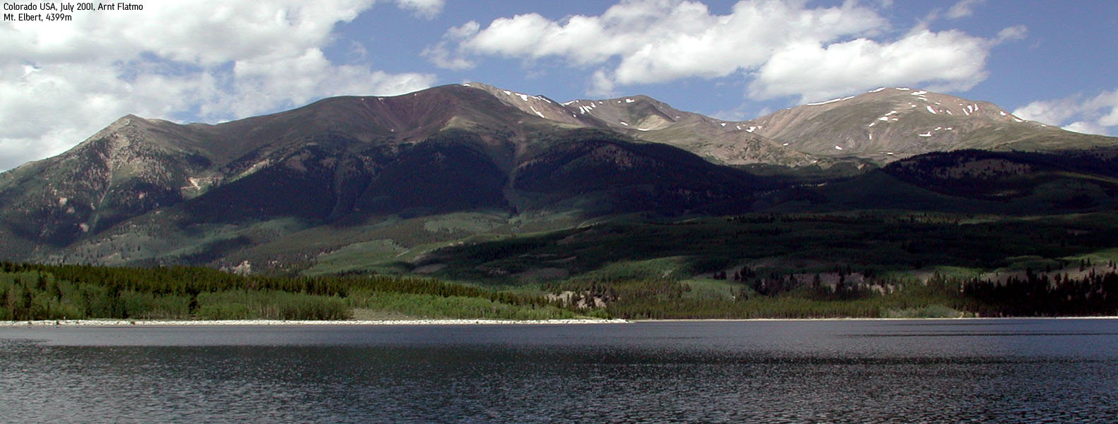 Mt. Elbert seen from HWY 82 |
Lakeview trailhead - Mt. Elbert trail
| Difficulty: | Easy |
| Risk: | None |
| Distance: | |
| Time: | 3-5 hours roundtrip |
| Starting Elevation: |
Introduction
Mt. Elbert is the highest mountain in Colorado. It is also the highest mountain in the U.S Rocky Mountains, located in the Sawatch Range, not far from Leadville. Mt. Elbert is the 2nd highest mountain in the 48 states (Alaska and Hawaii not counted), only beaten by Mt. Whitney in California - 4418m.
Access (Lakeview Campground):
Please refer to the above books for more details and alternative routes
From Granite (Colorado highway 24 Leadville - Buena Vista), exit onto Colorado highway 82 towards Twin Lakes. After 2,4 miles exit right onto Lake County Road 24. Drive about a mile, and pass the Lakeview campground on your left. Immediately after, you will see a turnout on the left side. This is the Mt. Elbert trailhead. You may park here, or if the parking is full, continue up into the upper campground and find parking there.
If you are driving a 4WD, notice a road going to the left just after the turnout described above. This road is partly ugly, but takes you up to 10,440ft, opposed to 9,600ft at the Mt. Elbert trailhead. The road lasts for about 1,8 miles. Near the end of the road, you will have to cross a stream. There are however multiple turnouts (but not enough, in my opinion) in case cars meet. I expect this road only to be open in the june - august timeframe.
The trail:
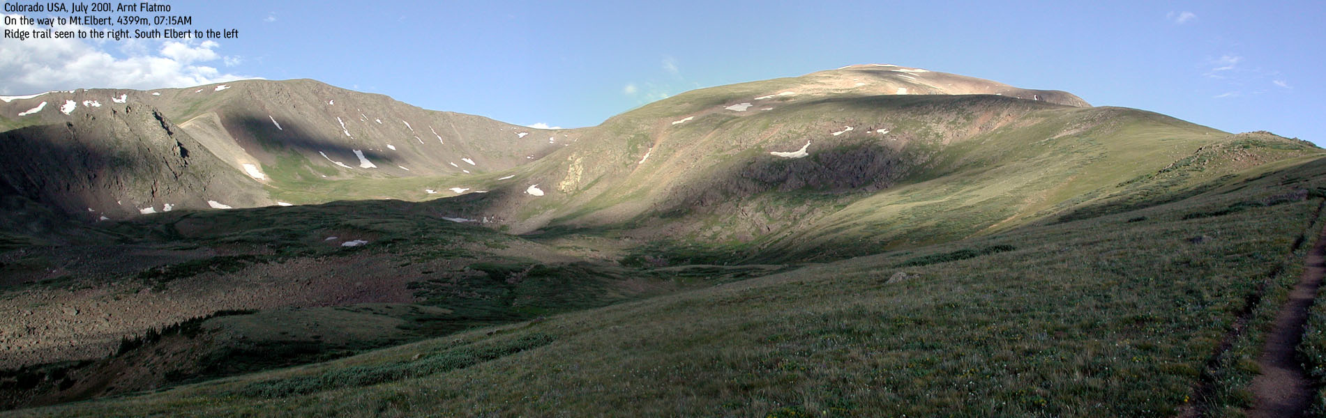
At the end of the 4WD road, you enter the Colorado Trail by a wooden bridge. After a 15 minute hike, you come to a Colorado Trail/Mt. Elbert trail junction. Go left towards Mt. Elbert. From here on, there are no more trail forks. The trail runs northwest through aspen forest before you meet the timberline at 11,600ft. You see the trail run up the long Mt. Elbert ridge, and this is where your blood pump works at its best.
Once you reach talus, and the trail starts to switchback towards the top, you think the summit is just above you. Not so. At the top of the ridge, the trail takes a southern direction, leading you around the summit block. Once around the block, you see the snow up on your right hand side. That is the Mt. Elbert summit. From here and up, the trail switchbacks on the talus.
Notes:
This is an easy hike. No technical difficulties and no steep climbs. All dependent on physical condition, some might find it long and strenuous.
Trip report:
Monday 23 july 2001: Two days earlier, I stopped by the doctor in Leadville, and got a prescription for Diamox. I had responded well to Diamox earlier, and I didn't look forward to another week of severe headaches. So I was very excited. After having taken the drugs for two days, I expected them to kick in any time soon.
The sky was clear at 5:00AM, and the choice of mountain (I never decided until I got up in the morning) was obvious. The trip from Buena Vista to Lakeview campground only took 45 minutes. At 6:00AM I didn't expect traffic on the 4WD road from the campground to the trailhead. I found the road somewhat bumpy.
I left the car at the end of the 4WD road at 6:15AM and reached the top at 8:30AM. I passed all people ahead of me, except an austrian guy with his two young sons, keeping the same pace as I. My goal for the day, in addition to reaching the top, was to make it back home - not having to go to bed.
I left the summit 8:35AM and after fast walking/light jogging, I reached the car 09:50AM. Which is ridiculous. Highest mountain in Coloado rockies up and down in 3,5 hours. Anyway, when I got back to the car, I had only a mild headache. I couldn't move my head around much, but mild, because I was able to listen to the radio. I was nervous of meeting cars on the 4WD road, as I was expected to back up, coming down. Not used to backing up a car on roads like that, I drove rather fast. And - before I headed down, I noticed a dashboard switch marked "4WD". I smiled to myself. I never stop amazing myself...
Back in Buena Vista, I didn't have to lay down. Victory! And I was looking forward to the rest of the week.
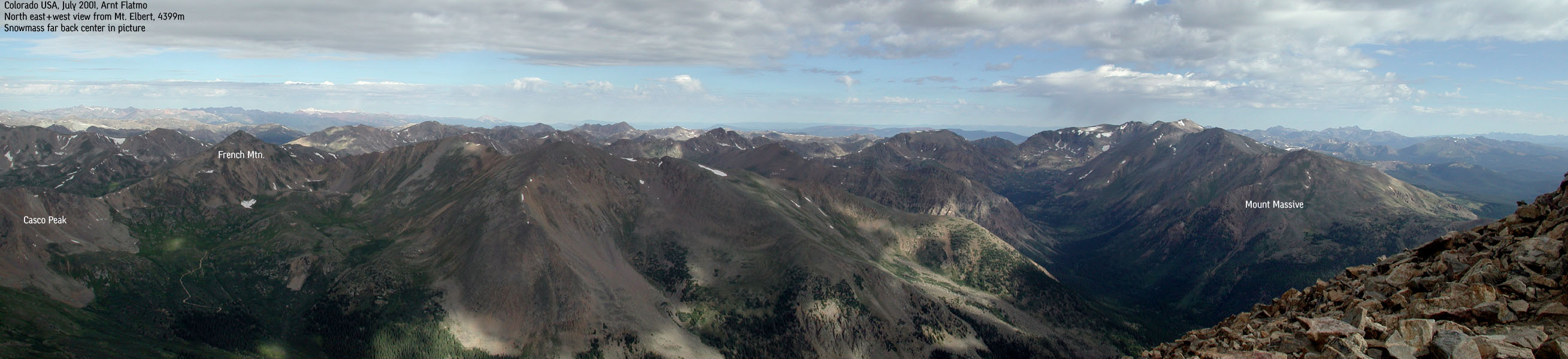
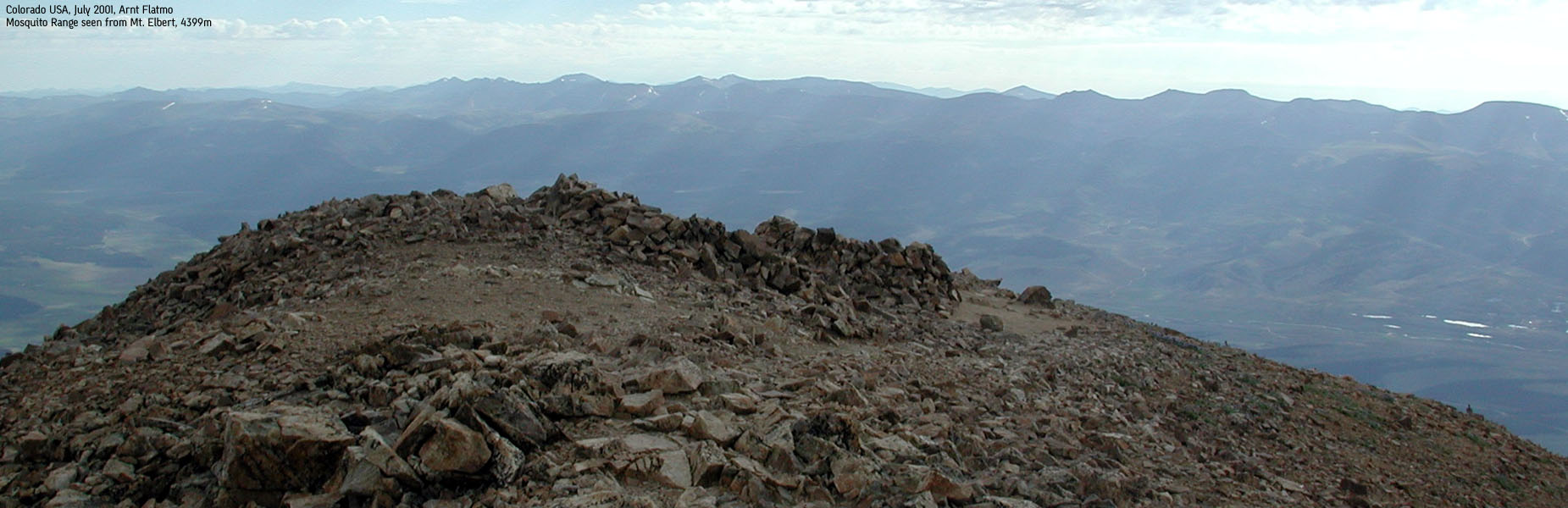
The view compensated for a non-thrilling hike. And I can't believe I forgot to sign the summit log. I wanted to read my friend Bjørn's notes from his hike july 2000. But while talking to the austrian party on top, I forgot all about it.
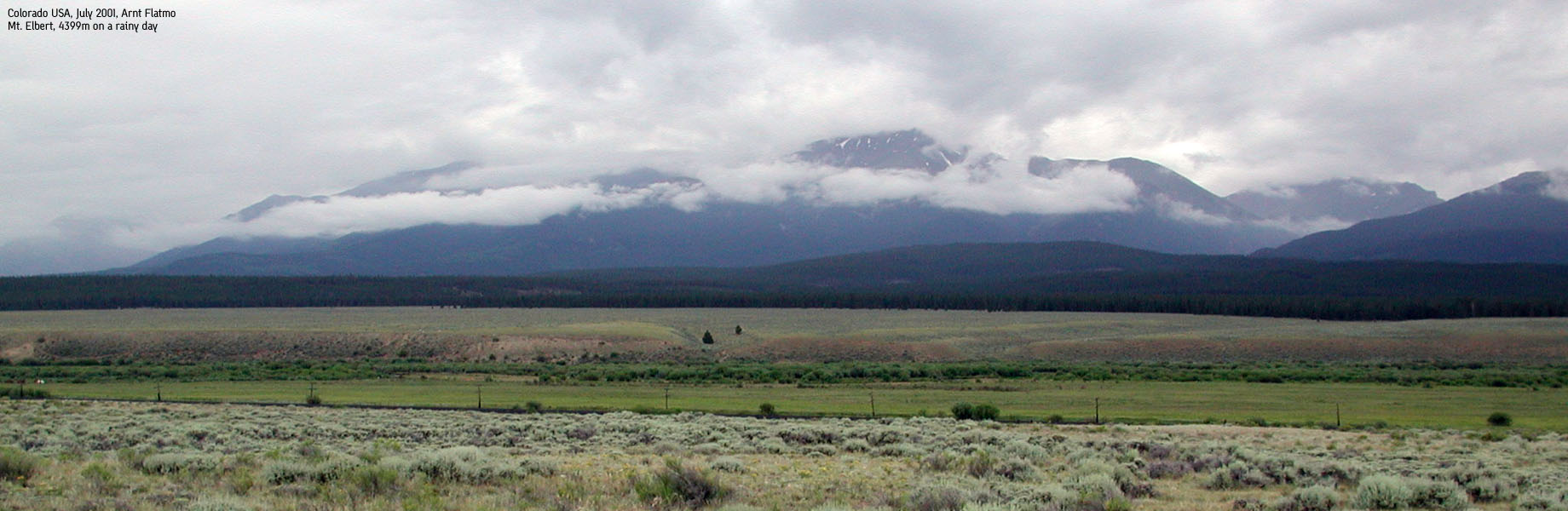
Pictures: (move cursor to read notes, and click on the images to see full version)


Pictures from other hikes:

Other trail descriptions for this region:
Other links: